ATLAS of ANTIENT GEOGRAPHY by SAMUEL BUTLER 1843John McInnis Auctioneers,LLC4.6(502)See Sold PriceFeb 24, 2024
18TH C. ANTIQUE MAP: FRENCH & INDIAN WAR, FRAMEDThomaston Place Auction Galleries4.4(386)See Sold PriceFeb 24, 2024
Rand McNally Railroad Map Cabinet w/ 21 Railroad MapsRail & Road Auctions4.6(165)See Sold PriceMar 08, 2024
Keith Haring - Ink on New York Map, Best Buddies, Inscribed, Signed, and DatedSapphire Auction Gallery4(67)See Sold PriceMar 02, 2024
LATE 17TH C. FRENCH MAP OF THE NEW WORLD BY ALEXIS-HUBERT JAILLOT (1632-1712)Thomaston Place Auction Galleries4.4(386)See Sold PriceFeb 24, 2024
Central Railroad of New Jersey Map of Sandy Hook Route-ca. 1903JM Hobby Supply and Railroad Artifact Auctions4.4(126)See Sold PriceFeb 24, 2024
Lot of Six Mixed Atlas Box Cars-HO Scale-New in BoxJM Hobby Supply and Railroad Artifact Auctions4.4(126)See Sold PriceFeb 25, 2024
Rand McNally/Santa Fe Railroad Map of Iowa-1912JM Hobby Supply and Railroad Artifact Auctions4.4(126)See Sold PriceFeb 24, 2024
NICOLAES VISSCHER (NETHERLANDS, 1618-1709) MAP OF THE NEW WORLDThomaston Place Auction Galleries4.4(386)See Sold PriceFeb 24, 2024
17TH C. WORLD MAP BY NICOLAES VISSCHER (NETHERLANDS, 1618-1709)Thomaston Place Auction Galleries4.4(386)See Sold PriceFeb 24, 2024
Lot of Six Mixed Atlas Cabooses-HO Scale-New in BoxJM Hobby Supply and Railroad Artifact Auctions4.4(126)See Sold PriceFeb 25, 2024
SoldUnusual configuration in the Southwest U.S., 1852 mapHeading: Author: Philip, George, & Son Title: Central America Including Mexico, Texas and California Place Published: Liverpool Publisher: Date Published: c.1852 Description: EnSee Sold Price
Scarce 1855 map of U.S. w/large territorial bordersScarce and collectible 1855 example of Cowperthwait, Desilver & Butler map of the U.S., at a time when the west was experiencing some of its most unusual US territorial configurations. Oregon TerritorSee Sold Price
Fenner: United States, 1825Map: United States Maker: R. Fenner Date: 1825Size: Quarto, 12 inches high x 15.5 inches wide Unusual U.S. map with 'Alabama Territory'. West Florida is 'States of Mississippi' shows Northwest and MisSee Sold Price
Collection of 3 Unframed MapsIncludes "Map No. 3 Group Map Showing Percentage Bases for Westbound Rates," "Erie Railroad with Branches and Connections 1915," and a Southwest U.S. map. Toning to each with some repairs and small teSee Sold Price
Marketing Map of the United StatesTitle: Marketing Map of the United States Publisher: Hearst Height: 42 Width: 58 Unusual U.S. wall map highlighting marketing information for Hearst Magazine from nearly half a century ago. Large andSee Sold Price
SoldThomas Kitchen 18th C. Map, US Southwest & MexicoMexico or New Spain; in which the motions of Cortes may be traced. Author: Thomas Kitchen Publication: Dr. Robertson's History of America, 1795.See Sold Price
SoldNautical Coastal Map of San Clemente Harbor, 1852Map: 1852 US Coast Guard Nautical Chart and Coastal Map of San Clemente Harbor California -- Reconnaissance of San Clemente Harbor, CA and Reconnaissance of Prisoners's Harbor and Cuyler's harbor andSee Sold Price
SoldMap of Southwest with Gadsden PurchaseHeading: (Southwest) Author: U.S. Government Title: Map of that Portion of the Boundary between the United States and Mexico, from the Pacific Coast to the Junction of the Gila and Colorado Rivers...aSee Sold Price
1852 Map Railroads US Southern States"Map illustrative of the Internal Improvement System of the South. Prepared by John C. Trautwine Civil Engineer". Map issued for The Journal of the Franklin Institute. Hand colored borders and to charSee Sold Price
SoldHumbolt Map of Southwest USHUMBOLDT, Alexander Von (1769-1859). Carte Du Mexique et des Pays Limitrophes… Engraved Map. Paris: Jules Renouard, 1827. 22 1/2" x 33" sheet. This is one of Alexander von Humboldt's important eSee Sold Price
SoldKiepert Map of Southwest USKIEPERT, Heinrich (1818-1899). Mexico, Texas und Californien. Engraved Map. Weimar: Verlag des Geograohischen Instituts, 1853. 22 1/2” x 27” sheet, 34” x 38” framed. Illustrating the ProposedSee Sold Price
SoldLarge Colton map of U.S. 1852Heading: (United States) Author: Colton, J.H. Title: Map of the United States of America, the British Provinces, Mexico, the West Indies and Central America, with Part of New Granada and Venezuela PlaSee Sold Price
SoldLarge map of U.S. 1852Heading: Author: Smith, John Calvin Title: Colton's Map of the United States including Canada and a large portion of Texas. Showing the Base Meridian and Township Lines of the U.S. Surveys, the LandsSee Sold Price
1852 Map of US western statesAuthor: Mitchell Title: 1852 Map of US western states Medium: Ink on Paper Dimensions: 18"X11.5" Map of the US Western states dated 1852. Engraved by W. Williams for Mitchell's School and Family GeogrSee Sold Price
Large map of U.S. 1852Heading: Author: Smith, John Calvin Title: Colton's Map of the United States including Canada and a large portion of Texas. Showing the Base Meridian and Township Lines of the U.S. Surveys, the LandsSee Sold Price
SoldNautical Chart and Coastal Map of Monterey Bay, 1852Map: 1852 Nautical Chart and Coastal Map of Monterey Bay, California -- Monterey Harbor, CA from a Trigonometrical Survey Cartographer: US Coast Survey Year / Place: 1852 Map Dimensions: 13.1 x 11.7 iSee Sold Price
Sold1852 Map of the USAuthor: Mitchell Title: 1852 Map of the US Medium: Ink on Paper Dimensions: 19"X12" Double folio map of US dated 1852. Engaved by Augustus Mitchell. Part of Mitchell's School & Family Geography, publiSee Sold Price
Sold1852 Map of the US Southern statesTitle: 1852 Map of the US Southern states Author: Mitchell Medium: Ink on Paper Dimensions: 18"X11.5" Description: Map of the US Southern states dated 1852. Engraved by W. Williams for Mitchell's SchoSee Sold Price
1852 Map of the USTitle: 1852 Map of the US Author: Mitchell Medium: Ink on Paper Dimensions: 19"X12" Double folio map of US dated 1852. Engaved by Augustus Mitchell. Part of Mitchell's School & Family Geography, publiSee Sold Price
1852 Map of the USAuthor: Mitchell Title: 1852 Map of the US Medium: Ink on Paper Dimensions: 19"X12" Double folio map of US dated 1852. Engaved by Augustus Mitchell. Part of Mitchell's School & Family Geography, publiSee Sold Price
SoldREPORT U.S. COAST SURVEY 1852 Rare Foldout MapsTitle: Report of the Superintendent of the Coast Survey Publisher: Robert Armstrong Printing Year: 1853 Condition/Details: Bound in sage green cloth with gilt embossing, this antique volume is a rareSee Sold Price
Ettling: Antique Civil War Map of North America, 1860U. S. & North America with oddly shaped Dakota--Ettling c1860. This uncommon Civil War era engraved map shows a very unusual configuration for Dakota. In this map the borders of Wyoming Territory haveSee Sold Price
U. S. & N. America w/odd Dakota--Ettling c1860This uncommon Civil War era engraved map shows a very unusual configuration for Dakota. In this map the borders of Wyoming and Utah have yet to be finalized. Numerous Indian tribes are located throughSee Sold Price
SoldU. S. & N. America w/odd Dakota--Ettling c1860This uncommon Civil War era engraved map shows a very unusual configuration for Dakota. In this map the borders of Wyoming and Utah have yet to be finalized. Numerous Indian tribes are located throughSee Sold Price
Central Railroad of New Jersey Map of Sandy Hook Route-ca. 1903JM Hobby Supply and Railroad Artifact Auctions4.4(126)See Sold PriceFeb 24, 2024
Louis Beroud (French,1852-1930) oil painting antiqueBroward Auction Gallery4.8(277)See Sold PriceMar 17, 2024
FLYING A TOURING SERVICE U.S. ROAD MAPS TIN WALL DISPLAY.Dan Morphy Auctions4.2(1.3k)See Sold PriceFeb 25, 2024
1885 CIVIL WAR 1ed Famous Memoirs US Grant Sheridan Sherman 6v RARE LOT MapsSchilb Antiquarian Rare Books4.8(421)See Sold PriceMar 10, 2024
1963 J.F.K. for US PRESIDENT RE-ELECTION MATERIALJohn McInnis Auctioneers,LLC4.6(502)See Sold PriceFeb 25, 2024
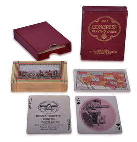
Fred Harvey Railroad Early Souvenir Playing Cards of the Great Southwest - Indians and Train SmokeRail & Road Auctions4.6(165)See Sold PriceMar 08, 2024
Fred Harvey Railroad Souvenir Playing Cards - Indians and Train Smoke and Indians of the SouthwestRail & Road Auctions4.6(165)See Sold PriceMar 08, 2024
[VIETNAM]. A group of approx. 120 photographs assembled by African American soldier Vernon CliftonFreeman's | Hindman4.4(1.6k)See Sold PriceFeb 27, 2024
GEORGE ANDREW CORLEY (DATES UNKNOWN) U.S. TEAM SKI TRYOUTS / MT. HOOD OREGON. 1939.Swann Auction Galleries4.4(65)See Sold PriceFeb 29, 2024
Unusual Large Antique Chinese Rose Canton Export Porcelain ChargerAkiba Galleries4.7(1.7k)See Sold PriceFeb 29, 2024
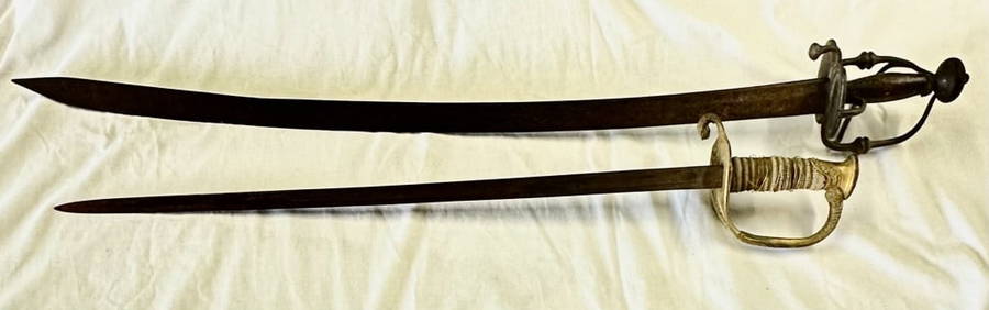
Unusual Antique Otis Bronze Elevator CrankWorld Auction Gallery LLC4.7(261)See Sold PriceMar 10, 2024


![[VIETNAM]. A group of approx. 120 photographs assembled by African American soldier Vernon Clifton (1 of 6)](https://p1.liveauctioneers.com/197/319238/171468143_1_x.jpg?height=282&quality=70&version=1707520367)