ATLAS of ANTIENT GEOGRAPHY by SAMUEL BUTLER 1843John McInnis Auctioneers,LLC4.6(502)See Sold PriceFeb 24, 2024
18TH C. ANTIQUE MAP: FRENCH & INDIAN WAR, FRAMEDThomaston Place Auction Galleries4.4(386)See Sold PriceFeb 24, 2024
Rand McNally Railroad Map Cabinet w/ 21 Railroad MapsRail & Road Auctions4.6(165)See Sold PriceMar 08, 2024
Keith Haring - Ink on New York Map, Best Buddies, Inscribed, Signed, and DatedSapphire Auction Gallery4(67)See Sold PriceMar 02, 2024
LATE 17TH C. FRENCH MAP OF THE NEW WORLD BY ALEXIS-HUBERT JAILLOT (1632-1712)Thomaston Place Auction Galleries4.4(386)See Sold PriceFeb 24, 2024
Central Railroad of New Jersey Map of Sandy Hook Route-ca. 1903JM Hobby Supply and Railroad Artifact Auctions4.4(126)See Sold PriceFeb 24, 2024
Lot of Six Mixed Atlas Box Cars-HO Scale-New in BoxJM Hobby Supply and Railroad Artifact Auctions4.4(126)See Sold PriceFeb 25, 2024
Rand McNally/Santa Fe Railroad Map of Iowa-1912JM Hobby Supply and Railroad Artifact Auctions4.4(126)See Sold PriceFeb 24, 2024
NICOLAES VISSCHER (NETHERLANDS, 1618-1709) MAP OF THE NEW WORLDThomaston Place Auction Galleries4.4(386)See Sold PriceFeb 24, 2024
17TH C. WORLD MAP BY NICOLAES VISSCHER (NETHERLANDS, 1618-1709)Thomaston Place Auction Galleries4.4(386)See Sold PriceFeb 24, 2024
Lot of Six Mixed Atlas Cabooses-HO Scale-New in BoxJM Hobby Supply and Railroad Artifact Auctions4.4(126)See Sold PriceFeb 25, 2024
SoldTallis: Map of Uk's Channel Island, 18501850 Tallis Map of Uk's Channel Island. This is an ornate and highly decorative map illustrates Jersey & Guernsey with an English Channel inset. The map features five vignettes and fancy borders of thSee Sold Price
John Tallis: Map of Channel Islands, 1850Map: Channel Islands Maker: John Tallis Date: ca. 1850 Origin: London Size: 13 x 10 inches This is an ornate and highly decorative map illustrates Jersey & Guernsey with an English Channel inset. TheSee Sold Price
SoldTallis, John (Pub) 1852 Map. Channel IslandsSteel Engraved Map with Original Outline Hand Color Published 1852-56 by John Tallis, London for "The Universal Pronouncing Dictionary" by Thomas Wright. Drawn & Engraved by John Rapkin. Centre fold aSee Sold Price
SoldChannel Islands.- Rapkin (John) - Channel Islands,for the Tallis Atlas, a double map of Guernsey above and Jersey below ; each with inset vignette views, set within a deocrative border, steel-engraved map with original hand-colouring, 370 x 260mm., JSee Sold Price
Tallis Map of Mounts, Rivers, Lakes, 1850Title: 1850 Tallis Map of Western Hemisphere Mounts, Rivers, Lakes Cartographer: J. Tallis Published: 1850 London Measurements: 13 x 10 in. A Comparative View of the Principal Waterfalls, Islands, LakSee Sold Price
SoldAntique Map, Polynesia, John TallisFramed engraved map, Polynesia or Islands in the Pacific Ocean (c.1850), published by John Tallis and Co., sight: 10''h x 14''w, overall: 17''h x 20''wSee Sold Price
SoldTallis: Map of W Hemisphere Mounts, Rivers, Lakes, 1850Map: 1850 Tallis Map of Western Hemisphere Mounts, Rivers, Lakes -- A Comparative View of the Principal Waterfalls, Islands, Lakes, Rivers and Mountains, in the Western Hemisphere Cartographer: J. TalSee Sold Price
SoldJOHN TALLIS - Islands in the AtlanticJOHN TALLIS in the United Kingdom 1817 - 1876 JOHN RAPKIN in the United Kingdom 1813 - 1899 Islands in the Atlantic. 1850 Steel engraving Signed and titled Sizes 27.6 x 35.8 cm Comes from the work "ThSee Sold Price
SoldTravel Poster Jersey Illustrated Map Channel IslandsOriginal vintage travel poster for Jersey featuring a colourful pictorial map of the largest of the Channel Islands located between England and France showing a map of the roads, sandy beaches, peopleSee Sold Price
SoldCHANNEL ISLANDS. St Peter Port view. Jersey & Guernsey.Reserve Reduced! TITLE/CONTENT OF MAP: 'Channel Islands' Vignettes: Jersey; Castle Cornet; St Peter's Port; Druidical altar near l'Ancresse, Mont Orgueil Castle. Guernsey DATE: 1851 IMAGE SIZE: ApproxSee Sold Price
SoldChannel Islands of jersey & Guernsey 1659 by J. Blaeu.Title/Content of Map: Channel Islands of jersey & Guernsey 1659 by J. Blaeu. Amsterdam. 21 x 24 1/2”. Please note that this lot has a confidential reserve. When you leave a bid in advance of the aucSee Sold Price
CHANNEL ISLANDS: St Peter Port view. Jersey & Guernsey.TITLE/CONTENT OF MAP: 'Channel Islands' Vignettes: Jersey; Castle Cornet; St Peter's Port; Druidical altar near l'Ancresse, Mont Orgueil Castle. Guernsey Date: 1851 IMAGE SIZE: Approx 36.5 x 26.5cm, 1See Sold Price
CHANNEL ISLANDS: St Peter Port view. Jersey & Guernsey.TITLE/CONTENT OF MAP: 'Channel Islands' Vignettes: Jersey; Castle Cornet; St Peter's Port; Druidical altar near l'Ancresse, Mont Orgueil Castle. Guernsey DATE PRINTED: 1851 IMAGE SIZE: Approx 36.5 x 2See Sold Price
Sold1851 Tallis Map of Islands in the Atlantic1851 Tallis Map of Islands in the Atlantic J. Tallis 1851 London 14 x 10 in. plus matting Beautiful steel engraved map consisting of four maps of the islands: the island groups of Cape Verde, CanariesSee Sold Price
SoldTallis: Map of Islands of the Atlantic, 1853Islands of the Atlantic - Bermuda, Canary & Azores by Tallis. Original lithograph by John Tallis & Company of London, c. 1853. Map features Azores, Madeira, Bermuda, Canary & Cape Verde Islands. VingnSee Sold Price
1851 Tallis Map of Islands in the Indian Ocean --Title/Content of Map: 1851 Tallis Map of Islands in the Indian Ocean -- Islands in the Indian Ocean Date: 1851, London Cartographer: J Tallis Size: 8.8 x 12 in. This is an excellent map featuring theSee Sold Price
SoldTallis: Map of Islands in the Indian Ocean, 1851Map: Islands in the Indian Ocean Cartographer: Tallis Place & Date: London/New York / 1851 Size: 13 1/4" x 10 1/2" The superb Indian Ocean islands map from Tallis' Illustrated Atlas extending from theSee Sold Price
1851 Tallis Map of Islands in the Indian Ocean --Reserve Reduced! Title/Content of Map: 1851 Tallis Map of Islands in the Indian Ocean -- Islands in the Indian Ocean Date: 1851, London Cartographer: J Tallis Size: 8.8 x 12 in. This is an excellent mSee Sold Price
1851 Tallis Map of Islands in the Indian Ocean --Title: 1851 Tallis Map of Islands in the Indian Ocean -- Islands in the Indian Ocean Date: 1851, London Cartographer: J Tallis Size: 8.8 x 12 in. Additional Information: This is an excellent map featuSee Sold Price
1851 Tallis Map of Islands in the Indian Ocean --Title/Content of Map: 1851 Tallis Map of Islands in the Indian Ocean -- Islands in the Indian Ocean Date: 1851, London Cartographer: J Tallis Size: 8.8 x 12 in. This is an excellent map featuring theSee Sold Price
1851 Tallis Map of Islands in the Indian Ocean --Title/Content of Map: 1851 Tallis Map of Islands in the Indian Ocean -- Islands in the Indian Ocean Date: 1851, London Cartographer: J Tallis Size: 8.8 x 12 in. This is an excellent map featuring theSee Sold Price
1851 Tallis Map of Islands in the Indian Ocean --Title/Content of Map: 1851 Tallis Map of Islands in the Indian Ocean -- Islands in the Indian Ocean Date: 1851, London Cartographer: J Tallis Size: 8.8 x 12 in. This is an excellent map featuring theSee Sold Price
1851 Tallis Map of Islands in the Indian Ocean -- Islands in the Indian OceanTitle: 1851 Tallis Map of Islands in the Indian Ocean -- Islands in the Indian Ocean Cartographer: J Tallis Year / Place: 1851, London Map Dimension (in.): 8.8 x 12 in. This is an excellent map featurSee Sold Price
1851 Tallis Map of Islands in the Indian Ocean --Title/Content of Map: 1851 Tallis Map of Islands in the Indian Ocean -- Islands in the Indian Ocean Date: 1851, London Cartographer: J Tallis Size: 8.8 x 12 in. This is an excellent map featuring theSee Sold Price
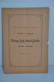
Chicago Rock Island and Pacific RR 11th Annual Report-April 1, 1891JM Hobby Supply and Railroad Artifact Auctions4.4(126)See Sold PriceFeb 24, 2024
Chicago Rock Island and Pacific RR Book Sunshine and Moonlight-1889JM Hobby Supply and Railroad Artifact Auctions4.4(126)See Sold PriceFeb 24, 2024
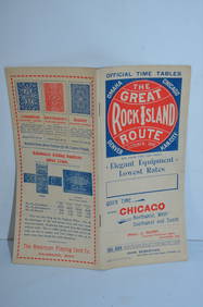
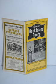
Chicago Rock Island and Pacific RY August 1, 1882 Public TimetableJM Hobby Supply and Railroad Artifact Auctions4.4(126)See Sold PriceFeb 24, 2024
Chicago Rock Island and Pacific RY October 1896 Public TimetableJM Hobby Supply and Railroad Artifact Auctions4.4(126)See Sold PriceFeb 24, 2024
Chicago Rock Island and Pacific RY November 4, 1899 Public TimetableJM Hobby Supply and Railroad Artifact Auctions4.4(126)See Sold PriceFeb 24, 2024
Chicago Rock Island and Pacific RY August 1903 Westbound Edition Public TimetableJM Hobby Supply and Railroad Artifact Auctions4.4(126)See Sold PriceFeb 24, 2024
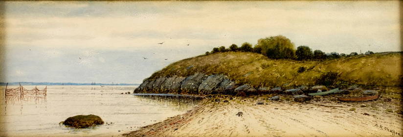
Samuel Chaffee (MA,RI,1850-1913) watercolor painting antiqueBroward Auction Gallery4.8(277)See Sold PriceMar 17, 2024
LATE 17TH C. FRENCH MAP OF THE NEW WORLD BY ALEXIS-HUBERT JAILLOT (1632-1712)Thomaston Place Auction Galleries4.4(386)See Sold PriceFeb 24, 2024
EARLY 18TH C. DUTCH CHART OF PACIFIC OCEAN BY FREDERIK DE WIT (1629-1706) WITH CALIFORNIA AS ANThomaston Place Auction Galleries4.4(386)See Sold PriceFeb 24, 2024
South Pacific Island Malekula Vanuatu Stone IdolTimeLine Auctions Ltd.4.5(183)See Sold PriceMar 08, 2024
Portfolio of 15 County Maps by Robert Morden (English 1650-1703)Nadeau's Auction Gallery4.7(401)See Sold PriceFeb 24, 2024
1853 Colton's Railroad & Township Map of Massachusetts, Rhode Island, and ConnecticutRail & Road Auctions4.6(165)See Sold PriceMar 07, 2024
Group of Ten Railroad Photographs, Maps, and Prints - New Jersey, Long Island, and New YorkRail & Road Auctions4.6(165)See Sold PriceMar 07, 2024
1764 Bellin Map of Lesser Antilles Northern Portion -- Petites Antilles ou Isles du Vent 3e. Partie.Jasper524.5(9.8k)See Sold PriceFeb 27, 2024
1750 Bowen Map of Bermuda and St. Kitts -- A New & Accurate Map of Bermudas or Sommer's Islands...Jasper524.5(9.8k)See Sold PriceFeb 27, 2024
Le Canal de Mosambique, l'Isle de Madagascar… Mozambique. Africa. BONNE 1788 mapJasper524.5(9.8k)See Sold PriceFeb 28, 2024
Le Canal de Mosambique, l'Isle de Madagascar… Mozambique. Africa. BONNE 1790 mapJasper524.5(9.8k)See Sold PriceFeb 28, 2024
Fifteen American Fiddleback Coin Silver Spoons by Various MakersGray's Auctioneers4.5(186)See Sold PriceMar 06, 2024