SoldSmith (C., & W.R. Gardner) Map of the Country TwelSmith (C., & W.R. Gardner) Map of the Country Twelve Miles Round London,showing from Enfield Wash through to Banstead Downs and Hornchurch through to Southall, engraved map, with original outlSee Sold Price
SoldLondon.- Smith (Charles) Map of the Country TwelveLondon.- Smith (Charles) Map of the Country Twelve Miles Round London, showing from Ewell to Enfield, and from Southall to Hornchurch in the east, engraved map by W.R. Gardner, with early hand-colouriSee Sold Price
SoldSmith (Charles) Map of the Country Twelve Miles RoSmith (Charles) Map of the Country Twelve Miles Round London,1st edition, from Enfield to Ewell and from Dartford to Southall, engraved map by W.R. Gardner, with original hand-colouring, 745 xSee Sold Price
Smith (Charles) Map of the Country Twelve Miles RoSmith (Charles) Map of the Country Twelve Miles Round London,1st edition, from Enfield to Ewell and from Dartford to Southall, engraved map by W.R. Gardner, with original hand-colouring, 745 xSee Sold Price
Sold(3) SMITH'S ATLAS MAPS, EGYPT, ASIA & PERSIA(lot of 3) Unframed maps from Smith's Atlas, 19th c., published by Charles Smith, London, including: (1) "Persia, Arabia, and Cabul," engraved by W.R. Gardner, sheet: approx 12.5"h, 15.75"w, (1) "EgypSee Sold Price
(3) SMITH'S ATLAS MAPS, EGYPT, ASIA & PERSIA(lot of 3) Unframed maps from Smith's Atlas, 19th c., published by Charles Smith, London, including: (1) "Persia, Arabia, and Cabul," engraved by W.R. Gardner, sheet: approx 12.5"h, 15.75"w, (1) "EgypSee Sold Price
London.- Gardner (W.R.) Map of the Country Twelve MilesLondon.- Gardner (W.R.) Map of the Country Twelve Miles Round London, engraved map, with outline hand-colouring, 750 x 880 mm. (29 1/2 x 34 3/4 in), dissected and mounted on linen, surface dirt and liSee Sold Price
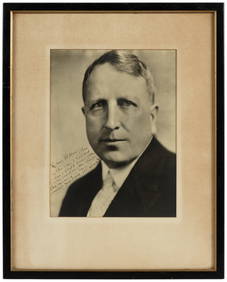
SoldAlexander Gardner (American, 1821-1882) Sioux IndiansAlexander Gardner (American, 1821-1882) "Sioux Indians at Fort Laramie, Scenes in the Indian Country," c. 1868, albumen print mounted, 9.25" x 12.75", framed Provenance: Andrew Smith Gallery, Inc., SaSee Sold Price
SoldTurkey.- Smith (C.) - Map of Turkey in Europe andengraved map with original hand-colouring in outline, 820 x 635mm., dissected and linen-backed, slight browning, spotting and off-setting, folding into contemporary cloth slipcase, 8vo, [1828]; withSee Sold Price
SoldSmith (C) Map of the County of CumberlandSmith (Charles) A New Map of the County of Cumberland,engraved map with original outline hand-colouring, 495 x 440mm., central horizontal fold, slightly discoloured, 1808 Cary (John) A Map oSee Sold Price
SoldFour 19th C. Maps of the Western HemisphereLot of four early 19th C. maps of countries in the western hemisphere, including St. Vincent, Grenada/Tobago/Curacao/Trinidad, Caracas/Guiana/Peru/Chile/La Plata. Various dates and publishers.See Sold Price
Map: C. Smith. S. Wheatley SculptA new and correct map of the County of Waterford. Hand coloured Cartouche. 14 1/2 " x 20 1/4". Rare 18th century map of Waterford, circa 1774. [1] Worldwide shipping available: shipping@sheppards.ieSee Sold Price
SoldFour 18th c. German Maps, European CountriesMAPS. Reilly, Franz Johann Joseph von (Vienna 1766-1820) Group of 4 colored engravings, maps of Europe including Scotland, Frankreich, Ireland, and Italy, possibly from Schauplatz der funf Theile derSee Sold Price
SoldU.S. map with large independent Texas, 1839Heading: Author: Smith, Roswell C. Title: Map of the United States and Canada Place Published: Hartford, Conn. Publisher:Daniel Burgess Date Published: 1839 Description: EngraveSee Sold Price
SoldA large linen backed map of Europe by Octavia & Co,A large linen backed map of Europe by Octavia & Co, Vienna 1856, 98 x 209cm, Bradshaws 'Map of Europe'; showing the railways opened and in progress , linen backed, no date. C Smith's 'Map of France' LSee Sold Price
SoldSmith (C.R.) Pub.- Illustrated Map of LondonSmith (C.R.) Publisher.- Illustrated Map of London or Guide to the public buildings, theatres, & all places of interestchromolithograph folding map, 510 x 670mm., vertical and horizontal foldsSee Sold Price
SoldNine 19th C. Maps of EuropeLot of nine early 19th C. maps of European countries, including the British Isles, France, The Netherlands, Spain/Portugal, Russia, etc. Various dates and publishers.See Sold Price
C. Smith 1804 Map of Nottingham hand coloured...C. Smith 1804 Map of Nottingham hand coloured date Jan 6th 1804 framed measures 48x53cm approx.See Sold Price
(2) Antique Italy Maps, Kitchin, C. SmithThese beautiful maps have both been hand colored and represent Italy. There is one published in London by Charles Smith, possibly early 1800s, framed and discolored from age, but still displays greatSee Sold Price
SoldLondon.- Smith & Sons (Charles) Smith's Indicator MapNO RESERVE London.- Smith & Sons (C.) Smith's Indicator Map of London, showing from Hyde Park to Mile End, including Regents Park and part of Victoria Park with the City of London highlighted in red,See Sold Price
SoldSmith (Charles) Map Twelve Miles Round LondonSmith (Charles) Map of the Country Twelve Miles Round London,extending from Hadley to Addington, and from Northolt to Hornchurch, engraved folding map, dissected and linen-backed, with originaSee Sold Price
SoldTwo Framed 19th Century Hand-colored Maps of New YoTwo Framed 19th Century Hand-colored Maps of New York City, 1836, J. Disturnell, and 1846, G.W. and C.B. Colton Map of the Country Thirty Miles Round the City of New York, respective sight size 22 x 2See Sold Price
SoldJohn SpeedJohn Speed Wight Island hand coloured engraved map published by Sudbury and Humble; with C.Smith dissected map of Devon, 2nd edition 1808, 46 x 50cm (2) 43 x 55cm (17 x 21in)See Sold Price
SoldHuntingdonshire. A collection of mainly 19th centuryHuntingdonshire. A collection of mainly 19th century loose county maps and plans, some coloured, including maps by C.Smith, John Cary, Thomas Dix, R.Rowe, James Duncan (1837 edition), J & C Walker, PiSee Sold Price
17TH C. WORLD MAP BY NICOLAES VISSCHER (NETHERLANDS, 1618-1709)Thomaston Place Auction Galleries4.4(393)See Sold PriceFeb 24, 2024
LATE 17TH C. FRENCH MAP OF THE NEW WORLD BY ALEXIS-HUBERT JAILLOT (1632-1712)Thomaston Place Auction Galleries4.4(393)See Sold PriceFeb 24, 2024
18TH C. ANTIQUE MAP: FRENCH & INDIAN WAR, FRAMEDThomaston Place Auction Galleries4.4(393)See Sold PriceFeb 24, 2024
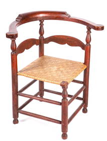
(18th / 19th c) COUNTRY CORNER CHAIR in RED WASHJohn McInnis Auctioneers,LLC4.5(505)See Sold PriceFeb 24, 2024
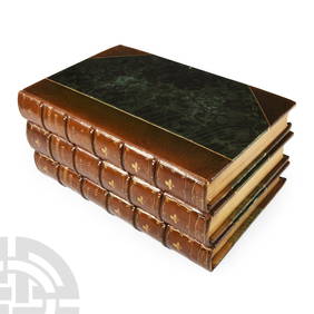
Archaeological Books - Roach Smith - Collectanea Antiqua, etchings and notices of ancient remains,TimeLine Auctions Ltd.4.6(183)See Sold PriceMar 06, 2024
Willem Blaeu, Etc. 17th C. Antiquarian Maps, 2Auctions at Showplace4.6(740)See Sold PriceMar 17, 2024
Birmingham.- Commercial map.- Smith (J. Pigott) To the Right Honourable William Earl of Dartmouth...Forum Auctions4.3(53)See Sold PriceFeb 29, 2024
Jules Verne, Le Testament d'un Excentrique, Aux HarponsLion and Unicorn4.8(1.9k)See Sold PriceMar 03, 2024
Jules Verne, L'Etoile du Sud, Au Steamer Red MacaronLion and Unicorn4.8(1.9k)See Sold PriceMar 10, 2024
EARLY 19TH C. DIMINUTIVE GREEN PAINTED CUPBOARD.William Smith Auctions4.6(147)See Sold PriceMar 06, 2024
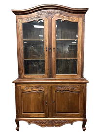
EARLY 19TH C. COUNTRY FRENCH PROVINCIAL VAISSELIER.William Smith Auctions4.6(147)See Sold PriceMar 06, 2024
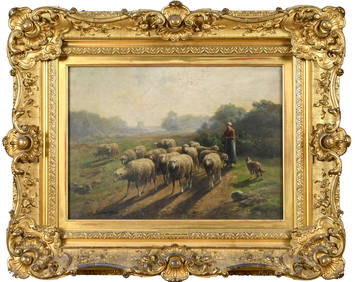
CORNELIUS VAN LEEMPUTTEN OIL, SHEEP IN LANDSCAPE.William Smith Auctions4.6(147)See Sold PriceMar 06, 2024