ATLAS of ANTIENT GEOGRAPHY by SAMUEL BUTLER 1843John McInnis Auctioneers,LLC4.5(505)See Sold PriceFeb 24, 2024
18TH C. ANTIQUE MAP: FRENCH & INDIAN WAR, FRAMEDThomaston Place Auction Galleries4.4(393)See Sold PriceFeb 24, 2024
Rand McNally Railroad Map Cabinet w/ 21 Railroad MapsRail & Road Auctions4.6(165)See Sold PriceMar 08, 2024
Keith Haring - Ink on New York Map, Best Buddies, Inscribed, Signed, and DatedSapphire Auction Gallery4.1(67)See Sold PriceMar 02, 2024
LATE 17TH C. FRENCH MAP OF THE NEW WORLD BY ALEXIS-HUBERT JAILLOT (1632-1712)Thomaston Place Auction Galleries4.4(393)See Sold PriceFeb 24, 2024
Central Railroad of New Jersey Map of Sandy Hook Route-ca. 1903JM Hobby Supply and Railroad Artifact Auctions4.4(127)See Sold PriceFeb 24, 2024
Lot of Six Mixed Atlas Box Cars-HO Scale-New in BoxJM Hobby Supply and Railroad Artifact Auctions4.4(127)See Sold PriceFeb 25, 2024
Rand McNally/Santa Fe Railroad Map of Iowa-1912JM Hobby Supply and Railroad Artifact Auctions4.4(127)See Sold PriceFeb 24, 2024
NICOLAES VISSCHER (NETHERLANDS, 1618-1709) MAP OF THE NEW WORLDThomaston Place Auction Galleries4.4(393)See Sold PriceFeb 24, 2024
17TH C. WORLD MAP BY NICOLAES VISSCHER (NETHERLANDS, 1618-1709)Thomaston Place Auction Galleries4.4(393)See Sold PriceFeb 24, 2024
Lot of Six Mixed Atlas Cabooses-HO Scale-New in BoxJM Hobby Supply and Railroad Artifact Auctions4.4(127)See Sold PriceFeb 25, 2024
SoldSketch G Showing the Progress in Section No. 7 ...Title: Sketch G Showing the Progress in Section No. 7 ... Date: 1850 Cartographer: U.S. COAST SURVEY Publisher: U.S. COAST SURVEY Description: in the year 1849 reconnoissance of Pensacola and PerdidoSee Sold Price
Sketch G Showing the Progress in Section No.9 [VicinityPublication Date: 1848 Title: Sketch G Showing the Progress in Section No.9 [Vicinity of Galveston] Cartographer: U.S. COAST SURVEY Publisher: U.S. C. S. Height: 9.75 Width: 7.6 Shows triangulation. RSee Sold Price
Sketch G Showing the Progress in Section No. 9Publication Date: 1848 Title: Sketch G Showing the Progress in Section No. 9 [Galveston Bay] Cartographer: U.S. COAST SURVEY Publisher: U.S. COAST SURVEY Height: 8.25 Width: 6 "U.S. Coast Survey in 18See Sold Price
Sketch G Showing the Progress of the Survey in SectionTitle: Sketch G Showing the Progress of the Survey in Section No. VII [Florida Gulf Coast] from 1849 to 1857 Publication Date: 1857 Cartographer: U.S. COAST SURVEY Publisher: U.S. COAST SURVEY Height:See Sold Price
Sketch G Showing the Progress of the Survey in SectionTitle: Sketch G Showing the Progress of the Survey in Section VII from 1849 to 1860. Publication Date: 1861 Cartographer: U.S. COAST SURVEY Publisher: GPO Height: 21 Width: 34.75 The Florida Gulf CoasSee Sold Price
Sketch G Showing the Progress of the Survey in SectionTitle/Content of Map: Sketch G Showing the Progress of the Survey in Section No. VII Cartographer: PIERCE, BENJAMIN Date: 1873 Publisher: U.S. COAST SURVEY Size: 21.5Height - 35.5Width Very large charSee Sold Price
Sketch G Showing the Progress of the Survey in Part ofTitle/Content of Map: Sketch G Showing the Progress of the Survey in Part of Section VII from 1849 to 1855... Publication Date: 1855 Cartographer: U.S. COAST SURVEY Publisher: U.S. COAST SURVEY DescriSee Sold Price
Sketch G Showing the Progress of the Survey in Part ofPublication Date: 1855 Title: Sketch G Showing the Progress of the Survey in Part of Section VII from 1849 to 1855... Cartographer: U.S. COAST SURVEY Publisher: U.S. COAST SURVEY Height: 9.5 Width: 23See Sold Price
Sketch G Showing the Progress of the Survey in Part ofTitle/Content of Map: Sketch G Showing the Progress of the Survey in Part of Section VII from 1849 to 1855... Cartographer: U.S. COAST SURVEY Date: 1855 Publisher: U.S. COAST SURVEY Size: 9.5Height -See Sold Price
Sketch Showing the Progress of the Survey in SectionTitle: Sketch Showing the Progress of the Survey in Section No.X (Middle Sheet) from Pt. Sal to Tomales Bay Publication Date: 1889 Cartographer: U.S. COAST AND GEODETIC SURVEY Publisher: U.S. C. & G.SSee Sold Price
SoldSketch C Showing the Progress of Section No.III fromPublication Date: 1861 Title: Sketch C Showing the Progress of Section No.III from 1843 to 1860 Cartographer: U.S. COAST SURVEY Publisher: GPO Height: 34.25 Width: 22.75 Triangulation of Chesapeake BaSee Sold Price
Sketch B Showing the Progress in Section No. 2Title/Content of Map: Sketch B Showing the Progress in Section No. 2 U.S.Coast Survey 1844 to 1850 [Long Island And New Jersey Shore] Cartographer: U.S. COAST SURVEY Date: 1851 Publisher: U.S. COAST SSee Sold Price
Sketch E Showing the Progress of Section No.V ...Title/Content of Map: Sketch E Showing the Progress of Section No.V ... 1847-51 Cartographer: U.S. COAST SURVEY Date: 1853 Publisher: U.S. COAST SURVEY Size: 11.1Height - 10.6Width "Reconnaissance ofSee Sold Price
Sketch F Showing the Progress of Section No.VI ... inTitle/Content of Map: Sketch F Showing the Progress of Section No.VI ... in 1849 Cartographer: U.S. COAST SURVEY Date: 1850 Publisher: U.S. COAST SURVEY Size: 11.75Height - 18.5Width "Reconnaissance oSee Sold Price
Sketch I Showing the Progress in Section No.IX fromTitle/Content of Map: Sketch I Showing the Progress in Section No.IX from 1848 to 1871 Publication Date: 1875 Cartographer: U.S. COAST SURVEY Publisher: GPO Description: Shows triangulation from GalveSee Sold Price
Sketch D Showing the Progress of Section IV 1845 toTitle: Sketch D Showing the Progress of Section IV 1845 to 1855 [Cape Henry to Cape Fear] Publication Date: 1855 Cartographer: U.S. COAST SURVEY Publisher: U.S.C.S. Size: 34.25 x 24.75 TriangulationsSee Sold Price
Sketch H Showing the Progress of Section No.8.Title: Sketch H Showing the Progress of Section No.8. Publication Date: 1850 Cartographer: U.S. COAST SURVEY Publisher: U.S. C. S. [GULF COAST ALABAMA MISSISSIPPI] Height: 8.75 Width: 11.5 "from 1846See Sold Price
Sketch I Showing the Progress in Section No.9 [VicinityPublication Date: 1849 Title: Sketch I Showing the Progress in Section No.9 [Vicinity of Galveston] Cartographer: U.S. COAST SURVEY Publisher: U.S. C. S. Height: 9.75 Width: 8.6 Shows triangulation ofSee Sold Price
Sketch E Showing the Progress of Section No.V ... 1847Title: Sketch E Showing the Progress of Section No.V ... 1847 to 1860 Cartographer: U.S. Coast Survey Publisher: GPO Size: 22 X 35.5 Bull's Island to Savannah River, South Carolina and Georgia coast,See Sold Price
Sketch F Showing the Progress in Section No. VI (LowerTitle/Content of Map: Sketch F Showing the Progress in Section No. VI (Lower Sheet) from Cape Florida to Tortugas Islands Date: 1863 Cartographer: U.S. COAST SURVEY Size: 24 X 34 "from 1845 to 1863" TSee Sold Price
Sketch C. Showing the Progress of Section No.3 U.S.Title: Sketch C. Showing the Progress of Section No.3 U.S. Coast Survey 1844 to 1850 [Chesapeake and Delaware Bays] Publication Date: 1850 Cartographer: U.S. COAST SURVEY Publisher: U.S. C. S. Height:See Sold Price
Sketch C. Showing the Progress of Section No.3 ... 1844Title/Content of Map: Sketch C. Showing the Progress of Section No.3 ... 1844 to 1850. Cartographer: U.S. COAST SURVEY Date: 1850 Publisher: U.S. COAST SURVEY Size: 21.75Height - 16Width Region aroundSee Sold Price
SoldSketch I Showing the Progress in Section No.Ix fromTitle: Sketch I Showing the Progress in Section No.Ix from 1848 to 1866 [Vicinity of Galveston] Cartographer: U.S. COAST SURVEY Publisher: GPO Size: 10 X 25 Shows triangulation of Galveston Bay. A litSee Sold Price
Sketch F Showing the Progress in Section No. VI ...Title: Sketch F Showing the Progress in Section No. VI ... 1849 & '50 [General Florida Reef and the Keys] Publication Date: 1850 Cartographer: U.S. COAST SURVEY Publisher: U.S. COAST SURVEY Size: 12.5See Sold Price
1954 Pennsylvania Railroad Calendar-Pittsburgh Promotes ProgressJM Hobby Supply and Railroad Artifact Auctions4.4(127)See Sold PriceFeb 24, 2024
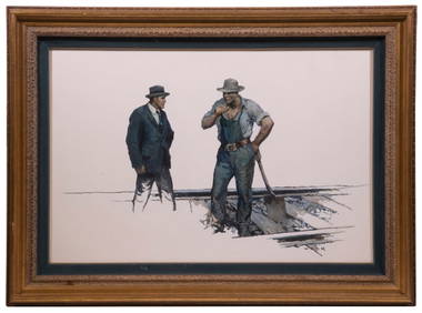
WILLIAM HENRY DETHLEF KOERNER (NJ/NY/MT, 1878-1938)Thomaston Place Auction Galleries4.4(393)See Sold PriceFeb 25, 2024
Pre-Columbian Nazca Painted Terracotta Stirrup VesselTimeLine Auctions Ltd.4.6(183)See Sold PriceMar 08, 2024
Natural History - Boxed Selenite Mineral Specimen Group [10].TimeLine Auctions Ltd.4.6(183)See Sold PriceMar 08, 2024
Natural History - Boxed Unpolished Fossil Tree Branch Section Group [8]TimeLine Auctions Ltd.4.6(183)See Sold PriceMar 08, 2024
Natural History - Agate Crystal Geode Cut Section Collection [3].TimeLine Auctions Ltd.4.6(183)See Sold PriceMar 09, 2024
Ten Pieces of Illinois Central Railroad China Coral Coffee Cups, Saucers, Bowls, Plates, BouillonRail & Road Auctions4.6(165)See Sold PriceMar 07, 2024
56.00CT NATURAL VIVID PINK KUNZITE DIAMOND RING 14KT RAISED TWIST+Jasper524.5(9.9k)See Sold PriceFeb 28, 2024
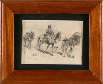
JOHN EDWARD BOREIN (California, 1872-1945), "Mexico", depicting a woman on horseback and two menEldred's4.7(419)See Sold PriceMar 07, 2024
18K Yellow Gold Yellow Gold Amethyst Diamond Pendant NecklaceGolden Gate Auctioneer4.1(278)See Sold PriceFeb 26, 2024
Bing and Grondahl Denmark Trinket Porcelain DishesRapid Estate Liquidators and Auction Gallery4.5(1.1k)See Sold PriceFeb 25, 2024
GORDON DEXTER: (1923-1990)International Autograph Auctions Europe S.L.4.4(52)See Sold PriceMar 13, 2024
Fancy 14K White Gold 0.72 ctw Diamond Section & Triple Twisted Wire Link BraceleSeized Assets Auctioneers4.3(602)See Sold PriceFeb 25, 2024
18K Yellow Gold Yellow Gold Amethyst Diamond Pendant NecklaceGolden Air Auctions4.3(265)See Sold PriceFeb 27, 2024
NAVAJO 14k GOLD DIAMOND & TURQUOISE CUFF BRACELETDejaVu Estate Sales & Auctions, LLC4.6(1.3k)See Sold PriceFeb 26, 2024


![Natural History - Boxed Selenite Mineral Specimen Group [10]. (1 of 1)](https://p1.liveauctioneers.com/1191/317892/170615796_1_x.jpg?height=282&quality=70&version=1706617191)
![Natural History - Boxed Unpolished Fossil Tree Branch Section Group [8] (1 of 1)](https://p1.liveauctioneers.com/1191/317892/170615929_1_x.jpg?height=282&quality=70&version=1706617191)
![Natural History - Agate Crystal Geode Cut Section Collection [3]. (1 of 1)](https://p1.liveauctioneers.com/1191/317894/170617057_1_x.jpg?height=282&quality=70&version=1706620797)