ATLAS of ANTIENT GEOGRAPHY by SAMUEL BUTLER 1843John McInnis Auctioneers,LLC4.6(502)See Sold PriceFeb 24, 2024
18TH C. ANTIQUE MAP: FRENCH & INDIAN WAR, FRAMEDThomaston Place Auction Galleries4.4(386)See Sold PriceFeb 24, 2024
Rand McNally Railroad Map Cabinet w/ 21 Railroad MapsRail & Road Auctions4.6(165)See Sold PriceMar 08, 2024
Keith Haring - Ink on New York Map, Best Buddies, Inscribed, Signed, and DatedSapphire Auction Gallery4(67)See Sold PriceMar 02, 2024
LATE 17TH C. FRENCH MAP OF THE NEW WORLD BY ALEXIS-HUBERT JAILLOT (1632-1712)Thomaston Place Auction Galleries4.4(386)See Sold PriceFeb 24, 2024
Central Railroad of New Jersey Map of Sandy Hook Route-ca. 1903JM Hobby Supply and Railroad Artifact Auctions4.4(126)See Sold PriceFeb 24, 2024
Lot of Six Mixed Atlas Box Cars-HO Scale-New in BoxJM Hobby Supply and Railroad Artifact Auctions4.4(126)See Sold PriceFeb 25, 2024
Rand McNally/Santa Fe Railroad Map of Iowa-1912JM Hobby Supply and Railroad Artifact Auctions4.4(126)See Sold PriceFeb 24, 2024
NICOLAES VISSCHER (NETHERLANDS, 1618-1709) MAP OF THE NEW WORLDThomaston Place Auction Galleries4.4(386)See Sold PriceFeb 24, 2024
17TH C. WORLD MAP BY NICOLAES VISSCHER (NETHERLANDS, 1618-1709)Thomaston Place Auction Galleries4.4(386)See Sold PriceFeb 24, 2024
Lot of Six Mixed Atlas Cabooses-HO Scale-New in BoxJM Hobby Supply and Railroad Artifact Auctions4.4(126)See Sold PriceFeb 25, 2024
SoldSixteen Antique French MapsSixteen Antique French Maps , 18th c., by Amedee Francois Frezier, 9 in. x 12 1/2 in Provenance: Property deaccessioned from the Louisiana State Museum, proceeds to be used for new acquisitions or theSee Sold Price
Bellin: Antique French Map Plan of Boston, 1757Title/Content of Map: Antique French Map and Plan of Boston, Massachusetts. Plan de la Ville de Boston et ses Environs Date Printed: 1757 Cartographer: Bellin, Jacques Nicolas Size (inches): 10 x 6 OnSee Sold Price
Sold(4) ANTIQUE FRENCH MAPS - FROM CHRISTIE'S AUCTIONFour antique French maps of Africa & Middle East. They were purchased from Christie's auction in 1994. Measures 8.75" x 7.75" to 16.25" x 13.5" w/ frames.See Sold Price
SoldAntique French Map and Plan of Boston, MassachusettsTitle/Content of Map: Antique French Map and Plan of Boston, Massachusetts Date Printed: 1757 Cartographer: Bellin, Jacques Nicolas Size (in): 10 x 6 One of the earliest obtainable town plans of BostoSee Sold Price
SoldTwelve Antique French Maps by BellinTwelve Antique French Maps by Bellin , 1750-1767, most sheets 25 in. x 36 in Provenance: Property deaccessioned from the Louisiana State Museum, proceeds to be used for new acquisitions or the directSee Sold Price
SoldTwelve Antique French Maps of EuropeTwelve Antique French Maps of Europe, 1704-1760, by Janvier and Jaillot, hand-colored in outline, incl. Prussia, Saxony, Poland, Hungary, Bohemia, Bavaria and the lands along the Rhine river, sheets aSee Sold Price
SoldSixty-Four Antique French MapsSixty-Four Antique French Maps, 1761, from Atlas Methodique et Elementaire de Geographie..., published by Louis Desnos, Paris, hand-colored engravings, 14 showing astronomical subjects, many of historSee Sold Price
SoldTwo Antique French Maps Depicting Near Eastern LandsTwo Antique French Maps Depicting Near Eastern Landsas follows: Terrae Sanctae Tabuls (Paris: Joseph De L'Isle, 1763), copperplate engraving with outline color, after the writings of Flavius Josephus,See Sold Price
Sold1705 Antique French Map of Portugal and Spain, P.1705 Antique French Map of Portugal and Spain, P. Starckman, Paris, Framed French Map "Les Frontieres D"™Espagne et De Portugal", marked 1705, "Gravee Par P. Starkman", site 23.25 x 17.75 inches, frSee Sold Price
SoldANTIQUE FRENCH MAP OF AUSTRIA & HUNGARYANTIQUE FRENCH MAP OF AUSTRIA & HUNGARY, H 6 3/4" W 7 3/4":Inscribed at the lower right, "L'Archiduche D'Autriche, et les Duches de Stirie, Carinthie et Carniole". Measuring H. 6 3/4" x 7 3/4" visibleSee Sold Price
Large Topographic Engraving Antique French map ofBasset ( Rue Jacque) edited and published this topographic map of Switzerland ( la Suisse ) Herisson eleve de Bonne is the cartographer , Rigobert Bonne (1727-1794) is a French geographer, hydrographeSee Sold Price
ANTIQUE FRENCH MAPS AFTER NICOLAS DE FER & M. BONNEANTIQUE FRENCH MAPS, AFTER NICOLAS DE FER & M. BONNE, TWO, H 8"-9" W 12"-13":Including one map of the Eastern part of the Great Empire of the Tatar, after Nicolas de Fer, inscribed at the lower rightSee Sold Price
SoldGroup of Twenty-Six Antique French MapsGroup of Twenty-Six Antique French Maps, from Atlas National Illustre, hand-colored in outline, showing the people, products and sights of various departments, image 11 in. x 15 3/4 in., mattedSee Sold Price
SoldLarge Topographic Engraving Antique French map of ParisEsnaud et Rapilly (Jacques Esnauts and Michel Rapilly ) edited and published this topographic map of Paris and its surrounding under the supervision of the Academie Royale des Sciences created under LSee Sold Price
SoldFour Antique French Maps of Holland and BelgiumFour Antique French Maps of Holland and Belgium, incl. "Partie Septentrionale des Pays Bas...", "Partie Meridionale des Pays Bas", both by Janvier, 1760, with cartouche on stern of a ship; "Carte du CSee Sold Price
Large Topographic Engraving Antique French map of SWITZERLAND 1796 HERISSONBasset ( Rue Jacque) edited and published this topographic map of Switzerland ( la Suisse ) Herisson eleve de Bonne is the cartographer , Rigobert Bonne (1727-1794) is a French geographer, hydrographeSee Sold Price
SoldFour Antique French Maps of Holland and BelgiumFour Antique French Maps of Holland and Belgium, incl. "Partie Septentrionale des Pays Bas...", "Partie Meridionale des Pays Bas", both by Janvier, 1760, with cartouche on stern of a ship; "Carte du CSee Sold Price
ANTIQUE FRENCH MAP LA ROCHE - SUR - YONANTIQUE FRENCH MAP ON FABRIC. SIZE: 28X20 INCHES APPROXIMATELY. UNFRAMED.See Sold Price
SoldAntique French Map of MississippiAntique French Map of Mississippi , "Carte Geographique, Statistique et Historique du Mississipi", Paris, Buchon, 1825, sight 21 in. x 27 1/2 in., framed Provenance: Estate of Julia Evans ReedSee Sold Price
SoldAntique French Map of Chili Signed J. De Laet. 1625Frame 20 1/2"x19" Map 15 1/2"x13 1/2"See Sold Price
SoldAntique French Map LVTETIA VULGO PARIS ANNO 1575,Antique French Map LVTETIA VULGO PARIS ANNO 1575, on LANA watermark paper. Sheet size: 15 ¾" x 20 1/8"See Sold Price
SoldAn Antique French Map of "Golfe du Mexique"An Antique French Map of "Golfe du Mexique", including Louisiana, sight 30-1/4" x 17-1/2". Matted and framed.See Sold Price
18TH C. ANTIQUE MAP: FRENCH & INDIAN WAR, FRAMEDThomaston Place Auction Galleries4.4(386)See Sold PriceFeb 24, 2024
UPPER/HAUTE VOLTA. Burkina Faso. French West Africa. Ouagadougou plan 1929 mapJasper524.5(9.8k)See Sold PriceFeb 28, 2024
Colonial Africa. British German French Spanish Portuguese Italian TIMES 1900 mapJasper524.5(9.8k)See Sold PriceFeb 28, 2024
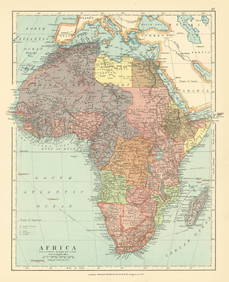
COLONIES FRANÇAISES en AFRIQUE. Africa Sénégal Madagascar. LEVASSEUR c1850 mapJasper524.5(9.8k)See Sold PriceFeb 28, 2024
Africa. French West/Equatorial. Tanganyika Belgian Congo. STANFORD c1925 mapJasper524.5(9.8k)See Sold PriceFeb 28, 2024
Colonial Africa North-West. British French. Nigeria Sahara. THE TIMES 1895 mapJasper524.5(9.8k)See Sold PriceFeb 28, 2024
Colonial Central Africa. Belgian Congo. French Equatorial Africa. TIMES 1922 mapJasper524.5(9.8k)See Sold PriceFeb 28, 2024
COLONIAL AFRICA. British French German Italian Portugal Spain.STANFORD 1906 mapJasper524.5(9.8k)See Sold PriceFeb 28, 2024
UPPER/HAUTE VOLTA. Burkina Faso. French West Africa. Ouagadougou plan 1931 mapJasper524.5(9.8k)See Sold PriceFeb 28, 2024
Colonial Africa. British German French Spanish Portuguese Italian TIMES 1895 mapJasper524.5(9.8k)See Sold PriceFeb 28, 2024
Colonial Africa North-West. British French. Nigeria Sahara. THE TIMES 1900 mapJasper524.5(9.8k)See Sold PriceFeb 28, 2024
L'Afrique Françoise ou du Senegal'. French West Africa. DE L’ISLE 1727 mapJasper524.5(9.8k)See Sold PriceFeb 28, 2024
1792 OLD INDIA HISTORY ANTIQUE ILLUSTRATED WITH MAPS OF THE EIGHTEENTH CENTURY IN FRENCHNY Elizabeth 4.3(84)See Sold PriceMar 03, 2024
James Cook - Map of the Friendly Isles - Tonga IslandsProverde Auctions4.3(3)See Sold PriceFeb 28, 2024
Poster "Les jardins de Paris", illustrated map and plan of Paris with its parcs, gardens, monuments,Proverde Auctions4.3(3)See Sold PriceFeb 28, 2024