SoldSeale (R.W.) A Correct Chart of the BaltickSeale (Richard William) A Correct Chart of the Baltick or East Sea, from ye Sound to Petersburg,decorative title cartouche, compass rose and rhum lines, and inset plan of The Harbour of PetersSee Sold Price
SoldSeale (R. W) The Baltick or East SeaSeale (Richard William) A Correct Chart of the Baltick or East Sea, from ye Sound to Petersburg,decorative title cartouche, compass rose and rhum lines, and inset plan of The Harbour of PetersSee Sold Price
SoldSeale (Richard William) Chart of the BaltickSeale (Richard William) A Correct Chart of the Baltick or East Sea, from ye Sound to Petersburg,decorative title cartouche, compass rose and rhum lijnes, and inset plan of The Harbour of PeterSee Sold Price
SoldRussia.- Baltic Sea.- St Petersburg.- Seale (RichardRussia.- Baltic Sea.- St Petersburg.- Seale (Richard William) A Correct Chart of the Baltick or East Sea from ye Sound to Petersburg from the Latest and Best Observations for Mr. Tindal's ContinuationSee Sold Price
SoldMap of St. George's Channel and theIrish Sea, 18th century British, 18th century. R.W. Seale (1732-1785), printed in 1745, "The Correct Chart of the St. George's Channel and the Irish Sea," including all the coast of Ireland and West CSee Sold Price
SoldR. W. SEALE A Correct Chart of St. George’s Channel andA Correct Chart of St. George's Channel and the Irish Sea [1743] , Handcoloured map (39 cm. wide; 49.5 cm. high) in outline with cartouche. From Mr. Tindal's Continuation of Mr Rapin's History of EnglSee Sold Price
SoldA Correct Chart of the German Ocean...R. W. Seale, A Correct Chart of the German Ocean..., engraving (hand colored), from Paul de Rapin Thoyras, The History of England. Continued by Nicholas Tindall (multiple eds., 1728-1745), 19 x 15 19See Sold Price
SoldA correct chart of the Mediterranean Sea…Richard William Seale , A correct chart of the Mediterranean Sea from the Straits of Gibraltar to the Levant. 1745 Incisione in rame in coloritura dei confini e cartigli. mm 350x725. Foglio: mm 392x74See Sold Price
SoldChart of the Mediterranean, c.1750Heading: Author: Seale, Richard William Title: Correct Chart of the Mediterranean Sea, from the Straits of Gibraltar to the Levant; from the Latest and Best Observations: For Mr. Tindal's ContinuatioSee Sold Price
Baltic Sea Lithuania Poland Latvia RussiaMap of the Baltic Sea and its surroundings; with the Port of Petersburg. 1744 Seale, Richard William; Knapton, John & Paul. A correct Chart of the Baltick or East Sea from ye Sound to Petersburg fromSee Sold Price
SoldTHREE EUROPEAN MAPS. Engraved, hand-colored maps, comprising:THREE EUROPEAN MAPS. Engraved, hand-colored maps, comprising: G. De l'Isle, In Notitiam Ecclesiasticam Africae Tabula Geographica (circa 1720), 21 x 26 in.; A Correct Chart of the Baltick or East SeaSee Sold Price
SoldRapin's Chart of St. George's ChannelRapin De Thoyras (Paul) A Correct Chart of St. George's Channel and the Irish Sea,Ireland and the west coast of the British Isles, decorative title cartouche, engraved map by R. W. Seale, 470See Sold Price
SoldRollinson: Correct Chart of the English Channel, 1796Map: A Correct Chart of the English Channel Publication Date: 1796-09-01 Maker: SPOTSWOOD AND NANCREDE, ROLLINSON. Publisher: SPOTSWOOD AND NANCREDE Size: Octavo – 7.10 H x 7.25 W Inches Malham's ChSee Sold Price
SoldSEALE, R.W. "A Map of North America with theEuropean Settlements & whatever else is remarkable in ye West Indies, from the latest and best observations" engraving, C. 1745. From a Scarsdale, NY collector. Particularly notable for displaying CalSee Sold Price
SoldJohn Senex (1678-1740), "A New and Correct Chart of theJohn Senex (1678-1740), "A New and Correct Chart of the Atlantic Ocean Reduced Describing parts of the Coasts of Europe, Africa and America," 1721, H. -21 in., W. - 25 3/8 in.See Sold Price
Sold"A New & Correct Chart of all the Known World" by"A New & Correct Chart of all the Known World" by Emanuel Bowen [London 1744]. 46 x 38cmSee Sold Price
SoldCorrect Chart of the Baltic Sea,Title/Content of Map: Correct Chart of the Baltic Sea, Date: 1797 Cartographer: ROLLINSON. Size: 9.25X7.3 "engraved for Malhams Naval Gazetteer. Rollinson sculpt. N. York." Please note that this lot hSee Sold Price
SoldPrice, Charles. A Correct Chart of Hispaniola with thePrice, Charles. A Correct Chart of Hispaniola with the Windward Passage......Humbly Dedicated to Mr. John Machin Professor of Astronomy at Gresham College by C. Price, Hydrographer to the King (LondonSee Sold Price
Sold*SEALE, R.W.(19th C. European) Map of Italy and surrounding nations, framed handcolored engraving, bears artist name in plate lower right, approximate plate size 15" x 18 1/2", frame 22" x 27".See Sold Price
SoldEMANUEL BOWEN, MAP PRINT "A NEW & CORRECT CHART"EMANUEL BOWEN, MAP PRINT, H 15", W 18", "A NEW & CORRECT CHART OF ALL THE KNOWN WORLD": Complete title "A New And Correct Chart of all the Known Word Laid down according to Mercator's Projection ExhibSee Sold Price
Sold18TH C. FRAMED MAP, ENGLISH CHANNEL "A Correct Chart of18TH C. FRAMED MAP, ENGLISH CHANNEL "A Correct Chart of the English Channel,...from Calais to Brest on the Coast of France", "For Mr. Tindal's Continuation of Mr. Rapin's History", London, 1746, (framSee Sold Price
A new & correct chart of the Channel between England &TITLE/CONTENT OF MAP: 'A new and correct chart of the Channel between England and France with considerable improvements not extant in any draughts hitherto publish'd shewing the sands, shoals, depthsSee Sold Price
SoldMap, A New and Correct Chart of the Harbour of CorkeRev John Lindsay, "A New and Correct Chart of the Harbour of Corke," hand-colored copper engraved map, overall (with frame): 23.25"h x 28"wSee Sold Price
Correct Chart of the Southern Coasts of Africa,Publication Date: 1797 Title: Correct Chart of the Southern Coasts of Africa, Cartographer: ROLLINSON. Publisher: SPOTSWOOD AND NANCREDE Height: 9.25 Width: 9.1 "from the Equator to the Cape of Good HSee Sold Price
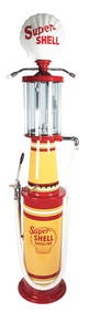
CORRECT MEASURE 10 GALLON PIPE ORGAN VISIBLE GAS PUMP RESTORED IN SKELLY.Dan Morphy Auctions4.2(1.3k)See Sold PriceFeb 24, 2024
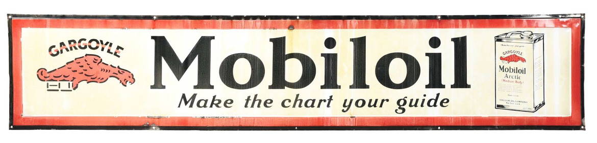
MOBILOIL "MAKE THE CHART YOUR GUIDE" PORCELAIN SIGN W/ OIL CAN & GARGOYLE GRAPHIC.Dan Morphy Auctions4.2(1.3k)See Sold PriceFeb 24, 2024
OUTSTANDING CORRECT MEASURE MODEL #10 VISIBLE GAS PUMP RESTORED IN SUPER SHELL GASOLINE.Dan Morphy Auctions4.2(1.3k)See Sold PriceFeb 24, 2024
CORRECT MEASURE TEN GALLON VISIBLE GAS PUMP RESTORED IN POLLY GASOLINE.Dan Morphy Auctions4.2(1.3k)See Sold PriceFeb 24, 2024
LATE 18TH C. VERY LARGE CHART OF NORTHEAST CANADA BY DES BARRES (1721-1824), 1780, FRAMEDThomaston Place Auction Galleries4.4(394)See Sold PriceFeb 24, 2024
LARGE LATE 17TH C. DUTCH CHART OF CANADA, GREAT LAKES, NEW FRANCE, LABRADOR, HUDSON BAY, BY PIERREThomaston Place Auction Galleries4.4(394)See Sold PriceFeb 24, 2024
EARLY 18TH C. DUTCH CHART OF PACIFIC OCEAN BY FREDERIK DE WIT (1629-1706) WITH CALIFORNIA AS ANThomaston Place Auction Galleries4.4(394)See Sold PriceFeb 24, 2024
LARGE EARLY 18TH C. DUTCH CHART OF UPPER NORTH AMERICA, PIERRE MORTIER (1661-1711), FRAMEDThomaston Place Auction Galleries4.4(394)See Sold PriceFeb 24, 2024
CHART "LONG ISLAND SOUND FROM NEW YORK TO MONTOCK POINT ..." New York, 1830 21" x 77" sight. FramedEldred's4.7(423)See Sold PriceFeb 27, 2024
CHART "SOUTHERN COAST OF LONG ISLAND FROM MONTAUK POINT TO EAST HAMPTON" Circa 1877 11.25" x 22.75"Eldred's4.7(423)See Sold PriceFeb 27, 2024
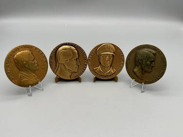
4/5 R.W. Julian's Satirical Bronze Medals 1977-1981Dana J. Tharp Auctions4.7(271)See Sold PriceFeb 24, 2024
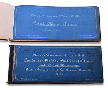
Chicago & Eastern Illinois Railroad 1901 Coal Mine Track and 1896 Brazil Division Track Chart BooksRail & Road Auctions4.6(165)See Sold PriceMar 08, 2024
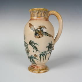
Rare Martin Brothers RW Wallace Stoneware Bird PitcherLion and Unicorn4.7(1.9k)See Sold PriceFeb 25, 2024
VINTAGE LEATHER DOCTORS BAG & HUMAN SKELETON CHARTCarlsen Gallery, Inc.4.6(165)See Sold PriceMar 03, 2024