ATLAS of ANTIENT GEOGRAPHY by SAMUEL BUTLER 1843John McInnis Auctioneers,LLC4.5(505)See Sold PriceFeb 24, 2024
18TH C. ANTIQUE MAP: FRENCH & INDIAN WAR, FRAMEDThomaston Place Auction Galleries4.4(393)See Sold PriceFeb 24, 2024
Rand McNally Railroad Map Cabinet w/ 21 Railroad MapsRail & Road Auctions4.6(165)See Sold PriceMar 08, 2024
Keith Haring - Ink on New York Map, Best Buddies, Inscribed, Signed, and DatedSapphire Auction Gallery4(67)See Sold PriceMar 02, 2024
LATE 17TH C. FRENCH MAP OF THE NEW WORLD BY ALEXIS-HUBERT JAILLOT (1632-1712)Thomaston Place Auction Galleries4.4(393)See Sold PriceFeb 24, 2024
Central Railroad of New Jersey Map of Sandy Hook Route-ca. 1903JM Hobby Supply and Railroad Artifact Auctions4.4(127)See Sold PriceFeb 24, 2024
Lot of Six Mixed Atlas Box Cars-HO Scale-New in BoxJM Hobby Supply and Railroad Artifact Auctions4.4(127)See Sold PriceFeb 25, 2024
Rand McNally/Santa Fe Railroad Map of Iowa-1912JM Hobby Supply and Railroad Artifact Auctions4.4(127)See Sold PriceFeb 24, 2024
NICOLAES VISSCHER (NETHERLANDS, 1618-1709) MAP OF THE NEW WORLDThomaston Place Auction Galleries4.4(393)See Sold PriceFeb 24, 2024
17TH C. WORLD MAP BY NICOLAES VISSCHER (NETHERLANDS, 1618-1709)Thomaston Place Auction Galleries4.4(393)See Sold PriceFeb 24, 2024
Lot of Six Mixed Atlas Cabooses-HO Scale-New in BoxJM Hobby Supply and Railroad Artifact Auctions4.4(127)See Sold PriceFeb 25, 2024
SoldScull Map of Philadelphia, 1752SCULL, Nicholas (1687-1761) & HEAP, George (1714-1752). A Map of Philadelphia and Parts Adjacent. Engraved map with original hand color. London: 1752. 15" x 12 1/2" sheet; 19 3/4" x 17 1/4" framed. EaSee Sold Price
SoldScull Map of Philadelphia with Statehouse, 1752 on SilkSCULL, Nicholas (1687-1761) and HEAP, George (active 1715-1760). A Map of Philadelphia, and Parts Adjacent with a Perspective View of the State House. Engraved Map on silk. c. 1752. 21 1/2" x 12 3/4"See Sold Price
SoldNicholas Scull - A Map of PhiladelphiaNicholas Scull (1687-1762), [A Map of Philadelphia and Parts Adjacent, by N. Scull and G. Heap], London, 1752, surveyor, George Heap, black and white line engraving with period hand color on laid papeSee Sold Price
SoldBowles View of Philadelphia, Heap and ScullRare 1778 Engraved map of Colonial Philadelphia after George Heap (1714-1752) and Nicholas Scull (1687-1761), published by Carington Bowles, London, 1778: AN EAST PERSPECTIVE VIEW OF THE CITY OF PHILASee Sold Price
SoldScull and Heap Map - PhiladelphiaMap titled "A Map of Philadelphia and parts Adjacent" by N. Scull and G. Heap. Printed in the London Gentleman's Magazine, Feb 1777. Measures 14 1/2" x 12" and has been trimmed tight on both left andSee Sold Price
SoldScull & Heap Map of PhiladelphiaMap titled "A Map of Philadelphia and Parts Adjacent" by N. Scull and G. Heap. Map is matted and framed and measures 13 1/4" x 11 1/2" (sight) and exhibits evidence of folding. Shipping: $26 plus insuSee Sold Price
Maps, Philadelphia: Centennial, Scull ReproA 1957 reproduction of an 1858 republication of the 1762 map of Philadelphia drawn by Nicholas Scull and published by Matthew Clarkson and Mary Biddle, printed by the the Society of Colonial Wars afteSee Sold Price
SoldScull and Heap Map of PhiladelphiaA framed map of "Philadelphia and Parts Adjacent" by N. Scull and G. Heap. Framed under glass. Mat opening: 13-1/4in x 11-1/2in.See Sold Price
Scull and Heap Map of Philadelphia.Black and white engraved map by N. Scull and G. Heap of Philadelphia and parts adjacent. Map measures 15" x 13" and presents evidence of previous removal from book with loss at left border. Image exhiSee Sold Price
Sold"Urban (Sylvanus) - The Gentleman's Magazine, andVol XXIII, only, engraved plates, a few hand coloured, 3 folding maps, including N. Scull & G. Heap's map of Philadelphia, all trimmed, with very slight loss, Philadelphia also with small tape-repairSee Sold Price
Sold2 Maps incl: Scull and Heap. A MAP OF PHILADELPHIA[United States] 2 Maps. ++ N. Scull and G. Heap. A MAP OF PHILADELPHIA And Parts Adjacent. From the folding map’s 2nd appearance in Gentleman’s Magazine [Lon: Dec. 1777], without the table of distSee Sold Price
SoldAN EARLY ENGRAVED MAP OF PHILADELPHIA, NICHOLAS SCULL,AN EARLY ENGRAVED MAP OF PHILADELPHIA, NICHOLAS SCULL, 1762 To the Mayor, Recorder, Aldermen, Common Council and Freemen of Philadelphia this plan of the improved part of the city, surveyed and laid dSee Sold Price
Sold2 pieces. Philadelphia - Cartographic & Pictorial2 pieces. Philadelphia - Cartographic & Pictorial Views: Scull, N.; Heap, G. A Map of Philadelphia and Parts Adjacent." [London: Gentleman's Magazine], [August, 1753]. Hand-colored engraved map. ApproSee Sold Price
Sold1 piece. Hand-Colored Engraved Map. Scull, Nichol1 piece. Hand-Colored Engraved Map. Scull, Nicholas; Heap, George. A Map of Philadelphia and Parts Adjacent."[London: Gentleman's Magazine], [August, 1753.] 13 5/8 x 11 1/4 inches; 346 x 285 mm, margiSee Sold Price
SCULL, Nicholas and George HEAP. A Map of PhiladelSCULL, Nicholas and George HEAP. A Map of Philadelphia and Parts Adjacent.[London: August 1753]. Engraved folding map. Sheet size: 14 x 12 in. Table of distances below the title. A year folSee Sold Price
SoldSCULL, Nicholas; and George HEAP. A Map of PhiladeSCULL, Nicholas; and George HEAP. A Map of Philadelphia and Parts Adjacent.[London: August 1753]. Engraved folding map (355 x 300 mm). Table of distances below the title. Provenance: MartinSee Sold Price
SoldScull Map of Pennsylvania, 1770SCULL, William (1739-1784). Map of the Province of Pennsylvania. Engraved Map. Hand color in outline. Philadelphia: James Nevil, 1770. 24 1/8" x 27 3/4" sheet; 32" x 45" framed. The First Map of PennsSee Sold Price
SoldScull Map of Pennsylvania, 1759SCULL, Nicholas (1687-1761). Map of the improved Part of the Province of Pennsylvania. Philadelphia: Engraved by Jas. Turner and Printed by John Davis for the Author; Published & Sold by the Author, NSee Sold Price
SoldScull Map of PennsylvaniaMap of the improved Part of the Province of Pennsylvania. Nicholas Scull (1687-1761). Philadelphia: Engraved by Jas. Turner and Printed by John Davis for the Author; Published & Sold by the Author, NiSee Sold Price
Sold18TH C. MAPS OF PHILADELPHIA & BOSTONMap of Philadelphia and parts adjacent, by N. Scull and G. Heap and Boston town plan and harbor chart; Hand-colored engravings (framed separately); Each: 12" x 14"See Sold Price
SoldMap of Philadelphia c.1777Title: A Map of Philadelphia and Parts Adjacent, by N. Scull and G. Heap Author: Scull & Heap Description: Copper-engraved map. 34x30 cm. (13½x12").Oddly, the left neat line is not printed. Heading:See Sold Price
SoldMap of 1750 Philadelphia, Printed in 1850A Map of Philadelphia and parts adjacent with a perspective view of the State-House by N. Scull & G.Heap. Republished April 1850 by David Lobach, Lobachsville, Berks County PA. 14"W x 21"H. Some tearsSee Sold Price
SoldHeap & Scull View of Philadelphia, London MagazineHEAP, George (1714-1752), after & SCULL, Nicholas (1687-1761). The East Prospect of the City of Philadelphia, in the Province of Pennsylvania. Engraving. London: London Magazine, 1761. 8 3/4" x 22 1/4See Sold Price
SoldHeap & Scull View of Philadelphia, BowelsHEAP, George (1714-1752), after & SCULL, Nicholas (1687-1761). An East Perspective View of the City of Philadelphia, in the Province of Pensylvania, in North America; Taken From the Jersey Shore. EngrSee Sold Price
1849 Mitchell School ATLAS 24 MAPS America Holy Land France Africa Egypt AsiaSchilb Antiquarian Rare Books4.8(428)See Sold PriceMar 31, 2024
1855 Guide for the Pennsylvania Railroad with an Extensive Map from the Pennsylvania RailroadRail & Road Auctions4.6(165)See Sold PriceMar 07, 2024
1876 The Centennial Exhibition Pennsylvania Railroad Worlds Fair Guide with Map and Trade CardRail & Road Auctions4.6(165)See Sold PriceMar 07, 2024
[BUSINESS]. Travel Guide of Negro Hotels and Guest Houses. Published by Afro-American Newspapers ofFreeman's | Hindman4.4(1.6k)See Sold PriceFeb 27, 2024
Mitchell - Map of the City of Washington (Washington, DC)Trillium Antique Prints & Rare Books4.5(32)See Sold PriceFeb 24, 2024
Carey, pub. 1796 - A Chart of the West IndiesTrillium Antique Prints & Rare Books4.5(32)See Sold PriceFeb 24, 2024
Carey, pub. 1796 - Map of the State of MarylandTrillium Antique Prints & Rare Books4.5(32)See Sold PriceFeb 24, 2024
Carey, pub. 1796 - Map of GeorgiaTrillium Antique Prints & Rare Books4.5(32)See Sold PriceFeb 24, 2024
Carey, pub. 1796 - Map of The State of South CarolinaTrillium Antique Prints & Rare Books4.5(32)See Sold PriceFeb 24, 2024
Carey, pub. 1796 - Map of KentuckyTrillium Antique Prints & Rare Books4.5(32)See Sold PriceFeb 24, 2024
Carey, pub. 1796 - Map of the Tennassee State formerly part of North Carolina (Tennessee)Trillium Antique Prints & Rare Books4.5(32)See Sold PriceFeb 24, 2024
McKenney & Hall, Folio, Rare - Hunting the BuffaloeTrillium Antique Prints & Rare Books4.5(32)See Sold PriceFeb 24, 2024
1797 1ST EDITION 5V IN 3 BOOKS BY FRANCES BURNEY TITLED CAMILLA LEATER BINDBidhaus4.3(762)See Sold PriceFeb 27, 2024
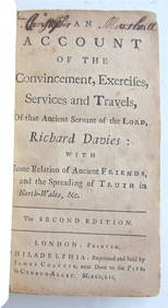
RICHARD DAVIES' 1752 "AN ACCOUNT OF EXERCISES, SERVICES, AND TRAVELS" VINTAGE AMERICANNY Elizabeth 4.2(86)See Sold PriceMar 03, 2024
1829 GERMAN-LANGUAGE ANTIQUE AMERICAN BIBLE ILLUSTRATED WITH MAPS OF PHILADELPHIANY Elizabeth 4.2(86)See Sold PriceMar 03, 2024


![[BUSINESS]. Travel Guide of Negro Hotels and Guest Houses. Published by Afro-American Newspapers of (1 of 4)](https://p1.liveauctioneers.com/197/319238/171467937_1_x.jpg?height=282&quality=70&version=1707520367)