ATLAS of ANTIENT GEOGRAPHY by SAMUEL BUTLER 1843John McInnis Auctioneers,LLC4.5(505)See Sold PriceFeb 24, 2024
18TH C. ANTIQUE MAP: FRENCH & INDIAN WAR, FRAMEDThomaston Place Auction Galleries4.4(393)See Sold PriceFeb 24, 2024
Rand McNally Railroad Map Cabinet w/ 21 Railroad MapsRail & Road Auctions4.6(165)See Sold PriceMar 08, 2024
Keith Haring - Ink on New York Map, Best Buddies, Inscribed, Signed, and DatedSapphire Auction Gallery4(67)See Sold PriceMar 02, 2024
LATE 17TH C. FRENCH MAP OF THE NEW WORLD BY ALEXIS-HUBERT JAILLOT (1632-1712)Thomaston Place Auction Galleries4.4(393)See Sold PriceFeb 24, 2024
Central Railroad of New Jersey Map of Sandy Hook Route-ca. 1903JM Hobby Supply and Railroad Artifact Auctions4.4(127)See Sold PriceFeb 24, 2024
Lot of Six Mixed Atlas Box Cars-HO Scale-New in BoxJM Hobby Supply and Railroad Artifact Auctions4.4(127)See Sold PriceFeb 25, 2024
Rand McNally/Santa Fe Railroad Map of Iowa-1912JM Hobby Supply and Railroad Artifact Auctions4.4(127)See Sold PriceFeb 24, 2024
NICOLAES VISSCHER (NETHERLANDS, 1618-1709) MAP OF THE NEW WORLDThomaston Place Auction Galleries4.4(393)See Sold PriceFeb 24, 2024
17TH C. WORLD MAP BY NICOLAES VISSCHER (NETHERLANDS, 1618-1709)Thomaston Place Auction Galleries4.4(393)See Sold PriceFeb 24, 2024
Lot of Six Mixed Atlas Cabooses-HO Scale-New in BoxJM Hobby Supply and Railroad Artifact Auctions4.4(127)See Sold PriceFeb 25, 2024
Scarce early Cram RR map of the Deep SouthFrom a very scarce Cram atlas comes this map of the Deep South showing the areas railway system in place in 1882. ”New Railroad and County Map of Arkansas, Louisiana & Mississippi.” The 18See Sold Price
Scarce early Cram RR map of Missouri“New Railroad and County Map of Missouri” from an exceedingly scarce 1882 edition of Cram’s Unrivaled Family Atlas of the World.” Collections of vintage maps of Missouri will nSee Sold Price
SoldScarce 1882 RR map of New JerseyScarce map of New Jersey from the first mass-produced world atlas by George F. Cram. He published at least two versions of his 1883 Universal Family Atlas, an early edition and a later edition. The eaSee Sold Price
SoldScarce 1882 Dakota, George F. CramReserve Reduced! Cerographic relief line engraving with county divisions in yellow and state boundaries outlined in deep rose. This map from 1882 or early 1883 is very uncommon, unlike the 1884 greenSee Sold Price
Scarce vintage map of the Deep South, 1875J. David Williams’ map of southern states from the very scarce Jones & Hamilton Atlas of the World Illustrated. Shows the six states that comprise the extreme southeastern United States. WonderfSee Sold Price
Double-page RR map of Texas from early Cram atlasInteresting cerographic map of Texas from 1883 edition of Cram’s Unrivaled Family Atlas of the World. Predates subdivision of Tom Green, Pecos, Crockett and Presidio Counties. Shows rail systemSee Sold Price
Scarce RR map of early Midwest, H. H. Lloyd 1872Elusive map showing the network of rail lines across a fourteen-state section of the Midwest from the Great Lakes to the Atlantic coast. Published just a few years after the end of the Civil War. IntrSee Sold Price
SoldScarce RR map of Colorado - 1897Scarce and large 2-page map from the very scarce Cram’s 1897 Standard American Railway System Atlas of the World. Cram was unique in producing a special group of atlases for just a few years that hiSee Sold Price
Fine RR map of Colorado from extremely scarce Cram RR atlasHighly detailed map of Colorado, from Cram's 1910 Standard American Railway System Atlas. Shows counties, railroads, railway stations, township surveys, mountains, rivers, lakes, and a host of other eSee Sold Price
Bradford Map of Illinois & Missouri, 18351835 Bradford map of Illinois & Missouri. 7.75 x 10 inches. Scarce early map of Missouri & Illinois, also showing Arkansaw Territory to the South and Missouri Territory to the North. A number of earlySee Sold Price
SoldScarce 1835 map of Illinois/Missouri.One of the earliest maps engraved in America to focus on this region. Scarce early map of Missouri & Illinois, also showing Arkansaw Territory to the South and Missouri Territory to the North. A numbeSee Sold Price
Scarce 1835 Bradford map of Illinois/Missouri.Reserve Reduced! One of the earliest maps engraved in America to focus on this region. Scarce early map of Missouri & Illinois, also showing Arkansaw Territory to the South and Missouri Territory to tSee Sold Price
SoldScarce 19th cent. RR map of TexasHighly detailed railroad map of Texas from the extremely scarce 1898 Cram’s Bankers and Brokers Railroad Atlas published by George F. Cram. All railroads and routes operating during that time periodSee Sold Price
Scarce 19th cent. RR map of Texas in fine conditionReserve Reduced! Highly detailed railroad map of Texas from the extremely scarce 1898 Cram’s Bankers and Brokers Railroad Atlas published by George F. Cram. All railroads and routes operating duringSee Sold Price
Scarce 19th cent. RR map of Texas in fine conditionReserve Reduced! Highly detailed railroad map of Texas from the extremely scarce 1898 Cram’s Bankers and Brokers Railroad Atlas published by George F. Cram. All railroads and routes operating duringSee Sold Price
Scarce Walling’s RR map of the Southern States, 1868Attractive and interesting map of the South including most of Texas, nearly the whole of Indian Territory and all of Florida. Nice illustration of a sailing ship off the northern Florida coast where nSee Sold Price
Large and scarce 19th century RR map of Western TexasHighly detailed railroad map of the western half of Texas from the extremely scarce 1898 Cram’s Bankers and Brokers Railroad Atlas. All railroads and routes operating during that time period areSee Sold Price
North and South CarolinaTitle: North and South Carolina Publication Date: 1901 Cartographer: CRAM, GEORGE F. Publisher: GEO. F. CRAM Size: 22.5X32.75 Scarce Cram Large Pocket Map of the Carolinas. Included with Cram's indexeSee Sold Price
SoldTanner / Reid Map of South Carolina, 1796Tanner, Benjamin (1775-1848). State of South Carolina from the Best Authorities. Engraved map. J. Reid, 1796. 15" x 17" sheet. Published by John Reid New York. A very early and scarce folio map of SouSee Sold Price
Extremely scarce RR map of Utah from 1910 Cram Std. Amer. Railway atlasImpossibly scarce, large format railroad map of Utah, showing counties, railroad lines, towns, mines, rivers, township surveys, Indian reservations, lakes, mountains, creeks, waterfalls, and a host ofSee Sold Price
SoldScarce and huge RR map of California – 1898Toward the end of the 19th century, the better atlas makers had pushed the size and quality of their maps to the limit. George F. Cram was one of these publishers, but he also put out a special groupSee Sold Price
SoldScarce 1883 map of TexasExtremely scarce early 1883 map is different from the more common later 1883 and 1884 version of Cram’s Texas. The later versions have green county borders with rose hachures for the state outline.See Sold Price
Uncommon early 1883 RR map of SE United StatesGeorge F. Cram published at least two versions of his 1883 Universal Family Atlas, an early edition and a later edition. The earlier edition is much less common. This map is from the earlier edition aSee Sold Price
Uncommon early 1883 RR map of southern statesGeorge F. Cram published at least two versions of his 1883 Universal Family Atlas, an early edition and a later edition. The earlier edition is much less common. This map is from the earlier edition aSee Sold Price
Ohio and Pennsylvania RR 2nd Annual Report-1850JM Hobby Supply and Railroad Artifact Auctions4.4(127)See Sold PriceFeb 24, 2024
Crams Colored Railway Map and Shippers Guide of South Dakota 1908-1909JM Hobby Supply and Railroad Artifact Auctions4.4(127)See Sold PriceFeb 24, 2024
Crams Township and Railroad Map of New York-1890JM Hobby Supply and Railroad Artifact Auctions4.4(127)See Sold PriceFeb 24, 2024
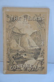
Chicago Burlington and Quincy RR The Heart of the Continent Book-1882JM Hobby Supply and Railroad Artifact Auctions4.4(127)See Sold PriceFeb 24, 2024
A 1971 Walt Disney World Magic Kingdom Souvenir Map.Van Eaton Galleries4.6(99)See Sold PriceMar 02, 2024
Arrowsmith & Lewis - Map of PolynesiaTrillium Antique Prints & Rare Books4.5(32)See Sold PriceFeb 24, 2024
Arrowsmith & Lewis - Map of North AmericaTrillium Antique Prints & Rare Books4.5(32)See Sold PriceFeb 24, 2024
Arrowsmith & Lewis - Map of the World on Mercator's ProjectionTrillium Antique Prints & Rare Books4.5(32)See Sold PriceFeb 24, 2024
Arrowsmith & Lewis - Map of LouisianaTrillium Antique Prints & Rare Books4.5(32)See Sold PriceFeb 24, 2024
Arrowsmith & Lewis - Map of the United StatesTrillium Antique Prints & Rare Books4.5(32)See Sold PriceFeb 24, 2024
Carey, pub. 1796 - A Chart of the West IndiesTrillium Antique Prints & Rare Books4.5(32)See Sold PriceFeb 24, 2024
Carey, pub. 1796 - Map of the State of MarylandTrillium Antique Prints & Rare Books4.5(32)See Sold PriceFeb 24, 2024
Carey, pub. 1796 - Map of GeorgiaTrillium Antique Prints & Rare Books4.5(32)See Sold PriceFeb 24, 2024
Carey, pub. 1796 - Map of The State of South CarolinaTrillium Antique Prints & Rare Books4.5(32)See Sold PriceFeb 24, 2024
Carey, pub. 1796 - Map of KentuckyTrillium Antique Prints & Rare Books4.5(32)See Sold PriceFeb 24, 2024
Carey, pub. 1796 - Map of the Tennassee State formerly part of North Carolina (Tennessee)Trillium Antique Prints & Rare Books4.5(32)See Sold PriceFeb 24, 2024
SOUTH CENTRAL AFRICA. Shows Zambesi river as circular! WELLER 1863 old mapJasper524.5(9.9k)See Sold PriceFeb 28, 2024