ATLAS of ANTIENT GEOGRAPHY by SAMUEL BUTLER 1843John McInnis Auctioneers,LLC4.5(505)See Sold PriceFeb 24, 2024
18TH C. ANTIQUE MAP: FRENCH & INDIAN WAR, FRAMEDThomaston Place Auction Galleries4.4(393)See Sold PriceFeb 24, 2024
Rand McNally Railroad Map Cabinet w/ 21 Railroad MapsRail & Road Auctions4.6(165)See Sold PriceMar 08, 2024
Keith Haring - Ink on New York Map, Best Buddies, Inscribed, Signed, and DatedSapphire Auction Gallery4(67)See Sold PriceMar 02, 2024
LATE 17TH C. FRENCH MAP OF THE NEW WORLD BY ALEXIS-HUBERT JAILLOT (1632-1712)Thomaston Place Auction Galleries4.4(393)See Sold PriceFeb 24, 2024
Central Railroad of New Jersey Map of Sandy Hook Route-ca. 1903JM Hobby Supply and Railroad Artifact Auctions4.4(127)See Sold PriceFeb 24, 2024
Lot of Six Mixed Atlas Box Cars-HO Scale-New in BoxJM Hobby Supply and Railroad Artifact Auctions4.4(127)See Sold PriceFeb 25, 2024
Rand McNally/Santa Fe Railroad Map of Iowa-1912JM Hobby Supply and Railroad Artifact Auctions4.4(127)See Sold PriceFeb 24, 2024
NICOLAES VISSCHER (NETHERLANDS, 1618-1709) MAP OF THE NEW WORLDThomaston Place Auction Galleries4.4(393)See Sold PriceFeb 24, 2024
17TH C. WORLD MAP BY NICOLAES VISSCHER (NETHERLANDS, 1618-1709)Thomaston Place Auction Galleries4.4(393)See Sold PriceFeb 24, 2024
Lot of Six Mixed Atlas Cabooses-HO Scale-New in BoxJM Hobby Supply and Railroad Artifact Auctions4.4(127)See Sold PriceFeb 25, 2024
Sanson (Nicolas) & Jaillot (Hubert) Partie OccidentaleSanson (Nicolas) & Jaillot (Hubert) Partie Occidentale du temporel de l'Archevesché et Eslectorat de Treves, from Jaillot’s 'Atlas Nouveau', trimmed, wormholing, 560 x 430 mm, Paris, 1696; Neue undSee Sold Price
SoldRARE 17TH C. SANSON MAP OF AUSTRIAAlexis-Hubert Jaillot (c. 1632-1712); Nicolas Sanson (1600-1667) "Partie du Cercle d'Austriche, scavoir l'Archduchie d'Austriche.......", hand colored engraving, published 1700 from earlier plates, PaSee Sold Price
SoldSanson (Nicolas) & Jaillot (Alexis Hubert) L’AsieSanson (Nicolas) & Jaillot (Alexis Hubert) L’Asie divisée en ses principales parties…, engraved map, hand coloured, title cartouche, central vertical fold, 63 x 98cm, Paris, 1692. ***Based upon tSee Sold Price
SoldCartografia - Sanson, Nicolas - Jaillot, Alexis HubertUna carta geografica incisa in rame, Parigi, Jaillot, 1692, cm 60 x 90,5, su 2 fogli giuntati, confini acquerellati, lievemente brunita, qualche brunitura e strappo marginale, piccoli difetti lungo laSee Sold Price
Carte ancienne : - Amsterdam - 1641 - Sanson et JaillotCarte ancienne : - Amsterdam - 1641 - Sanson et Jaillot - Partie occidentale du temporel de l'Archevesché et Eslectorat de Treves Tiré de l'Atlas nouveau - Paris - 1696 56 x 43 cmSee Sold Price
SANSON-JAILLOT. L' Europe 1696SANSON Nicolas e JAILLOT Alexis-Hubert. L'Europe divisee suivant l'esendue des ses principaux Estats. 1696.Incisione su doppio foglio 545x860mmSee Sold Price
COLLECTION OF FIVE ENGRAVINGS I.a. MatthäusCOLLECTION OF FIVE ENGRAVINGS I.a. Matthäus Merian, Alexis-Hubert Jaillot, Nicolas Sanson, Homann Heirs, 17th/18th century (partly later prints) Engravings, partly coloured, on different papers.See Sold Price
SoldEuropa. Jaillot - Sanson d'Abbeville. L'Europe diviseeEuropa. Alexis-Hubert Jaillot - Nicolas Sanson d'Abbeville.L'Europe divisee suivant l'esendue des ses principaux Estats. 1696 Incisione su doppio foglio. Buone condizioni, traccia centrale di piegaturSee Sold Price
Sold(SEVENTEEN PROVINCES.) Jaillot, Hubert; after Sanson,(SEVENTEEN PROVINCES.) Jaillot, Hubert; after Sanson, Nicolas. Les Dix-Sept Provinces des Pays-Bas Distinguees Suivant Quelles sont Possedees a Present par les Roys de France, et d'Espagne, et les EstSee Sold Price
SoldAntique French Regional MapLa Lorraine qui Comprend les Duches de Lorraine et de Bar. Nicolas Sanson -- Charles Hubert Jaillot, Paris, 1700. Engraving, uncolored.. 21" x 28".See Sold Price
SoldRARE 17TH C. SANSON MAP OF LUXEMBOURGAlexis-Hubert Jaillot (c. 1632-1712); Nicolas Sanson (1600-1667) "Le Duche de Luxembourg Divise en Quarter Walon et Allemand....", hand colored engraving, published 1700 from earlier plates, Paris, frSee Sold Price
SoldJAILLOT, ALEXIS-HUBERT; and SANSON, NICOLAS.JAILLOT, ALEXIS-HUBERT; and SANSON, NICOLAS. Mappe-Monde Geo-Hydrographique, ou Description Generale du Globe Terrestre. Large double-page double-hemispheric map of the world with fine decorative elemSee Sold Price
SoldSwitzerland.- Jaillot (Alexis-Hubert) La Suisse DiviseeSwitzerland.- Jaillot (Alexis-Hubert) and Nicolas Sanson. La Suisse Divisee en Ses Treze Cantons, Ses Alliez & Ses Sujets, map showing Switzerland divided into the 13 Cantons, decorated with 33 coatsSee Sold Price
1696 Mortier Maps From Jaillot's Atlas Nouveau1696 Mortier Maps From Jaillot's Atlas Nouveaua collection of (15) double-page monochrome folio maps by Alexis-Hubert Jaillot (1632-1712) after Nicolas Sanson and published in Amsterdam by Pierre MortSee Sold Price
SoldNicolas Sanson/Hubert Jaillot Map Europe ca. 1680Hubert Jaillot (1632-1712) and Nicolas Sanson (1600-1677), "L'Europe Divisee Suivant L'Estendue De Ses Principaux Etats, subdivises en leurs principales Provinces," Paris, ca. 1680. A lovely hand coloSee Sold Price
RARE 17TH C. SANSON MAP OF HUNGARYAlexis-Hubert Jaillot (c. 1632-1712); Nicolas Sanson (1600-1667) "Le Royaume Hongrie et les Estats quiont este sujets et dependans....", hand colored engraving, published 1700 from earlier plates, ParSee Sold Price
(3) RARE 17TH C. SANSON MAPS OF GERMANYAlexis-Hubert Jaillot (c. 1632-1712); Nicolas Sanson (1600-1667). All single sheet, including: "Le Duce de Iuliers"; "l'Evesche de Munster"; Le Comte de la Marck", hand colored engravings, published 1See Sold Price
RARE 17TH C. SANSON MAP OF DENMARKAlexis-Hubert Jaillot (c. 1632-1712); Nicolas Sanson (1600-1667) "Le Royaume de Danemark ou sont Les Isles de Seelande et de Fyone....", hand colored engraving, published 1700 from earlier plates, ParSee Sold Price
TITLE PAGE AND FIVE GENEAOLOGY SHEETS FROM 1700 ATLASAlexis-Hubert Jaillot (c. 1632-1712); Nicolas Sanson (1600-1667). All single sheet, including: Title Page and "Tables des Divisions de Royaume" for Denmark, Germany, France, Hungary and Turkey, publisSee Sold Price
RARE 17TH C. SANSON MAP OF FLEMISH FRANCEAlexis-Hubert Jaillot (c. 1632-1712); Nicolas Sanson (1600-1667) "Le Comte d'Artois, Dresse sur les Memoires les plus Nouveaux....", hand colored engraving, published 1700 from earlier plates, Paris,See Sold Price
TITLE PAGE AND FIVE GENEAOLOGY SHEETS FROM 1700 ATLASAlexis-Hubert Jaillot (c. 1632-1712); Nicolas Sanson (1600-1667). All single sheet, including: Title Page and "Tables des Divisions de Royaume" for Denmark, Germany, France, Hungary and Turkey, publisSee Sold Price
Sold(3) RARE 17TH C. SANSON MAPS OF GERMANYAlexis-Hubert Jaillot (c. 1632-1712); Nicolas Sanson (1600-1667). All single sheet, including: "Le Duce de Iuliers"; "l'Evesche de Munster"; Le Comte de la Marck", hand colored engravings, published 1See Sold Price
RARE 17TH C. SANSON MAP OF DENMARKAlexis-Hubert Jaillot (c. 1632-1712); Nicolas Sanson (1600-1667) "Le Royaume de Danemark ou sont Les Isles de Seelande et de Fyone....", hand colored engraving, published 1700 from earlier plates, ParSee Sold Price
LARGE LATE 17TH C. DUTCH CHART OF CANADA, GREAT LAKES, NEW FRANCE, LABRADOR, HUDSON BAY, BY PIERREThomaston Place Auction Galleries4.4(393)See Sold PriceFeb 24, 2024
LATE 17TH C. FRENCH MAP OF THE NEW WORLD BY ALEXIS-HUBERT JAILLOT (1632-1712)Thomaston Place Auction Galleries4.4(393)See Sold PriceFeb 24, 2024
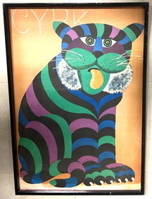
Hubert Hilscher CYRK Tiger Cat Polish Circus 1971 PosterBasel Auction House4.5(47)See Sold PriceFeb 24, 2024
Duval - Pair: Map of Georgia & Map of Moscow, RussiaTrillium Antique Prints & Rare Books4.5(32)See Sold PriceFeb 24, 2024
Duval - Pair: Map of India & Map of MaldivesTrillium Antique Prints & Rare Books4.5(32)See Sold PriceFeb 24, 2024
1758 MAP PARTIE DE LA MER GLACIALE contenants La Nouvelle Zemble RUSSIA antiqueJasper524.5(9.9k)See Sold PriceFeb 27, 2024
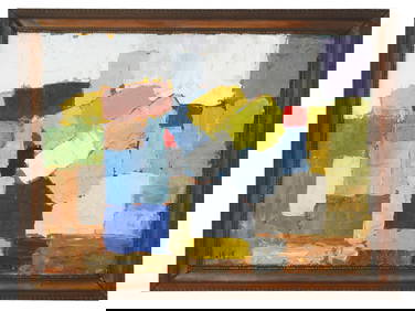
ATTR NICOLAS DE STAEL MID 20TH C FRENCH OIL PAINTINGAntique Arena Inc.4.5(878)See Sold PriceMar 02, 2024
1764 Bellin Map of Western Guadeloupe in the Lesser Antilles -- Partie Occidentale de l'Isle de laJasper524.5(9.9k)See Sold PriceFeb 27, 2024
NORTH AFRICA. 'Biledulgerid', a former North African country. MALLET 1683 mapJasper524.5(9.9k)See Sold PriceFeb 28, 2024
Partie Occidentale de l’Afrique. West Africa coast Canary islands BONNE 1788 mapJasper524.5(9.9k)See Sold PriceFeb 28, 2024
NORTH AFRICA. Barbary. Morocco Tunisia Libya Egypt. 'Barbarie'. MALLET 1683 mapJasper524.5(9.9k)See Sold PriceFeb 28, 2024
Partie Occidentale de l'Ancien Continent… W Africa Macaronesia. BONNE 1780 mapJasper524.5(9.9k)See Sold PriceFeb 28, 2024