ATLAS of ANTIENT GEOGRAPHY by SAMUEL BUTLER 1843John McInnis Auctioneers,LLC4.5(505)See Sold PriceFeb 24, 2024
18TH C. ANTIQUE MAP: FRENCH & INDIAN WAR, FRAMEDThomaston Place Auction Galleries4.4(393)See Sold PriceFeb 24, 2024
Rand McNally Railroad Map Cabinet w/ 21 Railroad MapsRail & Road Auctions4.6(165)See Sold PriceMar 08, 2024
Keith Haring - Ink on New York Map, Best Buddies, Inscribed, Signed, and DatedSapphire Auction Gallery4(67)See Sold PriceMar 02, 2024
LATE 17TH C. FRENCH MAP OF THE NEW WORLD BY ALEXIS-HUBERT JAILLOT (1632-1712)Thomaston Place Auction Galleries4.4(393)See Sold PriceFeb 24, 2024
Central Railroad of New Jersey Map of Sandy Hook Route-ca. 1903JM Hobby Supply and Railroad Artifact Auctions4.4(127)See Sold PriceFeb 24, 2024
Lot of Six Mixed Atlas Box Cars-HO Scale-New in BoxJM Hobby Supply and Railroad Artifact Auctions4.4(127)See Sold PriceFeb 25, 2024
Rand McNally/Santa Fe Railroad Map of Iowa-1912JM Hobby Supply and Railroad Artifact Auctions4.4(127)See Sold PriceFeb 24, 2024
NICOLAES VISSCHER (NETHERLANDS, 1618-1709) MAP OF THE NEW WORLDThomaston Place Auction Galleries4.4(393)See Sold PriceFeb 24, 2024
17TH C. WORLD MAP BY NICOLAES VISSCHER (NETHERLANDS, 1618-1709)Thomaston Place Auction Galleries4.4(393)See Sold PriceFeb 24, 2024
Lot of Six Mixed Atlas Cabooses-HO Scale-New in BoxJM Hobby Supply and Railroad Artifact Auctions4.4(127)See Sold PriceFeb 25, 2024
SoldNicolas Sanson/Hubert Jaillot Map Europe ca. 1680Hubert Jaillot (1632-1712) and Nicolas Sanson (1600-1677), "L'Europe Divisee Suivant L'Estendue De Ses Principaux Etats, subdivises en leurs principales Provinces," Paris, ca. 1680. A lovely hand coloSee Sold Price
Antique Map - Europe - Graueline Government Map - Sebastien Beaulieu - FranceTitle: Antique Map - Europe - Graueline Government Map - Sebastien Beaulieu - France Description: Rare original copper engraving from the small Beaulieu Atlas from ca. 1680. "Plans and Profiles of theSee Sold Price
Antique Map - Europe - Fort-Mardyck Government Map - Sebastien Beaulieu - FranceTitle: Antique Map - Europe - Fort-Mardyck Government Map - Sebastien Beaulieu - France Description: Rare original copper engraving from the small Beaulieu Atlas from ca. 1680. "Plans and Profiles ofSee Sold Price
Antique Map - Europe - Map of the Government of Bruges - Sebastien Beaulieu 1860Title: Antique Map - Europe - Map of the Government of Bruges - Sebastien Beaulieu 1860 Description: Rare original copper engraving from the small Beaulieu Atlas from ca. 1680. "Plans and Profiles ofSee Sold Price
Sold1680 MAP BY NICOLAS VISSCHERInsulae Americanae in Oceano SeptentrionaliMittelamerika und Antillen. "Insulae Americanae in Oceano Septentrionali". By Nicolas. Visscher, ca.1680. Original old coloring. With decorative title-cartouSee Sold Price
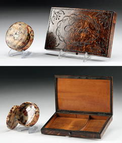
Sold[JAILLOT] MAP OF HUNGARY & SURROUNDINGS'Le Royaume De Hongrie Et Les Estats qui en ont este sujets....La Partie Septentrionale De La Turquie en Europe, by Alexis-Hubert Jaillot (ca. 1632-1712) and Guillaume Sanson (1633-1703), engraving wiSee Sold Price
SoldNicolas Sanson Map of AsiaNicolas Sanson (1600-1667) "L'Asie divisee en ses Principales Regions, et ou se peuvent voir l'estendue, Des Empires, Monarchies, Royaumes, et Estats," Paris: Jaillot, ca. 1719. Hand colored map of AsSee Sold Price
SoldEuropa. Jaillot - Sanson d'Abbeville. L'Europe diviseeEuropa. Alexis-Hubert Jaillot - Nicolas Sanson d'Abbeville.L'Europe divisee suivant l'esendue des ses principaux Estats. 1696 Incisione su doppio foglio. Buone condizioni, traccia centrale di piegaturSee Sold Price
Sold4 Maps: Italy, by Mortier. Verona, Ferrare...[Europe/Italy]. 4 Maps. Amst: Pierre Mortier, [ca. early 1700’s to 1720’s]. Based on earlier maps by Nicolas Sanson, these maps show rivers, and mark the locations of numerous towns. Each approx.See Sold Price
SoldNobilissimi Albis Fluvii Ostia... [Ca. 1735-1750.][Europe/Germany]. 2 Maps on 1 Sheet: NOBILISSIMI ALBIS FLUVII OSTIA, NEC NON HAMBURGENSE, ET ALIA TERRITORIA ADJACENTIA./ EMPORIUM HAMBURGUM. Amst: Nicolas Visscher, (nd). [Ca. 1735-1750.] Sometimes aSee Sold Price
Sold5 Maps: Mortier after Sanson. Italy, incl Venice.[Europe/Italy]. 5 Maps. Amst: Pierre Mortier, (nd), [ca. early 1700s to 1720s], after Nicolas Sanson. Varying degrees of creasing throughout sheets. Margins have losses and/or wear. Most are marginallSee Sold Price
Sold2 pieces. Engraved Maps with Outline Color. Sanso2 pieces. Engraved Maps with Outline Color. Sanson, d'Abbeville, Nicolas. [Central Europe]: Partie du Cercle d'Austriche." Paris: A.H. Jaillot, 1681. Double sheet, 22 3/4 x 34 3/4 inches; 578 x 882 mmSee Sold Price
Visscher. Portugalliae et Algarbiae c.1680.[Europe] Visscher, Nicolas. “Portugalliae et Algarbiae Regna.” Amsterdam, c.1680. Engraved map. 22 1/8” x 18 1/4”. Hand-colored. Two colored cartouches._x000D_ Condition SlightSee Sold Price
Sold5 maps (Europe). Ca. 1750, each hand colored.[EUROPE]. 5 Maps. No dates, ca.1700-1750. All but first one double-page engraving, hand-colored. All toned, some other defects, should be seen. ++ Mercator. Murs Comitatus. 13 1/8 x 8 3/4. French textSee Sold Price
SoldNicolaum Visscher engraved hand-colored mapNicolaum Visscher- ''Hispania et Portugalliae Regna''- double page engraved hand-colored map, ca. 1680-1720, cartouche with queen, shield and cupids. 19 1/4 x 23''See Sold Price
SoldFRENCH SCHOOL, 19th centuryDescription : "Map of Europe" ca 1890.-- Medium : Sepia on paper.-- Dimensions : 35 x 45 cmSee Sold Price
SoldSanson (Nicolas) maps of northern EuropeSanson (Nicolas) a bound group of maps of northern Europe,21 double-page maps of France, Germany and the Low Countries, national and regional, also the city of Namur, and French military postsSee Sold Price
SoldMaps, Europe, Jaillot, Daumont, Homann, Poirson(lot of 8) Unframed engraved maps, some handcolored: ''Theatre de la Guerre du Nord Comprenant les Pays Bays...,'' by Jean-Baptiste Poirson (French, 18th Century), plate: 24.25''h x 35.5''w, sheet: 26See Sold Price
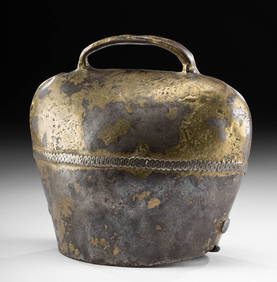
SoldTall 1680s Spanish Baroque Brass Candlestick**Originally Listed At $375** Europe, Spain, Baroque, ca. 1680 CE. An enormous brass candlestick from Baroque Spain! Note the attractive turned and incised stem with an acanthus leaf in relief, the drSee Sold Price
Large Spanish Baroque Brass Candlestick - Ca 1680Europe, Spain, Baroque, ca. 1680 CE. An enormous brass candlestick from Baroque Spain! Note the attractive turned and incised stem with an acanthus leaf in relief, the dramatically flared sconce, tallSee Sold Price
Tall 1680s Spanish Baroque Brass Candlestick**Originally Listed At $375** Europe, Spain, Baroque, ca. 1680 CE. An enormous brass candlestick from Baroque Spain! Note the attractive turned and incised stem with an acanthus leaf in relief, the drSee Sold Price
Tall 1680s Spanish Baroque Brass Candlestick**Originally Listed At $375** Europe, Spain, Baroque, ca. 1680 CE. An enormous brass candlestick from Baroque Spain! Note the attractive turned and incised stem with an acanthus leaf in relief, the drSee Sold Price
Jefferys: Map of Europe, 1763Map: Europe. Publication Date: 1763 ca. Authors: JEFFERYS, T. Size: Octavo – 7.10 H x 8.80 W Inches "T. Jefferys, Sc." On polar projection Please note that this lot has a confidential reserve. WhenSee Sold Price
SoldJefferys: Antique Map of Europe, 1763Map: Europe. Publication Date: 1763 ca. Authors: JEFFERYS, T. Size: Octavo – 7.10 H x 8.80 W Inches T. Jefferys, Sc. On polar projection Thomas Jefferys (1719-1771) was the Royal Cartographer tSee Sold Price
LARGE LATE 17TH C. DUTCH CHART OF CANADA, GREAT LAKES, NEW FRANCE, LABRADOR, HUDSON BAY, BY PIERREThomaston Place Auction Galleries4.4(393)See Sold PriceFeb 24, 2024
LATE 17TH C. FRENCH MAP OF THE NEW WORLD BY ALEXIS-HUBERT JAILLOT (1632-1712)Thomaston Place Auction Galleries4.4(393)See Sold PriceFeb 24, 2024
EARLY 18TH C. DUTCH CHART OF PACIFIC OCEAN BY FREDERIK DE WIT (1629-1706) WITH CALIFORNIA AS ANThomaston Place Auction Galleries4.4(393)See Sold PriceFeb 24, 2024
[DYE COLOR SAMPLE BOOKS]. A Group of Six Dye Color Sample B...Potter & Potter Auctions4.6(545)See Sold PriceMar 07, 2024
Patrician notebook, Kronstadt Thomas Melchior, ca. 1680Dr. Fischer Fine Art Auctions4.5(110)See Sold PriceMar 09, 2024
Two (2) Antique 18th C. Copper Engraved Framed Maps - America & EuropeMagnusson Art Group4.5(53)See Sold PriceMar 14, 2024
Carey, pub. 1796 - A Chart of the West IndiesTrillium Antique Prints & Rare Books4.5(32)See Sold PriceFeb 24, 2024
Carey, pub. 1796 - Map of GeorgiaTrillium Antique Prints & Rare Books4.5(32)See Sold PriceFeb 24, 2024
Carey, pub. 1796 - Map of The State of South CarolinaTrillium Antique Prints & Rare Books4.5(32)See Sold PriceFeb 24, 2024
Carey, pub. 1796 - Map of KentuckyTrillium Antique Prints & Rare Books4.5(32)See Sold PriceFeb 24, 2024
Carey, pub. 1796 - Map of the Tennassee State formerly part of North Carolina (Tennessee)Trillium Antique Prints & Rare Books4.5(32)See Sold PriceFeb 24, 2024
Russian Enamel - Inkwell, Blotter, Spoon, & CandlestickArtemis Fine Arts4.8(1.4k)See Sold PriceFeb 26, 2024
European Neoclassical Brass Protome Bust of ArtemisArtemis Fine Arts4.8(1.4k)See Sold PriceFeb 26, 2024
1920s Bakelite Lidded Jar + French Card Case for EcarteArtemis Fine Arts4.8(1.4k)See Sold PriceFeb 26, 2024


![[JAILLOT] MAP OF HUNGARY & SURROUNDINGS (1 of 8)](https://p1.liveauctioneers.com/522/124271/63207925_1_x.jpg?height=282&quality=70&version=1530290718)


![Nobilissimi Albis Fluvii Ostia... [Ca. 1735-1750.] (1 of 6)](https://p1.liveauctioneers.com/179/54294/26374860_1_x.jpg?height=282&quality=70&version=1398371595)


![[DYE COLOR SAMPLE BOOKS]. A Group of Six Dye Color Sample B... (1 of 2)](https://p1.liveauctioneers.com/928/318880/171361536_1_x.jpg?height=282&quality=70&version=1707501302)