ATLAS of ANTIENT GEOGRAPHY by SAMUEL BUTLER 1843John McInnis Auctioneers,LLC4.6(502)See Sold PriceFeb 24, 2024
18TH C. ANTIQUE MAP: FRENCH & INDIAN WAR, FRAMEDThomaston Place Auction Galleries4.4(386)See Sold PriceFeb 24, 2024
Rand McNally Railroad Map Cabinet w/ 21 Railroad MapsRail & Road Auctions4.6(165)See Sold PriceMar 08, 2024
Keith Haring - Ink on New York Map, Best Buddies, Inscribed, Signed, and DatedSapphire Auction Gallery4(67)See Sold PriceMar 02, 2024
LATE 17TH C. FRENCH MAP OF THE NEW WORLD BY ALEXIS-HUBERT JAILLOT (1632-1712)Thomaston Place Auction Galleries4.4(386)See Sold PriceFeb 24, 2024
Central Railroad of New Jersey Map of Sandy Hook Route-ca. 1903JM Hobby Supply and Railroad Artifact Auctions4.4(126)See Sold PriceFeb 24, 2024
Lot of Six Mixed Atlas Box Cars-HO Scale-New in BoxJM Hobby Supply and Railroad Artifact Auctions4.4(126)See Sold PriceFeb 25, 2024
Rand McNally/Santa Fe Railroad Map of Iowa-1912JM Hobby Supply and Railroad Artifact Auctions4.4(126)See Sold PriceFeb 24, 2024
NICOLAES VISSCHER (NETHERLANDS, 1618-1709) MAP OF THE NEW WORLDThomaston Place Auction Galleries4.4(386)See Sold PriceFeb 24, 2024
17TH C. WORLD MAP BY NICOLAES VISSCHER (NETHERLANDS, 1618-1709)Thomaston Place Auction Galleries4.4(386)See Sold PriceFeb 24, 2024
Lot of Six Mixed Atlas Cabooses-HO Scale-New in BoxJM Hobby Supply and Railroad Artifact Auctions4.4(126)See Sold PriceFeb 25, 2024
SoldRare folding map of Pasadena 1895Heading: (California - Pasadena) Author: Title: W.A. Hagans Map of Pasadena, Cal. Corrected to Aug. 1st, 1895 Place Published: Pasadena, Cal. Publisher:W.A. Hagans Date Published: 1895See Sold Price
SoldRare Promotional for Canon City, Colorado 1895Title: Picturesque Cañon, the Silver Gate City Author: ** Description: [16] pp. incl. self-wrappers. Folding map inserted; 2 illustrations. 8.5x14 cm. (3¼x5½").Rare little promotional booklet for tSee Sold Price
SoldBird's-Eye View of Yellowstone National Park, 1895BIRD’S-EYE VIEW OF YELLOWSTONE NATIONAL PARK IN 1895 99. [MAP] NORTHERN PACIFIC RAILWAY COMPANY. Folding colored brochure with text on recto and bird’s-eye view of Yellowstone National ParSee Sold Price
SoldJapan 1906 LG Rare Folding Map. Welcome Society"Map of Japan by the Welcome Society" Large Folding Lithograph Published 1905, Tokyo. Engraved by H. Kobayashi, Lithographed by The Tokio Printing Co. Fith Edition. Paper Size: 33 x 23 inch (84 x 59cmSee Sold Price
SoldRare folding map of Nevada 1862 full colorHeading: Author: DeGroot, Henry Title: DeGroot's Map of Nevada Territory exhibiting a portion of southern Oregon and eastern California Place Published: San Francisco Publisher:Published by Warren HoSee Sold Price
SoldRare folding map of northwest Mexico 1864Heading: Author: Fleury, E. de Title: Nuevo Mapa de los Estados de Sonora, Chihuahua, Sinaloa, Durango, Y Territorio de la Baja California Place Published: [San Francisco] Publisher:[A. Gensoul]See Sold Price
SoldRare folding map of Philippines c.1899Heading: (Philippines) Author: Title: Philippine Islands Place Published: Chicago Publisher:Fort Dearborn Pub. Co. Date Published: c.1899 Description: Folding map, printedSee Sold Price
SoldRare folding map of Humboldt Co. 1886Title: Official Map of Humboldt County, California. Compiled and Drawn by Stanly Forbes, 1886. Adopted by an act of the Honorable Board of Supervisors of Humboldt County Dated Feb. 6th, 1886 as the OfSee Sold Price
SoldRare folding map of Kansas 1902Heading: (Kansas) Author: Title: Map of Kansas Place Published: Des Moines, IA Publisher:Kenyon Printing & Mfg. Co. Date Published: 1902 Description: Color lithographed mapSee Sold Price
Rare folding map of Philippines c.1899Heading: (Philippines) Author: Title: Philippine Islands Place Published: Chicago Publisher:Fort Dearborn Pub. Co. Date Published: c.1899 Description: Folding map, printedSee Sold Price
SoldRare folding map of Wyoming 1886Heading: Author: Holt, George L., publisher Title: Holt's New Map of Wyoming. Compiled by permission from official records in U.S. Land Office. Published by G.L. Holt, Cheyenne, Wyo. Frank & Fred BonSee Sold Price
Rare folding map of Kansas 1902Heading: (Kansas) Author: Title: Map of Kansas Place Published: Des Moines, IA Publisher:Kenyon Printing & Mfg. Co. Date Published: 1902 Description: Color lithographed mapSee Sold Price
Rare folding map of Alpine County, CAHeading: (Map - Alpine County) Author: Title: Map of Alpine County, California Place Published: Fresno, CA Publisher:Progressive Map Service Date Published: [1924] Description:See Sold Price
Rare folding map of Mosquito Coast Nicaragua 1894Title: Map of the Mosquito Coast, Nicaragua, Central America. Compiled by H.G. Higley C.E. assisted by Sam D. Spellman. Butterfields, Nica. 1894 Author: Colton, G.W. & C.B. Description: Color lithograSee Sold Price
SoldGibbes rare folding map of California 1852Heading: Author: Gibbes, Charles Drayton Title: A New Map of California by Charles Drayton Gibbes from his own and other Recent Surveys and Explorations, MDCCCLII Place Published: Stockton, CA & NewSee Sold Price
SoldRare folding map of San Francisco 1852Heading: Author: Eddy, William Marston Title: A Topographical & Complete Map of San Francsico. Compiled from the Original Map, from the recent Surveys of W.M. Eddy, County Surveyor, and Others. ContaSee Sold Price
SoldRare folding map of Florida at start of 20th centuryHeading: (Florida) Author: Title: Geographically Correct Map of Florida, showing Seaboard Air Line Railway and Connections. Issued by the Industrial Department Place Published: Buffalo, NY Publisher:See Sold Price
SoldRare folding map of Tulare County CAHeading: (California - Tulare County) Author: Combes, Edw. A. Title: Tulare County, California Place Published: Visalia, CA Publisher:H. Levinson Date Published: 1902 Description: <See Sold Price
SoldRare folding map of Humboldt County CaliforniaHeading: (California - Humboldt County) Author: Lentell, J.N. Title: Map of Humboldt County, California Place Published: San Francisco Publisher:Galloway Litho. Co Date Published: 1903See Sold Price
SoldRare folding map of Albany, NY, 1890Title: City of Albany, New York. From official records furnished by Reuben H. Bingham, City Surveyor Author: Walling, H. F. Description: Folding lithographed map, hand-colored. 53x59 cm. (20¾x23¾"),See Sold Price
Rare folding map of Tientsin, ChinaHeading: (China) Author: Title: Map of Tientsin: City - special areas - concessions. With administrative, business and social places and revised street directory Place Published: Tientsin Publisher:TSee Sold Price
Rare folding map of Sacramento 1909Heading: (Map - California - Scaramento) Author: Squires, Raymond J. Title: Map of Sacramento, Sacramento County, California Place Published: Sacramento(?) Publisher:R.J. Squires Date Published:See Sold Price
Rare folding map of Comstock Lode 1875Heading: Author: Lasalle, Edward B. Title: Map of Virginia City and Comstock Lode, State of Nevada:showing the latest changes up to Jan. 1st 1875 Place Published: [San Francisco] Publisher:Steam PrinSee Sold Price
Rare folding map of Sacramento 1909Heading: (California - Sacramento) Author: Squires, Raymond J. Title: Map of Sacramento, Sacramento County, California Place Published: Sacramento(?) Publisher:R.J. Squires Date Published: 19See Sold Price
ALEXANDER BALD 1780 1st Edition Scotland Corn Dealer Agriculture AssistantLuis Porretta Fine Arts4.3(10)See Sold PriceMar 02, 2024
JOHN FULTON Coke Coal Mining Rare c1895 1st Edition TreatiseLuis Porretta Fine Arts4.3(10)See Sold PriceMar 02, 2024
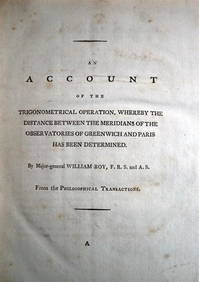
WILLIAM ROY Rare Navigation Book c1797 Trigonometry Between Paris & GreenwichLuis Porretta Fine Arts4.3(10)See Sold PriceMar 02, 2024
1822 Rare Map by Ambroise Tardieu Napoleon Caldiero Battle of Vento 17" x 11Luis Porretta Fine Arts4.3(10)See Sold PriceMar 02, 2024
AN ANTIQUE FOLDING MAP OF THE BRITISH ISLES DATED 1873Hutchinson Scott Auctioneers4.4(39)See Sold PriceFeb 28, 2024
Jesenske & Mucha's Ballady a Pisne - Ornately Bound Volume with Frontispiece illustrated by MuchaTrillium Antique Prints & Rare Books4.5(30)See Sold PriceFeb 24, 2024
1790 AFRICA TRAVELS Voyages dans le pays des Hottentots ILLUSTRATED antique RAREJasper524.5(9.8k)See Sold PriceFeb 27, 2024
Colonial Southern Africa. British Portuguese German. Madagascar. TIMES 1895 mapJasper524.5(9.8k)See Sold PriceFeb 28, 2024
Colonial Africa North-West. British French. Nigeria Sahara. THE TIMES 1895 mapJasper524.5(9.8k)See Sold PriceFeb 28, 2024
Colonial Africa North-East. Hejaz Kenya Abyssinia Sudan. THE TIMES 1895 mapJasper524.5(9.8k)See Sold PriceFeb 28, 2024
Colonial Africa. British German French Spanish Portuguese Italian TIMES 1895 mapJasper524.5(9.8k)See Sold PriceFeb 28, 2024
ANTIQUE ROMAN ARMORIAL VELLUM BINDING, 1744, ILLUSTRATED WITH AN ANTIQUE MAP BY FLORUSNY Elizabeth 4.3(84)See Sold PriceMar 03, 2024
OLD ILLUSTRATED 1902 CROSS-COVERED LANDS JOURNEY TO CALCUTTA, INDIA, 2 VOLUMESNY Elizabeth 4.3(84)See Sold PriceMar 03, 2024
ANTIQUE GEOMORPHOLOGY: 1782 POMPONII MELA DE SITU ORBIS ARMORIAL VELLUM BINDINGNY Elizabeth 4.3(84)See Sold PriceMar 03, 2024
THE WHOLE CHRONICLE OF POLYBIUS ANCIENT IN ENGLISH, 1756NY Elizabeth 4.3(84)See Sold PriceMar 03, 2024
1675: ANTIQUE ILLUSTRATED JULIUS CAESAR MAPS OF ROMAN HISTORYNY Elizabeth 4.3(84)See Sold PriceMar 03, 2024