ATLAS of ANTIENT GEOGRAPHY by SAMUEL BUTLER 1843John McInnis Auctioneers,LLC4.5(505)See Sold PriceFeb 24, 2024
18TH C. ANTIQUE MAP: FRENCH & INDIAN WAR, FRAMEDThomaston Place Auction Galleries4.4(393)See Sold PriceFeb 24, 2024
Rand McNally Railroad Map Cabinet w/ 21 Railroad MapsRail & Road Auctions4.6(165)See Sold PriceMar 08, 2024
Keith Haring - Ink on New York Map, Best Buddies, Inscribed, Signed, and DatedSapphire Auction Gallery4.1(67)See Sold PriceMar 02, 2024
LATE 17TH C. FRENCH MAP OF THE NEW WORLD BY ALEXIS-HUBERT JAILLOT (1632-1712)Thomaston Place Auction Galleries4.4(393)See Sold PriceFeb 24, 2024
Central Railroad of New Jersey Map of Sandy Hook Route-ca. 1903JM Hobby Supply and Railroad Artifact Auctions4.4(127)See Sold PriceFeb 24, 2024
Lot of Six Mixed Atlas Box Cars-HO Scale-New in BoxJM Hobby Supply and Railroad Artifact Auctions4.4(127)See Sold PriceFeb 25, 2024
Rand McNally/Santa Fe Railroad Map of Iowa-1912JM Hobby Supply and Railroad Artifact Auctions4.4(127)See Sold PriceFeb 24, 2024
NICOLAES VISSCHER (NETHERLANDS, 1618-1709) MAP OF THE NEW WORLDThomaston Place Auction Galleries4.4(393)See Sold PriceFeb 24, 2024
17TH C. WORLD MAP BY NICOLAES VISSCHER (NETHERLANDS, 1618-1709)Thomaston Place Auction Galleries4.4(393)See Sold PriceFeb 24, 2024
Lot of Six Mixed Atlas Cabooses-HO Scale-New in BoxJM Hobby Supply and Railroad Artifact Auctions4.4(127)See Sold PriceFeb 25, 2024
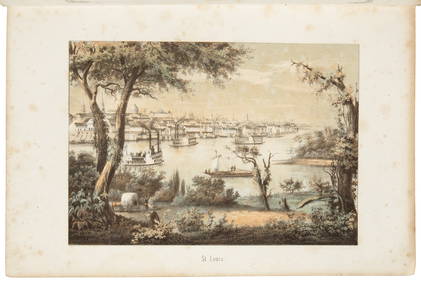
Sold(ALASKA.) Group of 4 items relating to the Yuk(ALASKA.) Group of 4 items relating to the Yukon Gold Rush. Format and condition vary. Vp, 1895-1900 Wilson. Guide to the Yukon Gold Fields. Folding map, plates. Seattle, 1895 * Ogilvie. Department ofSee Sold Price
1899 Rand McNally Map of New MexicoTitle: Rand, McNally & Co.'s Indexed County and Township Pocket Map and Shipper's Guide of New Mexico Author: Rand, McNally & Co. Description: Folding map, 48x31.5 cm (18¾x12¼") plus margins. 22, [7See Sold Price
Clason's Guide Map of New MexicoTitle: Clason's Guide Map of New Mexico Date: c1920 Cartographer: CLASON MAP CO. Publisher: THE CLASON MAP CO. Size: 17Height - 15Width Provenance: Small road map folding into Clason's New Mexico roadSee Sold Price
SoldLot of approximately 75 guide books to various coIllustrated, including numerous maps, many folding. Most approx 6½x4¼, cloth or boards. Guides to the United States, Mexico, Switzerland, France, Belgium, Bankok, Algeria, India, Moscow, Paris, theSee Sold Price
Rand McNally & Co overland guide 1888Title: Rand, McNally & Co.'s New Overland Guide to the Pacific Coast. California, Arizona, New Mexico, Colorado and Kansas Author: Steele, James W. Description: Folding map (with printed text on versoSee Sold Price
Rand McNally Pocket Map of New Mexico & Other EphemeraPocket map and shippers guide published in 1895 by Rand McNally. Map in very good condition. Also a pile of ephemera: giant post cards, "La Fonda," brochures, a Fred Harvey Company resort in Santa Fe;See Sold Price
SoldEurope.- Baedeker (Karl) - Collection of Guides,South-Western France, second edition, 1895; Sourthern France, fifth edition, 1907; Northern France, fifth edition, 1909; Central Italy, sixth edition, 1879, maps and plans, some folding, original redSee Sold Price
SoldNova Mexico folding map from American 1671 by OgilbyOgilby, John, 1600-1676, Montanus, Arnoldus, 1625?-1683, Nova Mexico from Novissima et Accuratissima Totius Americae Descriptio.11 x 21.25 inches, America: Being The Latest, And Most accurate DescriptSee Sold Price
SoldLumholtz, Carl85. Lumholtz, Carl.Unknown Mexico. Folding map, plates and illustrations, including 15 in color. 2 volumes. Tall 8vo, publisher's gilt-lettered cloth, pictorial cover medallions, top-edge gilt; moderaSee Sold Price
SoldRitchie (Leitch) Scott & ScotlandRitchie (Leitch) Scott & Scotland,engravings after George Cattermole, contemporary morocco, rubbed, 1835 § Galignani (A.&W.) New Paris Guide, folding map, contemporary calf, spine defectivSee Sold Price
SoldLondon (The) and Brighton Railway GuideLondon (The) and Brighton Railway Guide,folding map and folding section and a folding table, title slightly foxed, slightly browned, hinges a little weak, original gilt pictorial cloth, slighSee Sold Price
SoldMatson (Walter J.) Salmon & TroutMatson (Walter J.) Salmon & Trout Fishing in Ireland, the Angler's Pocket-Book and Guide,folding map showing the fishery districts, 6 colour plates of flies, 4ff. advertisements at beginning,See Sold Price
Sold(WEST--NEW MEXICO.) William Watts Hart Davis. The(WEST--NEW MEXICO.) William Watts Hart Davis. The Spanish Conquest of New Mexico. Folding map (detached), frontispiece portrait. 438 pages. 8vo, publisher's cloth, moderate wear; minor dampstaining toSee Sold Price
Sold(WEST.) George G. Street. Che! Wah! Wah! or, The Modern(WEST.) George G. Street. Che! Wah! Wah! or, The Modern Montezumas In Mexico. Folding map, frontispiece plate in blue and black, one additional plate after page 92, 33 mounted albumen photos, and textSee Sold Price
SoldAmerica.- DomenechAmerica.- Domenech (Abbé Emmanuel) Missionary Adventures in Texas and Mexico, folding map, half-title, publisher's catalogue at end, bookplate on front pastedown, original blind-stamped cloth,See Sold Price
Sold(ENGLAND.) Harvey's Improved Weymouth Guide.(ENGLAND.) Harvey's Improved Weymouth Guide. Folding map. 8vo, original marbled wrappers, with paper title label on front cover. Dorchester, circa 1800 All items are offered for sale subject to SwannSee Sold Price
SoldRailway Guide.-Railway Guide.- Appletons' Illustrated Railway and Steam Navigation Guide..., large folding map and maps in the text, advertisements at beginning and end, original printed wrappers, browned, sSee Sold Price
SICKELMORE, HISTORY OF BRIGHTON ... and others (8SICKELMORE, HISTORY OF BRIGHTON AND PICTURE OF THE ROADS, 3rd ed, folding frontis map and other plates, 1824; BRUCE (J), HISTORY OF BRIGHTON AND STRANGERS GUIDE, folding frontis, map and other plates,See Sold Price
SoldNew Mexico177. New Mexico.Graham, James D. Report...on the Subject of a Boundary Line between the United States and Mexico. 2 folding maps, folding chart. 8vo, removed; remnants of leather on spine, generally sSee Sold Price
SoldMeyler (W.) The original Bath guide,Meyler (W.) The original Bath guide, 2 folding maps, 8 engraved plates, Bath, [c. 1840] § Lee (J.E.)Isca Silurum...Caerlon, 52 lithographed plates of antiquities(some loose), 1862 § [BedfordSee Sold Price
SoldTwo Services Guides to Egypt - WWIITwo Services Guides: to Cairo and Alexandria. The guides include folding maps, illustrations, advertisements, and general information about the cities. Approximately 44 and 32 pages. Published by theSee Sold Price
SoldRare folding map of Pasadena 1895Heading: (California - Pasadena) Author: Title: W.A. Hagans Map of Pasadena, Cal. Corrected to Aug. 1st, 1895 Place Published: Pasadena, Cal. Publisher:W.A. Hagans Date Published: 1895See Sold Price
SoldScarce guide to Mexico with maps, 1852Heading: (Mexico) Author: Almonte, Juan Nepomuceno Title: Guía de Forasteros, y Repertorio de Conocimientos Útiles Place Published: México Publisher:Imprenta de I. Cumplido Date Published: 18See Sold Price
AN ANTIQUE FOLDING MAP OF THE BRITISH ISLES DATED 1873Hutchinson Scott Auctioneers4.4(42)See Sold PriceFeb 28, 2024
Kent & Sussex.- Moss (W.G.) The History and Antiquities of the Town and Port of Hastings, 1824; andForum Auctions4.3(53)See Sold PriceFeb 29, 2024
Colonial Southern Africa. British Portuguese German. Madagascar. TIMES 1895 mapJasper524.5(9.9k)See Sold PriceFeb 28, 2024
Colonial Africa North-West. British French. Nigeria Sahara. THE TIMES 1895 mapJasper524.5(9.9k)See Sold PriceFeb 28, 2024
Colonial Africa North-East. Hejaz Kenya Abyssinia Sudan. THE TIMES 1895 mapJasper524.5(9.9k)See Sold PriceFeb 28, 2024
Colonial Africa. British German French Spanish Portuguese Italian TIMES 1895 mapJasper524.5(9.9k)See Sold PriceFeb 28, 2024
1906 Mendenhalls Northern Ohio Road Guide Map BookCheck the Oil Promotions, LLC4.6(327)See Sold PriceMar 10, 2024