ATLAS of ANTIENT GEOGRAPHY by SAMUEL BUTLER 1843John McInnis Auctioneers,LLC4.5(505)See Sold PriceFeb 24, 2024
18TH C. ANTIQUE MAP: FRENCH & INDIAN WAR, FRAMEDThomaston Place Auction Galleries4.4(393)See Sold PriceFeb 24, 2024
Rand McNally Railroad Map Cabinet w/ 21 Railroad MapsRail & Road Auctions4.6(165)See Sold PriceMar 08, 2024
Keith Haring - Ink on New York Map, Best Buddies, Inscribed, Signed, and DatedSapphire Auction Gallery4(67)See Sold PriceMar 02, 2024
LATE 17TH C. FRENCH MAP OF THE NEW WORLD BY ALEXIS-HUBERT JAILLOT (1632-1712)Thomaston Place Auction Galleries4.4(393)See Sold PriceFeb 24, 2024
Central Railroad of New Jersey Map of Sandy Hook Route-ca. 1903JM Hobby Supply and Railroad Artifact Auctions4.4(127)See Sold PriceFeb 24, 2024
Lot of Six Mixed Atlas Box Cars-HO Scale-New in BoxJM Hobby Supply and Railroad Artifact Auctions4.4(127)See Sold PriceFeb 25, 2024
Rand McNally/Santa Fe Railroad Map of Iowa-1912JM Hobby Supply and Railroad Artifact Auctions4.4(127)See Sold PriceFeb 24, 2024
NICOLAES VISSCHER (NETHERLANDS, 1618-1709) MAP OF THE NEW WORLDThomaston Place Auction Galleries4.4(393)See Sold PriceFeb 24, 2024
17TH C. WORLD MAP BY NICOLAES VISSCHER (NETHERLANDS, 1618-1709)Thomaston Place Auction Galleries4.4(393)See Sold PriceFeb 24, 2024
Lot of Six Mixed Atlas Cabooses-HO Scale-New in BoxJM Hobby Supply and Railroad Artifact Auctions4.4(127)See Sold PriceFeb 25, 2024
SoldPownall Map of Middle British ColoniesEvans, Lewis (1700-1756) & Pownall, Thomas (1722-1805) A Map of Middle British Colonies in North America... Engraved map. London: J. Almon, 1776. 19 3/4" x 32 1/2" sheet, 29" x 42" framed. ownall's maSee Sold Price
SoldPownall Map of the Middle British ColoniesPOWNALL, Thomas (1722-1805), after EVANS, Lewis (1700-1756). A Map of the Middle British Colonies in North America... First Published By Mr. Lewis Evans of Philadelphia in 1755; and since corrected anSee Sold Price
SoldPownall & Evans Map of Middle British ColoniesPownall, Thomas (1722-1805). After Lewis Evans (c. 1700-1756). A General Map of the Middle British Colonies... Engraved map with original color in outline. London: Sayer & Bennett, 1776. 20 1/2" x 27"See Sold Price
SoldBritish Colonies in America MapRobert Sayer And John Bennett, and Thomas Pownall. A general map of the middle British colonies, in America. Containing Virginia, Maryland, the Delaware counties, Pennsylvania, and New Jersey. OriginaSee Sold Price
Sold(North America, Colonial), Evans, Lewis (1700?-175(North America, Colonial), Evans, Lewis (1700?-1756) and Pownall, Thomas (1722-1805), A Map of the Middle British Colonies in North America...with the Addition of New England, and the bordering PartsSee Sold Price
SoldUpdated Edition of Lewis Evan's Engraved Map of theA General Map. of the Middle British Colonies... and since corrected and improved . . . By T. Pownall. Lewis Evans (c. 1700-1756). Engraved map with original color in outline. London: R. Sayer & J. BeSee Sold Price
Sold(Maps and Charts, North America), Pownall, Thomas(Maps and Charts, North America), Pownall, Thomas (1722-1805), A Topographical Description of Such Parts of North America as are contained in the (Annexed) Map of the Middle British Colonies in NorthSee Sold Price
Thomas Pownall, A Topographical Description of SuchPOWNALL, Thomas (1722-1805). A Topographical Description of Such Parts of North America as are Contained in the (Annexed) Map of the Middle British Colonies, &c in North America. London: Printed for JSee Sold Price
Early Map of North America Pre-American RevolutionA Map of the Middle British Colonies In North America First Published By Mr. Lewis Evans of Philadelphia in 1755; and since corrected and improved . . . By T. Pownall . . . March 25th 1776. Lewis EvanSee Sold Price
SoldGroup of Historical MapsGroup of Historical Maps. Artic Sea, Spitsbergen, 1913 (39" x 27"); Map of the Province of Canada, 1887 (25" x 35"); Map of New York (21" x 28"); Map of Middle British Colonies in America (22" x 30");See Sold Price
SoldThe General Map of the Middle British Colonies...The General Map of the Middle British Colonies, In America...Lewis Evans (1700-c.1756) & John Gibson (1750-1792). London:Jeffreys, 1758. Engraved map with original hand color in outline. 20 x 27 incheSee Sold Price
SoldEvans - Map of the Middle British ColoniesLewis Evans (circa 1700-1756), A General Map of The Middle British Colonies, in America; Viz Virginia, Màriland, Dèlaware, Pensilvania, New-Jersey, New-York, Connecticut, And Rhode Island, 1755, JaSee Sold Price
SoldEvans, Lewis A General Map of the Middle British Colonies in AmericaEvans, Lewis A General Map of the Middle British Colonies in America viz. Virginia, Maryland, Delaware, Pensilvania, New-Jersey, New York, Connecticut and Rhode Island: of Aquanishuonigy the Country oSee Sold Price
Sold1771, MAP of the MIDDLE BRITISH COLONIES IN AMERICHistoric Maps1771 "A General MAP of the MIDDLE BRITISH COLONIES IN AMERICA..." After the Original Publish'd at Philadelphia by Mr. Lewis Evans January 1, 1771-Dated, Hand-Colored Outline Map eSee Sold Price
SoldA General Map of the Middle British Colonies, A General Map of the Middle British Colonies, viz. Virginia, Maryland, Delaware, Pensilvania, New Jersey, New York, Connecticut & Rhode-Island of Aquanishuonigy the Country of the Confederate IndianSee Sold Price
SoldEvans - Map of the Middle British ColoniesLewis Evans (circa 1700-1756), A General Map of The Middle British Colonies in America Viz. Virginia, Maryland, Delaware, Pensilvania, New-Jersey, New York, Connecticut & Rhode-Island of AquanshuonigySee Sold Price
SoldEvans Map of the Middle British Colonies, 1755EVANS, Lewis (1700-1756). A General Map of the Middle British Colonies, in America; viz Virginia, Mariland, Delaware Pensilvania, New-Jersey New-York, Connecticut, and Rhode Island of Aquanishuonigy,See Sold Price
SoldLewis Evans and Thomas Jeffreys hand colored outlinedLewis Evans and Thomas Jeffreys hand colored outlined double page engraved map A General Map of the Middle British Colonies in America marked lower left: Sold by R. Sayer in Fleet Street and T. JefSee Sold Price
Sold1766 British Colonies MapHigh Quality Color Printed Map on heavy paper circa 1970's A General Map of the Middle British Colonies, in America. containing Virginia, Maryland, the Delaware Counties, Pennsylvania and New Jersey.See Sold Price
SoldEvans, Lewis (ca. 1900-1756). 'A General Map of TheEvans, Lewis (ca. 1900-1756). 'A General Map of The Middle British Colonies...', Printed in London, 1771, Engraved and hand colored, Thomas Jeffery's edition. Framed dimensions: h: 27 x w: 20 7/8 in.See Sold Price
SoldLewis Evans published by Robert Sayer and John BenA General Map of the Middle British Colonies in America Copperplate engraving, London, 1776 Reference: Page 165, Plate 98 in Schwartzês The Mapping of AmericaSee Sold Price
SoldLewis Evans and Thomas Jefferys, A general Map of theEVANS, Lewis (ca 1700-1756) - JEFFERYS, Thomas (1719-1771). A general Map of the Middle British Colonies in America: via Virginia, Maryland, Delaware, Pensilvania, New Jersey, New York, Connecticut anSee Sold Price
SoldEVANS, LEWIS. A General Map of the Middle BritEVANS, LEWIS. A General Map of the Middle British Colonies. Engraved folding map, 495x670 mm, ample margins; hand-colored in outline; fire browning in upper and side margins, extending a short distancSee Sold Price
Lewis Evans, Geographical, Historical, Political,EVANS, Lewis (ca 1700-1756). Geographical, Historical, Political, Philosophical and Mechanical Essays. The First, Containing an Analysis of a General Map of the Middle British Colonies in America; AndSee Sold Price
Jerusalem Map for British Soldiers in Palestine - WW2Levy Auction House4.3(11)See Sold PriceFeb 27, 2024
1977 JRR Tolkien 1st ed Silmarillion Lord of the Rings Middle Earth + MAPSchilb Antiquarian Rare Books4.8(428)See Sold PriceMar 31, 2024
1937 Khartum Sudan First All Up Flight Airmail cover FFC to London EnglandMynt Auctions4.6(697)See Sold PriceFeb 24, 2024
1943 British SWA South WEst Africa Prisoner of War POW Cover Andalusia to TahitiMynt Auctions4.6(697)See Sold PriceFeb 26, 2024
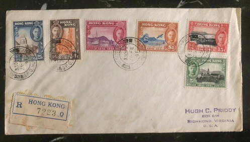
1941 Hong Kong First Day Cover FDC 100 Years British Colony Stamp Set MI 163-68Mynt Auctions4.6(697)See Sold PriceFeb 26, 2024
1940s Sudan Italian Prisoner of War POW Postcard Cover To Asmara Eritrea MedicalMynt Auctions4.6(697)See Sold PriceFeb 26, 2024
1919 Lome Togo Anglo French Occupation Gold Coast Cover to Buchs SwitzerlandMynt Auctions4.6(697)See Sold PriceFeb 26, 2024
1935 England Airmail Postcard Cover London to Njoro Kenya Colony British KUTMynt Auctions4.6(697)See Sold PriceFeb 29, 2024
AN ANTIQUE FOLDING MAP OF THE BRITISH ISLES DATED 1873Hutchinson Scott Auctioneers4.4(42)See Sold PriceFeb 28, 2024
Chatelain - 3 Maps of the British Isles (England, Ireland, Scotland)Trillium Antique Prints & Rare Books4.5(32)See Sold PriceFeb 24, 2024
De Jode, Rare, pub. 1593 - Map of the British Isles [England, Scotland, Ireland] (Angliae Scotiae etTrillium Antique Prints & Rare Books4.5(32)See Sold PriceFeb 24, 2024
De Jode, Rare, pub. 1593 - Map of the Middle East, Eastern Asia (Primae Partis Asiae accurataTrillium Antique Prints & Rare Books4.5(32)See Sold PriceFeb 24, 2024
1932 Juba Sudan First Flight Airmail Cover To Johannesburg South Africa 25 FlowMynt Auctions4.6(697)See Sold PriceMar 01, 2024
BRITISH AFRICAN COLONIES. West Africa Ascension St. Helena Mauritius 1876 mapJasper524.5(9.9k)See Sold PriceFeb 28, 2024
COLONIES FRANÇAISES en AFRIQUE. Africa Sénégal Madagascar. LEVASSEUR c1850 mapJasper524.5(9.9k)See Sold PriceFeb 28, 2024
Stanford, Edward 1901 Large Map. Geological Map of the British IslesAlbion Auctions4.6(341)See Sold PriceMar 01, 2024
Stanford, Edward 1901 Large Map. Hydrographical Map of the British IslesAlbion Auctions4.6(341)See Sold PriceMar 01, 2024
Stanford, Edward 1901 Large Map. Stereographical Map of The British IslesAlbion Auctions4.6(341)See Sold PriceMar 01, 2024


![De Jode, Rare, pub. 1593 - Map of the British Isles [England, Scotland, Ireland] (Angliae Scotiae et (1 of 2)](https://p1.liveauctioneers.com/6581/319571/171593327_1_x.jpg?height=282&quality=70&version=1707853304)


