SoldOrig. Hand Colored Map, Ossining NY 19th C.Original hand-colored map of Ossining, New York, titled "SINGSING, Town of Ossining, Westchester Co. N.Y." Map shows individuals' property ownership, Mt. Pleasant Military Academy, M. Churchill's SchoSee Sold Price
SoldHand-Colored Map of Paris, 19th c. or later, 1564 orig.Hand-Colored Map of Paris, 19th Century or later reproduction, after the original dated 1564(SBAR2349) {PR} Measurements: Framed: 15" x 17 1/2" Condition: poorly engraved and paper badly browned.See Sold Price
SoldL.R. Burleigh, birdseye map Peekskill NYL.R. Burleigh, birdseye map Peekskill NY, L.R. Burleigh (American, 19th c.), "Peekskill, N.Y.", c. 1883, hand-colored engraving, published by Beck & Pauli, 18.5"h x 27"w (sight), 27.5"h x 35.5"w (framSee Sold Price
Sold19TH C. MAP OF NEW YORK Framed map of Lower Manhattan,19TH C. MAP OF NEW YORK Framed map of Lower Manhattan, "Plan of the City of NY and its Environs,...", John Montresor engineer, 1855, G. Hayward, 120 Water St., N.Y., glazed and matted, hand-colored, oSee Sold Price
Sold[Missouri] Hand-Colored Map, 19th c.Hand-colored map of Missouri, colored by county, with inset of St. Louis. Measured from neatlines 14.5" x 11.75", sheet 17.25" x 14.25". From a Colton atlas, circa 1850s.See Sold Price
SoldFour matted hand colored township maps,Four matted hand colored township maps, late 19th C., which include Marlborough and Lederachsville Combination Atlas map, Gilbertville and Douglas, Lower Salford and Marlborough with COA, and MorelandSee Sold Price
SoldGroup of Twenty-Four Hand-Colored MapsGroup of Twenty-Four Antique Hand-Colored Maps , 17th to 19th c., majority showing provinces of Europe, unframed. Provenance: Property deaccessioned from the Louisiana State Museum, proceeds to be useSee Sold Price
SoldThree matted hand colored township maps,Three matted hand colored township maps, late 19th C., two combination atlas maps of Montgomery County, which includes Upper Hanover Palm Station with COA, New Hanover, Zieglersville, Limerick SquareSee Sold Price
SoldHand Colored Map of Europe, Early 19th C19th Century hand clored Map “Carte Politique et Itineraire de L’Europe et de L’Empire Francais en 1807”. By Chex Hyacinethe Langlois, Libraire, engraved by D. Derveaux, del.See Sold Price
SoldHand Colored Map of Europe, Early 19th C19th Century hand clored Map “Carte Politique et Itineraire de L’Europe et de L’Empire Francais en 1807”. By Chex Hyacinethe Langlois, Libraire, engraved by D. Derveaux, del. On laid paper. NoSee Sold Price
Hand Colored Map of Europe, Early 19th C19th Century hand clored Map "Carte Politique et Itineraire de L'Europe et de L'Empire Francais en 1807". By Chex Hyacinethe Langlois, Libraire, engraved by D. Derveaux, del. On laid paper. Not examinSee Sold Price
Sold19th c. Hand-colored map19th c. Hand-colored map- ''Nouveau Plan du Port et de la ville D'Acapulco situee dans la Nouvelle Es Pagne sur la Cote de la Mer du Zud'', laid down, some age staining throughout. 16 1/4 x 22''See Sold Price
Sold19th c. Hand-colored map19th c. Hand-colored map- of Turkey in Europe and Hungary- engraved for Carey's American edition of Gutherie's Geography improved, some age toning. 13 x 14''See Sold Price
Sold6 19th c. hand-colored maps of Asia6 19th c. hand-colored maps of Asia- ''Map of Asia Showing Its Political Divisions''; ''Map of Hindoostan, Farther India, China and Tibet''; ''China''; ''Asia'' (2 copies); Russia in Asia and Tartary'See Sold Price
Sold19th C Hand Colored Map of State of Maine FRAMEDPublished by S.Augustus Mitchell, Jr. having a published date year of 1860. This hand colored map contains maps of the various countries of the world and plans of cities. Inset at lower right featuresSee Sold Price
Sold18th / 19th c. hand-colored map18th / 19th c. hand-colored map- ''Nuova / e corretta carta dell' / Indie Occidentali / cavata dalle migliori / autorita''. 10 5/8 x 13 1/2''See Sold Price
SoldBiloxi Bay, 19th c., hand colored map, framed, H.Biloxi Bay, 19th c., hand colored map, framed, H.- 14 1/2 in., W.- 16 1/2 in.See Sold Price
Sold"Johnson's West Indies," 19th c., hand colored map,"Johnson's West Indies," 19th c., hand colored map, framed, H.- 15 1/2 in., W.- 21 1/2 in.See Sold Price
19th C. Hand Colored Map of the Black SeaHand-colored map of the Black Sea and surrounding countries, print, depicting countries of Asia Minor and East Europe, published by Grays circa 1877, featuring European Russia, Turkey and Austria-HungSee Sold Price
Sold(3) 19th c. hand colored maps of ConnecticutGrouping of three circa 1867 hand colored maps and one black and white advertisement from the "Atlas of New York and Vicinity" by Beers, Ellis & Soule, the drawings based on land surveys performed undSee Sold Price
Sold(4) 19th c. hand colored maps of ConnecticutGrouping of four circa 1867 hand colored maps and one black and white advertisement from the "Atlas of New York and Vicinity" by Beers, Ellis & Soule, the drawings based on land surveys performed undeSee Sold Price
SoldA Group Of 17-18 & 19th C Maps Hand Colored EngravedA Group Of 17-18 & 19th C Maps Hand Colored Engraved. These Are Affixed To A Screen Or Divider. 17 & 18th C Maps Are Hand-colored And Etched or Engraved. The 19th C Maps Are Rand McNally. Please ViewSee Sold Price
Sold(4) Mid 19th c. hand colored maps of New YorkGrouping of four circa 1867 hand colored maps and one black and white advertisement from the "Atlas of New York and Vicinity" by Beers, Ellis & Soule, the drawings based on land surveys performed undeSee Sold Price
Sold(3) 19th c. hand colored maps of ConnecticutGrouping of three circa 1867 hand colored maps from the "Atlas of New York and Vicinity" by Beers, Ellis & Soule, the drawings based on land surveys performed under the direction of F.W. Beers, includSee Sold Price
Rare 19thc German Handcolored Costume Plates, 17thc NobilityConnoisseur Auctions4(333)See Sold PriceMar 02, 2024
(13) 19th C. Prints Great Homes of Britain PrintsEpic Auctions and Estate Sales4.6(204)See Sold PriceMar 02, 2024
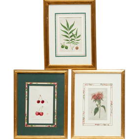
Pr. English 19th C. Floral Botanical PrintsEpic Auctions and Estate Sales4.6(204)See Sold PriceMar 02, 2024
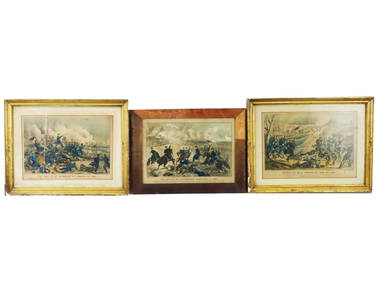
ANTIQUE AMERICAN CIVIL WAR HAND COLORED LITHOGRAPHSAntique Arena Inc.4.5(852)See Sold PriceFeb 24, 2024
Johann Homann Hand-Colored Map Engraving, c. 1730Auctions at Showplace4.5(726)See Sold PriceMar 17, 2024
Two Hand-Colored 19th Century Maps of New Orleans and Louisiana, Larger- H.- 12 1/2 in., W.- 15 1/2Crescent City Auction Gallery4.3(229)See Sold PriceMar 08, 2024
T. Rowlandson (19th C) Hand Colored Engravings (2)Keystone Auction LLC4.6(922)See Sold PriceMar 01, 2024
Rare 19thc German Handcolored Costume Plates, ByzantinesConnoisseur Auctions4(333)See Sold PriceMar 16, 2024
Rare 19thc Handcolored Costume Plates, 15thc KnightsConnoisseur Auctions4(333)See Sold PriceMar 16, 2024
Rare 19thc Colton Map, Argentine Republic, Chile, Uruguay, PataguayConnoisseur Auctions4(333)See Sold PriceMar 16, 2024
Napoleon Bonaparte Hand-Colored Engraving, 19th C.Auctions at Showplace4.5(726)See Sold PriceApr 16, 2024


![[Missouri] Hand-Colored Map, 19th c. (1 of 2)](https://p1.liveauctioneers.com/3532/197462/99749575_1_x.jpg?height=282&quality=70&version=1615763688)