ATLAS of ANTIENT GEOGRAPHY by SAMUEL BUTLER 1843John McInnis Auctioneers,LLC4.6(502)See Sold PriceFeb 24, 2024
18TH C. ANTIQUE MAP: FRENCH & INDIAN WAR, FRAMEDThomaston Place Auction Galleries4.4(386)See Sold PriceFeb 24, 2024
Rand McNally Railroad Map Cabinet w/ 21 Railroad MapsRail & Road Auctions4.6(165)See Sold PriceMar 08, 2024
Keith Haring - Ink on New York Map, Best Buddies, Inscribed, Signed, and DatedSapphire Auction Gallery4(67)See Sold PriceMar 02, 2024
LATE 17TH C. FRENCH MAP OF THE NEW WORLD BY ALEXIS-HUBERT JAILLOT (1632-1712)Thomaston Place Auction Galleries4.4(386)See Sold PriceFeb 24, 2024
Central Railroad of New Jersey Map of Sandy Hook Route-ca. 1903JM Hobby Supply and Railroad Artifact Auctions4.4(126)See Sold PriceFeb 24, 2024
Lot of Six Mixed Atlas Box Cars-HO Scale-New in BoxJM Hobby Supply and Railroad Artifact Auctions4.4(126)See Sold PriceFeb 25, 2024
Rand McNally/Santa Fe Railroad Map of Iowa-1912JM Hobby Supply and Railroad Artifact Auctions4.4(126)See Sold PriceFeb 24, 2024
NICOLAES VISSCHER (NETHERLANDS, 1618-1709) MAP OF THE NEW WORLDThomaston Place Auction Galleries4.4(386)See Sold PriceFeb 24, 2024
17TH C. WORLD MAP BY NICOLAES VISSCHER (NETHERLANDS, 1618-1709)Thomaston Place Auction Galleries4.4(386)See Sold PriceFeb 24, 2024
Lot of Six Mixed Atlas Cabooses-HO Scale-New in BoxJM Hobby Supply and Railroad Artifact Auctions4.4(126)See Sold PriceFeb 25, 2024
Official Historical Atlas Map of Alameda County, CAOfficial and Historical Atlas Map of Alameda County, California. Compiled, Drawn and Published From Personal Examinations and Surveys. [Thompson & West]. Fresno: Valley Publishers, 1976. Profusely illSee Sold Price
Official & Historical Atlas Map of Alameda County, CATitle: Official and Historical Atlas Map of Alameda County, California. Compiled, Drawn and Published From Personal Examinations and Surveys. Fresno. Valley Publishers. 1976 Author(s): Thompson & WestSee Sold Price
Official and Historical Atlas Map of Alameda County, CaOfficial and Historical Atlas Map of Alameda County, California. Compiled, Drawn and Published From Personal Examinations and Surveys. [Thompson & West]. Bicentennial edition facsimile of the originalSee Sold Price
Official Historical Atlas Map Alameda County CaliforniaOfficial and Historical Atlas Map of Alameda County, California. Compiled, Drawn and Published From Personal Examinations and Surveys. Thompson & West. Valley Publishers. Reprint. 4to. Lithographic reSee Sold Price
Official Historical Atlas Map Alameda County CaliforniaOfficial and Historical Atlas Map of Alameda County, California. Compiled, Drawn and Published From Personal Examinations and Surveys. Thompson & West. Valley Publishers. Reprint. 4to. Lithographic reSee Sold Price
SoldAtlas Map of Alameda CountyTitle: Official and Historical Atlas Map of Alameda County, California Author: ** Description: 170 pp. Illustrated with 36 hand-colored maps (including 22 double-page and 3 folding), and 70 (of 71) liSee Sold Price
SoldAtlas Map of Alameda CountyTitle: Official and Historical Atlas Map of Alameda County, California Author: ** Description: 13-170 pp. Illustrated with hand-colored maps and lithographed views. (folio) 17½x15, original cloth (laSee Sold Price
SoldAtlas, Maps of Alameda County, 1878Thompson & West, ''Official and Historical Atlas Map of Alameda County California, Compiled, Drawn and Published from Personal Examinations and Surveys,'' Oakland, 1878, incomplete, rebound in buckramSee Sold Price
SoldOfficial Historical Atlas Map of Tulare County...Author: Thompson, Thos. H. Illustrated with maps, lithograph plates, some double-page, many with multiple images. 15½x14½, quarter morocco, gilt-lettered cloth; housed in a custom folding box. FirstSee Sold Price
SoldHistorical Atlas Map of Tulare County CaliforniaHeading: (Tulare County) Author: Thompson, Thos. H. Title: Official Historical Atlas Map of Tulare County.... Compiled, Drawn and Published from Personal Examinations and Surveys by Thos. H. Thompson,See Sold Price
SoldSonoma County atlasHeading: (California - Sonoma County) Author: Thompson, Thos. H. Title: Historical Atlas Map of Sonoma County, California Place Published: Oakland, CA Publisher:Thos. H. Thompson & Co. Date PubliSee Sold Price
Map of Alameda County, CAP.A. Haviland & F. H. Carter Official Map of Alameda County, California Commercial blueprinting on white paper Oakland Blue Print Company, 1915 Framed: 53" x 87" Commercial Blue Printing on white papeSee Sold Price
SoldMap of Claremont Heights Cal. real estate 1928Heading: (California - Alameda County) Author: Title: Properties of Claremont Heights Company, Oakland, Alameda County, California Place Published: Oakland, CA Publisher: Date Published: MaySee Sold Price
SoldNEW HISTORICAL ATLAS OF ALAMEDA COUNTY CALIFORNIA1976 reprint of the 1878 original, unpaginated folio. Measures 12.25 x 9.25 inches. We are happy to offer in-house shipping for all but very large or very fragile items. Some international orders maySee Sold Price
SoldHistorical Atlas of Alameda County, 1878Historical atlas of Alameda County, California, Thompson & West, 1878, Illustrated title page, impressive maps and views of Oakland, Alameda, Berkeley and other more obscure parts of the county, fullSee Sold Price
SoldHistorical Atlas of Alameda CountyHistorical Atlas of Alameda County, California, Thompson & West, 1878, Illustrated title page, impressive maps and views of Oakland, Alameda, Berkeley and other more obscure parts of the county, fullSee Sold Price
SoldHistorical Atlas of Alameda CountyHistorical Atlas of Alameda County, California, Thompson and West, 1878, illustrated title page, impressive maps and views of Oakland, Alameda, Berkeley and other more obscure parts of the county, fulSee Sold Price
Rare Trinity County CaliforniaTrinity County (5): 1. Trinity 1982; Official Year Book; About Trinity County; CA; 2. Weaverville Trinity County California; 1990 Limited Ed.; by Patricia Johnson Hicks; 3. OByrnes Ferry Covered BridgSee Sold Price
SoldMap of the County of Santa Clara, CAJ.G. McMillan Official Map of the County of Santa Clara California 1902-1903. overall size 67 418 x77 inches McMILLAN, |ohn G. Official map of the County of Santa Clara, California, compiled from offiSee Sold Price
SoldLarge Kern County map on 3 sheets 1918Heading: (California - Kern County) Author: Stegeman, A.E. Title: Map of Kern County, California. Compiled from Official Data Place Published: [Bakersfield, CA?] Publisher:A.E. Stegeman, County SurveySee Sold Price
SoldRare map of Riverbank, Stanislaus Co., Cal.Heading: (California - Riverbank) Author: Macomber, Geo. D. Title: Official Map of the City of Riverbank, Stanislaus County, California Place Published: [Riverbank, CA?] Publisher: Date PublishedSee Sold Price
SoldLarge colored map of Shasta Co. CA 1912Heading: (California - Shasta County) Author: Wiegel, C. R. Title: Map of the County of Shasta California. Compiled from U.S. geological and U.S. land surveys, official and private surveys, etc. by C.See Sold Price
Rare map of Newman, California, in 1940Heading: (California - Stanislaus County) Author: Sherman, W.R. Title: Official map of the City of Newman, California Place Published: Newman, CA Publisher:City Council of the City of Newman DateSee Sold Price
Rare map of Newman, California, in 1940Heading: (California - Stanislaus County) Author: Sherman, W.R. Title: Official map of the City of Newman, California Place Published: Newman, CA Publisher:City Council of the City of Newman DateSee Sold Price
Rand McNally & Co's New Ideal State and County Survey and Atlas 1911North American Artifact Auctions4.6(182)See Sold PriceApr 20, 2024
HAMMOND'S READY REFERENCE HISTORICAL ATLAS 1920North American Artifact Auctions4.6(182)See Sold PriceApr 20, 2024
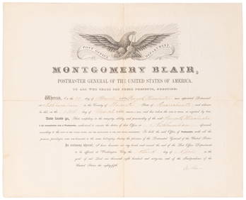
SOMERSET, Lord Charles (1767-1831) and BLAIR, Montgomery (1...Potter & Potter Auctions4.6(539)See Sold PriceMar 07, 2024
[UNDERGROUND RAILROAD]. [THE KENTUCKY RAID OF 1847]. An Arc...Potter & Potter Auctions4.6(539)See Sold PriceMar 07, 2024
[BASEBALL]. Group of Three Vintage Postcards (Including one...Potter & Potter Auctions4.6(539)See Sold PriceMar 07, 2024
[BLACK PANTHER PARTY]. Black is Beautiful poster. [With:] Photographic essays, incl. The VanguardFreeman's | Hindman4.4(1.6k)See Sold PriceFeb 27, 2024
[ENSLAVEMENT & ABOLITION]. A group of 2 legal documents related to cases involving enslaved persons.Freeman's | Hindman4.4(1.6k)See Sold PriceFeb 27, 2024
1822 MAP of LEEWARD ISLANDS GEOGRAPHICAL STATISTICAL HISTORICAL antique 17.5x22"Jasper524.5(9.8k)See Sold PriceFeb 27, 2024
1822 MAP of SOUTH AMERICA GEOGRAPHICAL STATISTICAL HISTORICAL antique 17.5x 22"Jasper524.5(9.8k)See Sold PriceFeb 27, 2024
1822 MAP of NORTH & SOUTH AMERICA GEOGRAPHICAL STATISTICAL HISTORICAL antiqueJasper524.5(9.8k)See Sold PriceFeb 27, 2024
1822 MAP of CHILI GEOGRAPHICAL STATISTICAL HISTORICAL antique 17.5x 22" CHILEJasper524.5(9.8k)See Sold PriceFeb 27, 2024
Robert H Labberton - Map of The Territory of the Present United States - The territory of theProverde Auctions4.3(3)See Sold PriceFeb 28, 2024


![[UNDERGROUND RAILROAD]. [THE KENTUCKY RAID OF 1847]. An Arc... (1 of 1)](https://p1.liveauctioneers.com/928/318880/171361212_1_x.jpg?height=282&quality=70&version=1707501302)
![[BASEBALL]. Group of Three Vintage Postcards (Including one... (1 of 2)](https://p1.liveauctioneers.com/928/318880/171361376_1_x.jpg?height=282&quality=70&version=1707501302)

![[BLACK PANTHER PARTY]. Black is Beautiful poster. [With:] Photographic essays, incl. The Vanguard (1 of 8)](https://p1.liveauctioneers.com/197/319238/171467899_1_x.jpg?height=282&quality=70&version=1707520367)
![[ENSLAVEMENT & ABOLITION]. A group of 2 legal documents related to cases involving enslaved persons. (1 of 11)](https://p1.liveauctioneers.com/197/319238/171468068_1_x.jpg?height=282&quality=70&version=1707520367)