ATLAS of ANTIENT GEOGRAPHY by SAMUEL BUTLER 1843John McInnis Auctioneers,LLC4.6(504)See Sold PriceFeb 24, 2024
18TH C. ANTIQUE MAP: FRENCH & INDIAN WAR, FRAMEDThomaston Place Auction Galleries4.4(389)See Sold PriceFeb 24, 2024
Rand McNally Railroad Map Cabinet w/ 21 Railroad MapsRail & Road Auctions4.6(165)See Sold PriceMar 08, 2024
Keith Haring - Ink on New York Map, Best Buddies, Inscribed, Signed, and DatedSapphire Auction Gallery4.1(67)See Sold PriceMar 02, 2024
LATE 17TH C. FRENCH MAP OF THE NEW WORLD BY ALEXIS-HUBERT JAILLOT (1632-1712)Thomaston Place Auction Galleries4.4(389)See Sold PriceFeb 24, 2024
Central Railroad of New Jersey Map of Sandy Hook Route-ca. 1903JM Hobby Supply and Railroad Artifact Auctions4.4(126)See Sold PriceFeb 24, 2024
Lot of Six Mixed Atlas Box Cars-HO Scale-New in BoxJM Hobby Supply and Railroad Artifact Auctions4.4(126)See Sold PriceFeb 25, 2024
Rand McNally/Santa Fe Railroad Map of Iowa-1912JM Hobby Supply and Railroad Artifact Auctions4.4(126)See Sold PriceFeb 24, 2024
NICOLAES VISSCHER (NETHERLANDS, 1618-1709) MAP OF THE NEW WORLDThomaston Place Auction Galleries4.4(389)See Sold PriceFeb 24, 2024
17TH C. WORLD MAP BY NICOLAES VISSCHER (NETHERLANDS, 1618-1709)Thomaston Place Auction Galleries4.4(389)See Sold PriceFeb 24, 2024
Lot of Six Mixed Atlas Cabooses-HO Scale-New in BoxJM Hobby Supply and Railroad Artifact Auctions4.4(126)See Sold PriceFeb 25, 2024
SoldNorth East US Maps (4) (64213)Vermont & New Hampshire, Lithography & color by Hardesty, 1883, 10.5" x 14.5"; VA, WV, MD & DE, 1885, cartography & color lithography by CRAM, 13.5" x 11"; Maine, 1866, engraved cartography & hand colSee Sold Price
North East US Maps (4) 64213Vermont & New Hampshire, Lithography & color by Hardesty, 1883, 10.5" x 14.5"; VA, WV, MD & DE, 1885, cartography & color lithography by CRAM, 13.5" x 11"; Maine, 1866, engraved cartography & hand colSee Sold Price
SoldJansson Northeast U.S. MapJansson, Jan (1588-1664). Nova Anglia Novum Belgium et Virginia. Engraved map with original hand color. Amsterdam, c. 1636. 17 3/4” x 22” sheet. This is the first state of Jansson's important mapSee Sold Price
Jansson Northeast U.S. MapJansson, Jan (1588-1664). Nova Anglia Novum Belgium et Virginia. Engraved map with original hand color. Amsterdam, c. 1636. 18 1/4" x 22 1/4" sheet, 24" x 28" framed. This is the first state of JanssoSee Sold Price
Sold18th C. English Map of Northeast US18th century English map, depicting New England and New York, by Thomas Basset and Richard Chiswell, 15" 1/8" h x 19 3/4" w (view), 22 1/4" h x 17 1/4" w (frame). Provenance: from a Massachusetts estaSee Sold Price
SoldHAND COLORED MAPS OF US NORTHEAST & GREAT LAKESHAND COLORED MAPS OF THE US NORTHEAST & THE GREAT LAKES REGION, 5 FROM THE SAME ATLAS, C. 1800:c. 12 1/4" x 16 1/2"; unframed. Ex. Collection Nancy and the late G. Mennen Williams.See Sold Price
SoldFrench Map of the North East U.S.[After Overton & Nollin]. Carte des Colonies Anglaises dans l'Amerique Septentrionale Terminee par la Re. Ohio. Engraved map with hand color in outline. Paris: R. J. B. de Poilly. c. 1756. 17 1/4" x 1See Sold Price
North AmericaTitle/Content of Map: North America Date Printed: 1855 ca. Cartographer: JOHNSTON, KEITH/JOHNSTON, W. & A.K. Size: 22.5X17.4 Map showing from Russian America east to Greenland and south to Panama. U.SSee Sold Price
Ottens Northeast U.S. MapOttens, Reiner (d. 1750) & Joshua (d. 1765). Totius Neobelgii Nova et Accuratissima Tabula. Engraved map with original hand color in part. Amsterdam, 1674 (1720). 19 x 22 inches visible, 27 1/2 x 30 iSee Sold Price
Sold18TH C. MAP OF NORTHEAST U.S. Eglomise framed map of18TH C. MAP OF NORTHEAST U.S. Eglomise framed map of the Northeast United States, "An Account of ye Post of Ye Continent of Nth America as they were Regulated by ye Postmasters Genl of Ye Post House."See Sold Price
Sold4 Maps: Bradford (1838): Mass., CT, NJ, Boston.[United States/Northeast] 4 Maps. ++ MASSACHUSETTS. ++ BOSTON. ++ CONNECTICUT. ++ NEW JERSEY. ++ Maps 10, 11, 13, and 16 from T. G. Bradford, “An Illustrated Atlas, Geographical, Statistical, And HiSee Sold Price
SoldAntique map, Northeast US, by Robert De VaugondyAntique map, Northeast US, by Robert De Vaugondy "Partie De L'Amerique Septentrionale Qui Comprend Le Cours De L'Ohio, La Nlle Angleterre, La Nlle York, Le New Jersey, La Pensyvanie, Le Maryland La ViSee Sold Price
MAP, Northeast US & Canada, BellinColonial Northeast United States & Canada. Jacques Nicolas Bellin, Carte Reduite des Costes Orientales de l'Amerique Septentrionale 1re Feuille Contenant l'Isle Royale, l'Accadie, la Baye Francoise, lSee Sold Price
Sold4 19th Century Maps The World, North/South U.S.4 19th Century Maps The World, North South U.S.. 4 Maps of The World, Political Map of The Southern Division of the U.S., The Northern Division of the U.S. and Political Map of South America and AfricSee Sold Price
SoldJansonius Map of North.East. U.S., 1636.JANSSONIUS, Johannes (1588-1664). Nova Anglia Novum Belgium et Virginia. Engraving with original hand color in part. Amsterdam, 1636 or later. 18 1/2" x 22".See Sold Price
SoldPOWDER HORN SCRIMSHAW MAP OF NORTHEAST U.S.Sterling accouterment, nice map art work, super quality reinactor powder horn, measures along the curve 16 inches.See Sold Price
Sold1860 Mitchell Map of the US Northeast States -- CountyTitle/Content of Map: 1860 Mitchell Map of the US Northeast States -- County Map of the States of New York, New Hampshire, Vermont, Massachusetts, Rhode Id. & Connecticut Date: 1860, Philadelphia CartSee Sold Price
Sold1749 Robert de Vaugondy Map of Virginia, Northeast USTitle/Content of Map: 1749 Robert de Vaugondy Map of Virginia, Northeast US and Lake Ontario -- Nouvelle Angleterre Nlle. York Nlle. Jersey Pensilvanie Mariland et Virginie Date: 1749, Paris CartograpSee Sold Price
SoldGroup of three cobalt-decorated stoneware jugsNortheast U.S., circa 1850. H13" W7 1/4"See Sold Price
1785 AND 1730 ENGRAVED MAPSCARTE DE LA PARTIE NORD, DES ETATS UNIS, DE L'AMERIQUE SEPTENTRIONALE. R. BONNE. PARIS. 1785. Map of early U.S. Northeast, shortly after the Treaty of Paris created the U.S.A. Shows forts Duquesne, NeSee Sold Price
SoldCeremonial Death Mask, 1500s, Northeast US, 9 3/4"This is a 9 3/4" Ceremonial Death Mask, documented as being from 750 A.D. - 850 A.D. We believe the mask is dated somewhere around the 1500s. Northeast US European. (Documents Attached) This artifactSee Sold Price
Sold4 NATIVE AMERICAN BEADED BAGS, 19TH Ctribes from Northeast US; all four w/ colorful floral embroidery; 2 Iroquois in early Niagra style, 1845-1855; 1 Wabanaki; 3 envelope style, 1 pouch, very goodSee Sold Price
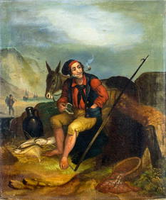
ATTR Henry Perlee Parker (UK,1795-1873) oil painting antiqueBroward Auction Gallery4.8(285)See Sold PriceMar 10, 2024
Natural History - Polished Douvilleiceras Fossil Ammonite GroupTimeLine Auctions Ltd.4.6(182)See Sold PriceMar 08, 2024
Eleven Pieces of North Eastern Railroad Flatware - Chesapeake & Ohio, Baltimore & Ohio, TheRail & Road Auctions4.6(165)See Sold PriceMar 08, 2024
[ARCTIC]. BOWEN, Emanuel. A New & Accurate Map of the North...Potter & Potter Auctions4.6(544)See Sold PriceMar 07, 2024
1760 MAP CARTE PARTICULIERE DE L'ISLE DE JUAN FERNANDES antique Robinson CrusoeJasper524.5(9.8k)See Sold PriceFeb 27, 2024
2.3/4" Ferruginous Quartz Hump Bannerstone- Knoblock featured/Ex Townsend Collection -featured onHeartland Artifact Auctions4.6(783)See Sold PriceMar 10, 2024
1764 Bellin Map of Port Antonio, Jamaica -- Plan des Havres de Port Antonio et de Saint FrancoisJasper524.5(9.8k)See Sold PriceFeb 27, 2024
NORTH AFRICA. 'Biledulgerid', a former North African country. MALLET 1683 mapJasper524.5(9.8k)See Sold PriceFeb 28, 2024
Colonial Africa North-East. Hejaz Kenya Abyssinia Sudan. THE TIMES 1895 mapJasper524.5(9.8k)See Sold PriceFeb 28, 2024
NORTH EAST AFRICA. Libya Egypt Sudan Ethiopia Ubangi-Shari Chad 1952 old mapJasper524.5(9.8k)See Sold PriceFeb 28, 2024
Colonial Africa North-East. Hejaz Kenya Abyssinia Colonial. THE TIMES 1900 mapJasper524.5(9.8k)See Sold PriceFeb 28, 2024


![[ARCTIC]. BOWEN, Emanuel. A New & Accurate Map of the North... (1 of 1)](https://p1.liveauctioneers.com/928/318880/171360917_1_x.jpg?height=282&quality=70&version=1707501302)