SoldMuenster's map of the Americas, 1574Title: Die neüwen Inseln/ so hinder Hispanien gegen Orient bey dem land Indie ligen Author: Münster, Sebastian Description: Woodcut map, hand-colored (later). 25.2x33.8 cm. (10x13¼").One of the mosSee Sold Price
SoldMunster map of Americas 1574Heading: (Maps) Author: Münster, Sebastian Title: Die neüwen Inseln/ so hinder Hispanien gegen Orient bey dem land Indie ligen Place Published: Basel, Switzerland Publisher: Date Published:See Sold Price
SoldMunster map of Americas 1574Heading: (Americas) Author: Münster, Sebastian Title: Die neüwen Inseln/ so hinder Hispanien gegen Orient bey dem land Indie ligen Place Published: Basel, Switzerland Publisher: Date Published: <See Sold Price
SoldMuenster's map of the Americas, 1564Title: Die neüwen Inseln/ so hinder Hispanien gegen Orient bey dem land Indie ligen Author: Münster, Sebastian Description: Woodcut map. 25.2x33.8 cm. (10x13¼"). One of the most influential early mSee Sold Price
SoldEARLY GERMAN MAP OF THE AMERICASEARLY GERMAN MAP OF THE AMERICAS: Early German map of the America's, by Sebastian Muenster (1489-1552). This particular antique map is Circa 1540. In frame with UV protective glass. Approx. 21.5" h xSee Sold Price
SoldMuenster, Tabula Novarum Insularum, map, 1550[Americas]. Tabula Novarum Insularum, Quas Diversis Respectibus Occidentales & Indianas Vocant. Woodcut map of the New World as its geography was understood at the time of publication. From the 1550 LSee Sold Price
SoldOriginal Copper Engraving ANTIQUE MAP AMERICAS 1817Details: Original Copper Engraving ANTIQUE MAP AMERICAS 1817 John & George Menzies Engravers John Thomson New General Atlas Political Borders British Territory Spain British Canada Atlas Original HanSee Sold Price
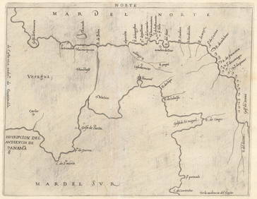
SoldLarge Lot of Maps AmericasLarge group of maps including maps of the South Seas, North and South America, the Azore Islands, a province of Peru, Lima, Cayenne Island, Suriname, a world map, the cost of Peru, and Pisco. SKU: 034See Sold Price
Sold[MAP - AMERICAS]. BRION DE LA TOUR, Louis[MAP - AMERICAS]. BRION DE LA TOUR, Louis (1743?-1803). L'Amerique Dressee pour l'etude de la Geographie. Paris, 1764. Engraved map with hand-coloring in wash and outline, visible area 515 x 610 mSee Sold Price
SoldEarly Americas Map [Americas Map]20th-century (exact date unknown) of early Americas geology. Beautiful colors and detail. Measures 15.125-in. x 19.625-in. sheet size. In VG/EX condition, with warping upper and lower margins. UnframeSee Sold Price
SoldAmerica Noviter Delineata Map [Americas Map]Jodicus Hondius (1563-1811), 'America Noviter Delineata Auct: Henrico Hondio, 1631' map. Exact date unknown; this restrike appears to be the right-side 2/3rds of original map. Beautiful colors and detSee Sold Price
Sold1779 French Engraved Framed Map Americas NR1779 French engraved framed map of North & Central America (probably printed about 100 years later) (Center fold with small, minor tears & holes; nice old appearance; frame much later; Old Print ShopSee Sold Price
SoldMap: Americas Showing The Island Of CaliforniaHistoric MapsMap Of The Americas Showing The Island Of California c. 1700, Map of the Americas, Titled "Americae Tam Septentrionalis Quam Meridionalis," by A. F. Zurner, published by P. SchenkSee Sold Price
SoldMap: Americas Showing The Island Of CaliforniaMapsMap Of The Americas Showing The Island Of California c.1700, Map of the Americas, Titled “Americae Tam Septentrionalis Quam Meridionalis,” by A. F. Zurner, published by P. Schenk in AmSee Sold Price
SoldMap: Americas Showing The Island Of CaliforniaHistoric MapsMap Of The Americas Showing The Island Of California c. 1700, Map of the Americas, Titled Americae Tam Septentrionalis Quam Meridionalis," by A. F. Zurner, published by P. Schenk in AmsteSee Sold Price
SoldAmerica Septentrio Map [Americas Map]America Septentrio Map, printed 20th-century, exact date unknown. Beautiful colors and detail. Measures 19.5-in. x 24.5-in. sheet size. In VG/EX condition. Unframed, loose and not glued or mounted. IfSee Sold Price
Sold18th and 19th century maps Americas18th and 19th century maps, Americas: "America Divided Into North and South…", Lourie & Whittle, London, 1794, native tribes noted, 19-3/4 x 21-3/4 in. (sight), [separated at central fold]; "The WorSee Sold Price
1574 c. Braun and Hogenberg View of Granada, Spain --Title/Content of Map: 1574 c. Braun and Hogenberg View of Granada, Spain -- Amoenissimus castri Granatensis… Cartographer: Braun and Hogenberg Year/Place: 1574 c., Koln Size: 14.3 X 18.4 in. This isSee Sold Price
1574 c. Braun and Hogenberg View of Granada, Spain --Title/Content of Map: 1574 c. Braun and Hogenberg View of Granada, Spain -- Amoenissimus castri Granatensis… Cartographer: Braun and Hogenberg Year/Place: 1574 c., Koln Size: 14.3 X 18.4 in. This isSee Sold Price
Sanson: Map of Americas with Mythical Atlantis, 1699Map: 1699 Sanson Map of Americas with Mythical Atlantis -- Atlantis Insula, a Nicolao Sanson Antiquitati Restituta; nunc demum Majori Forma Delineata, et in Decem Regna, iuxta Decem Neptuni Filios DisSee Sold Price
SoldSanson: Antique Map of Americas with Atlantis, 1699Map: 1699 Sanson Map of Americas with Mythical Atlantis and California as Island -- Atlantis Insula, a Nicolao Sanson Antiquitati Restituta; nunc demum Majori Forma Delineata, et in Decem Regna, iuxtaSee Sold Price
Sold17TH C. MAP OF AMERICAS NICOLAUM VISSCHER(1618-1679):17th century map of Americas by Nicolaum Visscher. Also known as: Nicolaes Visscher Among the many great Dutch map publishers active in the seventeenth century were the Visscher family, begun by ClaesSee Sold Price
SoldDanckerts' Map of Americas Circa 169021" X 24" matted and in a 27" X 30" wood frame, under glass, Map of the Americas, Circa 1690, an interesting version in this series of maps inspired by Nicolas Visscher in 1658. Danckerts' map followsSee Sold Price
18TH C. ANTIQUE MAP: FRENCH & INDIAN WAR, FRAMEDThomaston Place Auction Galleries4.4(386)See Sold PriceFeb 24, 2024
Keith Haring - Ink on New York Map, Best Buddies, Inscribed, Signed, and DatedSapphire Auction Gallery4(67)See Sold PriceMar 02, 2024
Rand McNally Railroad Map Cabinet w/ 21 Railroad MapsRail & Road Auctions4.6(165)See Sold PriceMar 08, 2024
Chatelain - Map of the Americas and Details and Insets of Government CounselsTrillium Antique Prints & Rare Books4.5(30)See Sold PriceFeb 24, 2024
Chatelain - 3 Maps of the British Isles (England, Ireland, Scotland)Trillium Antique Prints & Rare Books4.5(30)See Sold PriceFeb 24, 2024
Putnam - First Map of the State of Ohio by Rufus PutnamTrillium Antique Prints & Rare Books4.5(30)See Sold PriceFeb 24, 2024
Audubon - 8 Quadruped LithographsTrillium Antique Prints & Rare Books4.5(30)See Sold PriceFeb 24, 2024
1760 MAP CARTE PARTICULIERE DE L'ISLE DE JUAN FERNANDES antique Robinson CrusoeJasper524.5(9.8k)See Sold PriceFeb 27, 2024
NASA Facts JFK Space Center Booklet And MoreRapid Estate Liquidators and Auction Gallery4.5(1.1k)See Sold PriceFeb 24, 2024
William H. Bartlett - Set of 12 views of America - Susquehanna - City of Louisville - ColoradoProverde Auctions4.3(3)See Sold PriceFeb 28, 2024
William H. Bartlett - Set of 12 views of America - Golden Gate from Telegraph Hill - West Point andProverde Auctions4.3(3)See Sold PriceFeb 28, 2024


![[MAP - AMERICAS]. BRION DE LA TOUR, Louis (1 of 1)](https://p1.liveauctioneers.com/197/161882/81723400_1_x.jpg?height=282&quality=70&version=1581711364)
![Early Americas Map [Americas Map] (1 of 4)](https://p1.liveauctioneers.com/5755/154409/77936932_1_x.jpg?height=282&quality=70&version=1573094011)
![America Noviter Delineata Map [Americas Map] (1 of 3)](https://p1.liveauctioneers.com/5755/154409/77936930_1_x.jpg?height=282&quality=70&version=1573094011)


![America Septentrio Map [Americas Map] (1 of 3)](https://p1.liveauctioneers.com/5755/154409/77936931_1_x.jpg?height=282&quality=70&version=1573094011)