ATLAS of ANTIENT GEOGRAPHY by SAMUEL BUTLER 1843John McInnis Auctioneers,LLC4.5(505)See Sold PriceFeb 24, 2024
18TH C. ANTIQUE MAP: FRENCH & INDIAN WAR, FRAMEDThomaston Place Auction Galleries4.4(393)See Sold PriceFeb 24, 2024
Rand McNally Railroad Map Cabinet w/ 21 Railroad MapsRail & Road Auctions4.6(165)See Sold PriceMar 08, 2024
Keith Haring - Ink on New York Map, Best Buddies, Inscribed, Signed, and DatedSapphire Auction Gallery4(67)See Sold PriceMar 02, 2024
LATE 17TH C. FRENCH MAP OF THE NEW WORLD BY ALEXIS-HUBERT JAILLOT (1632-1712)Thomaston Place Auction Galleries4.4(393)See Sold PriceFeb 24, 2024
Central Railroad of New Jersey Map of Sandy Hook Route-ca. 1903JM Hobby Supply and Railroad Artifact Auctions4.4(127)See Sold PriceFeb 24, 2024
Lot of Six Mixed Atlas Box Cars-HO Scale-New in BoxJM Hobby Supply and Railroad Artifact Auctions4.4(127)See Sold PriceFeb 25, 2024
Rand McNally/Santa Fe Railroad Map of Iowa-1912JM Hobby Supply and Railroad Artifact Auctions4.4(127)See Sold PriceFeb 24, 2024
NICOLAES VISSCHER (NETHERLANDS, 1618-1709) MAP OF THE NEW WORLDThomaston Place Auction Galleries4.4(393)See Sold PriceFeb 24, 2024
17TH C. WORLD MAP BY NICOLAES VISSCHER (NETHERLANDS, 1618-1709)Thomaston Place Auction Galleries4.4(393)See Sold PriceFeb 24, 2024
Lot of Six Mixed Atlas Cabooses-HO Scale-New in BoxJM Hobby Supply and Railroad Artifact Auctions4.4(127)See Sold PriceFeb 25, 2024
SoldMATTHAUS SEUTTER (LUXEMBOURG C. 1730) MAPMap of fort and city of Luxembourg. Hand colored engraving. Dimensions: (Frame) H 20.75" x W 24.25", (Sight) H 19.75" x W 23" Condition: Foxing. Age toning.See Sold Price
Seutter, Matthaus. Daniae RegnumSeutter, Matthaus Daniae Regnum C. 1730 Copperplate engraving; area coloured Printed size: 58.7 x 50.4 cm; 23.1 x 19.9 in A map of Denmark including Schleswig-Holstein and the southern coast of SwedenSee Sold Price
Sold(3) ANTIQUE MAPS, SPAIN, PORTUGAL, SAXONY, 18TH C.(lot of 3) Antique maps, including: (1) "Saxonie Inferioris Circulus...," c.1730, Georg Matthaus Seutter (German, 1678-1757), hand colored, approx 20.5"h, 23.75"w; (1) "La Catalogna Li Regni Di AragonSee Sold Price
SoldDetailed Map of The Americas by SeutterNovus Orbis Sive America Meridionalis et Septentrionalis... Matthaus Seutter (1678-1757). Engraved Map with original hand color in part. Ausburg, c. 1730 or later. 21 x 24 1/2 inches sheet, 30 1/2 x 3See Sold Price
SoldDetailed Map of The World by SeutterDiversi Globi Terr-Aquei Statione Variante et Visu Intercedente, per Coluros Tropicorum...Matthaus Seutter (1678-1757). Engraved Map with original hand color in part. Ausburg, c. 1730 or later. 21 x 2See Sold Price
Seutter Map of New SpainSEUTTER, Matthaus (1678-1757). Mappa Gerographica Regioeum Mexicanum et Floridam. Engraved map with original hand color in part. Augsburg, c. 1730. 21 3/8" x 24 3/4" sheet. Seutter's map of Colonial ASee Sold Price
Seutter, M. Circulus Westfalicus in suas Prov.Seutter, Matthaus Circulus Westfalicus in suas Provincias et Ditiones C. 1730 Copperplate engraving; coloured Printed area: 58.4 x 50.1 cm; 23 x 19.7 in Map of Westphalia and its former provinces. TheSee Sold Price
Seutter World MapSEUTTER, Georg Matthaus (1678-1757). [World Map] Diversi Globi terr-Aquei statione variante et visu interxedente. Engraved map with hand color. Augsburg: c. 1730. 21 1/4" x 25" sheet. The double-hemisSee Sold Price
SoldMatthaus Seutter, Map, c. 1740Matthaus Seutter, "Mappa Geographica Regionem Mexicanam et Floridam...", Augsburg, c. 1740, hand-colored, with inset maps of Havana, Portobell, Cartagena and Vera Cruz, with vignettes of a sea battleSee Sold Price
Soldc 1730 Seutter Map: Novi Belgii, in America ...Historic Maps c. 1730 Historic Rare Earlier State of Seutter's Important American Northeast Map & New York City Restitutio View c. 1730 Hand-Colored Copper-Engraved Map titled, "Recens Edita totius NoSee Sold Price
Sold18th C Sphaerae Artificiales, M. SeutterBy German engraver Matthäus Seutter (1678-1757). Possibly c.1730-1735. Hand coloured, copper engraved print depicting two globes (celestial and terrestrial) and Ptolemaic armillary sphere. The celestSee Sold Price
Sold6 Maps incl: Seutter. Majestas Austriaca...[Austria/DC/Ancient World] 6 Maps. ++ Matthaus Seutter. Majestas Austriaca… C. 1730s-1740s. Detailed map showing rivers and towns in Austria. Hand colored. Border: 19 1/8 x 22 in. Frame: 30 1/2 x 35See Sold Price
Mattheus Seutter: Planisphaerium Coeleste. Map.Celestial map by Matthaus Seutter, published in Augsburg circa 1730. The map includes two maps of the Northern & Southern Skies. A diagram in the upper right corner showing the monthly orbit and illumSee Sold Price
SoldAntique Map Georg Matthaus Seutter 18th C.18th C. antique map is third state of Seutter's map based on Jansson's map of 1651. Hand colored and embellished with decorations and animal figures. Shows boundaries of Massachusetts, New England, NeSee Sold Price
SoldSeutter, Georg MatthaüsSeutter, Georg Matthaüs Insula Corsica… c.1730, aquarellée. Très beau cartouche en haut à gauche. Belle carte décorative. 57 x 49 cmSee Sold Price
SoldMap of Spain & Portugal by Matthew Seutter c.1730Heading: Author: Seutter, Matthew Title: Novissima et Accuratissima Regnorum Hispaniae et Portugalliae Mappa Geographica, Cura et Sumtibus Place Published: Augsburg Publisher: Date Published: </See Sold Price
Soldc. 1730 MAP of America With California an IslandHistoric Maps Seutter’s Map of the Americas with California as an Island c. 1730 Colonial Era, Historic Hand-Colored Map titled, “NOVUS ORBIS SIVE AMERICA MERIDIONALIS ET SEPTENTRIONALIS...” bySee Sold Price
SoldMatthaus Seutter (1678-1757)Lot 94 Matthaus Seutter (1678-1757) NOVUS ORBIS SIVE AMERICA MERIDIONALIS ET SEPTENTRIONALIS Augsburg, c.1730, engraved, coloured hamp of the Americas with California as an island, and with elaborateSee Sold Price
SoldTwo historical maps of the 18th century, Germany andTwo historical maps of the 18th century, Germany and Denmark, ''Imperium Romano-Germanicum ...'' (Central Germany). Copper engraving, Matthias Seutter c. 1730, ''Regni Daniae ...'', copperplate engravSee Sold Price
c1730 Mattaus Seutter Hand Engraved/Colored Map"Gorgeous map from Mattaus Seutter (1678-1757). Seutter started working life as an apprentice brewer but apparently it wasn't something he enjoyed and moved to Nuremberg and worked as an apprentice enSee Sold Price
Sold18th c. Hand-colored mapSeutter, Georg Matthaus 18th c. hand-colored map- ''Plan De La Cupitale Et Fortresse Midolebour...Augsbourg''- Town plan in color with an uncoloured general view above bottom margin, embellished withSee Sold Price
Longobardian Map, Signed by Matthaus Seutter17th C. Longobardian Map, Signed by Matthaus Seutter (1678-1757). Black etching with red and green colored detail. Image size: 22.5 x 18 inches.See Sold Price
SoldMattheus Seutter, Antique Map of Firenza, c.1730Antique map of Firenza / Florence, Italy by Mattheus Seutter, Augsburg c.1730. Copperplate engraving, the image measures 18-7/8" x 22". Sheet measurement 20-3/8" x 25". Elaborate cartouche of the citySee Sold Price
SoldMatthaus Seutter Map of Germany Saxony 1730Matthaus Seutter Map of Germany, Saxony, 1730. Titled "Saxoniae Inferioris Circulus Juxta Principatus et Status Suos Accurate Delineatus Cura et Stilo". Measures 23.75" x 20.5" sheet size. Unframed, lSee Sold Price
17TH C. WORLD MAP BY NICOLAES VISSCHER (NETHERLANDS, 1618-1709)Thomaston Place Auction Galleries4.4(393)See Sold PriceFeb 24, 2024
LATE 17TH C. FRENCH MAP OF THE NEW WORLD BY ALEXIS-HUBERT JAILLOT (1632-1712)Thomaston Place Auction Galleries4.4(393)See Sold PriceFeb 24, 2024
17TH C. ANTIQUE MAP SIEGE OF LA ROCHELLE, FRANCE, FRAMEDThomaston Place Auction Galleries4.4(393)See Sold PriceFeb 24, 2024
EARLY 18TH C. MAP OF ITALY, FRAMEDThomaston Place Auction Galleries4.4(393)See Sold PriceFeb 24, 2024
LATE 16TH C. MAP OF SCOTLAND BY MERCATOR, FRAMEDThomaston Place Auction Galleries4.4(393)See Sold PriceFeb 24, 2024
17TH C. MAP OF THE BERKSHIRES BY JOHN SPEED, FRAMEDThomaston Place Auction Galleries4.4(393)See Sold PriceFeb 24, 2024
18TH C. ANTIQUE MAP: FRENCH & INDIAN WAR, FRAMEDThomaston Place Auction Galleries4.4(393)See Sold PriceFeb 24, 2024
17TH C. ENGLISH LINEAR MAP BY OGILBY, FRAMEDThomaston Place Auction Galleries4.4(393)See Sold PriceFeb 24, 2024
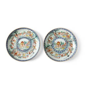
A PAIR OF FAMILLE ROSE 'COCKEREL' BARBED-RIM DISHES, YONGZHENG TO EARLY QIANLONG PERIODGalerie Zacke 4.4(50)See Sold PriceMar 01, 2024
Johann Homann Hand-Colored Map Engraving, c. 1730Auctions at Showplace4.6(740)See Sold PriceMar 17, 2024
Willem Blaeu, Etc. 17th C. Antiquarian Maps, 2Auctions at Showplace4.6(740)See Sold PriceMar 17, 2024
Two (2) Antique 18th C. Copper Engraved Framed Maps - America & EuropeMagnusson Art Group4.5(53)See Sold PriceMar 14, 2024
Perry, Matthew C. 1856 Large Map. Shah Bay, Lew Chew I. JapanAlbion Auctions4.6(341)See Sold PriceMar 01, 2024
PAIR OF RARE BLUE AND WHITE DUTCH DECORATED CHINESE EXPORT PORCELAIN 'HUNTING' DISHESLyon & Turnbull4.3(51)See Sold PriceMar 13, 2024