ATLAS of ANTIENT GEOGRAPHY by SAMUEL BUTLER 1843John McInnis Auctioneers,LLC4.6(502)See Sold PriceFeb 24, 2024
18TH C. ANTIQUE MAP: FRENCH & INDIAN WAR, FRAMEDThomaston Place Auction Galleries4.4(386)See Sold PriceFeb 24, 2024
Rand McNally Railroad Map Cabinet w/ 21 Railroad MapsRail & Road Auctions4.6(165)See Sold PriceMar 08, 2024
Keith Haring - Ink on New York Map, Best Buddies, Inscribed, Signed, and DatedSapphire Auction Gallery4(67)See Sold PriceMar 02, 2024
LATE 17TH C. FRENCH MAP OF THE NEW WORLD BY ALEXIS-HUBERT JAILLOT (1632-1712)Thomaston Place Auction Galleries4.4(386)See Sold PriceFeb 24, 2024
Central Railroad of New Jersey Map of Sandy Hook Route-ca. 1903JM Hobby Supply and Railroad Artifact Auctions4.4(126)See Sold PriceFeb 24, 2024
Lot of Six Mixed Atlas Box Cars-HO Scale-New in BoxJM Hobby Supply and Railroad Artifact Auctions4.4(126)See Sold PriceFeb 25, 2024
Rand McNally/Santa Fe Railroad Map of Iowa-1912JM Hobby Supply and Railroad Artifact Auctions4.4(126)See Sold PriceFeb 24, 2024
NICOLAES VISSCHER (NETHERLANDS, 1618-1709) MAP OF THE NEW WORLDThomaston Place Auction Galleries4.4(386)See Sold PriceFeb 24, 2024
17TH C. WORLD MAP BY NICOLAES VISSCHER (NETHERLANDS, 1618-1709)Thomaston Place Auction Galleries4.4(386)See Sold PriceFeb 24, 2024
Lot of Six Mixed Atlas Cabooses-HO Scale-New in BoxJM Hobby Supply and Railroad Artifact Auctions4.4(126)See Sold PriceFeb 25, 2024
US GLO Map of the State of Mississippi 1878United States General Land Office. J.A. Williamson, Commissioner; Charles Roser, principal draughtsman; Photo-lithograph, Julius Bien, NY. State of Mississippi, 1878. Color printed photo-lithograph WaSee Sold Price
Soil Map Mississippi Pearl River CountyTitle/Content of Map: Soil Map Mississippi Pearl River County Date: 1918 Cartographer: E. Malcolm Jones, G.W. Musgrave Publisher: U.S. Department of Agriculture Bureau of Soils Size: 39Height - 30.75WSee Sold Price
SoldAN ANTIQUE EARLY AMERICAN MAP, "Mississippi River fromAN ANTIQUE EARLY AMERICAN MAP, "Mississippi River from Iberville to Yazous," 1779, hand colored copper plate engraving on laid paper, "Published according to Act of Parliament 1st Jan. 1779 by J.F.W.See Sold Price
Soil Map Mississippi Biloxi SheetSoil Map Mississippi Biloxi Sheet. DEPT OF AGRICULTURE BUREAU OF SOILS, U.S. G.S., 1904, Wall size - 40.00 H x 26.75 W Inches, Area around Biloxi and the Gulf Coast. Although this is a map showing theSee Sold Price
SoldUS DEPARTMENT OF THE INTERIOR MAP MISSISSIPPI TNUnited States Department of the Interior geological survey map for the Corinth Quadrangle, Mississippi-Tennessee 1950. Cased behind plastic onto chipboard backing. Measures 18" by 22".See Sold Price
SoldVNTG REPRO MAP MISSISSIPPI RIVER 1765 EXPEDITIONVintage reproduction. Map reads "Course of the River Mississippi from the Balise to Fort Chartres; Taken on and Expedition to the Illinois, in the latter end of the Year 1765." Measures approximatelySee Sold Price
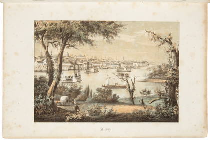
Sold7Pcs ANTIQUE MISSISSIPPI EPHEMERA Civil War Maps River7Pcs ANTIQUE MISSISSIPPI EPHEMERA Civil War Maps River Prints Ship Lithos Engraved Prints Tardieu L′Aime George Callot Natchez St. Louis Nogales Baton Rouge New Map Mississippi Roads Distances JSee Sold Price
SoldUNITED STATES 19th CENTURY MISSISSIPPI SURVEY MAPUNITED STATES 19th CENTURY MISSISSIPPI SURVEY MAP Mississippi survey map, circa 1835. Measures: 10 x 12"See Sold Price
SoldMississippi TerritoryTitle/Content of Map: Mississippi Territory Date: 1812 Cartographer: Arrowsmith & Lewis Size: 7.8X9.75 Scarce map of Mississippi Territory when it included Alabama. Depicts Indian tribes, paths and toSee Sold Price
SoldTanner: Antique Map of Mississippi, 1843Title/Content of Map: Mississippi by Tanner Date Printed: 1843 Cartographer: H.C. Tanner Material/Medium: Paper Size: 17" x 14" Hand colored engraved Map based on the work of H.C. Tanner from the firsSee Sold Price
SoldColton: Antique Map of Mississippi, 1859Title/Content of Map: Mississippi by Colton Date Printed: 1859 Cartographer: H. J. Colton Material/Medium: Paper Size: 14" x 17" Provenance: New York Published in New York Please note that this lot haSee Sold Price
Mississippi River. Sheet No.14 [Island No.80 to LakeTitle/Content of Map: Mississippi River. Sheet No.14 [Island No.80 to Lake Lee] Cartographer: MOLITOR, E. Date: 1900 Publisher: MISSISSIPPI RIVER COMMISSION Size: 22.75Height - 12.5Width Updated in reSee Sold Price
SoldMap LotLot (2) maps. Includes 1852 Geological map, Mississippi to the Pacific. Office of the U. S. Pacific Rail Road Exploration & Survey War Department, by William P. Blake. Hand coloring. Folds as issued.See Sold Price
Mississippi Territory.Title/Content of Map: Mississippi Territory. Date: 1814 Cartographer: CAREY, MATHEW Size: 5.75X7.75 Includes what is now Alabama. From the 4th edition of Carey's American Pocket Atlas. With text. FoldSee Sold Price
Antique Map of Mississippi by Colton, 1859Title/Content of Map: Mississippi by Colton Date Printed: 1859 Cartographer: Material/Medium: Paper Size: 14 x 17" Provenance: New York Please note that this lot has a confidential reserve. When you lSee Sold Price
Mississippi 1889Title/Content of Map: Mississippi 1889 Date Printed: 1889 Material/Medium: paper Size: approx 13.5x11 inches Additional Info: The Peerless Atlas. Published by Mast, Crowell & Kirkpatrick Reserve: $20.See Sold Price
U.S. Western centered Map, 1865Hawes, J.H. / Franks, Theodore. Map of the Public Land States And Territories. Lithographed map. GLO, 1865. 28 ¼" x 44 ¾" sheet. Map showing U.S. except for easternmost parts (from FL west). ShoSee Sold Price
Mississippi 1889Title/Content of Map: Mississippi 1889 Date Printed: 1889 Material/Medium: paper Size: approx 13.5x11 inches Additional Info: The Peerless Atlas. Published by Mast, Crowell & Kirkpatrick Reserve: $25.See Sold Price
Colton: Antique Map of Mississippi, 1859Title/Content of Map: Mississippi Date Printed: 1859 Cartographer: H.J. Colton Material/Medium: Paper Size: 17 1/1" x 15" Hand colored,engraved. Published in New York in 'Colton's General Atlas.' PleaSee Sold Price
Mississippi 1889Title/Content of Map: Mississippi 1889 Date Printed: 1889 Material/Medium: paper Size: approx 13.5x11 inches The Peerless Atlas. Published by Mast, Crowell & Kirkpatrick Reserve: $20.00 Shipping:See Sold Price
Lake Superior and Mississippi River RR 1869 Seven Percent Bonds Book/Report-1869JM Hobby Supply and Railroad Artifact Auctions4.4(126)See Sold PriceFeb 24, 2024
1885 CIVIL WAR 1ed Famous Memoirs US Grant Sheridan Sherman 6v RARE LOT MapsSchilb Antiquarian Rare Books4.8(421)See Sold PriceMar 10, 2024
Large lot of assorted prints. 18th-20th century. To include: North American and other maps, CivilTremont Auctions4.6(293)See Sold PriceFeb 25, 2024
Large Assortment of Railroad Items - Insulators, Globes, Hand Bell, Posters, Maps, Timetables,Rail & Road Auctions4.6(165)See Sold PriceMar 07, 2024
Collection of Allied Military Silk Printed Maps, WWII Era and LaterMaterial Culture4.6(765)See Sold PriceFeb 29, 2024
Rand McNally Railroad Map Cabinet w/ 21 Railroad MapsRail & Road Auctions4.6(165)See Sold PriceMar 08, 2024
George E. Ohr (Mississippi, 1857-1918), Pottery Baluster Vase, with a burned finish, Unsigned, H.- 3Crescent City Auction Gallery4.3(229)See Sold PriceMar 01, 2024
Willem Blaeu, Etc. 17th C. Antiquarian Maps, 2Auctions at Showplace4.5(726)See Sold PriceMar 17, 2024
[BUSINESS]. Travel Guide of Negro Hotels and Guest Houses. Published by Afro-American Newspapers ofFreeman's | Hindman4.4(1.6k)See Sold PriceFeb 27, 2024
Putnam - First Map of the State of Ohio by Rufus PutnamTrillium Antique Prints & Rare Books4.5(30)See Sold PriceFeb 24, 2024
De Jode, Rare, pub. 1593 - Map of Africa (Africae Vera Forma, et Situs)Trillium Antique Prints & Rare Books4.5(30)See Sold PriceFeb 24, 2024
John Senex Map of Louisiana & Mississippi RiverWillow Auction House4.5(283)See Sold PriceMar 14, 2024


![[BUSINESS]. Travel Guide of Negro Hotels and Guest Houses. Published by Afro-American Newspapers of (1 of 4)](https://p1.liveauctioneers.com/197/319238/171467937_1_x.jpg?height=282&quality=70&version=1707520367)