ATLAS of ANTIENT GEOGRAPHY by SAMUEL BUTLER 1843John McInnis Auctioneers,LLC4.6(502)See Sold PriceFeb 24, 2024
18TH C. ANTIQUE MAP: FRENCH & INDIAN WAR, FRAMEDThomaston Place Auction Galleries4.4(386)See Sold PriceFeb 24, 2024
Rand McNally Railroad Map Cabinet w/ 21 Railroad MapsRail & Road Auctions4.6(165)See Sold PriceMar 08, 2024
Keith Haring - Ink on New York Map, Best Buddies, Inscribed, Signed, and DatedSapphire Auction Gallery4(67)See Sold PriceMar 02, 2024
LATE 17TH C. FRENCH MAP OF THE NEW WORLD BY ALEXIS-HUBERT JAILLOT (1632-1712)Thomaston Place Auction Galleries4.4(386)See Sold PriceFeb 24, 2024
Central Railroad of New Jersey Map of Sandy Hook Route-ca. 1903JM Hobby Supply and Railroad Artifact Auctions4.4(126)See Sold PriceFeb 24, 2024
Lot of Six Mixed Atlas Box Cars-HO Scale-New in BoxJM Hobby Supply and Railroad Artifact Auctions4.4(126)See Sold PriceFeb 25, 2024
Rand McNally/Santa Fe Railroad Map of Iowa-1912JM Hobby Supply and Railroad Artifact Auctions4.4(126)See Sold PriceFeb 24, 2024
NICOLAES VISSCHER (NETHERLANDS, 1618-1709) MAP OF THE NEW WORLDThomaston Place Auction Galleries4.4(386)See Sold PriceFeb 24, 2024
17TH C. WORLD MAP BY NICOLAES VISSCHER (NETHERLANDS, 1618-1709)Thomaston Place Auction Galleries4.4(386)See Sold PriceFeb 24, 2024
Lot of Six Mixed Atlas Cabooses-HO Scale-New in BoxJM Hobby Supply and Railroad Artifact Auctions4.4(126)See Sold PriceFeb 25, 2024
Soil Map Mississippi Pearl River CountyTitle/Content of Map: Soil Map Mississippi Pearl River County Date: 1918 Cartographer: E. Malcolm Jones, G.W. Musgrave Publisher: U.S. Department of Agriculture Bureau of Soils Size: 39Height - 30.75WSee Sold Price
Pearl River County, Mississippi1.18 Acred lot in established subdivision in town- close to daycare, schools, and shopping.See Sold Price
Pearl River County, Mississippi1.18 Acred lot in established subdivision in town- close to daycare, schools, and shopping.See Sold Price
SoldOld Maps of Minnesota including Mississippi RiverOld Maps of Minnesota including Mississippi River. Map of Hennepin County. The reference on the map is so old it shows, Farm Houses, School Houses, Mills, Blacksmith Shops, Proposed Railroads, Timber,See Sold Price
Part of Fractional Township 14.Range.5 East.Title: Part of Fractional Township 14.Range.5 East. Cartographer: GENERAL LAND OFFICE Publication Date: 1836 Publisher: Size: 13Height - 8.25Width "Land district west of Pearl River, Mississippi." (DoSee Sold Price
Sold18th century map of Georgia,"Georgia, from the latest Authorities" by William Barker, Atlantic seaboard to the Mississippi River, includes the boundaries of several early counties in Georgia, published in [Carey's General Atlas,See Sold Price
Antique map of Arkansas, Mississippi and Louisiana, Mitchell 1874Attractive map of these southern states, with original hand coloring by counties. Shows towns, roads, railroads, rivers, lakes, forts, swamps, islands, bays, sounds and other coastal features. Drawn aSee Sold Price
SoldAutomobile Green Book 1931 Eastern StatesAutomobile Green Book 1931-1932 All States East of Mississippi River Eastern Ontario, Quebec and Maritime Provinces. Ads. Folding Maps are present in rear pocketSee Sold Price
1860 Topographical Map of HancockCounty Maine from Actural Surveys under the direction of H. F. Walling published by Lee and Marsh No.s 356, 358 & 360 Pearl Street, New York 1860. Has the original nails in wooden scroll top. Also hasSee Sold Price
SoldAN ANTIQUE EARLY AMERICAN MAP, "Mississippi River fromAN ANTIQUE EARLY AMERICAN MAP, "Mississippi River from Iberville to Yazous," 1779, hand colored copper plate engraving on laid paper, "Published according to Act of Parliament 1st Jan. 1779 by J.F.W.See Sold Price
Soil Map Mississippi Biloxi SheetSoil Map Mississippi Biloxi Sheet. DEPT OF AGRICULTURE BUREAU OF SOILS, U.S. G.S., 1904, Wall size - 40.00 H x 26.75 W Inches, Area around Biloxi and the Gulf Coast. Although this is a map showing theSee Sold Price
SoldVNTG REPRO MAP MISSISSIPPI RIVER 1765 EXPEDITIONVintage reproduction. Map reads "Course of the River Mississippi from the Balise to Fort Chartres; Taken on and Expedition to the Illinois, in the latter end of the Year 1765." Measures approximatelySee Sold Price
Mississippi River. Sheet No.14 [Island No.80 to LakeTitle/Content of Map: Mississippi River. Sheet No.14 [Island No.80 to Lake Lee] Cartographer: MOLITOR, E. Date: 1900 Publisher: MISSISSIPPI RIVER COMMISSION Size: 22.75Height - 12.5Width Updated in reSee Sold Price
Mississippi River Commission. Plum Point Reach fromTitle/Content of Map: Mississippi River Commission. Plum Point Reach from Surveys Executed Under the Direction of Capt. Wm. T. Rossell Corps of Engrs. U.S.A. Date: 1888-05-31 Cartographer: ROSSELL, WMSee Sold Price
SoldBellin: Antique Map of Pearl River Delta Islands, 1764Map: Carte des Isles qui sont a l'Entree de la Riviere de Canton Cartographer: Bellin Place & Date: Paris / 1764 Size: 6 3/4" x 8 5/8" Condition: full color; light overall age toning Bellin's wonderfuSee Sold Price
SoldHistorical Map of Mississippi River.From the Balise to Fort Chartres. Dated 1765. Minor folds and minor water stains at bottom left. Framed under glass. Condition (Excellent). Size Framed: 48 - 1/4" x 27 - 1/2".See Sold Price
SoldBOWEN & Co LITHOGRAPH MAP OF MISSISSIPPI RIVERBOWEN & Co LITHOGRAPH MAP OF MISSISSIPPI RIVER Bowen & Co. lithograph. Captain William Hoelcke and Major General John Pope, "Map Showing The System of Rebel Fortifications On The Mississippi River AtSee Sold Price
SoldBOWEN & Co LITHOGRAPH MAP OF MISSISSIPPI RIVERBOWEN & Co LITHOGRAPH MAP OF MISSISSIPPI RIVER Bowen & Co. lithograph. Captain William Hoelcke and Major General John Pope, "Map Showing The System of Rebel Fortifications On The Mississippi River AtSee Sold Price
SoldBellin: Map of Pearl River Delta, Guangdong, 1750Carte des Isles qui Sont a L'Embouchure de la Riviere de Canton Bellin's boldly designed chart of the islands "at the mouth of the Canton River" (Pearl River Delta), encompassing parts of Lantau islanSee Sold Price
SoldRailroad Map Shows Mississippi River to Pacific Route11"x 38" geological map showing a railroad surveyed route from the Mississippi River to the Pacific Ocean. Map has some frayed edges, but is still in useful decorative condition. Please see photos forSee Sold Price
1863 Civil War map of Mississippi RiverOriginal and authentic 1863 “Map of Mississippi, Showing the Field Operations of Generals Sherman, Grant and Banks.” Published at the beginning of 1863 in Harper’s Weekly. Small piece missing frSee Sold Price
SoldMap of Mississippi River From Natchez to NolaLarge Historic Fine Art Map depicting plantations on the Mississippi River from Natchez to New Orleans. Gold Accent Framed. Height: 60 in Width:40 inchesSee Sold Price
SoldDe L'Isle Map of Mississippi RiverDe L'Isle, Guillaume (1675-1726). Carte de la Louisiane a du cours du Mississipi. Engraved map with hand color in outline. Paris: Chez L'Autur, sur le quay de l'horloge, 1718. The map that shows the eSee Sold Price
Bellin: Antique Map fo Pearl River Delta, China, 1750Title/Content of Map: Carte des Isles qui Sont a L'Embouchure de la Riviere de Canton Cartographer: Bellin Place & Date: Paris / 1750s Size: 12 1/2" x 8" Condition: outline color; light overall age toSee Sold Price
Lake Superior and Mississippi River RR 1869 Seven Percent Bonds Book/Report-1869JM Hobby Supply and Railroad Artifact Auctions4.4(126)See Sold PriceFeb 24, 2024
Rand McNally County/Township/Railroad Map of Kansas-1911JM Hobby Supply and Railroad Artifact Auctions4.4(126)See Sold PriceFeb 24, 2024
Rand McNally Railroad Map of Arizona-1909JM Hobby Supply and Railroad Artifact Auctions4.4(126)See Sold PriceFeb 24, 2024
Rand McNally Railroad Map of Washington-1906JM Hobby Supply and Railroad Artifact Auctions4.4(126)See Sold PriceFeb 24, 2024
1883 Mark Twain 1ed Life on the Mississippi St. Louis Missouri Steamboat CLASSICSchilb Antiquarian Rare Books4.8(421)See Sold PriceMar 31, 2024
4 1/4" Red Avery Jar. Arkansas. Recovered along The Red River.Tony Putty Artifacts4.7(404)See Sold PriceMar 09, 2024
2 Books: Olive Branch and Return to Olive BranchTony Putty Artifacts4.7(404)See Sold PriceMar 09, 2024
[BUSINESS]. Travel Guide of Negro Hotels and Guest Houses. Published by Afro-American Newspapers ofFreeman's | Hindman4.4(1.6k)See Sold PriceFeb 27, 2024
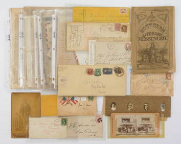
[ENSLAVEMENT & ABOLITION]. Manuscript legal complaint related to the hire of "the negro girl Ellen."Freeman's | Hindman4.4(1.6k)See Sold PriceFeb 27, 2024
After Adrien Persac (Louisiana/France, 1823-1873), "Plantations of the Mississippi River," 20th c.,Crescent City Auction Gallery4.3(229)See Sold PriceMar 08, 2024
John Senex Map of Louisiana & Mississippi RiverWillow Auction House4.5(283)See Sold PriceMar 14, 2024


![[BUSINESS]. Travel Guide of Negro Hotels and Guest Houses. Published by Afro-American Newspapers of (1 of 4)](https://p1.liveauctioneers.com/197/319238/171467937_1_x.jpg?height=282&quality=70&version=1707520367)
![[ENSLAVEMENT & ABOLITION]. Manuscript legal complaint related to the hire of "the negro girl Ellen." (1 of 2)](https://p1.liveauctioneers.com/197/319238/171468061_1_x.jpg?height=282&quality=70&version=1707520367)