ATLAS of ANTIENT GEOGRAPHY by SAMUEL BUTLER 1843John McInnis Auctioneers,LLC4.6(502)See Sold PriceFeb 24, 2024
18TH C. ANTIQUE MAP: FRENCH & INDIAN WAR, FRAMEDThomaston Place Auction Galleries4.4(386)See Sold PriceFeb 24, 2024
Rand McNally Railroad Map Cabinet w/ 21 Railroad MapsRail & Road Auctions4.6(165)See Sold PriceMar 08, 2024
Keith Haring - Ink on New York Map, Best Buddies, Inscribed, Signed, and DatedSapphire Auction Gallery4(67)See Sold PriceMar 02, 2024
LATE 17TH C. FRENCH MAP OF THE NEW WORLD BY ALEXIS-HUBERT JAILLOT (1632-1712)Thomaston Place Auction Galleries4.4(386)See Sold PriceFeb 24, 2024
Central Railroad of New Jersey Map of Sandy Hook Route-ca. 1903JM Hobby Supply and Railroad Artifact Auctions4.4(126)See Sold PriceFeb 24, 2024
Lot of Six Mixed Atlas Box Cars-HO Scale-New in BoxJM Hobby Supply and Railroad Artifact Auctions4.4(126)See Sold PriceFeb 25, 2024
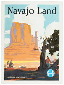
Rand McNally/Santa Fe Railroad Map of Iowa-1912JM Hobby Supply and Railroad Artifact Auctions4.4(126)See Sold PriceFeb 24, 2024
NICOLAES VISSCHER (NETHERLANDS, 1618-1709) MAP OF THE NEW WORLDThomaston Place Auction Galleries4.4(386)See Sold PriceFeb 24, 2024
17TH C. WORLD MAP BY NICOLAES VISSCHER (NETHERLANDS, 1618-1709)Thomaston Place Auction Galleries4.4(386)See Sold PriceFeb 24, 2024
Lot of Six Mixed Atlas Cabooses-HO Scale-New in BoxJM Hobby Supply and Railroad Artifact Auctions4.4(126)See Sold PriceFeb 25, 2024
MAP, US & Mexico, Von EulerSouthwestern United States & Mexico. Leonhard von Euler, Americae Septentrionalis Pars III, from Atlas Geographicus Omnes Orbis Terrarum…, 1760 (circa). Hand Color. This scarce map is one sheet of vSee Sold Price
SoldRadefeld/Meyer: Antique Map of U.S. & Mexico, 1852Vereinigte Staaten von Nord-America und Mexico. A highly detailed map of the United States and Mexico from Meyer's Groschen-Atlas, showing the pre-Gadsen Purchase border between the U.S. and Mexico anSee Sold Price
SoldMAP IN BOOK, US & Mexico, KitchinSouthwestern United States & Mexico. Thomas Kitchin, Mexico oder Neu Spanien zu Campens Entdekkung von America [bound in] Die Entdeckung von Amerika..., 1808 (published). Black & White. This attractivSee Sold Price
Radefeld: Antique Map of Pre-Gadsen Treaty US & MexicoMap: Vereinigte Staaten von Nord-America und Mexico Cartographer: Bibliographischen Instituts. Place & Date: Hildburghausen / 1852 Size: 10" x 7 3/4" Condition: original color; overall age toning, spoSee Sold Price
SoldMAP, US & Mexico, TallisSouthern United States & Mexico. John Tallis, Mexico, California and Texas, from Illustrated Atlas and Modern History of the World, 1850 (circa). Hand Color. This is the second, and most desirable, stSee Sold Price
MAP, US & Mexico, PrevostSouthwestern United States & Mexico. Anton Francois Prevost, Carte de la Californie d'Apres les Observations le Plus Exactes, pour Servir a l'Histoire Generale des Voyages, from Histoire Generale desSee Sold Price
MAP - US & Mexico. EttlingUnited States & Mexico. Theodor Ettling, Map of the United States of North America, Upper & Lower Canada New Brunswick, Nova Scotia & British Columbia Mexico Cuba, Jamaica, St. Domingo and the BahamaSee Sold Price
SoldMap of U.S., Mexico, & GuatemalaMap of the U.S. and Texas & Mexico and Guatemala by S. Augustus Mitchell Jr. 1840 Size: 17.5 x 11.75 in Please note that this lot has a confidential reserve. When you leave a bid in advance of the aucSee Sold Price
Sold1854 Thayer, Bridgman, Fanning Map of US, Mexico andTitle/Content of Map: 1854 Thayer, Bridgman, Fanning Map of US, Mexico and Caribbean -- Map of the United States, Canada, Mexico, and the West Indies with Central America, Showing All the Routes to CaSee Sold Price
Haven & Emmerson Map of U.S. & Mexico, 1846HAVEN & EMMERSON. Map of the United States and Mexico, including Oregon, Texas, and the Californias. Engraved map with original hand color in outline. New York: Haven & Emmerson, 1846. 30 1/2" x 20 1/See Sold Price
1854 Thayer, Bridgman, Fanning Map of US, Mexico andTitle/Content of Map: 1854 Thayer, Bridgman, Fanning Map of US, Mexico and Caribbean -- Map of the United States, Canada, Mexico, and the West Indies with Central America, Showing All the Routes to CaSee Sold Price
SoldTanner map of U.S. & Mexico 1830Title: Map of the United States and Mexico, Drawn & Engraved under the direction of H.S. Tanner, for the Atlas, to accompany Thos. T. Smiley's Easy Introduction the Study of Geography Author: Tanner,See Sold Price
SoldMAP - Southern US & Mexico. D'AnvilleSouthern United States, Mexico & Central America. D'Anville/Santini, Carte du Mexique, et de la Nouvelle Espagne, Contenant la Partie Australe de l'Amerique Septentle., 1779 (dated). Hand Color. A lovSee Sold Price
SoldThomas Kitchen 18th C. Map, US Southwest & MexicoMexico or New Spain; in which the motions of Cortes may be traced. Author: Thomas Kitchen Publication: Dr. Robertson's History of America, 1795.See Sold Price
A75-3 ORIGINAL 18TH CENTURY MAP OF US & MEXICOBy Johann Baptist Homann 1663-1724. Measures 30 1/2" x 33 3/4" with frame. Good condition. Estimate $1,500 - $1,800 Starting Bid $700See Sold Price
Map of U.S. & Mexico 1858Title: Mexique Antilles et Californie Author: Dufour, Adolphe Hippolyte Description: Engraved map, hand-colored. 55x74 cm. (21½x29").Includes the West Indies & most of the United States, with pre-GadSee Sold Price
MAP - Southern US & Mexico. D'AnvilleSouthern United States, Mexico & Central America. D'Anville/Santini, Carte du Mexique, et de la Nouvelle Espagne, Contenant la Partie Australe de l'Amerique Septentle., 1779 (dated). Black & White. ASee Sold Price
SoldFrench map of U.S. & Mexico, c.1848Title: États-Unis & Méxique Author: Furne et Cie. Description: Steel-engraved map, hand-colored. 33.5x42 cm. (13¼x16½"), matted.The United States and Mexico just after the war which secured CalifoSee Sold Price
SoldMap of U.S. & Mexico 1858Title: Mexique Antilles et Californie Author: Dufour, Adolphe Hippolyte Description: Engraved map, hand-colored. 55x74 cm. (21½x29").Includes the West Indies & most of the United States, with pre-GadSee Sold Price
SoldLaPie / Tardieu: Antique Map of US, Texas, Mexico, 1809Map: Mexique Cartographer: P. LaPie / Tardieu Place & Date: Paris / 1809/1812 Size: 11 7/8" x 8 3/4" Condition: outline color; light overall age toning, otherwise beautifully preserved A detailed mapSee Sold Price
SoldAntique Map of Southwestern US & MexicoTitle/Content of Map: Important Southwestern U.S., Texas to CA with Mexico and Guatemala Date Printed: 1843 Cartographer: Based on the work of H.C. Tanner Material/Medium: Paper Size: 17" x 14" Hand cSee Sold Price
Andriveau-Coujon: Map of the US & Mexico, 1875Map: Carte Generale des Etats-Unis et du Mexique comprenant L’Amerique Centrale et Les Antilles By: E. Andriveau-Coujon Date: 1875 (dated) Paris Dimensions: 24 x 35.25 inches (61 x 89.5 cm) ConditioSee Sold Price
Map of the U.S. & Mexico, Published by H. PhelpsTitle: Ornamental Map of the United States & Mexico. 1847. Published by H. Phelps, No. 144 Fulton Street, near Broadway, New York. Wood engraving and typography, 1846-47. Sheet size, 28 5/8 x 21 3/See Sold Price
1855 Wall Map of US and MexicoMap of the United States with its Territories: Also Mexico and the West Indies … 1855 [Wall Map]. Lithographed wall map with hand color. New York: Ensign, Bridgman & Fanning, 1855. 36 1/2 x 35 1/2 iSee Sold Price
Map of Mexico, Central America, New Grenada, Venzuela and the West IndiesJasper524.5(9.8k)See Sold PriceFeb 27, 2024