ATLAS of ANTIENT GEOGRAPHY by SAMUEL BUTLER 1843John McInnis Auctioneers,LLC4.6(502)See Sold PriceFeb 24, 2024
18TH C. ANTIQUE MAP: FRENCH & INDIAN WAR, FRAMEDThomaston Place Auction Galleries4.4(386)See Sold PriceFeb 24, 2024
Rand McNally Railroad Map Cabinet w/ 21 Railroad MapsRail & Road Auctions4.6(165)See Sold PriceMar 08, 2024
Keith Haring - Ink on New York Map, Best Buddies, Inscribed, Signed, and DatedSapphire Auction Gallery4(67)See Sold PriceMar 02, 2024
LATE 17TH C. FRENCH MAP OF THE NEW WORLD BY ALEXIS-HUBERT JAILLOT (1632-1712)Thomaston Place Auction Galleries4.4(386)See Sold PriceFeb 24, 2024
Central Railroad of New Jersey Map of Sandy Hook Route-ca. 1903JM Hobby Supply and Railroad Artifact Auctions4.4(126)See Sold PriceFeb 24, 2024
Lot of Six Mixed Atlas Box Cars-HO Scale-New in BoxJM Hobby Supply and Railroad Artifact Auctions4.4(126)See Sold PriceFeb 25, 2024
Rand McNally/Santa Fe Railroad Map of Iowa-1912JM Hobby Supply and Railroad Artifact Auctions4.4(126)See Sold PriceFeb 24, 2024
NICOLAES VISSCHER (NETHERLANDS, 1618-1709) MAP OF THE NEW WORLDThomaston Place Auction Galleries4.4(386)See Sold PriceFeb 24, 2024
17TH C. WORLD MAP BY NICOLAES VISSCHER (NETHERLANDS, 1618-1709)Thomaston Place Auction Galleries4.4(386)See Sold PriceFeb 24, 2024
Lot of Six Mixed Atlas Cabooses-HO Scale-New in BoxJM Hobby Supply and Railroad Artifact Auctions4.4(126)See Sold PriceFeb 25, 2024
Map of Upper New York City and adjacent country.Title/Content of Map: Map of Upper New York City and adjacent country. Cartographer: Wm. M. Goldthwaite, 107 Nassau St. Date: 1889 Publisher: N.Y. Country Club and N.Y. Athletic Club / Hyde & Company.See Sold Price
Wall Map of Upper NYC and Lower Westchester/ also MapsGoldthwaite, William M. (Late 19th-Early 20th Century). Map of Upper New York City and adjacent country. Hyde & Co. for New York Country and Athletic Club. Lithographed map. 1889. 31" x 23" sheet. ShoSee Sold Price
SoldPre-Central Park Map of New York CityMap of the City and County of New York with the Adjacent Country. David H. Burr (1803-1875). Simeon deWitt, New York, 1839.Lithographed in Ithaca, NY: Stone & Clark, 1839. 22 1/4 x 51 inches sheet, 27See Sold Price
SoldColton (G.W. and C.B.) - G.Woolworth Colton's New Planfolding pocket map with inset plan of The Upper Part of New York City with the adjacent portion of Westchester County, upper left, engraved plan with original hand-colouring, the full sheet 630 x 480mSee Sold Price
SoldSimeon DeWitt, Map of the City and County of New YorkDEWITT, Simeon. Map of the City and County of New York with the adjacent country. 1832. Sheet size: 21 x 49 3/4 inches.See Sold Price
Large Format Map of the Manhattan Grid System by BurrBURR, David (1803-1875). Map of the City and County of New York with the Adjacent Country. Engraved map with original hand color. Ithaca, NY: Stone & Clark, 1839. 20 1/2" x 50 1/2" visible, 35" x 64"See Sold Price
MAPS - Eastern US Cities. MelishEastern United States Cities. John Melish, [Lot of 7] New-York, and Adjacent Country [and] District of Columbia [and] Boston... [and] Baltimore, Annapolis... [and] Charleston... [and] View of the CounSee Sold Price
Map of New York & Adjacent Cities 1864Map: Map of New York and the Adjacent Cities Maker: Johnson & Ward, Colton, Joseph Hutchins Publishing: New York 1864 Size: 16 x 26 inches Colton plan reissued by Johnson with a different border PleasSee Sold Price
Johnson's Map of New York and Adjacent CitiesJohnson & Ward, Johnson, A.J., 1863, Double Folio – 15.30 H x 24.70 W Inches, City plan naming streets, squares, parks, railroads etc. Decorative border. Inset: continuation of N.Y.C. north. PleaseSee Sold Price
SoldJohnson's Map of New York and Adjacent Cities.Title: Johnson's Map of New York and Adjacent Cities. Date: 1862 Cartographer: Size: 15 X 24.8 Detailed city plan of streets, parks, principal buildings, railroads, etc. Shows Brooklyn and part of JerSee Sold Price
Johnson's Map of New York and Adjacent CitiesPublication Date: 1863 Title: Johnson's Map of New York and Adjacent Cities Cartographer: JOHNSON, A.J. Publisher: JOHNSON & WARD Height: 15.3 Width: 24.7 29. 30. City plan naming streets, squares, paSee Sold Price
Johnson's Map of New York & the Adjacent Cities, 1862Map: Johnson's Map of New York and the Adjacent Cities Maker: Johnson and Ward, Alvin Jewett Johnson Date: 1862 Size: Double Folio, 14.5 inches high x 24.5 inches wide Map detailing districts separateSee Sold Price
GAYLORD WATSON -MAP OF NEW YORK AND ADJACENT CITIES,Gaylord Watson -map Of New York And Adjacent Cities, 1874 - Giclée On Canvas -31 1/4 X 40 In. - A Giclée Print Is The Highest Quality Print Available Today. Because There Is No Visible Dot Screen PaSee Sold Price
GAYLORD WATSON -MAP OF NEW YORK AND ADJACENT CITIES,Gaylord Watson -map Of New York And Adjacent Cities, 1874 - Giclée On Canvas -34 3/8 X 44 In. - A Giclée Print Is The Highest Quality Print Available Today. Because There Is No Visible Dot Screen PaSee Sold Price
GAYLORD WATSON"MAP OF NEW YORK AND ADJACENT CITIEThis Is A GAYLORD WATSON Giclee on CANVAS Titled "MAP OF NEW YORK AND ADJACENT CITIES, 1874"Measuring - 23 1/2 x 30 in.This Giclée is high-resolution and of the highest quality, has a color permanencSee Sold Price
SoldJohnson's Map of New York and the Adjacent Cities.Title: Johnson's Map of New York and the Adjacent Cities. Publication Date: 1866 Cartographer: JOHNSON, ALVIN JEWETT Publisher: JOHNSON AND WARD Size: 16Height - 26Width 29-30. Original coloring. BrowSee Sold Price
SoldJohnson's Map of New York and the Adjacent Cities.Title: Johnson's Map of New York and the Adjacent Cities. Publication Date: 1864 Cartographer: JOHNSON, ALVIN JEWETT Publisher: JOHNSON AND WARD Size: 16x26 Original coloring. 29-30. Browned, margin sSee Sold Price
SoldMap of New York and the Adjacent Cities.Title: Map of New York and the Adjacent Cities. Date: 1858 Cartographer: COLTON, JOSEPH HUTCHINS Size: 15.75 X 25 Browned. Margin spotted. Centerfold repaired. Please note that this lot has a confidenSee Sold Price
SoldJohnson's Map of New York and the Adjacent Cities.Title/Content of Map: Johnson's Map of New York and the Adjacent Cities. Date: 1866 Cartographer: JOHNSON, ALVIN JEWETT Size: 16X26 Original coloring. Damped with some loosening of sections. 4' X 5'+See Sold Price
SoldGrp: 3 Maps of New York CityGroup of three maps of New York City. Includes Mark Tiddeman, "A Draught of New York from the Hook to New York Town," London: W. Mount & T. Page; "Map of New York and the Adjacent Cities," New York: JSee Sold Price
Johnson’s map of New York and the Adjacent Cities,"c.Johnson’s map of New York and the Adjacent Cities,"c. 1860, by Johnson & Ward, H.- 18 in., W.- 27 in.See Sold Price
SoldAntebellum Colton Map of New York CityAntebellum Colton Map of New York CityMap of New York and the Adjacent Cities (New York: J. R. Colton & co., 1855), steel engraving with color from Colton's General Atlas; presented in two-sided woodeSee Sold Price
SoldTwo hand colored engraved double page large folio mapsTwo hand colored engraved double page large folio maps including The United States of America and Map of New York and the Adjacent Cities. 16 1/2" x 27" and 17 1/2" x 27" Provenance: Property from CSee Sold Price
Sold1846 Colton Map of the Area 33 Miles Around New YorkTitle: 1846 Colton Map of the Area 33 Miles Around New York City -- Map of the Country Thirty Three Miles Around The City of New York Cartographer: G Colton Year / Place: 1846, New York Map DimensionSee Sold Price
Erie Railway Tourist Book/Magazine-1874JM Hobby Supply and Railroad Artifact Auctions4.4(126)See Sold PriceFeb 24, 2024
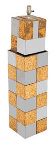
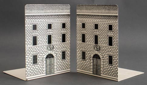
Paul Evans CItyscape Chrome and Cork Floor LampAuctions at Showplace4.5(726)See Sold PriceMar 03, 2024
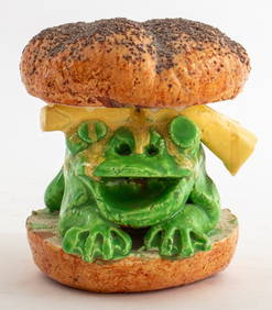
David James Gilhooly "Frog Burger" Ceramic, 1977Auctions at Showplace4.5(726)See Sold PriceMar 03, 2024
George Hayward - Map of the City of New York 1854Dane Fine Art Auctions4.4(494)See Sold PriceMar 07, 2024
Pair of The Gateway to a Continent Books - Grand Central Zone and 1939 World's FairRail & Road Auctions4.6(165)See Sold PriceMar 07, 2024
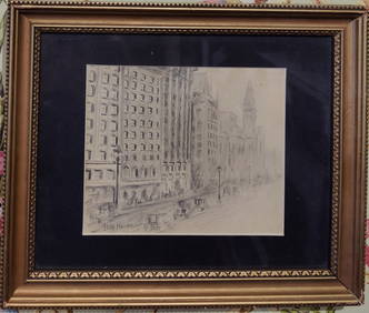
Attributed Childe Hassam Pencil Drawing of New York CityHeritage Gallery Auctions4.4(56)See Sold PriceMar 10, 2024
Johann Homann Hand-Colored Map Engraving, c. 1730Auctions at Showplace4.5(726)See Sold PriceMar 17, 2024
Willem Blaeu, Etc. 17th C. Antiquarian Maps, 2Auctions at Showplace4.5(726)See Sold PriceMar 17, 2024
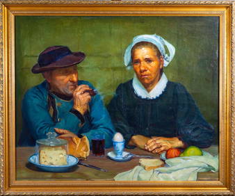
Abel George Warshawsky (American, 1883-1962) "Apres le Repas" Oil on CanvasMagnusson Art Group4.5(46)See Sold PriceMar 14, 2024
Georg Bockler Map of Ancient Jerulsaem EtchingAuctions at Showplace4.5(726)See Sold PriceApr 07, 2024
Black and white map of part of New York City (mostly Manhattan)Proverde Auctions4.3(3)See Sold PriceFeb 28, 2024
Laminated Unique Media New York City MapRapid Estate Liquidators and Auction Gallery4.5(1.1k)See Sold PriceFeb 29, 2024