SoldMap of Pennsylvania by Tobias C. LotterDESCRIPTION: Map of Pennsylvania, Nova Jersey et Nova York cum Regionibus ad Fluvium Delaware in America sitis by Tobias Conrad Lotter (German, 1717-1777). Hand colored engraving on laid paper. AugsbuSee Sold Price
Sold(Maps and Charts, Pennsylvania), Lotter, Tobias Co(Maps and Charts, Pennsylvania), Lotter, Tobias Conrad (1717-1777), Pensylvania, Nova Jersey et Nova York Cum Regionibus ad Fluvium Delaware in America Sitis, Augsburg, [c 1750], double page folio witSee Sold Price
Sold1 piece. Hand-Colored Engraved Map. Lotter, Tobia1 piece. Hand-Colored Engraved Map. Lotter, Tobias Conrad. Pennsylvania, Nova Jersey et Nova York cum Regionibus ad Fluvium Delaware in America Sitis,..." Augsburg, [1748-1774]. 22 3/8 x 19 3/8 inchesSee Sold Price
Pre-Revolutionary War era map of Pennsylvania, NewPensylvania Nova Jersey et Nova York cum Regionibus Ad Fluvium Delaware In America Sitis, Nova Delinatione ob oculos posita...Tobias Conrad Lotter (1717 - 1777). Engraved map with handcolor in part. ASee Sold Price
Sold(MAP, BALKANS) SEUTTER, MATTHEW. A group of 4 hand(MAP, BALKANS) SEUTTER, MATTHEW A group of six hand-colored copper engraved maps by Matthew Seutter engraved by Tobias Lotter. (Augsburg, c. 1740) Each with detailed decorative cartouches, featuring mSee Sold Price
SoldLOTTER, TOBIAS CONRAD. Pennsylvania Nova Jersey et NovaLOTTER, TOBIAS CONRAD. Pennsylvania Nova Jersey et Nova York cum Regionibus ad Fluvium Delaware in America Sitis. Double-page engraved map of colonial Pennsylvania, New Jersey and New York with an elaSee Sold Price
SoldLOTTER, TOBIAS CONRAD. Pensylvania Nova Jersey et NewLOTTER, TOBIAS CONRAD. Pensylvania Nova Jersey et New York. Engraved map of eastern Pennsylvania, New Jersey, New York and parts of an amusingly condensed New England with a large decorative title carSee Sold Price
Lotter Map of the Pennsylvania & NJLOTTER, Tobias Conrad (1717 - 1777). Pensylvania, Nova Jersey et Nova York...Engraved map with hand color. Augsburg, ca 1756-57. 25 1/2" x 22 sheet. This is a notable pre-Revolutionary War era map basSee Sold Price
SoldSeutter (G.M.) Hispania AugustinianaSeutter (Georg Mattheus) Hispania Augustiniana, engraved map of Spain with original hand-colouring, 500 x 580mm., central vertical fold, Augsburg, Tobias Conrad Lotter, [c.1730].See Sold Price
SoldTobias Conrad Lotter 19th C. Israel Holy Land MapTobias Conrad Lotter (German, 1717-1777). A 19th Century map of the Holy Land in its twelve tribal divisions, based on the work of Lotter, one of the best known 18th century German mapmakers. MeasuresSee Sold Price
SoldTobias Conrad Lotter Turkish Empire Map C - 1750Magni Turcarum Dominatoris Imperium per Europae, Asiam, et Africam, se extendens Regiones tam proprias, quam tributarias et clientelares ut et omnes Beglerbegatus sive Praefecturas Generales oculis siSee Sold Price
Lotter Map of the WorldLOTTER, Tobias Conrad (1717-1777), after DELISLE, Guillaume (1675-1726).Mappa Totius Mundi.Engraved map with original hand color in part. Augsburg: T.C. Lotter, c. 1770.21 3/4" x 26 3/4" sheet.This laSee Sold Price
Lotter Map of North AmericaLOTTER, Tobias Conrad (1717-1777), after DELISLE, Guillaume (1675-1726).America Septentrionalis...Engraved map with hand color in part.Augsburg" Lotter, c. 1762-1770.21 1/8" x 24 1/2" sheet.This map rSee Sold Price
Lotter, C; Seutter, M. Partie Orientale du CanadaLotter, Conrad Tobias; Seutter, Matthaus Partie Orientale de la Nouvelle France ou du Canada C. 1760 Copperplate engraving; area coloured Printed area: 57 x 49.3 cm; 22.4 x 19.4 in One of the first geSee Sold Price
Lotter map of New York & New Jersey 1777Title: A Map of the Provinces of New-York and New-Jersey, with a Part of Pennsylvania and the Province of Quebec. From the Topographical Observations of C.J. Sauthier Author: Lotter, Mathew Albert DesSee Sold Price
SoldLotter map of New York & New Jersey 1777Title: A Map of the Provinces of New-York and New-Jersey, with a Part of Pennsylvania and the Province of Quebec. From the Topographical Observations of C.J. Sauthier Author: Lotter, Mathew Albert DesSee Sold Price
SoldLotter (T. C.) Graecia Nova.Lotter (Tobias Conrad) Graecia Nova, mainland Greece, the Cyclades and principal islands of the Aegean, part of Bulgaria and Asia Minor, with decorative title cartouche, engraved map with handSee Sold Price
Lotter map of New York & New Jersey 1777Title: A Map of the Provinces of New-York and New-Jersey, with a Part of Pennsylvania and the Province of Quebec. From the Topographical Observations of C.J. Sauthier Author: Lotter, Mathew Albert DesSee Sold Price
SoldLotter (T C) Carte de l'Océan PacifiqueLotter (Tobias Conrad) Carte de l'Océan Pacifique,the Pacific Ocean with the coasts of Asia and America, text in French and German, engraved map with original hand-colouring in outline and wasSee Sold Price
SoldLotter, Atlas Geographicus portatilis …Lotter Tobias Conrad, Atlas Geographicus portatilis XIX mappis urbis habitabilis regna exhibens... [Augsburg]: Delineavit et excudit Tobias Lobeck, [1750 c.a.]. Trigesimo-Secundo (mm 105x75) withSee Sold Price
SoldLotter (Tobias Conrad) AsiaLotter (Tobias Conrad) Asiaengraved map with hand-colouring, 480 x 570mm., central vertical fold, some rubbing and surface dirt, margins a little browned, Augsburg, [c.1760].See Sold Price
SoldLotter (Tobias Conrad) SwitzerlandLotter (Tobias Conrad) Switzerlandengraved map, 480 x 570mm., original hand-colouring, decorative title cartouche, a few short tears at bottom edge, Augsburg, c.1750 Jansson (J.) BasiliensisSee Sold Price
SoldLotter, Atlas Geographicus portatilis. 1750Lotter Tobias Conrad, Atlas Geographicus portatilis XIX mappis urbis habitabilis regna exhibens... S.l. [ma Augsburg]: Delineavit et excudit Tobias Lobeck, s.d. [1750 c.a.]. In-32° (mm 103x69See Sold Price
[atlases] Lotter, 1750Lotter Tobias Conrad, Atlas Geographicus portatilis XIX mappis urbis habitabilis regna exhibens... S.l. [ma Augsburg]: Delineavit et excudit Tobias Lobeck, s.d. [1750 c.a.]. In-32° oblungo (mSee Sold Price
Crams Township and Railroad Map of Pennsylvania-1898JM Hobby Supply and Railroad Artifact Auctions4.4(127)See Sold PriceFeb 24, 2024
17TH C. WORLD MAP BY NICOLAES VISSCHER (NETHERLANDS, 1618-1709)Thomaston Place Auction Galleries4.4(394)See Sold PriceFeb 24, 2024
LATE 17TH C. FRENCH MAP OF THE NEW WORLD BY ALEXIS-HUBERT JAILLOT (1632-1712)Thomaston Place Auction Galleries4.4(394)See Sold PriceFeb 24, 2024
17TH C. ANTIQUE MAP SIEGE OF LA ROCHELLE, FRANCE, FRAMEDThomaston Place Auction Galleries4.4(394)See Sold PriceFeb 24, 2024
EARLY 18TH C. MAP OF ITALY, FRAMEDThomaston Place Auction Galleries4.4(394)See Sold PriceFeb 24, 2024
LATE 16TH C. MAP OF SCOTLAND BY MERCATOR, FRAMEDThomaston Place Auction Galleries4.4(394)See Sold PriceFeb 24, 2024
17TH C. MAP OF THE BERKSHIRES BY JOHN SPEED, FRAMEDThomaston Place Auction Galleries4.4(394)See Sold PriceFeb 24, 2024
18TH C. ANTIQUE MAP: FRENCH & INDIAN WAR, FRAMEDThomaston Place Auction Galleries4.4(394)See Sold PriceFeb 24, 2024
Austin Wooster (PA,1838-1913) oil painting antiqueBroward Auction Gallery4.7(300)See Sold PriceApr 14, 2024
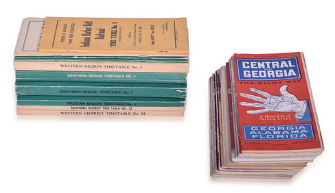
23 Employee and Public Railroad Timetables - NC&StL, NYC, Pennsylvania, C&EI, Southern Pacific, ACL,Rail & Road Auctions4.6(165)See Sold PriceMar 07, 2024
1855 Guide for the Pennsylvania Railroad with an Extensive Map from the Pennsylvania RailroadRail & Road Auctions4.6(165)See Sold PriceMar 07, 2024
1904 Pennsylvania Railroad Winter Excursions Book with Fold Out MapRail & Road Auctions4.6(165)See Sold PriceMar 07, 2024
Johann Homann Hand-Colored Map Engraving, c. 1730Auctions at Showplace4.6(744)See Sold PriceMar 17, 2024
Willem Blaeu, Etc. 17th C. Antiquarian Maps, 2Auctions at Showplace4.6(744)See Sold PriceMar 17, 2024
Vintage Street Map of Pittsburgh, Pennsylvania - Rand McNallyProverde Auctions4.3(3)See Sold PriceFeb 28, 2024
Antique Pennsylvania Map Fragment incl Wellersburg and New CentervilleCordier Auctions & Appraisals4.4(1.5k)See Sold PriceMar 02, 2024


![[atlases] Lotter, 1750 (1 of 4)](https://p1.liveauctioneers.com/1306/149409/75467393_1_x.jpg?height=282&quality=70&version=1567670708)