ATLAS of ANTIENT GEOGRAPHY by SAMUEL BUTLER 1843John McInnis Auctioneers,LLC4.6(504)See Sold PriceFeb 24, 2024
18TH C. ANTIQUE MAP: FRENCH & INDIAN WAR, FRAMEDThomaston Place Auction Galleries4.4(389)See Sold PriceFeb 24, 2024
Rand McNally Railroad Map Cabinet w/ 21 Railroad MapsRail & Road Auctions4.6(165)See Sold PriceMar 08, 2024
Keith Haring - Ink on New York Map, Best Buddies, Inscribed, Signed, and DatedSapphire Auction Gallery4.1(67)See Sold PriceMar 02, 2024
LATE 17TH C. FRENCH MAP OF THE NEW WORLD BY ALEXIS-HUBERT JAILLOT (1632-1712)Thomaston Place Auction Galleries4.4(389)See Sold PriceFeb 24, 2024
Central Railroad of New Jersey Map of Sandy Hook Route-ca. 1903JM Hobby Supply and Railroad Artifact Auctions4.4(126)See Sold PriceFeb 24, 2024
Lot of Six Mixed Atlas Box Cars-HO Scale-New in BoxJM Hobby Supply and Railroad Artifact Auctions4.4(126)See Sold PriceFeb 25, 2024
Rand McNally/Santa Fe Railroad Map of Iowa-1912JM Hobby Supply and Railroad Artifact Auctions4.4(126)See Sold PriceFeb 24, 2024
NICOLAES VISSCHER (NETHERLANDS, 1618-1709) MAP OF THE NEW WORLDThomaston Place Auction Galleries4.4(389)See Sold PriceFeb 24, 2024
17TH C. WORLD MAP BY NICOLAES VISSCHER (NETHERLANDS, 1618-1709)Thomaston Place Auction Galleries4.4(389)See Sold PriceFeb 24, 2024
Lot of Six Mixed Atlas Cabooses-HO Scale-New in BoxJM Hobby Supply and Railroad Artifact Auctions4.4(126)See Sold PriceFeb 25, 2024
SoldMap of Eretz Israel - Woodcut - France, 1535Tabula Terre Sanctae, map of Eretz Israel. Woodcut. [Published by Melchior Gaspar Treschel, France (Lyon), 1535]. Map of Eretz Israel facing east, divided according to the territories of the twelve trSee Sold Price
SoldTwo Maps of Eretz Israel, 16th century1. Terra Sancta XVI nova tabula [Modern map of Palestine 16th century], Sebastian Münster. Basel, 1542. Colored woodcut. Eretz Israel spans on both sides of the Jordan River according to the TribesSee Sold Price
Hebrew .- Haggadah shel Pesach, Hebrew, letterpressHebrew .- Haggadah shel Pesach , Hebrew, letterpress title with woodcut decoration, 14 copper-engraved illustrations, copper-engraved folding map of Eretz Israel, lacking additional engraved title, tiSee Sold Price
Sold1535 map with Pakistan & AfghanistanHeading: Author: Ptolemy, Claudius / Lorenz Fries Title: Tabula IX Asiae Place Published: Lyons, France Publisher: Date Published: 1535 Description: Woodcut map. Title andSee Sold Price
1535 map with Pakistan & AfghanistanHeading: Author: Ptolemy, Claudius / Lorenz Fries Title: Tabula IX Asiae Place Published: Lyons, France Publisher: Date Published: 1535 Description: Woodcut map. Title andSee Sold Price
1535 map with Pakistan & AfghanistanHeading: Author: Ptolemy, Claudius / Lorenz Fries Title: Tabula IX Asiae Place Published: Lyons, France Publisher: Date Published: 1535 Description: Woodcut map. Title andSee Sold Price
SoldLandmark map of Southeast Asia, 1535Heading: Author: Ptolemy, Claudius / Lorenz Fries Title: India Orientalis Place Published: Lyons, France Publisher: Date Published: 1635 Description: Woodcut map. 27x42.5 cSee Sold Price
SoldMap of Palestine - Woodcut - Lyon, 1535Tabula Terre Sanctae. Map of Palestine. Woodcut from "Geographia" by Ptolemy Claudius, edited by Michael Servetus. [Lyon, 1535]. Map of Palestine, showing the territories of the Tribes of Israel. TheSee Sold Price
Sold"Biblia Sacra". Lyon, France, 1569Biblia Sacra, ad Vetustissima Exemplaria Castigata. Hundreds of etchings and important maps of the Land of Israel. Lyon, France, 1569. [10], 394, [65], 4 woodcuts of maps and hundreds of etchings of tSee Sold Price
SoldHebrew Map – Eretz Israel and the Wanderings of the"Map of Eretz Israel and the wanderings of the People of Israel in the desert…till they reached Canaan….printed by…Zvi Hirsch Boyrsky". Bomberg lithography printing press, Warsaw 187See Sold Price
SoldHebrew Map - Eretz Israel and Grapevines - Germany,Onomasticum veteris testamenti sive tractatus philologicus. Lexicon of the Old Testament with Philological treatise by Johann Simonis. Halle, 1741.Latin, Hebrew, Arabic, Ethiopian and Greek. EngravedSee Sold Price
SoldPalestine and Israel Map LotLarge lot of 20th century maps, Eretz Israel (Palestine) and Israel. Including Mandatory Palestine maps, maps from old atlases and more. Various sizes and conditions, overall good condition.See Sold Price
SoldBrass Item Lot, PalestineLot of two brass items embossed with reliefs of Palestine maps, Eretz Israel (Palestine). Including an Oppenheim ink blotter and a Klein-Kom notebook cover. Dimensions: 13.5X8 - 10.5X10 cm. Marked. MiSee Sold Price
SoldMap of Eretz Israel from the Rabbi Eliyahu MizrahiMap of the borders of Eretz Israel according to Rabbi Eliyahu Mizrahi [leaf from the book about Rashi commentary by Rabbi Eliyahu Mizrahi. Fürth, 1763]. On p.122/2 appears a map of the borders of EreSee Sold Price
SoldMap of Eretz Israel - Engraving - Amsterdam, 1629Terra Sancta quae in sacris Terra Promissionis olim Palestina. Map of Eretz Israel. Engraving colored by hand, out of the first atlas by Willem Janszoon Blaeu. Amsterdam, 1629. Map of Eretz Israel, SiSee Sold Price
SoldMap of Eretz Israel - Heinrich Bunting - Swede...Thet Helighe Landzens Egentlighe Affmalningh. Out of Itinerarium sacrae scripturae, thet ar een reesebook, offuer then helighe Schrifft, vthi twa boker deelat, by Heinrich Bunting, translated by LaureSee Sold Price
SoldAlbum of the Lands of the Bible - Map of Eretz IsraelAlbum of the lands of the Bible, 50 original views of important places mentioned in scripture, drawn from nature by Johann Martin Bernatz. Stuttgart-Leipzig: J.L. Steinkopf, 1858. English, German andSee Sold Price
SoldHebrew Map of Eretz Israel / Sefer "Be'er HaLuchot" -•"Map of the Holy Land as it is in the Bible…copied from the Latin language by Jacob Auspitz of Ofen. Approbation…Moshe Mintz", [1816-7]. Plate 4 of Sefer "Be'er HaLuchot" by Jacob ASee Sold Price
SoldMap of Eretz Israel - From the Amsterdam Haggadah, 1712"…Fourty years in the desert through the Holy Land…", by Avraham Ben Ya'akov Hagar. Copper engraving. [Amsterdam], 1712. Eretz Israel, divided among the tribes, on both sides of the JordanSee Sold Price
SoldMap of Eretz Israel - Engraving Colored by Hand -Palestinae delineatio ad geographiae canones revocata, map of Eretz Israel by Philippe Briet. Copper engraving, colored by hand. Paris: Pierre Mariette publishing, [1641]. Map of Eretz Israel, dividedSee Sold Price
SoldMap of Eretz Israel, Showing Division into Tribes - EngTerrae Israel omnis ante Canaan dictae in tribus undecim distributae… Map of Eretz Israel showing division into tribes by Benito Arias Montano. Engraving work by Pieter van der Heyden, Leiden, 1593.See Sold Price
SoldLarge "Mizrah" with a Map of Eretz Israel"Jerusalem – Mizrah – Map of Palestine". [USA?], 1937. Lithographic printing on paper. In the center – Map of Eretz Israel and its surrounding. Around the map appear the holy sites, list of 22 sSee Sold Price
SoldBritish Map of Eretz Israel - Pro-Arab - with an EtzelPrinted map of Eretz Israel, [1946-7]. Map of Eretz Israel with sites of mosques, a title in Arabic, Arab figures and space for integrating a calendar. A note on behalf of the Etzel is pasted to the mSee Sold Price
SoldMap of Eretz Israel in Romanian, 1948Statul Evreesc Independent Israel si Palestina [Independent Jewish State and Palestine], 1948. Romanian. Two parts. On the upper part of the map appears a historic description of settlement in Eretz ISee Sold Price
LARGE LATE 17TH C. DUTCH CHART OF CANADA, GREAT LAKES, NEW FRANCE, LABRADOR, HUDSON BAY, BY PIERREThomaston Place Auction Galleries4.4(389)See Sold PriceFeb 24, 2024
17TH C. ANTIQUE MAP SIEGE OF LA ROCHELLE, FRANCE, FRAMEDThomaston Place Auction Galleries4.4(389)See Sold PriceFeb 24, 2024
ABRAHAM ORTELIUS (1527-1598) MAP OF ROMAN GAUL (FRANCE)Thomaston Place Auction Galleries4.4(389)See Sold PriceFeb 24, 2024
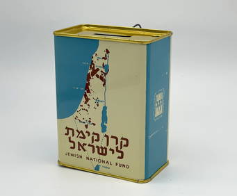
Jewish National Fund Collection Box - Great BritainLevy Auction House4.3(11)See Sold PriceFeb 27, 2024
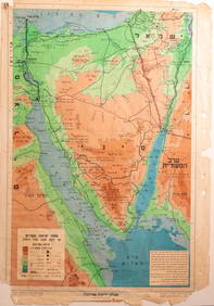
Eretz Israel Map Postcard - World Zionist OrganizationLevy Auction House4.3(11)See Sold PriceFeb 27, 2024
Illustrated Sabbath Cloth - Holy Sites of Eretz IsraelLevy Auction House4.3(11)See Sold PriceFeb 27, 2024
1849 Mitchell School ATLAS 24 MAPS America Holy Land France Africa Egypt AsiaSchilb Antiquarian Rare Books4.8(422)See Sold PriceMar 31, 2024
[MAPS]. DUFOUR, Auguste-Henri (1795-1865). Bound Volume of ...Potter & Potter Auctions4.6(544)See Sold PriceMar 07, 2024
Framed Hand Colored Antique Map of the Department of Nord, FranceDonny Malone Auctions4.4(1.8k)See Sold PriceMar 04, 2024
1558 SCANDINAVIA SWEDEN ILLUSTRATED HISTORY Gothorum Sveonumque historia antiqueJasper524.5(9.8k)See Sold PriceFeb 27, 2024
Aristide Maillol (France 1861-1944) "Harvest Bouty" WoodcutCV Auction LLC4.4(34)See Sold PriceMar 09, 2024
[Choisnet (Pierre)] [Le Rozier ou Epithome Hystorial de France], second editon, [Paris], [1528].Forum Auctions4.3(53)See Sold PriceFeb 29, 2024
Alfred Salzman, Etc. JNF Tin Tzedakah Boxes, 3Auctions at Showplace4.6(731)See Sold PriceApr 07, 2024
Salvador Dali (SPANISH / FRANCE, 1904 - 1989) unsigned woodcut print of "Erinnyes", Hell Plate 11.Joshua Kodner4.2(387)See Sold PriceMar 09, 2024
Herman Moll A New Map of Ye North Parts of AmericaWillow Auction House4.5(284)See Sold PriceMar 14, 2024


![[MAPS]. DUFOUR, Auguste-Henri (1795-1865). Bound Volume of ... (1 of 2)](https://p1.liveauctioneers.com/928/318880/171361279_1_x.jpg?height=282&quality=70&version=1707501302)


![[Choisnet (Pierre)] [Le Rozier ou Epithome Hystorial de France], second editon, [Paris], [1528]. (1 of 1)](https://p1.liveauctioneers.com/5458/319736/171654434_1_x.jpg?height=282&quality=70&version=1708010439)


![Vintage Airplane Desk Model [Air France] (1 of 7)](https://p1.liveauctioneers.com/5755/320282/172113951_1_x.jpg?height=282&quality=70&version=1708463029)