SoldMap of Eretz Israel, Showing Division into Tribes - EngTerrae Israel omnis ante Canaan dictae in tribus undecim distributae… Map of Eretz Israel showing division into tribes by Benito Arias Montano. Engraving work by Pieter van der Heyden, Leiden, 1593.See Sold Price
Two Maps of the Land of Israel, 18th Century ...1. Iudaea, seu Terra Sancta quae Hebraeorum sive Israelitarum. Map of the Land of Israel on both banks of the Jordan River, showing the division of land among the tribes, by Guillaume Sanson. AmsterdaSee Sold Price
SoldMap of Eretz Israel in its Division to the Kingdoms ofTerra Sancta sive Promissionis, olim Palestina, in duo divisa Regna, Israel, et Iuda, et in sex subdvisa Provincias. Rome, [1679?]. Latin. Map of Eretz Israel, in its division to the kingdoms of JudeaSee Sold Price
Map of the Holy Land – Engraving – Venice, 1786Chorographia Terrae Sanctae in anguistiorem forman redacta, et ex variis auctoribus a multis expurgate. Map of Eretz Israel, divided into tribes, and additional illustrations by Jacobus Tirinus [VenicSee Sold Price
SoldLarge Mizrah with Map of Eretz Israel"Jerusalem - Mizrah - Map of Palestine". [USA?], 1927. Lithographic printing on paper. In the center - map of Eretz Israel divided into the tribes' territories. All around - drawings of towns and holySee Sold Price
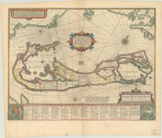
SoldBermuda.- Speed (John) A Mapp of the Sommer Ilands onceBermuda.- Speed (John) A Mapp of the Sommer Ilands once called the Bermudas... / Mappa Aestivarum Insularum..., map showing the division of the island into "Tribes" and lists below the proprietors, wiSee Sold Price
SoldMap of Eretz Israel - From the Amsterdam Haggadah, 1712"…Fourty years in the desert through the Holy Land…", by Avraham Ben Ya'akov Hagar. Copper engraving. [Amsterdam], 1712. Eretz Israel, divided among the tribes, on both sides of the JordanSee Sold Price
Map of Eretz Israel - Engraving - Amsterdam, 1707Tabula Geographica Terrae Sanctae. Map of Eretz Israel. Franciscus Halma publishing, Amsterdam [1707]. Large map of Eretz Israel, divided according to the living areas of the Twelve Tribes. From the bSee Sold Price
SoldBrass plate by NordiaA brass plate by Nordia, with illustrations on paper of the symbols of the 12 tribes and of the map of Eretz Israel. Diameter: 31 cm. Signed.See Sold Price
SoldTwo Land of Israel Maps, 18th Century1. Iudaea, seu Terra Sancta quae Hebraeorum sive Israelitarum. Map of the Land of Israel on both sides of the Jordan, with division into the tribes' inheritances by Guillaume Sanson, Amsterdam,See Sold Price
SoldA Collection of Important Maps of the Land of Israel,A collection of some 17 engravings and prints of important and early maps of the biblical Land of Israel including its division between the 12 tribes, some of them hand painted. Europe, 16th-18th centSee Sold Price
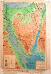
SoldA collection [7] of Ancient Maps of the Land of IsraelEarly geographical maps from various publishers. Some of the maps show the division into tribes. Three maps are painted by hand from the time of printing, and four are black and white. Two large maSee Sold Price
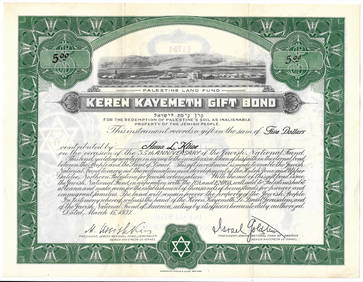
SoldCollection of 4 Receipts - Jewish National Fund, 1946Collection of four receipts of the Youth Plant, the National comittee for Eretz Israel of the Jewish National Fund, showing: Revivim and the Jewish Brigade symbol, Metullah and a map of the galilee, ZSee Sold Price
Map of the Land of Israel - Etching. London 1814CANAAN illustrating the books of Joshua and Judges, London 1814. Map of the Holy Land according to the division of the tribes in Joshua. The National Library has a copy of the map from the Amir KahanoSee Sold Price
SoldMap of the Land of Israel with Tribal Divisions.“Thet Helighe Landzens Egentligh.†The Land of Israel divided by the 12 tribes. Both banks of the Jordan River. Heinrich Bunting. Stockholm, 1595. 29x38 cm. Old Swedish. Nice woodcut depictiSee Sold Price
IMPORTANT JUDAICA AMSTERDAM PASSOVER HAGGADAHPRINTED IN HOLLAND 1695 ; WITH THE MAP OF HOLY LAND HAVING THE TRACK OF THE CHILDREN OF ISRAEL ON THEIR WAY AND THE DIVISION AMONG TRIBES .THIS IS THE EARLIEST REAL MAP EXTANT BEARING HEBREW LETTERINGSee Sold Price
SoldEretz-Israel In Fergangenheit un gegenwart, Yiddish,Eretz-Israel In Fergangenheit un gegenwart, Yiddish, with map of tribes, publ Ha/Vaad Ha/Palestinai Shel Poaley Zion, N.Y. D. Ben Gurion un I. Ben-ZviSee Sold Price
Early Engraved and Colored Map of IsraelEarly Engraved and Colored Map of Israel. Twelve Tribes of Israel during Biblical times. Showing present day Israel, Jordan and Lebanon. Published by: Covens, I./Mortimer, C., Amsterdam 1700. 16 1/2"See Sold Price
Égypte Ancienne de la Palestine et de l'Arabie Petrée'.TITLE/CONTENT OF MAP: 'Carte Generale de L'Égypte Ancienne de la Palestine et de l'Arabie Petrée' A map of Ancient Egypt and Palestine, showing the twleve tribes of Israel DATE: 1875 IMAGE SIZE: AppSee Sold Price
Map of the Holy Land in Twelve Tribal Divisions. T.J.An Accurate Map pf Canaan. Divided into the Twelve Tribes of Israel. Map of the Holy Land in twelve tribal divisions. By Georg Rollos? London, c. 1764. Above the map: "Engraved for the Christian's FamSee Sold Price
Map of Palestine - Engraving - 16th CenturyTerrae Israel omnis ante Canaan. Map of Palestine, copperplate engraving. [16th century]. Map of Palestine, showing the territories of the tribes and the stations of the journey of the Israelites in tSee Sold Price
Early 19th C Handcolored Map Holy LandHandcolored map of the Holy Land showing territories of the tribes of Israel to the river Jordan. Beautiful circa 1812. Measures 9 x 11.5".See Sold Price
SoldArias Montanus (Benedictus) IsraelArias Montanus (Benedictus) Terræ Israel Omnis Ante Canaan,map of the Holy Land showing the distribution of the twelve tribes of Israel, most probably for a bible from the Plantin press, withSee Sold Price
SoldMontanus (Benedictus Arias) Terrae IsraelMontanus (Benedictus Arias) Terrae Israel,the Holy Land, oriented with east at the top, with the divisions of the 12 tribes of Israel, decorative title cartouche, ships and sea monsters, engraSee Sold Price
Rand McNally Railroad Map of Arizona-1909JM Hobby Supply and Railroad Artifact Auctions4.4(127)See Sold PriceFeb 24, 2024
CHARLES ROLLIN c1828 Ceasar Hand Colored Africa Military MapLuis Porretta Fine Arts4.3(10)See Sold PriceMar 02, 2024
Early 1900's Railway Service Map, Illinois, Ohio, Indiana, Kentucky, TennesseeConnoisseur Auctions3.9(336)See Sold PriceFeb 24, 2024
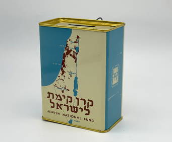
Jewish National Fund Collection Box - Great BritainLevy Auction House4.3(11)See Sold PriceFeb 27, 2024
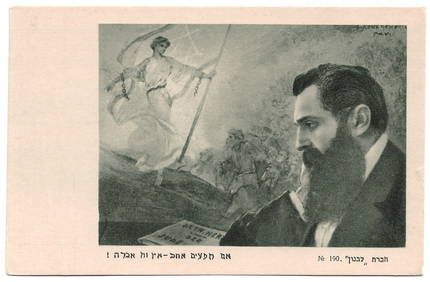
Eretz Israel Map Postcard - World Zionist OrganizationLevy Auction House4.3(11)See Sold PriceFeb 27, 2024
Postcard Set - Silhouettes from Eretz Israel - BezalelLevy Auction House4.3(11)See Sold PriceFeb 27, 2024
Illustrated Sabbath Cloth - Holy Sites of Eretz IsraelLevy Auction House4.3(11)See Sold PriceFeb 27, 2024
Vintage County Map Of NY State Plate EngravingThe Benefit Shop Foundation Inc.4.3(2.9k)See Sold PriceFeb 28, 2024
Pair of Early Railroad Maps - 1862 Pittsburgh, Ft. Wayne & Chicago Railway and 1873 PennsylvaniaRail & Road Auctions4.6(165)See Sold PriceMar 07, 2024
Blackie (Pub) 1882 Folio Print. North American Indians, USAAlbion Auctions4.6(341)See Sold PriceMar 07, 2024
PRE COLONIAL WESTERN AFRICA. Shows Mountains of Kong. Tribes. WELLER 1863 mapJasper524.5(9.9k)See Sold PriceFeb 28, 2024


![A collection [7] of Ancient Maps of the Land of Israel (1 of 7)](https://p1.liveauctioneers.com/2398/92630/47375540_1_x.jpg?height=282&quality=70&version=1471793846)