ATLAS of ANTIENT GEOGRAPHY by SAMUEL BUTLER 1843John McInnis Auctioneers,LLC4.5(505)See Sold PriceFeb 24, 2024
18TH C. ANTIQUE MAP: FRENCH & INDIAN WAR, FRAMEDThomaston Place Auction Galleries4.4(394)See Sold PriceFeb 24, 2024
Rand McNally Railroad Map Cabinet w/ 21 Railroad MapsRail & Road Auctions4.6(165)See Sold PriceMar 08, 2024
Keith Haring - Ink on New York Map, Best Buddies, Inscribed, Signed, and DatedSapphire Auction Gallery4.1(67)See Sold PriceMar 02, 2024
LATE 17TH C. FRENCH MAP OF THE NEW WORLD BY ALEXIS-HUBERT JAILLOT (1632-1712)Thomaston Place Auction Galleries4.4(394)See Sold PriceFeb 24, 2024
Central Railroad of New Jersey Map of Sandy Hook Route-ca. 1903JM Hobby Supply and Railroad Artifact Auctions4.4(127)See Sold PriceFeb 24, 2024
Lot of Six Mixed Atlas Box Cars-HO Scale-New in BoxJM Hobby Supply and Railroad Artifact Auctions4.4(127)See Sold PriceFeb 25, 2024
Rand McNally/Santa Fe Railroad Map of Iowa-1912JM Hobby Supply and Railroad Artifact Auctions4.4(127)See Sold PriceFeb 24, 2024
NICOLAES VISSCHER (NETHERLANDS, 1618-1709) MAP OF THE NEW WORLDThomaston Place Auction Galleries4.4(394)See Sold PriceFeb 24, 2024
17TH C. WORLD MAP BY NICOLAES VISSCHER (NETHERLANDS, 1618-1709)Thomaston Place Auction Galleries4.4(394)See Sold PriceFeb 24, 2024
Lot of Six Mixed Atlas Cabooses-HO Scale-New in BoxJM Hobby Supply and Railroad Artifact Auctions4.4(127)See Sold PriceFeb 25, 2024
SoldLot of Maps of the Straits of MagellanGroup of fourteen maps of the Straits of Magellan. SKU: 03602See Sold Price
Sold4 LOTS OF ANTIQUE MAPS4 LOTS OF ANTIQUE MAPS: 1) Nicholas de Fer (1646-1720), "Le Detroit de Magellan," 1705, Map of the Straits of Magellan. Approx. 11" h x 16.25" w. 2) 2 OLD CARTE D'ARTOIS MAPS: Pair of copper engravedSee Sold Price
Jansson: Map Straits of Magellan, Tierra del Fuego 1640Map: Tabula Magellanica Qua Tierrae del Fuego Cartographer: Jansson Place & Date: Amsterdam / 1640 Size: 21 1/4" x 16 3/8" Jansson's superbly decorative chart of the strategic Straits of Magellan andSee Sold Price
Sold(2) antique hand-colored maps: Strait of Magellan(2) antique hand-colored maps: Strait of Magellan, 17th/18th century, larger: 21" x 24", unframedSee Sold Price
MAP - Strait of Magellan. MercatorStrait of Magellan. Mercator/Hondius, Exquisita & Magno Aliquot Mensium Periculo Lustrata Etiam Retecta Freti Magellanici Facies..., 1619 (published). Hand Color. This exquisite map of the Strait of MSee Sold Price
MAP, Strait of Magellan, FerStrait of Magellan. Nicholas de Fer, Le Detroit de Magellan..., from L'Atlas Curieux ou le Monde, 1705 (dated). Hand Color. This attractive map provides excellent detail of the coastlines, soundings,See Sold Price
SoldMAP, Strait of Magellan, BenardStrait of Magellan. Jacques Francois Benard, Carte du Detroit de Magellan dans Laquelle on a Insere les Observations et les Decouvertes du Capne. Byron, du Capne. Wallis, et du Capne. Carteret, from RSee Sold Price
MAP, Strait of Magellan, JanssonStrait of Magellan, Tierra del Fuego. Jan Jansson, Freti Magellanici ac Novi Freti Vulgo Le Maire Exactissima Delineatio, from Atlas Novus, 1647 (published). Hand Color. This is a beautifully decorateSee Sold Price
SoldJ. DE HONDT, COLOR MAP OF STRAITS OF MAGELLANJoost de Hondt (Belgian 1563-1612), "Freti Magel Lanici Ac Novi Freti Vulgo, Le Maitre Exactissima Delineatio", hand colored map of the Straits of Magellan, Le Maire Strait, Fire Lands and the southerSee Sold Price
SoldColored Engraved Early Map of Straits of Magellan"Exquisita & Magno Aliquot Mensium Periculo Lustrata et iam Retecta Freti Magellanici Facies. Eijgentlicke Asbeeldinghe der Magellanischer Strate die nu met Veel Gevaers Eitelijeke Maenden Doorsien vaSee Sold Price
Sold17th c. Map of Straits of Magellan by Henricus HondiusEarly 17th century map titled "Freti Magellanici ac novi Freti vulgo Le Maire exactissima delineatio" showing the Straits of Magellan and southern tip of South America by Jodocus Hondius. Framed map mSee Sold Price
Captivating map of Strait of MagellanHeading: Author: Montanus, Arnoldus / John Ogilby Title: Tabula Magellanica, qua Tierrae del Fuego, cum celeberrimis fretis a F. Magellano et I. Le Maire detectis Place Published: London Publisher:See Sold Price
Bellin map of Strait of Magellan c.1755Heading: Author: Bellin, Jacques Nicolas Title: Carte Reduite du Detroit de Magellan Dressee sur les Journaux des Navigateurs Place Published: No place Publisher: Date Published: c.1755 <See Sold Price
Bellin map of Strait of Magellan c.1755Heading: (Map) Author: Bellin, Jacques Nicolas Title: Carte Reduite du Detroit de Magellan Dressee sur les Journaux des Navigateurs Place Published: No place Publisher: Date Published: c.1755See Sold Price
SoldCaptivating map of Strait of MagellanHeading: Author: Montanus, Arnoldus / John Ogilby Title: Tabula Magellanica, qua Tierrae del Fuego, cum celeberrimis fretis a F. Magellano et I. Le Maire detectis Place Published: London Publisher:See Sold Price
SoldMercator Hondius Map of the Straits of Magellan cGerardus Mercator (1512–1594) and Jodocus Hondius (1563-1612), "Exquisita & magno aliquot mensium periculo lustrata et iam retecta Freti Magellanici Facies: eijgentlicke asbeeldinghe der MagellSee Sold Price
SoldMercator-Hondius Map of the Straits of Magellan cJodocus Hondius (1563-1612), "Exquisita & magno aliquot mensium periculo lustrata et iam retecta Freti Magellanici Facies: eijgentlicke asbeeldinghe der Magellanischer Strate die nu met veel gevaers eSee Sold Price
TWO UNCOLORED MAPS OF THE STRAITS OF MAGELLANTwo uncolored maps about Magellan comprising Robert Fitzroy (1805-1865), "Carte Du Detroit De Magellan... par les Capitains Phillip Parker King et Robert Fitz Roy..." mid 19th century; "Carte du DetroSee Sold Price
Sold18TH CENTURY EDITION SANSON MAP OF MAGELLAN STRAIT18TH CENTURY EDITION SANSON MAP OF MAGELLAN STRAIT Nicolas Sanson (1600–1667). French cartographer. This hand tinted map engraving is taken from an 18th century atlas after the original 17th centurySee Sold Price
SoldGrp: 13 Maps of South AmericaGroup of thirteen maps of South America. Includes six overall maps of the continent; three maps of Chile and Argentina; two maps of the Straits of Magellan; one map of Tierra del Fuego; and one map ofSee Sold Price
SoldBlaeu 17th C Hand Colored Straits of Magellan Map17th Century hand colored map of the Straits of Magellan, framed under glass, bearing the arms of D. Constantino Hugenio and the signature of Guiljelmus (Willem) Blaeu but published by his son JohanneSee Sold Price
''Le Detroit de Magellan,'' 1705, MapNicholas de Fer (1646-1720), ''Le Detroit de Magellan,'' 1705, Map of the Straits of Magellan. Approx. 11'' h x 16.25'' w.See Sold Price
Blaeu 17th C Hand Colored Straits of Magellan Map17th Century hand colored map of the Straits of Magellan, bearing the arms of D. Constantino Hugenio and the signature of Guiljelmus (Willem) Blaeu but published by his son Johannes; measures approximSee Sold Price
Blaeu 17th C Hand Colored Straits of Magellan Map17th Century hand colored map of the Straits of Magellan, bearing the arms of D. Constantino Hugenio and the signature of Guiljelmus (Willem) Blaeu but published by his son Johannes; measures approximSee Sold Price
1885 CIVIL WAR 1ed Famous Memoirs US Grant Sheridan Sherman 6v RARE LOT MapsSchilb Antiquarian Rare Books4.8(431)See Sold PriceMar 10, 2024
Large lot of assorted prints. 18th-20th century. To include: North American and other maps, CivilTremont Auctions4.5(298)See Sold PriceFeb 25, 2024
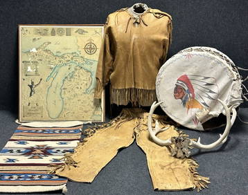
Antique Native American 5 Piece Lot: Deerskin Jacket & Pants, Rug, Drum, Michigan Map & Mule DeerHoller and Hammer4.6(75)See Sold PriceFeb 24, 2024
Oyster Bay Long Island NY Vintage Color Reproduction Map 12 x 18Mynt Auctions4.6(711)See Sold PriceFeb 23, 2024
George Strait Signed Autographed Guitar Singer Songwriter Actor JSA LOA XX76903Mynt Auctions4.6(711)See Sold PriceMar 02, 2024
Lot Of Mid Century Ephemera, Including Maps & 1957 License PlatesClark's Auction Company4.6(447)See Sold PriceMar 03, 2024
Goode, George Brown 1884 Lot of 4 Natural History & Meteorology MapsAlbion Auctions4.7(341)See Sold PriceMar 01, 2024
Rees & Macpherson 1820 Lot of 6 Ancient Geography MapsAlbion Auctions4.7(341)See Sold PriceMar 01, 2024
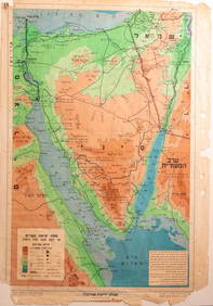
Virginia and West Virginia Topography MapsRapid Estate Liquidators and Auction Gallery4.5(1.1k)See Sold PriceFeb 28, 2024
Vintage Boardwalk And Baseball Employee GuidesRapid Estate Liquidators and Auction Gallery4.5(1.1k)See Sold PriceFeb 28, 2024
Framed Vintage Map Of Le Port Au Prince In The Island Of Santo DomingoRapid Estate Liquidators and Auction Gallery4.5(1.1k)See Sold PriceMar 01, 2024
Framed Collection Engravings & A Map From The Excursions In The County Of Sussex Published In 1822Rapid Estate Liquidators and Auction Gallery4.5(1.1k)See Sold PriceMar 01, 2024
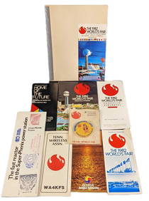
1982 Knoxville World's Fair Information And Maps LotRapid Estate Liquidators and Auction Gallery4.5(1.1k)See Sold PriceMar 02, 2024
Vintage Rare Orlando Florida Boardwalk Baseball Souvenir - Fridge Magnet - Pens - Park MapRapid Estate Liquidators and Auction Gallery4.5(1.1k)See Sold PriceMar 03, 2024