Sold18TH CENTURY EDITION SANSON MAP OF MAGELLAN STRAIT18TH CENTURY EDITION SANSON MAP OF MAGELLAN STRAIT Nicolas Sanson (1600–1667). French cartographer. This hand tinted map engraving is taken from an 18th century atlas after the original 17th centurySee Sold Price
Sold18TH CENTURY EDITION SANSON MAP OF FLORIDA18TH CENTURY EDITION SANSON MAP OF FLORIDA Nicolas Sanson (1600–1667). French cartographer. This hand tinted map engraving is taken from an 18th century atlas after the original 17th century map. SiSee Sold Price
Sold18TH CENTURY EDITION SANSON MAP OF THE AMERICAS18TH CENTURY EDITION SANSON MAP OF THE AMERICAS Nicolas Sanson (1600–1667). French cartographer. This hand tinted map engraving is taken from an 18th century atlas after the original 17th century maSee Sold Price
Sold18TH CENTURY EDITION SANSON MAP OF CALIFORNIA18TH CENTURY EDITION SANSON MAP OF CALIFORNIA Nicolas Sanson (1600–1667). French cartographer. This hand tinted map engraving is taken from an 18th century atlas after the original 17th century map.See Sold Price
Sold18TH CENTURY EDITION SANSON MAP OF CANADA18TH CENTURY EDITION SANSON MAP OF CANADA Nicolas Sanson (1600–1667). French cartographer. This hand tinted map engraving is taken from an 18th century atlas after the original 17th century map. SizSee Sold Price
Sold18TH CENTURY EDITION SANSON MAP OF THE ANTILLES18TH CENTURY EDITION SANSON MAP OF THE ANTILLES Nicolas Sanson (1600–1667). French cartographer. This hand tinted map engraving is taken from an 18th century atlas after the original 17th century maSee Sold Price
Sold18TH CENTURY EDITION SANSON MAP OF MEXICO18TH CENTURY EDITION SANSON MAP OF MEXICO Nicolas Sanson (1600–1667). French cartographer. This hand tinted map engraving is taken from an 18th century atlas after the original 17th century map. SizSee Sold Price
Sold18TH CENTURY EDITION SANSON MAP OF SOUTH AMERICA18TH CENTURY EDITION SANSON MAP OF SOUTH AMERICA Nicolas Sanson (1600–1667). French cartographer. This hand tinted map engraving is taken from an 18th century atlas after the original 17th century mSee Sold Price
Sold18TH CENTURY EDITION SANSON MAP OF GUATIMALA18TH CENTURY EDITION SANSON MAP OF GUATIMALA Nicolas Sanson (1600–1667). French cartographer. This hand tinted map engraving is taken from an 18th century atlas after the original 17th century map.See Sold Price
Sold18TH CENTURY EDITION SANSON MAP OF BRAZIL18TH CENTURY EDITION SANSON MAP OF BRAZIL Nicolas Sanson (1600–1667). French cartographer. This hand tinted map engraving is taken from an 18th century atlas after the original 17th century map. SizSee Sold Price
Sold18TH CENTURY EDITION SANSON MAP OF PARAGUAY18TH CENTURY EDITION SANSON MAP OF PARAGUAY Nicolas Sanson (1600–1667). French cartographer. This hand tinted map engraving is taken from an 18th century atlas after the original 17th century map. SSee Sold Price
Sold18TH CENTURY EDITION SANSON MAP OF CHILI18TH CENTURY EDITION SANSON MAP OF CHILI Nicolas Sanson (1600–1667). French cartographer. This hand tinted map engraving is taken from an 18th century atlas after the original 17th century map. SizeSee Sold Price
Sold18TH CENTURY EDITION SANSON MAP OF GRENADA18TH CENTURY EDITION SANSON MAP OF GRENADA Nicolas Sanson (1600–1667). French cartographer. This hand tinted map engraving is taken from an 18th century atlas after the original 17th century map. SiSee Sold Price
Sold18TH CENTURY EDITION SANSON MAP OF PERU18TH CENTURY EDITION SANSON MAP OF PERU Nicolas Sanson (1600–1667). French cartographer. This hand tinted map engraving is taken from an 18th century atlas after the original 17th century map. Size:See Sold Price
Sold18TH CENTURY EDITION SANSON MAP OF GUIANA18TH CENTURY EDITION SANSON MAP OF GUIANA Nicolas Sanson (1600–1667). French cartographer. This hand tinted map engraving is taken from an 18th century atlas after the original 17th century map. SizSee Sold Price
SoldJefferys' 18th Century Map of the Straight of MagellanA Chart of the Straits of Magellan Inlarged from the Chart Published at Madrid in 1769 by Don Juan de la Cruz Cano y Olmedilla. Thomas Jefferys (c. 1719 – 1771). Copperplate engraved map with handcoSee Sold Price
Sold(2) antique hand-colored maps: Strait of Magellan(2) antique hand-colored maps: Strait of Magellan, 17th/18th century, larger: 21" x 24", unframedSee Sold Price
SoldAN IMPARTIAL HISTORY OF ENGLAND, 1799 and other aAN IMPARTIAL HISTORY OF ENGLAND, folio, folding maps and other plates, Ch 38 (415) to finish only, 1799; BUNYAN (J), PILGRIMS PROGRESS, an 18th century edition with plates and map, lacks title; Vols ISee Sold Price
SoldM371-M377 Grp: 7 Maps of South AmericaGroup of seven maps of South America. Includes one hand colored map, "A Chart of the Streights of Magellan;" one 18th century map of Guyana by R. Waddington, "A Chart of the Coast of Guayana, From theSee Sold Price
SoldMorden, Robert. Westmorland MapMorden, Robert. Westmorland Mapfrom an 18th century edition of Camden's Britannia, copperplate engraving with hand-coloring. Presented in silver toned wooden frame. SS 14.5 x 17 in.; DOA 21.25 x 23.5See Sold Price
SoldSEA CAPTAIN PORTRAIT18th Century; Strait of Dover map, misc. instruments; unsigned; relined; gilt frame damaged; 32" x 26", GSee Sold Price
Sold18TH CENTURY MAP OF LOWER SOUTH AMERICAAntique hand-colored lithograph map reads, "Carte du Chili Meridional, du Rio de la Plata des Patagons et du Detroit de Magellan Ce quii fait l'extremite Australe de L'Amerrique Merid Par le S. D'AnviSee Sold Price
SoldSanson, Sr., (18th Century), Two MapsSanson, Sr. (18th Century) Two Maps hand colored engraving Largest 22 1/2 x 35 inches. Property from the Estate of Marcia B. Nachtrieb.See Sold Price
Three mid 18th century editions of CurtiusTitle: Three mid 18th century editions of Curtius Author: Curtius Rufus, Quintus Description: Includes: De Rebus Alexandri Magni. (8vo) period calf. Folding map. Lacking front free endpaper. Augsburg:See Sold Price
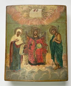
Unknown Artist - 18th Century Russian Icon (Deesis)Dane Fine Art Auctions4.4(498)See Sold PriceFeb 29, 2024
An early Dutch hand colored engraving map by Georg Balthasar Probst (1732-1801)Ostantix Auctions4.4(11)See Sold PriceFeb 27, 2024
18th Century Hess Germany Hand colored Engraved MapGlobal Auctions Company4.3(36)See Sold PriceMar 03, 2024
18th century MAP of ARMENIA GEORGIA NATOLIA BLACK SEA ASIA MINOR antiqueJasper524.5(9.9k)See Sold PriceFeb 27, 2024
World map.- Macrobius (Ambrosius Aurelius Theodosius) In somnium Scipionis, Libri II. Saturnaliorum,Forum Auctions4.3(53)See Sold PriceFeb 29, 2024
La Basse-Guinée… Loango, Congo, AngoIa & Benguela Southern Africa BONNE 1790 mapJasper524.5(9.9k)See Sold PriceFeb 28, 2024
États du Roi de Maroc… d’Alger, Tunis & Tripoli. North Africa. BONNE 1790 mapJasper524.5(9.9k)See Sold PriceFeb 28, 2024
Le Canal de Mosambique, l'Isle de Madagascar… Mozambique. Africa. BONNE 1788 mapJasper524.5(9.9k)See Sold PriceFeb 28, 2024
Royaumes, Etats et Pays de la Haute Guinée. Gulf of Guinea. BONNE 1788 old mapJasper524.5(9.9k)See Sold PriceFeb 28, 2024
La Nubia ed Abissinia. Red Sea Ethiopia Sudan Eritrea Arabia. ZATTA 1785 mapJasper524.5(9.9k)See Sold PriceFeb 28, 2024
Le Royaume d’Adel… Ajan & Zanguebar. Adal Ajuran. Kenya Tanzania. BONNE 1788 mapJasper524.5(9.9k)See Sold PriceFeb 28, 2024
Le Canal de Mosambique, l'Isle de Madagascar… Mozambique. Africa. BONNE 1790 mapJasper524.5(9.9k)See Sold PriceFeb 28, 2024
Partie Occidentale de l’Afrique. West Africa coast Canary islands BONNE 1788 mapJasper524.5(9.9k)See Sold PriceFeb 28, 2024
Le Royaume d’Adel… Ajan & Zanguebar. Adal Ajuran. Kenya Tanzania. BONNE 1790 mapJasper524.5(9.9k)See Sold PriceFeb 28, 2024
États du Roi de Maroc… d’Alger, Tunis & Tripoli. North Africa. BONNE 1788 mapJasper524.5(9.9k)See Sold PriceFeb 28, 2024
La Basse-Guinée… Loango, Congo, AngoIa & Benguela Southern Africa BONNE 1788 mapJasper524.5(9.9k)See Sold PriceFeb 28, 2024
Egypte, Nubie et Abissinie. Egypt, Nubia & Abyssinia. Sudan. BONNE 1788 mapJasper524.5(9.9k)See Sold PriceFeb 28, 2024
Late 18th century map of England and Wales sampler and two printsFellows4.3(159)See Sold PriceMar 05, 2024
1675 MED-PHYSICA PHARMACOPOEIA A COMMENTARY BY THE ANCIENT FRIEDRICH HOFFMANNY Elizabeth 4.2(86)See Sold PriceMar 03, 2024
1713 GERMAN BIBLE, RARE FIRST EDITION ANTIQUE BOTH NEW AND OLD TESTSNY Elizabeth 4.2(86)See Sold PriceMar 03, 2024
1792 OLD INDIA HISTORY ANTIQUE ILLUSTRATED WITH MAPS OF THE EIGHTEENTH CENTURY IN FRENCHNY Elizabeth 4.2(86)See Sold PriceMar 03, 2024