ATLAS of ANTIENT GEOGRAPHY by SAMUEL BUTLER 1843John McInnis Auctioneers,LLC4.5(505)See Sold PriceFeb 24, 2024
18TH C. ANTIQUE MAP: FRENCH & INDIAN WAR, FRAMEDThomaston Place Auction Galleries4.4(393)See Sold PriceFeb 24, 2024
Rand McNally Railroad Map Cabinet w/ 21 Railroad MapsRail & Road Auctions4.6(165)See Sold PriceMar 08, 2024
Keith Haring - Ink on New York Map, Best Buddies, Inscribed, Signed, and DatedSapphire Auction Gallery4.1(67)See Sold PriceMar 02, 2024
LATE 17TH C. FRENCH MAP OF THE NEW WORLD BY ALEXIS-HUBERT JAILLOT (1632-1712)Thomaston Place Auction Galleries4.4(393)See Sold PriceFeb 24, 2024
Central Railroad of New Jersey Map of Sandy Hook Route-ca. 1903JM Hobby Supply and Railroad Artifact Auctions4.4(127)See Sold PriceFeb 24, 2024
Lot of Six Mixed Atlas Box Cars-HO Scale-New in BoxJM Hobby Supply and Railroad Artifact Auctions4.4(127)See Sold PriceFeb 25, 2024
Rand McNally/Santa Fe Railroad Map of Iowa-1912JM Hobby Supply and Railroad Artifact Auctions4.4(127)See Sold PriceFeb 24, 2024
NICOLAES VISSCHER (NETHERLANDS, 1618-1709) MAP OF THE NEW WORLDThomaston Place Auction Galleries4.4(393)See Sold PriceFeb 24, 2024
17TH C. WORLD MAP BY NICOLAES VISSCHER (NETHERLANDS, 1618-1709)Thomaston Place Auction Galleries4.4(393)See Sold PriceFeb 24, 2024
Lot of Six Mixed Atlas Cabooses-HO Scale-New in BoxJM Hobby Supply and Railroad Artifact Auctions4.4(127)See Sold PriceFeb 25, 2024
SoldLondon.- Anonymous. An Accurate Map of the CountryNO RESERVE London.- Anonymous. An Accurate Map of the Country Sixteen Miles round London Drawn and Engrav'd from an Actual Survey, originally published in four parts with The Gentleman's Magazine, engSee Sold Price
London.- Andrews (John) Andrews's Accurate Map of theLondon.- Andrews (John) Andrews's Accurate Map of the Country, Twenty-Five Miles Round London, showing north west of central London, from Windsor to Rochford in the east, and from Sevenoak up to Ware,See Sold Price
Sold1764 Four Maps Sixteen Miles Round London1764 Four-Map set of "An Accurate Map of the Country Sixteen Miles round London Drawn and Engrav’d from an Actual Survey". The maps represent the four section of the total map and were printed for GSee Sold Price
Andrews's New and Accurate Map of the Country ThirtyAndrews's New and Accurate Map of the Country Thirty Miles Round London, late Georgian hand coloured folding map with slip case, published and sold by James Heskett 1826 68cm x 65cmSee Sold Price
Andrews (John) A New and Accurate Map of the CountAndrews (John) A New and Accurate Map of the Country Twenty-Five Miles Round London,from Welwyn to East Grinstead, and from Windsor Great Park to Sheerness, title panel above, engraved map witSee Sold Price
SoldAndrews (John) A New and Accurate Map of the CountAndrews (John) A New and Accurate Map of the Country Twenty-Five Miles Round London,from Welwyn to Tunbridge Wells, and from Rochford to Windsor, engraved map with original hand-colouring in oSee Sold Price
Andrews (John) Andrews's New and Accurate Map of tAndrews (John) Andrews's New and Accurate Map of the Country Thirty Miles Round London,from Stevenage to East Grinstead, and from Great Marlow to Canvey Island, title panel above, engraved mapSee Sold Price
SoldAndrews (John) Andrews's New and Accurate Map of tAndrews (John) Andrews's New and Accurate Map of the Country Thirty Miles Round London,from Stevenage to East Grinstead, and from Canvey Island to Great Marlow, title panel above, engraved mapSee Sold Price
Sold18th Century Map of the SoutheastLondon, 1747, [A New & Accurate Map of the Provinces of North & South Carolina, Georgia, & C.,] by Emanuel Bowen (1720-1767), noting towns, forts and Indian populations, "Country of the Charokees [sicSee Sold Price
SoldBowles's Universal Atlas London ca. 1795John Palairet (1697–1774) et al., "Bowles's Universal Atlas: Being a Complete Collection of New and Accurate Maps, of all the Known Countries in the World; displaying the Whole Surface of the TSee Sold Price
SoldHAND COLORED MAP OF PERU & COUNTRY OF THE AMAZONS,"A New And Accurate Map Of Peru And The Country Of The Amazones. Drawn From The Most Authentick French Maps &C. And Regulated By Astronomical Observations", London]: William Innys [et al.], 1747. A deSee Sold Price
Bowen map of Peru & Amazon 1747Heading: Author: Bowen, Emanuel Title: A New and Accurate Map of Peru, and the Country of the Amazones. Drawn from the most authentick French Maps &c. Place Published: London Publisher: Date PubSee Sold Price
Bowen map of Peru & Amazon 1747Heading: Author: Bowen, Emanuel Title: A New and Accurate Map of Peru, and the Country of the Amazones. Drawn from the most authentick French Maps &c. Place Published: London Publisher: Date PubSee Sold Price
Bowen map of Peru & Amazon 1747Heading: Author: Bowen, Emanuel Title: A New and Accurate Map of Peru, and the Country of the Amazones. Drawn from the most authentick French Maps &c. Place Published: London Publisher: Date PubSee Sold Price
SoldTwo Hand-Colored Maps, Siberia andPersia [A New and Accurate Map of Persia], with adjacent countries, by Emanuel Bowen, London, circa 1747, 14 x 17 in (plate), 16 x 18-1/2 in. (page); with [Carte de la Siberie, et des Pays voisins] bySee Sold Price
SoldA Map of the Countries Thirty Miles Round London.A Map of the Countries Thirty Miles Round London. Drawn & engraved from Accurate Surveys by Tho. Kitchin, Hydrographer to His Majesty Sight: 19 1/2" x 20 1/2" Frame: 24" x 25"See Sold Price
Bowen map of Persian Empire 1747Heading: Author: Bowen, Emanuel Title: A New & Accurate Map of Persia with the adjacent Countries. Drawn from the most approved Modern Maps, &c. Place Published: London Publisher: Date PublishedSee Sold Price
SoldBowen map of Persian Empire 1747Heading: (Map) Author: Bowen, Emanuel Title: A New & Accurate Map of Persia with the adjacent Countries. Drawn from the most approved Modern Maps, &c. Place Published: London Publisher: Date PublSee Sold Price
SoldMiddle Atlantic, New England MapLondon, England, 18th century, "A New and Accurate Map of New Jersey, Pensilvania [sic], New York and New England, with the adjacent Countries,?", by Emanuel Bowen (1714-1767), from Bowen's [A CompletSee Sold Price
SoldLondon.- Mogg (Edward) New Map of the Country FortLondon.- Mogg (Edward) New Map of the Country Forty-Five Miles Round London,outline colouring, linen backed, original card case, worn, 970x1180mm, 1821 § Andrews (John) A New and Accurate MapSee Sold Price
SoldA New and Accurate Map of the Kingdom of Ireland, FromHand-coloured map, taken from the Universal Magazine, 1799. Abl SG48. London: 1779. Hand-coloured map (30 cm. wide; 34 cm. high) of the whole country of Ireland. Good and clean. (1)See Sold Price
18th Century Map of South America"A New and Accurate Map of Terra Firma and the Caribbe Islands", by Emmanuel Bowen, published in [Complete System of Geography,] by William Innys, et al., London, 1747, showing the country of Terra FiSee Sold Price
SoldThomas Bowen map, Holy LandMap, Thomas Bowen (1749-1790), An Accurate Map of the Holy Land, with the Adjacent Countries, circa 1770, London, copper plate engraving, with partial color, sight: 12''h x 7.5''w, frame: 16.25''h x 1See Sold Price
SoldJigsaw. Anonymous. - A New & accurate Plan of thewith the Out Parts & New Buildings compleated to the Year 1792, Rare map of London, here presented as a jigsaw puzzle, from Angel to Newington Butts, and from Stepney to Knightsbridge, titled above, eSee Sold Price
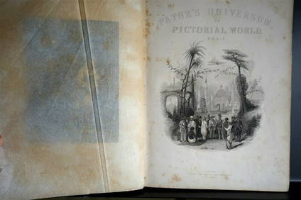
PAYNES UNIVERSUM ca1850 Calf 1st ed Travel 65 X Engravings China etc.Luis Porretta Fine Arts4.3(10)See Sold PriceMar 02, 2024
Archaeological Books - Streeter - Gold: Legal Regulations for the Standard of Gold & Silver Wares inTimeLine Auctions Ltd.4.6(183)See Sold PriceMar 06, 2024
Archaeological Books - Streeter - Gold: Legal Regulations for the Standard of Gold & Silver Wares inTimeLine Auctions Ltd.4.6(183)See Sold PriceMar 06, 2024
[ARCTIC]. BOWEN, Emanuel. A New & Accurate Map of the North...Potter & Potter Auctions4.6(545)See Sold PriceMar 07, 2024
Map: An 18thC engraved map of Bedfordshire titled An Accurate Map of the County of Bedford DividedClaydon Auctioneers Ltd4.3(125)See Sold PriceFeb 26, 2024
1764 MAP OF COUNTRIES THIRTY MILES ROUND LONDON antique 12.5 by 15"Jasper524.5(9.9k)See Sold PriceFeb 27, 2024
1800 MUNGO PARK TRAVELS to AFRICA 2 VOLS w/ MAP antique in ENGLISHJasper524.5(9.9k)See Sold PriceFeb 27, 2024
1738 RUSSIA SIBERIA & GREAT TARTARY Description illustrated ANTIQUE in ENGLISHJasper524.5(9.9k)See Sold PriceFeb 27, 2024
1750 Bowen Map of Bermuda and St. Kitts -- A New & Accurate Map of Bermudas or Sommer's Islands...Jasper524.5(9.9k)See Sold PriceFeb 27, 2024
Stanford, Edward 1901 Large Map. Burma and Adjacent CountriesAlbion Auctions4.7(341)See Sold PriceMar 01, 2024
T. Kelly - Plan of Bruseels - Battle of Waterloo, London - History of the French RevolutionProverde Auctions4.3(3)See Sold PriceFeb 28, 2024


![[ARCTIC]. BOWEN, Emanuel. A New & Accurate Map of the North... (1 of 1)](https://p1.liveauctioneers.com/928/318880/171360917_1_x.jpg?height=282&quality=70&version=1707501302)


