L'Asie, mid-1700s, hand colored map.[Asia]. De L'Asie. Double-page engraved map spanning from Mideast to New Guinea to Kamchatka, flanked by a panel of French text on either side, c. mid-late 1700s. 12 3/8 x 14 inches (with text, 12 3/8See Sold Price
Sold''De L'Asie,'' hand colored map, 1700s?[Asia]. De L'Asie. Double-page map engraved map spanning from Mideast to New Guinea to Kamchatka, flanked by a panel of French text on either side, c.mid-late 1700s. Map 12 3/8 x 14 in. Including textSee Sold Price
SoldCarte Generale de LCarte Generale de L'Asie. Hand-colored engraved map by A.H. Brue, 1820 14.25" x 20.25" Frame: 20.5" x 26.5"See Sold Price
SoldHand Colored French Map, "Carte de Lasie"French map, "Carte de Lasie," hand colored, by Robert de Vangondy, 19" h x 21" w (view), 25" h x 27" w (frame). Provenance: From a FL estate.See Sold Price
Soldmap, Jaillot, Asia, Middle East, AfricaUnframed handcolored engraved map, ''L'Asie distinguee en ses Principales Regions,'' (1692), by Alexis-Hubert Jaillot (French, 1632-1712), plate: 22.5''h x 34.5''w, overall: 24.5''h x 37.5''w. Note: MSee Sold Price
Soldmap, Desnos, Asia, Brion de la TourFramed handcolored engraved map, ''L'Asie dressee pour l'etude de la Geographique,'' 1765, by Louis Brion de la Tour and Desnos, map plate: 9.125''h x 10.375''w, overall: 12.25''h x 14.125''w. Note: SSee Sold Price
Sold(8) 18TH CENTURY MAPS OF THE HOLY LAND(6) black and white, "De l'Asie" with maps of Syria and Jerusalem, 8 1/4" x 5 1/4" and (2) hand colored,"Terra Sancta" and "Judee on Terre Sainte" 7" x 9" and 11" x 15 1/2"; also (1) hand colored mapSee Sold Price
SoldNicolas Sanson Map of AsiaNicolas Sanson (1600-1667) "L'Asie divisee en ses Principales Regions, et ou se peuvent voir l'estendue, Des Empires, Monarchies, Royaumes, et Estats," Paris: Jaillot, ca. 1719. Hand colored map of AsSee Sold Price
Sold[Maps]. Jean Baptiste Nolin. Collection of Four[Maps]. Jean Baptiste Nolin. Collection of Four Hand-Colored Maps. Paris: Chez Daumont, 1See Sold Price
[Maps]. Jean Baptiste Nolin. Collection of Four[Maps]. Jean Baptiste Nolin. Collection of Four Hand-Colored Maps. Paris: Chez Daumont, 1See Sold Price
l'Asie Divisee en Ses Principaux EtatsTitle/Content of Map: l'Asie Divisee en Ses Principaux Etats Date Printed: 1762 Cartographer: Janvier, Robert (Jean) Size (in): 17 x 12 An attractive, hand-colored antique map depicting the Asian contSee Sold Price
Nicolas Bailleul map of Asia French (wk 1720-1760)Nicolas Bailleul map of Asia French (wk 1720-1760) "l'Asie" hand-colored engraving. (Good condition, trimmed) paper size: H21 1/2" W31 1/2"See Sold Price
SoldL'Asie Suivant les Nouvelles Decouvertes dont les PointNicolas De Fer (1646-1720). Original hand-colored engraved map.Nicolas De Fer: Paris, 1717. 10 3/4 x 15 inches. The map is based primarily on Dutch sources, particularly the outlines of Siberia and thSee Sold Price
Sold3 Maps: 2 of Asia (De Vaugondy, Sayer) + 1 Japan.[Asia]. 3 Maps. Variously hand-colored. ++ Carte De L’Asie dressee sur les Relations les plus Nouvelles, principalement sur les Cartes de Russie, de la Chine, et de la Tartarie Chinoise… Robert deSee Sold Price
SoldHubert Jaillot map, hand colored engraved, large doubleHubert Jaillot map, hand colored engraved, large double page, L'Asie Divisee en ses principales Regions Sanson. sight size: 23" x 34 1/2".See Sold Price
De Vaugondy's Map of Asia c.1750Title: Carte de l'Asie Dressee sur les Relations les Plus Nouvelles... Author:De Vaugondy, Robert Description:Copper-engraved map, hand-colored in outline. 47x53 cm. (18½x21"). Map of the whole of AsSee Sold Price
Sold19th century Maps of Asia and Europe(lot of 2) Hand-colored copper engraved maps, "Carte de l'Asie," 1829 and "Carte des etats de l'Europe," 1829, for Herisson Geographe, published in Paris chez Jean, rue St. Jean de Beauvais No. 10, ovSee Sold Price
Sold3 maps of China/Asia: De Fer, 1705 + Bayly, 1782.[China/Asia]. 3 engraved maps, hand-colored in outline. Very good condition. ++ Nicolas de Fer. La Partie Orientale De L'Asie Ou Se Trouvent Le Grand Empire Des Tartares Chinois Et Celuy Du Iapon. EngSee Sold Price
Sold2 Maps: Scythia [1729] + De Fer, L'Asie 1717[Asia]. 2 double-page engraved maps, early hand-colored. Overall in very good condition, lightly toned. ++ Nicolas de Fer. L'Asie Suivant Les Nouvelles Decouvertes Dont Les Point Principaux Sont PlaceSee Sold Price
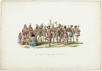
SoldMallet, 3 maps: Asia & China. c.1683[Asia]. 3 engraved maps, fully hand-colored, from Alain Manesson Mallet's ''Description de l'Univers,'' Paris: c.1683. ++ Asie Ancienne. ''De L'Asie. Figure I'' upper margin with #5. French text on veSee Sold Price
SoldGlobe Terrestre. Globe Celeste.Brion de la Tour, Globe Terrestre. Globe Celeste., engraving (hand colored), mid-1700s, 8.5 x 11 8.5 x 11See Sold Price
Sold25 maps of Asia, 1748 - [c1888]. Vaugondy, others[Asia]. 26 Maps. Size varies from about 5 x 7 to 11 x 14 in. Most are very good condition, about 18 are hand-colored. ++ Robert De Vaugondy. L'Asie, Divisee selon ses differens Etats. Paris: 1748. ++See Sold Price
DE L'ISLE, Guillaume. Carte d'Asie dressée sur lesDE L'ISLE, Guillaume. Carte d'Asie dressée sur les Memoires envoyéz sur le Czar a l'Academie Royale des Science. Amsterdam: Covens et Mortier, [c.1733]. Double-page engraved map, hand-colored.See Sold Price
SoldMap of Asia. 1854.Print of hand colored steel engraving titled „Carte Physique & Politique de L’Asie“.Drawn by L. Dussieux.Engraved by unknown.From „Atlas General De Geographie physique, politique et historiqueSee Sold Price
LATE 17TH C. FRENCH MAP OF THE NEW WORLD BY ALEXIS-HUBERT JAILLOT (1632-1712)Thomaston Place Auction Galleries4.4(386)See Sold PriceFeb 24, 2024
Japanese Woodblock hand Colored c19150 6 x Floor PagodaLuis Porretta Fine Arts4.3(10)See Sold PriceMar 02, 2024
Japanese Woodblock Print Hand Colored Sealed Cheery BlossomLuis Porretta Fine Arts4.3(10)See Sold PriceMar 02, 2024
Japanese Woodblock c1950 Hand Colored Kegon Falls 10" x 7" SealedLuis Porretta Fine Arts4.3(10)See Sold PriceMar 02, 2024
Japanese Woodblock c1950 Valley Of Trees Hand Colored 10" x 7"Luis Porretta Fine Arts4.3(10)See Sold PriceMar 02, 2024
[MAPS]. DUFOUR, Auguste-Henri (1795-1865). Bound Volume of ...Potter & Potter Auctions4.6(539)See Sold PriceMar 07, 2024
Pascal's Collection de fleurs... - Volume with 48 Originally Hand-colored LithographsTrillium Antique Prints & Rare Books4.5(30)See Sold PriceFeb 24, 2024
Italian edition of Sanson's map of North America, 1677PBA Galleries4.7(381)See Sold PriceMar 07, 2024


![[Maps]. Jean Baptiste Nolin. Collection of Four (1 of 1)](https://p1.liveauctioneers.com/906/86613/44530529_1_x.jpg?height=282&quality=70&version=1458833675)
![[Maps]. Jean Baptiste Nolin. Collection of Four (1 of 1)](https://p1.liveauctioneers.com/906/80657/41935123_1_x.jpg?height=282&quality=70&version=1445283342)


![2 Maps: Scythia [1729] + De Fer, L'Asie 1717 (1 of 2)](https://p1.liveauctioneers.com/179/15522/5074001_1_x.jpg?height=282&quality=70&version=1206672512)


![25 maps of Asia, 1748 - [c1888]. Vaugondy, others (1 of 1)](https://p1.liveauctioneers.com/179/15522/5074004_1_x.jpg?height=282&quality=70&version=1206672512)


![[MAPS]. DUFOUR, Auguste-Henri (1795-1865). Bound Volume of ... (1 of 2)](https://p1.liveauctioneers.com/928/318880/171361279_1_x.jpg?height=282&quality=70&version=1707501302)