Soldmap, Jaillot, Asia, Middle East, AfricaUnframed handcolored engraved map, ''L'Asie distinguee en ses Principales Regions,'' (1692), by Alexis-Hubert Jaillot (French, 1632-1712), plate: 22.5''h x 34.5''w, overall: 24.5''h x 37.5''w. Note: MSee Sold Price
SoldHarmsworth: Map of Asia Middle East Industries, 1920TITLE/CONTENT OF MAP: 'Oriental Industries' ASIA MIDDLE EAST AFRICA COMMERCIAL.Shows agricultural/mineral products DATE PRINTED: 1920 IMAGE SIZE: Approx 33.0 x 44.0cm, 13 x 17.25 inches (Large) TYPE:See Sold Price
SoldLot Of 9 Vintage Maps ( World Maps, US Army 1939 )Map Of Artic ocean including Siberia and Alaska, Artic ocean including Greenland, Finland etc., A map of Europe,Asia,Africa, Middle east, A map of Argentina,Peru,Brazil substantially ripped, Pacific ASee Sold Price
ASIA MIDDLE EAST AFRICA COMMERCIAL.Shows agricultural/mineral products 1920 mapTITLE/CONTENT OF MAP: 'Oriental Industries' DATE PRINTED: 1920 IMAGE SIZE: Approx 33.0 x 44.0cm, 13 x 17.25 inches (Large) TYPE: Vintage colour map CONDITION: Good; suitable for framing. However, pleaSee Sold Price
South Asia. Middle East Africa Indian Ocean. "Dubayy" Dubai. TIMES 1959 mapCAPTION PRINTED BELOW PICTURE: 'Indo-Arabia' DATE PRINTED: 1959 IMAGE SIZE: Approx 47.5 x 59.5cm, 18.75 x 23.5 inches (Large); Please note that this is a folding map. TYPE: Vintage coloured map CONDITSee Sold Price
ASIA MIDDLE EAST AFRICA COMMERCIAL.Shows agricultural/mineral products 1920 mapTITLE/CONTENT OF MAP: 'Oriental Industries' DATE PRINTED: 1920 IMAGE SIZE: Approx 33.0 x 44.0cm, 13 x 17.25 inches (Large) TYPE: Vintage colour map CONDITION: Good; suitable for framing. However, pleaSee Sold Price
Sold18th c. Needlepoint MapNeedlepoint map, 18th century, on silk, showing Africa, Middle-East, Europe, Asia, Australia. Framed and with early matting, sight measures 15" x 15", overall with frame 20" x 20". The designation ofSee Sold Price
Orbis Veteribus Notus. World as known to the Ancients.TITLE/CONTENT OF MAP: 'Orbis Veteribus Notus' The world as known to the Ancients. Europe, North Africa, the Middle East, South Asia and Indochina Date: Published in 1785. Engraved in 1785 (this date iSee Sold Price
Orbis Veteribus Notus. World as known to the Ancients.TITLE/CONTENT OF MAP: 'Orbis Veteribus Notus' The world as known to the Ancients. Europe, North Africa, the Middle East, South Asia and Indochina Date: Published in 1785. Engraved in 1785 (this date iSee Sold Price
Orbis Veteribus Notus. World as known to the Ancients.TITLE/CONTENT OF MAP: 'Orbis Veteribus Notus' The world as known to the Ancients. Europe, North Africa, the Middle East, South Asia and Indochina DATE PRINTED: Published in 1785. Engraved in 1785 (thiSee Sold Price
SoldEarly Map Egypt Nubia AfricaDe l'Egipte. Antique map by Clouet, Paris, 1730. Egypt, Nubia, Abyssinia, Middle East, Asia. . 16" x 24.See Sold Price
SoldAntique Map: Imperium Turcicum in Europa, Asia etMiddle East.- Homann Heirs (publisher) Imperium Turcicum in Europa, Asia et Africa Regiones Proprias, Tributarias, Clientelares ..., detailed map centred on the Levant and Arabian Peninsula, with theSee Sold Price
Sold-. Tirion (Isaak) Carta Nuova del Dominio, E Stato-. Tirion (Isaak) Carta Nuova del Dominio, E Stato Del Turco,Situati Nell'Europa Asia ed Æfrica, Turkish empire in southern Europe, northern Africa and the Middle East, engraved map traces ofSee Sold Price
SoldTirion (Isaak) Carta Nuova del Dominio, E Stato DeTirion (Isaak) Carta Nuova del Dominio, E Stato Del Turco,Situati Nell'Europa Asia ed Æfrica, Turkish empire in southern Europe, northern Africa and the Middle East, engraved map tracesSee Sold Price
SoldMiddle East.- Turkish Empire.- Homann (Johann Baptist)Middle East.- Turkish Empire.- Homann (Johann Baptist) Imperium Turcicum in Europa, Asia et Africa Regiones Proprias, Tributarias, Clientelares ..., detailed map centred on the Levant and Arabian PeniSee Sold Price
SoldMiddle East.- Homann Heirs (publisher) ImperiumMiddle East.- Homann Heirs (publisher) Imperium Turcicum in Europa, Asia et Africa Regiones Proprias, Tributarias, Clientelares ..., detailed map centred on the Levant and Arabian Peninsula, with theSee Sold Price
SoldMiddle East.- Homann Heirs (publisher) ImperiumMiddle East.- Homann Heirs (publisher) Imperium Turcicum in Europa, Asia et Africa Regiones Proprias, Tributarias, Clientelares ..., detailed map centred on the Levant and Arabian Peninsula, with theSee Sold Price
2 Maps incl: The Ottoman Or Turkish Empire, 1792.[Middle East]. 2 Maps. ++ The Ottoman Othman Or Turkish Empire: In Europe, Asia and Africa. 1792. In lower margin: “Engraved for Jacksons Edition of Paynes New System of Universal Geography.” 13 �See Sold Price
Sold46Pcs World & International VINTAGE/ANTIQUE STAMPS AsiaDetails: 46Pcs World & International VINTAGE/ANTIQUE STAMPS Asia MIddle East Africa Pacific Rare Scarce Historical Colored Dubai Liberia Bahawalpur Pakistan Syria Niger Middle East PhilatelyThis lotSee Sold Price
Sold811 PAGES OF HISTORIC INTERNATIONAL STAMPS811 pages of stamps from various countries in North, Central, and South America, the Caribbean, Europe, Asia, The Middle East, Africa, Pacific Islands, and East Indies. Some stamps reflect different pSee Sold Price
SoldJ. Speed map of Asia Minor, Middle East and TurkeyCartographer: John Speed Title: The Turkish Empire. Newly Augmented by. Iohn Speed. 1626. Subject: Asia Minor, Middle East, Turkey Published: London: G. Humble Date: 1627 Description: Carte-…-figureSee Sold Price
Mitchell: Antique Map of Asia [verso] Middle East, 1878Title/Content of Map: 1878 Mitchell Map of Asia [verso] Middle East -- Map of Asia Showing its Gt. Political Divisions… [verso] Map of Persia, Arabia, Turkey in Asia, Afghanistan, Beloochistan DateSee Sold Price
Sold1879 Mitchell Map of Asia [verso] Middle East-- Map ofTitle/Content of Map: 1879 Mitchell Map of Asia [verso] Middle East-- Map of Asia Showing its Gt. Political Divisions… [verso] Map of Persia, Arabia, Turkey in Asia, Afghanistan, Beloochistan Date:See Sold Price
SoldMitchell: Antique Map of Asia [verso] Middle East 1878Title/Content of Map: 1878 Mitchell Map of Asia [verso] Middle East -- Map of Asia Showing its Gt. Political Divisions… [verso] Map of Persia, Arabia, Turkey in Asia, Afghanistan, Beloochistan DateSee Sold Price
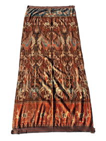
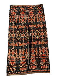
A Fine RARE Antique Woven ikat Pictorial TextilePremier Auction Galleries4.3(329)See Sold PriceMar 09, 2024
Raphael Jacquemin. Hand colored historical fashion plates. Medieval and early modern periods fromTremont Auctions4.6(294)See Sold PriceFeb 25, 2024
[MAPS]. DUFOUR, Auguste-Henri (1795-1865). Bound Volume of ...Potter & Potter Auctions4.6(544)See Sold PriceMar 07, 2024
Carey, pub. 1796 - A Chart of the West IndiesTrillium Antique Prints & Rare Books4.5(30)See Sold PriceFeb 24, 2024
Carey, pub. 1796 - Map of the State of MarylandTrillium Antique Prints & Rare Books4.5(30)See Sold PriceFeb 24, 2024
Carey, pub. 1796 - Map of GeorgiaTrillium Antique Prints & Rare Books4.5(30)See Sold PriceFeb 24, 2024
Carey, pub. 1796 - Map of The State of South CarolinaTrillium Antique Prints & Rare Books4.5(30)See Sold PriceFeb 24, 2024
Carey, pub. 1796 - Map of KentuckyTrillium Antique Prints & Rare Books4.5(30)See Sold PriceFeb 24, 2024
Carey, pub. 1796 - Map of the Tennassee State formerly part of North Carolina (Tennessee)Trillium Antique Prints & Rare Books4.5(30)See Sold PriceFeb 24, 2024
De Jode, Rare, pub. 1593 - Map of the Middle East, Eastern Asia (Primae Partis Asiae accurataTrillium Antique Prints & Rare Books4.5(30)See Sold PriceFeb 24, 2024
COLONIAL EAST AFRICA. German/British/Portuguese East Africa. Tanzania 1895 mapJasper524.5(9.8k)See Sold PriceFeb 28, 2024
SOUTHERN AFRICA. Congo British/Portuguese/German East Africa Rhodesia 1912 mapJasper524.5(9.8k)See Sold PriceFeb 28, 2024
COLONIAL EAST AFRICA. German/British/Portuguese East Africa. Tanzania 1899 mapJasper524.5(9.8k)See Sold PriceFeb 28, 2024
Central Africa. Congo Free State Rhodesia German East Africa. STANFORD 1896 mapJasper524.5(9.8k)See Sold PriceFeb 28, 2024
COLONIAL EAST AFRICA. British/German/Portuguese East Africa. Tanzania 1910 mapJasper524.5(9.8k)See Sold PriceFeb 28, 2024
CENTRAL AFRICA. Tanzania, Kenya, Angola, Zambia, Congo, Mozambique 1903 mapJasper524.5(9.8k)See Sold PriceFeb 28, 2024
COLONIAL EAST AFRICA. German/British/Portuguese East Africa. Tanzania 1906 mapJasper524.5(9.8k)See Sold PriceFeb 28, 2024


![Mitchell: Antique Map of Asia [verso] Middle East, 1878 (1 of 2)](https://p1.liveauctioneers.com/5584/113160/58115914_1_x.jpg?height=282&quality=70&version=1512524398)
![1879 Mitchell Map of Asia [verso] Middle East-- Map of (1 of 2)](https://p1.liveauctioneers.com/5584/127125/64626580_1_x.jpg?height=282&quality=70&version=1536103231)

![[MAPS]. DUFOUR, Auguste-Henri (1795-1865). Bound Volume of ... (1 of 2)](https://p1.liveauctioneers.com/928/318880/171361279_1_x.jpg?height=282&quality=70&version=1707501302)


![Mitchell: Antique Map of Asia [verso] Middle East 1878 (1 of 2)](https://p1.liveauctioneers.com/5584/117349/60339353_1_x.jpg?height=282&quality=70&version=1520390147)