SoldKent.- 11 Ordnance Survey MapsKent & Sussex.- 11 Ordnance Survey Maps,Sheets 272-274, 287-290, 304, 305, 319 & 320, hand-coloured engraved maps, in sections, linen-backed, 338 x 507mm., n.d. [c. 1840s].See Sold Price
Book of Kent and Sussex ordnance survey maps, 82cm xBook of Kent and Sussex ordnance survey maps, 82cm x 60cmSee Sold Price
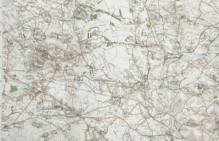
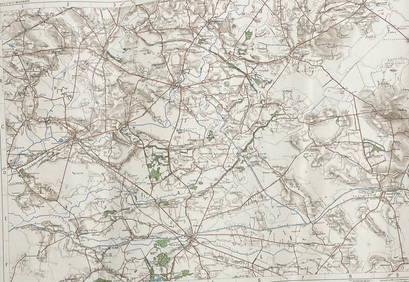
SoldCruchley (G.F.) - [Ordnance Survey map of Kent],4-sheet map of the South East, covering all of Kent, most of Sussex, parts of Surrey, Middlesex and Essex, sheets 13, 14, 20 and 21, engraved map with extensive original hand-colouring, on 4-sheets, jSee Sold Price
SoldEngland.- A group of 16 Ordnance Survey maps, mainlyEngland.- A group of 16 Ordnance Survey maps, including a Col. Mudge map of Kent showing Whitstable, Ramsgate and Dover, 4 Col. Colby maps sold by Letts, Son & Co. of Essex, Kent, Berkshire, and HampsSee Sold Price
SoldMudge - Ordnance Survey map sheets of the coast of( Lt. Col. William) Ordnance Survey map sheets of the coast of Kent, Sussex and Hampshire , sheets IV, V, IX, X and XI, New Romney, Lewes, Chichester, Isle of Wight and Southampton, respectively, 5 enSee Sold Price
SoldSouth East England.- Mudge (Lt. Col. William) OrdnanceSouth East England.- Mudge (Lt. Col. William) Ordnance Survey maps covering Surrey, Sussex, and Kent, four sections, engraved maps, each approx. 635 x 920 mm. (25 x 36 1/4 in), dissected and mounted oSee Sold Price
SoldFrench War maps (D-Day planning),French War maps (D-Day planning), 11 folding Ordnance Survey sheets circa 1943-44, scale 1:50,000 (11)See Sold Price
SoldPosters(12) by Jef Leempoels - Noodlijdende VolkereJef Leempoels (1867-1935)Noodlijdende Volkeren42x61, 1948, (design from 1920's) added: various artist, 11 more with same issue, diff. images, all 1948, printed on topographic ordnance survey war mapsSee Sold Price
SoldOrdnance Survey. Kent, Sussex, SurreyOrdnance Survey. Kent, Sussex, Surrey,4 sheets by Col. Mudge, V, VI, VIII and IX, East and West Sussex each with a folding extension, engraved maps, each c.645 x 960mm., dissected, linen-backeSee Sold Price
Ordnance Survey of Scotland. Sheet 16. St. Mary's Loch.Title/Content of Map: Ordnance Survey of Scotland. Sheet 16. St. Mary's Loch. Ettrick. Date: 1864-11-01 Cartographer: Ordnance Survey Publisher: Ordnance Survey Size: 21Height - 27.5Width Dissected, lSee Sold Price
SoldOrdnance Survey. South East EnglandOrdnance Survey. South East England,index map of England and Wales, and sheets 1-16, covering S. Essex, Kent, E. and W. Sussex, Middlesex, Surrey, S. Buckingham, Hampshire, Berkshire, S. WiltsSee Sold Price
SoldDamaged Maps 18th-19th Mixed Lot of 11 MapsMixed Lot of 11 - All with faults. Incl Asia, Europe, France, Hastings, London, UK, Palestine, Glasgow, and France. Examples Gall & Inglis, Ordnance Survey, Charles Copley, Guthrie, Thomson and othersSee Sold Price
SoldOrdnance Survey.- MudgeOrdnance Survey.- Mudge (Lt. Col. William) Ordnance Survey of Great Britain Part the VIIIth, containing the greater part of Kent, With Portions of Surrey and Sussex, sheets III and VI, engraveSee Sold Price
SoldOrdnance Survey maps,South West England and Wales, late 19th century, double page coastal maps/charts, including Falmouth Harbour, Menai Strait 1464, Newquay to Holyhead 1411, Milford Haven, Bristol Channel 1179, TrevoseSee Sold Price
SoldOrdnance Survey maps,West Coast of Scotland, late 19th century with some revisions, approx 60 sheets, some with vignettes, including Lochs, Western Isles, Skye, Harris, Hebrides etc, condition varies (c.60)See Sold Price
SoldCruchley's Reduced Ordnance Survey Map of DevonshireTitle/Content of Map: Cruchley's Reduced Ordnance Survey Map of Devonshire and adjoining areas Date Printed: 1840 ca. Cartographer: CRUCHLEY, C.F. Material/Medium: C.F. CRUCHLEY, mapseller and globe mSee Sold Price
SoldWilliam Collins Ordnance Survey Map of the CountrWilliam Collins divided coloured engraving, Ordnance Survey Map of the Country Thirty Miles round London, 1841, and three other maps.See Sold Price
SoldA quantity of folding ordnance survey maps, includingA quantity of folding ordnance survey maps, including examples by Bacon, Ward, Lock & Co., Gall & Inglis and Bartholomew. To include, Motoring and Touring Map of England, Map and Guide to London, HertSee Sold Price
Sold2 boxes of ordnance survey maps including library2 boxes of ordnance survey maps including library editions.See Sold Price
SoldCOUNTY SERIES ORDNANCE SURVEY MAPSA metal case of County Series Ordnance Survey 1 to 2500 scale maps of Scottish, Welsh and Cotswold counties, mainly EdwardianSee Sold Price
SoldBox containing a collection of Ordnance Survey maps ofBox containing a collection of Ordnance Survey maps of the U.K. from 1920 / '30's, approximately fiftySee Sold Price
SoldBooks Vintage Ordnance Survey Maps and Others20th century AD. A mixed group of travel documents comprising: an Ordnance Survey map sheet 38 (Solent, Isle of Wight), 1912 edition; Bartholomew's reduced survey map, sheet 20 (Suffolk); one similar,See Sold Price
Approximately fifty Ordnance Survey maps, mostly ofApproximately fifty Ordnance Survey maps, mostly of Scotland, Landranger Series (1980's) also three plant kits by Airfix.See Sold Price
Josiah HENSCHELL c1828 Engraving Quay At Ramsgate Kent FramedLuis Porretta Fine Arts4.3(10)See Sold PriceMar 02, 2024
Archaeological Books - Bowman - Remains of Antiquity Relating to the County of YorkTimeLine Auctions Ltd.4.6(183)See Sold PriceMar 06, 2024
Archaeological Books - Stillwell - The Princeton Encyclopedia of Classical SitesTimeLine Auctions Ltd.4.6(183)See Sold PriceMar 06, 2024
General Books - Four Maps of Great Britain Designed by Matthew Paris About A.D. 1250TimeLine Auctions Ltd.4.6(183)See Sold PriceMar 08, 2024
Numismatic Books - Lelewel - Numismatique du Moyen-AgeTimeLine Auctions Ltd.4.6(183)See Sold PriceMar 09, 2024
Nottingham.- Ordnance Survey Office (publisher) Collection 8 geological maps on the environs ofForum Auctions4.3(53)See Sold PriceFeb 29, 2024
ORDNANCE SURVEY OF IRELAND/ Sheet No. 89/ LONGFORD, MEATH & WESTMEATH/ Published in 1903Churchill Galleries3.7(217)See Sold PriceFeb 26, 2024
ORDNANCE SURVEY OF IRELAND/ Sheet No. 89/ LONGFORD, MEATH & WESTMEATH/ Published in 1903Churchill Galleries3.7(217)See Sold PriceFeb 26, 2024
ORDNANCE SURVEY OF IRELAND/ Sheet No.90/ MEATH & WESTMEATH/ Published in 1903Churchill Galleries3.7(217)See Sold PriceFeb 26, 2024
ORDNANCE SURVEY OF IRELAND/ Sheet No.90/ MEATH & WESTMEATH/ Published in 1903Churchill Galleries3.7(217)See Sold PriceFeb 26, 2024
ORDNANCE SURVEY OF IRELAND/ Sheet No.90/ MEATH & WESTMEATH/ Published in 1903Churchill Galleries3.7(217)See Sold PriceFeb 26, 2024
ORDNANCE SURVEY OF IRELAND/ Sheet No.90/ MEATH & WESTMEATH/ Published in 1903Churchill Galleries3.7(217)See Sold PriceFeb 26, 2024
ORDNANCE SURVEY OF IRELAND/ Sheet No.99/ KILDARE, MEATH, KINGS & WESTMEATH/ Published in 1902Churchill Galleries3.7(217)See Sold PriceFeb 26, 2024
ORDNANCE SURVEY OF IRELAND/ Sheet No.100/ KILDARE, MEATH & WESTMEATH/ Published in 1903Churchill Galleries3.7(217)See Sold PriceFeb 26, 2024
ORDNANCE SURVEY OF IRELAND/ Sheet No.100/ KILDARE, MEATH & WESTMEATH/ Published in 1903Churchill Galleries3.7(217)See Sold PriceFeb 26, 2024
ORDNANCE SURVEY OF IRELAND/ Sheet No.100/ KILDARE, MEATH & WESTMEATH/ Published in 1903Churchill Galleries3.7(217)See Sold PriceFeb 26, 2024
ORDNANCE SURVEY OF IRELAND/ Sheet No.100/ KILDARE, MEATH & WESTMEATH/ Published in 1903Churchill Galleries3.7(217)See Sold PriceFeb 26, 2024
ORDNANCE SURVEY OF IRELAND/ Sheet No.100/ KILDARE, MEATH & WESTMEATH/ Published in 1903Churchill Galleries3.7(217)See Sold PriceFeb 26, 2024
ORDNANCE SURVEY OF IRELAND/ SHEET NO.109/ KING CO. & CO. WESTMEATH. / PUBLISHED IN 1900Churchill Galleries3.7(217)See Sold PriceFeb 26, 2024


![Cruchley (G.F.) - [Ordnance Survey map of Kent], (1 of 1)](https://p1.liveauctioneers.com/410/57502/28186031_1_x.jpg?height=282&quality=70&version=1403878133)