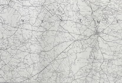
SoldCruchley (G.F.) - [Ordnance Survey map of Kent],4-sheet map of the South East, covering all of Kent, most of Sussex, parts of Surrey, Middlesex and Essex, sheets 13, 14, 20 and 21, engraved map with extensive original hand-colouring, on 4-sheets, jSee Sold Price
SoldCruchley's Reduced Ordnance Survey Map of DevonshireTitle/Content of Map: Cruchley's Reduced Ordnance Survey Map of Devonshire and adjoining areas Date Printed: 1840 ca. Cartographer: CRUCHLEY, C.F. Material/Medium: C.F. CRUCHLEY, mapseller and globe mSee Sold Price
SoldCruchley (G.) Reduced Ordnance Map of LondonCruchley (G.F.) Reduced Ordnance Map of London,central London, extending from Notting Hill to Bethnal Green, and from Kentish Town to Battersea Park, folding lithographed map, dissected and liSee Sold Price
SoldKent.- 11 Ordnance Survey MapsKent & Sussex.- 11 Ordnance Survey Maps,Sheets 272-274, 287-290, 304, 305, 319 & 320, hand-coloured engraved maps, in sections, linen-backed, 338 x 507mm., n.d. [c. 1840s].See Sold Price
SoldSouth East England.- Mudge (Lt. Col. William) OrdnanceSouth East England.- Mudge (Lt. Col. William) Ordnance Survey maps covering Surrey, Sussex, and Kent, four sections, engraved maps, each approx. 635 x 920 mm. (25 x 36 1/4 in), dissected and mounted oSee Sold Price
Book of Kent and Sussex ordnance survey maps, 82cm xBook of Kent and Sussex ordnance survey maps, 82cm x 60cmSee Sold Price
SoldMudge - Ordnance Survey map sheets of the coast of( Lt. Col. William) Ordnance Survey map sheets of the coast of Kent, Sussex and Hampshire , sheets IV, V, IX, X and XI, New Romney, Lewes, Chichester, Isle of Wight and Southampton, respectively, 5 enSee Sold Price
SoldEngland.- A group of 16 Ordnance Survey maps, mainlyEngland.- A group of 16 Ordnance Survey maps, including a Col. Mudge map of Kent showing Whitstable, Ramsgate and Dover, 4 Col. Colby maps sold by Letts, Son & Co. of Essex, Kent, Berkshire, and HampsSee Sold Price
SoldLondon.- Cruchley (George Frederick) From the OrdnanceLondon.- Cruchley (George Frederick) From the Ordnance Survey of the Country Thirty Miles round London, map of the environs of London showing from Hertford to Godalming and Tunbridge, and from MaidenhSee Sold Price
London.- Cruchley (George Frederick) From the OrdnanceLondon.- Cruchley (George Frederick) From the Ordnance Survey of the Country Thirty Miles round London, map of the environs of London showing from Hertford to Godalming and Tunbridge, and from MaidenhSee Sold Price
SoldOrdnance Survey. South East EnglandOrdnance Survey. South East England,index map of England and Wales, and sheets 1-16, covering S. Essex, Kent, E. and W. Sussex, Middlesex, Surrey, S. Buckingham, Hampshire, Berkshire, S. WiltsSee Sold Price
SoldOrdnance Survey.- MudgeOrdnance Survey.- Mudge (Lt. Col. William) Ordnance Survey of Great Britain Part the VIIIth, containing the greater part of Kent, With Portions of Surrey and Sussex, sheets III and VI, engraveSee Sold Price
19th century hand coloured ordnance survey of the19th century hand coloured ordnance survey of the country 30 miles around London, in four sections published by G F Cruchley, map seller and publisher Fleet Street London, overall 113cm x 135cmSee Sold Price
SoldOrdnance Survey. Kent, Sussex, SurreyOrdnance Survey. Kent, Sussex, Surrey,4 sheets by Col. Mudge, V, VI, VIII and IX, East and West Sussex each with a folding extension, engraved maps, each c.645 x 960mm., dissected, linen-backeSee Sold Price
SoldCruchley's Road and Railway Map... County of Kent[Britain]. Cruchley's Road And Railway Map Of The County Of Kent Showing all the Railways and Names of Stations Also the Turnpike Roads, Villages, Gentlemens Seats &c.&c. Improved from the Ordnance SuSee Sold Price
SoldWilliam Collins Ordnance Survey Map of the CountrWilliam Collins divided coloured engraving, Ordnance Survey Map of the Country Thirty Miles round London, 1841, and three other maps.See Sold Price
SoldMap : A framed Ordnance Survey map of Buckingham andMap : A framed Ordnance Survey map of Buckingham and the surrounding to include Bletchley, Aylesbury and Towcester. £25 - 35See Sold Price
SoldA quantity of folding ordnance survey maps, includingA quantity of folding ordnance survey maps, including examples by Bacon, Ward, Lock & Co., Gall & Inglis and Bartholomew. To include, Motoring and Touring Map of England, Map and Guide to London, HertSee Sold Price
SoldLt. Col. Mudge Ordnance Survey Map of EssexMudge (Lt. Col. ) Ordnance Survey Map of Essex And South Suffolk, plate XLVIII depicting the coastline from Orfordness to the mouth of the river Colne, engraving, 640 x 920mm., two areas of daSee Sold Price
SoldBooks Vintage Ordnance Survey Maps and Others20th century AD. A mixed group of travel documents comprising: an Ordnance Survey map sheet 38 (Solent, Isle of Wight), 1912 edition; Bartholomew's reduced survey map, sheet 20 (Suffolk); one similar,See Sold Price
SoldA folding Ordnance Survey map, circa 1840, South EastA folding Ordnance Survey map, circa 1840, South East England section, hand coloured, (part of a larger map), one leather board attached, canvas backed, 105 x 89cmSee Sold Price
SoldOrdnance Survey map of SproughtonOrdnance Survey map of Sproughton, Burstall, Bramford and Hintlesham Parishes, folding hand-coloured lithographed map, in 2 sections, each c.716 x 10160mm., linen-backed, original slip-case,See Sold Price
Sold19th century Ordnance Survey map of South London includ19th century Ordnance Survey map of South London including Greenwich and Woolwich, published 1872See Sold Price
Nottingham.- Ordnance Survey Office (publisher) Collection 8 geological maps on the environs ofForum Auctions4.3(52)See Sold PriceFeb 29, 2024
INDIA WITHIN THE GANGES SUSAN GOLE ILLUSTRATED MAPS EARLY CARTOGRAPHYJasper524.5(9.8k)See Sold PriceFeb 27, 2024
ORDNANCE SURVEY OF IRELAND/ Sheet No. 79/ CAVAN, LEITRIM, LONGFORD, MEATH & WESTMEATH Revised 1899Churchill Galleries3.7(213)See Sold PriceFeb 26, 2024
ORDNANCE SURVEY OF IRELAND/ Sheet No. 80/ CAVAN, MEATH & MONAGHAN/ Surveyed 1837 - 39. Printed inChurchill Galleries3.7(213)See Sold PriceFeb 26, 2024
ORDNANCE SURVEY OF IRELAND/ Sheet No. 89/ LONGFORD, MEATH & WESTMEATH/ Published in 1903Churchill Galleries3.7(213)See Sold PriceFeb 26, 2024
ORDNANCE SURVEY OF IRELAND/ Sheet No. 89/ LONGFORD, MEATH & WESTMEATH/ Published in 1903Churchill Galleries3.7(213)See Sold PriceFeb 26, 2024
ORDNANCE SURVEY OF IRELAND/ Sheet No. 89/ LONGFORD, MEATH & WESTMEATH/ Published in 1903Churchill Galleries3.7(213)See Sold PriceFeb 26, 2024
ORDNANCE SURVEY OF IRELAND/ Sheet No. 89/ LONGFORD, MEATH & WESTMEATH/ Published in 1903Churchill Galleries3.7(213)See Sold PriceFeb 26, 2024
ORDNANCE SURVEY OF IRELAND/ Sheet No.90/ MEATH & WESTMEATH/ Published in 1903Churchill Galleries3.7(213)See Sold PriceFeb 26, 2024
ORDNANCE SURVEY OF IRELAND/ Sheet No.90/ MEATH & WESTMEATH/ Published in 1903Churchill Galleries3.7(213)See Sold PriceFeb 26, 2024
ORDNANCE SURVEY OF IRELAND/ Sheet No.90/ MEATH & WESTMEATH/ Published in 1903Churchill Galleries3.7(213)See Sold PriceFeb 26, 2024
ORDNANCE SURVEY OF IRELAND/ Sheet No.90/ MEATH & WESTMEATH/ Published in 1903Churchill Galleries3.7(213)See Sold PriceFeb 26, 2024
ORDNANCE SURVEY OF IRELAND/ Sheet No.90/ MEATH & WESTMEATH/ Published in 1903Churchill Galleries3.7(213)See Sold PriceFeb 26, 2024
ORDNANCE SURVEY OF IRELAND/ Sheet No.99/ KILDARE, MEATH, KINGS & WESTMEATH/ Published in 1902Churchill Galleries3.7(213)See Sold PriceFeb 26, 2024
ORDNANCE SURVEY OF IRELAND/ Sheet No.100/ KILDARE, MEATH & WESTMEATH/ Published in 1903Churchill Galleries3.7(213)See Sold PriceFeb 26, 2024
ORDNANCE SURVEY OF IRELAND/ Sheet No.100/ KILDARE, MEATH & WESTMEATH/ Published in 1903Churchill Galleries3.7(213)See Sold PriceFeb 26, 2024
ORDNANCE SURVEY OF IRELAND/ Sheet No.100/ KILDARE, MEATH & WESTMEATH/ Published in 1903Churchill Galleries3.7(213)See Sold PriceFeb 26, 2024
ORDNANCE SURVEY OF IRELAND/ Sheet No.100/ KILDARE, MEATH & WESTMEATH/ Published in 1903Churchill Galleries3.7(213)See Sold PriceFeb 26, 2024
ORDNANCE SURVEY OF IRELAND/ Sheet No.100/ KILDARE, MEATH & WESTMEATH/ Published in 1903Churchill Galleries3.7(213)See Sold PriceFeb 26, 2024
ORDNANCE SURVEY OF IRELAND/ SHEET NO.109/ KING CO. & CO. WESTMEATH. / PUBLISHED IN 1900Churchill Galleries3.7(213)See Sold PriceFeb 26, 2024
![Cruchley (G.F.) - [Ordnance Survey map of Kent], First Image](https://p1.liveauctioneers.com/410/57502/28186031_1_x.jpg?height=282&quality=95&version=1403878133&width=282)
![Cruchley (G.F.) - [Ordnance Survey map of Kent], (1 of 1)](https://p1.liveauctioneers.com/410/57502/28186031_1_x.jpg?height=282&quality=70&version=1403878133)
![Cruchley (G.F.) - [Ordnance Survey map of Kent], First Image](https://p1.liveauctioneers.com/410/57502/28186031_1_x.jpg?height=282&quality=1&version=1403878133&width=282)