ATLAS of ANTIENT GEOGRAPHY by SAMUEL BUTLER 1843John McInnis Auctioneers,LLC4.6(504)See Sold PriceFeb 24, 2024
18TH C. ANTIQUE MAP: FRENCH & INDIAN WAR, FRAMEDThomaston Place Auction Galleries4.4(389)See Sold PriceFeb 24, 2024
Rand McNally Railroad Map Cabinet w/ 21 Railroad MapsRail & Road Auctions4.6(165)See Sold PriceMar 08, 2024
Keith Haring - Ink on New York Map, Best Buddies, Inscribed, Signed, and DatedSapphire Auction Gallery4.1(67)See Sold PriceMar 02, 2024
LATE 17TH C. FRENCH MAP OF THE NEW WORLD BY ALEXIS-HUBERT JAILLOT (1632-1712)Thomaston Place Auction Galleries4.4(389)See Sold PriceFeb 24, 2024
Central Railroad of New Jersey Map of Sandy Hook Route-ca. 1903JM Hobby Supply and Railroad Artifact Auctions4.4(126)See Sold PriceFeb 24, 2024
Lot of Six Mixed Atlas Box Cars-HO Scale-New in BoxJM Hobby Supply and Railroad Artifact Auctions4.4(126)See Sold PriceFeb 25, 2024
Rand McNally/Santa Fe Railroad Map of Iowa-1912JM Hobby Supply and Railroad Artifact Auctions4.4(126)See Sold PriceFeb 24, 2024
NICOLAES VISSCHER (NETHERLANDS, 1618-1709) MAP OF THE NEW WORLDThomaston Place Auction Galleries4.4(389)See Sold PriceFeb 24, 2024
17TH C. WORLD MAP BY NICOLAES VISSCHER (NETHERLANDS, 1618-1709)Thomaston Place Auction Galleries4.4(389)See Sold PriceFeb 24, 2024
Lot of Six Mixed Atlas Cabooses-HO Scale-New in BoxJM Hobby Supply and Railroad Artifact Auctions4.4(126)See Sold PriceFeb 25, 2024
Johnston: Antique Map of China & Japan, 1879Title/Content of Map: 'China and Japan [inset: Islands of Japan]' Date Printed: 1879 Image Size: Approx 47.5 x 61.0cm, 18.75 x 24 inches (Large); Please note that this is a folding map. Type: Large, fSee Sold Price
SoldJohnston: Antique Map of China and Japan, 1873Title/Content of Map: China and Japan Cartographer: JOHNSTON, KEITH Size: 12X16.25 by Keith Johnston, F.R.S.E. Sheet 49 from an American and French Joines and Hamilton atlas edition printed by Ferd. MSee Sold Price
EAST ASIA China Japan Korea Formosa Taiwan JOHNSTON 1901 old antique map chartTITLE/CONTENT OF MAP: 'China and Japan' DATE PRINTED: 1901 IMAGE SIZE: Approx 36.5 x 46.5cm, 14.25 x 18.25 inches (Large); Please note that this is a folding map. TYPE: Antique colour map CONDITION: GSee Sold Price
EAST ASIA China Japan Korea Formosa Taiwan JOHNSTON 1901 old antique map chartTITLE/CONTENT OF MAP: 'China and Japan' DATE PRINTED: 1901 IMAGE SIZE: Approx 36.5 x 46.5cm, 14.25 x 18.25 inches (Large); Please note that this is a folding map. TYPE: Antique colour map CONDITION: GSee Sold Price
ASIA POLITICAL. Persia Siam Hejaz China Japan Korea Turkestan. JOHNSTON 1910 mapTITLE/CONTENT OF MAP: Asia [Political] DATE PRINTED: 1910 IMAGE SIZE: Approx 21.5 x 27.5cm, 8.25 x 10.75 inches (Medium) TYPE: Colour antique map CONDITION: Good; suitable for framing. However, pleaseSee Sold Price
ASIA POLITICAL. Persia Siam Hejaz China Japan Corea Turkestan. JOHNSTON 1906 mapTITLE/CONTENT OF MAP: 'Asia, political' DATE PRINTED: 1906 IMAGE SIZE: Approx 20.5 x 26.5cm, 8 x 10.5 inches (Medium) TYPE: Colour antique map CONDITION: Good; suitable for framing. However, please noSee Sold Price
ASIA POLITICAL. Persia Siam Hejaz China Japan Corea Turkestan. JOHNSTON 1900 mapTITLE/CONTENT OF MAP: 'Asia' DATE PRINTED: 1900 IMAGE SIZE: Approx 20.5 x 26.0cm, 8 x 10.25 inches (Medium) TYPE: Antique colour map CONDITION: Good; suitable for framing. However, please note: The imSee Sold Price
ASIA POLITICAL. Persia Siam Hejaz China Japan Corea Turkestan. JOHNSTON 1895 mapTITLE/CONTENT OF MAP: 'Asia' DATE PRINTED: 1895 IMAGE SIZE: Approx 20.5 x 26.0cm, 8 x 10.25 inches (Medium) TYPE: Antique colour map CONDITION: Good; suitable for framing. However, please note: The imSee Sold Price
ASIA POLITICAL Persia Siam Hejaz China Japan Corea Turkestan JOHNSTON 1892 mapTITLE/CONTENT OF MAP: 'Asia' DATE PRINTED: 1892 IMAGE SIZE: Approx 20.5 x 26.0cm, 8 x 10.25 inches (Medium) TYPE: Antique colour map CONDITION: Good; suitable for framing. However, please note: The imSee Sold Price
SoldFramed large antique map of China, Japan and KoreFramed large antique map of China, Japan and Korea. Hand-colored copper-plate engraving. Dutch map. Circa 17th C, possibly earlier by Jodocus Hondius, from Hondius' Gerardi Mercatoris Atlas, publishedSee Sold Price
Original Antique Map - China - Korea - Japan - 19th Century - East Asia - LapieA fine first edition example of M. Lapie's 1832 map of the Chinese empire and Japan. The map covers all of China, Korea, and Japan from Asiatic Russia to India and the Sea of China and from IndependenSee Sold Price
Antique Map - Asia - China Japan Korea Taiwan Vietnam - Philipp Cluver 1701Title/Artist: Antique Map - Asia - China Japan Korea Taiwan Vietnam - Philipp Cluver 1701 Date/Period: 1701 Material: Paper Dimensions: 15 cm x 13 cm Description: A detailed small map from ”IntrSee Sold Price
Petermann: Antique Map of Korea, China, Japan 1875CHINA KOREA UND JAPAN Beatiful map of China Korea and Japan of 1875 circa coloured by hand with aquarello painting. Author: Von A. Petermann Date: 1875 circa Technique: Copper etching Leaf Dimension:See Sold Price
Original Antique Map of Asia - China - Japan - 19th Century - East Asia - LapieA fine first edition example of M. Lapie's 1832 map of the Chinese empire and Japan. The map covers all of China, Korea, and Japan from Asiatic Russia to India and the Sea of China and from IndependenSee Sold Price
Original Antique Map of Asia - China - Japan - 19th Century - Adolf StielerTopographically detailed map of China & Japan, colored by county and province, showing towns, rivers, mtns, lakes, deserts, etc. Table at the bottom, identifying provinces. On the reverse side, thereSee Sold Price
Original Antique Map of Asia - China - Japan - 19th Century - Corea - ThailandDecorative and detaield map of the Chinese empire with Japan, Corea, the isalnd Formosa and partly Thailand. On inset map the area of Macao. History: By the 15th century, Beijing took its current shapSee Sold Price
SoldBonne: Antique Map of Tartary China Korea Japan, 1787Item: Map of Tartary China Korea Japan 1787 Bonne Etching On Copper Very beautiful map of Tartary, China, Korea and Japan Author: Bonne Rigobert (1727-1794) Atlas: Atlas de toutes parties connues du gSee Sold Price
Bonne: Antique Map of Tartary China Korea Japan, 1787Item: Map of Tartary China Korea Japan 1787 Bonne Etching On Copper Very beautiful map of Tartary, China, Korea and Japan Author: Bonne Rigobert (1727-1794) Atlas: Atlas de toutes parties connues du gSee Sold Price
Antique Map of East Asia - China - Japan - 19th Century - Korea - Central AsiaA fine first edition example of M. Lapie's 1832 map of the Chinese empire and Japan. The map covers all of China, Korea, and Japan from Asiatic Russia to India and the Sea of China and from IndependenSee Sold Price
Johnston: Antique Map of European Russia, 1879TITLE/CONTENT OF MAP: 'European Russia' European Russia. Caucasus Baltic States Ukraine 50x60cm. DATE PRINTED: 1879 IMAGE SIZE: Approx 60.5 x 48.0cm, 23.75 x 18.75 inches (Large); Please note that thiSee Sold Price
Original Antique Map - East & West Indies - China - Japan - Asia - 19th CenturyPolitical map of China, East and West Indies at a scale of 1:20 million, with a continuation of the East Indies archipelago (1:20 million) and an inset map of Japan (1:15 million). On the Japan map, oSee Sold Price
Sold1640 China Veteribus Sinarum Regio nunc Incolis TameBy: Willem Johannes BlaeuDate: 1640 (circa) AmsterdamDimensions: 16 x 19.5 inches (40.7 x 49.5 cm)This is an authentic antique map of China, Korea, and Japan by the Blaeu Family. The map was publishedSee Sold Price
Johnston: Antique Map of Persia and Afghanistan, 1879TITLE/CONTENT OF MAP: 'Persia and Afghanistan' Iran Beluchistan SW Asia DATE PRINTED: 1879 IMAGE SIZE: Approx 47.5 x 60.5cm, 18.5 x 23.75 inches (Large); Please note that this is a folding map. TYPE:See Sold Price
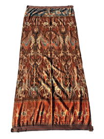
A Fine RARE Antique Woven ikat Pictorial TextilePremier Auction Galleries4.3(329)See Sold PriceMar 09, 2024
NORTH WEST AFRICA Maghreb Morocco Tunisia Algeria JOHNSTON 1897 old mapJasper524.5(9.8k)See Sold PriceFeb 28, 2024
MAGHREB. North Africa Morocco Algeria & Tunisia. JOHNSTON 1913 old antique mapJasper524.5(9.8k)See Sold PriceFeb 28, 2024
AFRICA NW & SOUTH. Maghreb. Cape Colony electoral divisions. JOHNSTON 1906 mapJasper524.5(9.8k)See Sold PriceFeb 28, 2024
COLONIAL CENTRAL AFRICA. Kenya Tanzania Belgian Congo Angola. JOHNSTON 1912 mapJasper524.5(9.8k)See Sold PriceFeb 28, 2024
COLONIAL CENTRAL AFRICA. Kenya Tanzania Belgian Congo Angola. JOHNSTON 1913 mapJasper524.5(9.8k)See Sold PriceFeb 28, 2024
COLONIAL/TRIBAL AFRICA British East/Central/South Africa JOHNSTON 1892 old mapJasper524.5(9.8k)See Sold PriceFeb 28, 2024
Blackie (Pub) 1882 Folio Map. Chinese Empire and JapanAlbion Auctions4.6(341)See Sold PriceMar 01, 2024
Perry, Matthew C. 1856 Large Map. Shah Bay, Lew Chew I. JapanAlbion Auctions4.6(341)See Sold PriceMar 01, 2024
ANTIQUE ILLUSTRATED HANDBOOK OF GEOGRAPHY AND TRAVEL IN ASIA, VOLUME 2, 1896NY Elizabeth 4.3(85)See Sold PriceMar 03, 2024
Henri Plon - Set of 20 topographical prints depicting Asia - Japan - China - Religious building -Proverde Auctions4.3(3)See Sold PriceFeb 28, 2024
Lot of 4 Assorted Vintage Antique China Dishes - Floral Rose PatternsRapid Estate Liquidators and Auction Gallery4.5(1.1k)See Sold PriceMar 01, 2024