ATLAS of ANTIENT GEOGRAPHY by SAMUEL BUTLER 1843John McInnis Auctioneers,LLC4.6(504)See Sold PriceFeb 24, 2024
18TH C. ANTIQUE MAP: FRENCH & INDIAN WAR, FRAMEDThomaston Place Auction Galleries4.4(389)See Sold PriceFeb 24, 2024
Rand McNally Railroad Map Cabinet w/ 21 Railroad MapsRail & Road Auctions4.6(165)See Sold PriceMar 08, 2024
Keith Haring - Ink on New York Map, Best Buddies, Inscribed, Signed, and DatedSapphire Auction Gallery4.1(67)See Sold PriceMar 02, 2024
LATE 17TH C. FRENCH MAP OF THE NEW WORLD BY ALEXIS-HUBERT JAILLOT (1632-1712)Thomaston Place Auction Galleries4.4(389)See Sold PriceFeb 24, 2024
Central Railroad of New Jersey Map of Sandy Hook Route-ca. 1903JM Hobby Supply and Railroad Artifact Auctions4.4(126)See Sold PriceFeb 24, 2024
Lot of Six Mixed Atlas Box Cars-HO Scale-New in BoxJM Hobby Supply and Railroad Artifact Auctions4.4(126)See Sold PriceFeb 25, 2024
Rand McNally/Santa Fe Railroad Map of Iowa-1912JM Hobby Supply and Railroad Artifact Auctions4.4(126)See Sold PriceFeb 24, 2024
NICOLAES VISSCHER (NETHERLANDS, 1618-1709) MAP OF THE NEW WORLDThomaston Place Auction Galleries4.4(389)See Sold PriceFeb 24, 2024
17TH C. WORLD MAP BY NICOLAES VISSCHER (NETHERLANDS, 1618-1709)Thomaston Place Auction Galleries4.4(389)See Sold PriceFeb 24, 2024
Lot of Six Mixed Atlas Cabooses-HO Scale-New in BoxJM Hobby Supply and Railroad Artifact Auctions4.4(126)See Sold PriceFeb 25, 2024
John Cary: Map of the Russian Empire, 1799Map: A New Map of the Russian Empire, Divided into its Governments; from the Latest Authorities Maker: John Cary Date: 1799 Origin: London Size: 18 x 40 inches A magnificent map of the Russian EmpireSee Sold Price
SoldA New Map Of The Russian Empire, 1799.[Russia]. J. Cary. A New Map Of the Russian Empire. Divided into its Governments. Double-page engraving. Lon: John Cary, 1799. 18 x 39 3/4 in. Contemporary hand-coloring, with mountain ridges and swamSee Sold Price
SoldAtlas. CARY (John) Folio atlas with 26 hand colouredAtlas. CARY (John) Folio atlas with 26 hand coloured double page maps only, dated from 1799 to 1807, including two hemispherical world maps, Russian Empire, South America (on 2 sheets), India, Africa,See Sold Price
J.CARY, MAP OF RUSSIAN EMPIRE 1799, 17" X 40"J. CARY, MAP OF RUSSIAN EMPIRE 1799, 17" X 40":17 3/4" x 40". Russian Empire divided into its governments. Two sheets hinged at center Framed. J. Cary engraver, London.See Sold Price
SoldJOHN CARY (ENGLISH 1754-1835), ENGRAVED MAPS, THEJOHN CARY (ENGLISH 1754-1835), ENGRAVED MAPS, THE RUSSIAN EMPIRE, LONDON, 1811. SIGHT 18 1/2 X 40"; FRAMED AND GLAZED-21 X 42" (2/JOINED SHEETS)See Sold Price
SoldCary (John) A New Map of the Russian EmpireCary (John) A New Map of the Russian Empire divided into its Governments, engraved map of the Russian Empire on 2 sheets, joined, with original hand-colouring, 460 x 1005mm., some soiling to uSee Sold Price
Map Russian Empire, 1799, antique"A New Map Of the Russian Empire", 1799, J. Cary, engraverSee Sold Price
SoldCARY, RUSSIAN EMPIRE, HC ENGRAVING, C.1799Artist: John Cary, Title: Russian Empire in two parts, Printmaker: John Cary, Pub: John Cary, Date: C.1799, Medium: Hand-colored engraving, Paper size: 20 x 22 1/2 each, Inscribed: Engraver & publisheSee Sold Price
SoldNew Map of the Russian Empire 1799[Russia]. J. Cary. A New Map Of The Russian Empire, Divided into its Governments, From the Latest Authorities. Two double-page sheets, Russia extending from Poland to the Bering Strait. Lon: 1799. EacSee Sold Price
SoldTHREE MAPS. - unframed.THREE MAPS. A New Map of the Russian Empire. London, J. Cary, 1799, two sheets. Partie Meridionale des Etats de Castille. Paris, Robert de Vaugondy, 1757. The Road from London to Weymouth, London, JohSee Sold Price
SoldCary: Antique Map of Russia Under the Czars, 1799Title/Content of Map: 1799 Cary Map of Russia Under the Czars -- A New Map of the Russian Empire, Divided into its Governments; from the Latest Authorities Date Printed: 1799 London Cartographer: J. CSee Sold Price
Cary: Map of Russia Under the Czars, 1799Map: 1799 Cary Map of Russia Under the Czars -- A New Map of the Russian Empire, Divided into its Governments; from the Latest Authorities Cartographer: J. Cary Year / Place: 1799 London Map DimensionSee Sold Price
Cary: Antique Map of Russia Under the Czars, 1799Map: 1799 Cary Map of Russia Under the Czars -- A New Map of the Russian Empire, Divided into its Governments; from the Latest Authorities Cartographer: J. Cary Year / Place: 1799 London Dimensions: 1See Sold Price
Cary Map of Russia Under the Czars, 1799Map: 1799 Cary Map of Russia Under the Czars -- A New Map of the Russian Empire, Divided into its Governments; from the Latest Authorities Cartographer: J. Cary Year / Place: 1799 London Map DimensionSee Sold Price
Cary Map of Russia Under the Czars, 17991799 Cary Map of Russia Under the Czars -- A New Map of the Russian Empire, Divided into its Governments; from the Latest Authorities. A magnificent map of the Russian Empire in its zenith. Great detaSee Sold Price
Cary: Map of Kingdom of Prussia, 1799Map: A New Map of the Kingdom of Prussia with its Divisions into Provinces and Governments from the Latest Authorities By: John Cary Date: 1799 (Dated) London Dimensions: 18 x 20 inches (45.7 cm x 50.See Sold Price
SoldJOHN CARY 1799 MAP OF IRELANDHand colored engraving. Dimensions: (Paper) H 20" x W 26" Condition: Toning and wrinkles. With center fold and small worm holes.See Sold Price
Antique Map Print - John Cary - United Provinces - Holland, Zealand, UtrechtAn extremely attractive example of John Cary's 1799 map of the Netherlands. Consists of the provinces of Holland, Zealand, Utrecht, Gelders, Over Yssel, Friesland, and Groningen, as well as Drent, DutSee Sold Price
Sold1799 Map ITALY JOHN CARY "A New Map of Piedmont" 18th CA beautifully engraved and colored 18th Century map of Italy. This piece is entitled: "A New Map of Piedmon the Duchies of Savoy and Milan; and the Republic of Genoa; with their Subdivisions." EngraveSee Sold Price
SoldJohn Cary New Map of France Engraving 1799John Cary (ca. 1754–1835), "A New Map of France, Divided into Departments, as decreed by the National Assembly, MDCCXC," 1799. Hand colored engraved map of France. Dimensions: Sight; height: inSee Sold Price
SoldRussian Empire , Map from John Thomson's New Generalpublished in London, Edinburgh, and Dublin, circa 1814-1817, outline color. Unframed. DOA 20.75 x 28 in. Additional high-resolution photos are available at LelandLittle.comSee Sold Price
1799 Map ITALY JOHN CARY "A New Map of Piedmont" 18th CThis is a beautifully engraved and colored 18th Century map of Italy. This piece is entitled: "A New Map of Piedmon the Duchies of Savoy and Milan; and the Republic of Genoa; with their Subdivisions."See Sold Price
SoldSet of five framed Cary's Atlas maps including ChinaSet of five framed Cary's Atlas maps including China Great Provinces, German, Russian Empire in Europe and Asia, Europe, and Asia, all framed and matted. 13 1/2" x 15 1/2" to 16" x 18 1/2" ProvenanceSee Sold Price
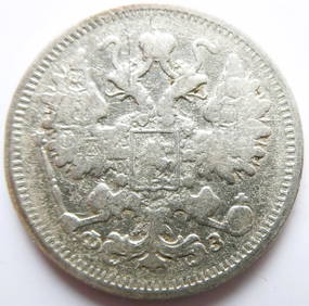
Russian Empire 15 Kopecks - Alexander II / III / Nicholas II 1900 Silver coinBazaar of Persia4.4(24)See Sold PriceFeb 24, 2024
Map: A 19thC engraved map titled Gloucestershire from the Best Authorities, after John Cary. Approx.Claydon Auctioneers Ltd4.3(125)See Sold PriceFeb 26, 2024
Map: A 19thC engraved and hand coloured map of Buckingham titled A New Map of BuckinghamshireClaydon Auctioneers Ltd4.3(125)See Sold PriceFeb 26, 2024
Map: A 19thC engraved map of West Riding, titled A Map of the North Part of the West Riding ofClaydon Auctioneers Ltd4.3(125)See Sold PriceFeb 26, 2024
1816 MAP NORTHERN PART OF RUSSIA or MUSCOVY in EUROPE copper engraving ANTIQUEJasper524.5(9.8k)See Sold PriceFeb 27, 2024
ANTIQUE ILLUSTRATED HANDBOOK OF GEOGRAPHY AND TRAVEL IN ASIA, VOLUME 2, 1896NY Elizabeth 4.3(85)See Sold PriceMar 03, 2024