
Popular Searches
Popular Searches

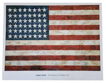
Jasper Johns - Maps of the United States
You May Also Like


Similar Sale History
Sold

Sold

Sold

Sold

Sold

Sold

Sold

Sold

Sold

Sold

Sold

Sold

Sold

Sold

Sold

Sold

Sold

Sold

![[MAP]. MELISH. Map of the United States.... 1816 (1 of 6)](https://p1.liveauctioneers.com/514/38482/16500354_1_x.jpg?height=282&quality=70&version=1363615005)
Sold

Sold

Sold

Sold


Upcoming Sales
View All


TOP