SoldEARLY UNITED STATES MAP, JOHN MELISHSight- 15 3/4" x 19 1/4" Overall- 24 1/2" x 27 1/2"See Sold Price
Map of Early United States of AmericaColor print map of the "Early United States of America, Compiled from the Latest & Best Authorities by John Melish". Within mahogany glazed frame with beige linen mat. Map: 16 x 19 1/4 inches; Frame oSee Sold Price
[MAP]. MELISH. United States of America.... 1821Early Manifest Destiny Map 333. [MAP]. MELISH, John. United States of America Compiled from the Latest & Best AuthorSee Sold Price
SoldUnited States of AmericaUnited States of America, after John Melish, 1829. This influential original engraved early map of the United States has an interesting connection with the Adams-Onis Treaty of 1819, which helped estaSee Sold Price
SoldJOHN MELISH (SCOTLAND/AMERICAN 1771-1822), EARLY ANDJOHN MELISH (SCOTLAND/AMERICAN 1771-1822), EARLY AND RARE MAP OF THE UNITED STATES OF AMERICA, C.1813. ENTERED AS THE ACT DIRECTS AND PUBLISHED BY JOHN MELISH, PHILADELPHIA, JUNE 1813. SIGHT 13 X 17 1See Sold Price
SoldJOHN MELISH MAP OF THE UNITED STATES CIRCA 1820From 'Lavoigne's Atlas,' circa 1820. Professionally matted and framed in archival materials, 17.25 x 21.75 inch sight size, 27.25 x 32 inches overall.See Sold Price
SoldMELISH, JOHN. Map of the United States with thMELISH, JOHN. Map of the United States with the Contiguous British & Spanish Possessions. Large engraved map, dissected in 40 sections and linen-backed, 895x1425 mm overall; hand-colored; new linen baSee Sold Price
Sold* MELISH, John. Map of the United States with the* MELISH, John (1771-1822). Map of the United States with the contiguous British & Spanish Possessions. Philadelphia: John Melish, 1816. Engraved folding map by J. Vallance and H.S. Tanner, overall 90See Sold Price
SoldELEVEN MAPS. - unframed.ELEVEN MAPS. United States of America. John Melish, published by Carey & Son, 1820 (17 1/2 x 22) Map of Long Island. De Beers, NY, c. 1840, a fold out map in brown buckram covers (13 x 50 in.). TerraSee Sold Price
SoldEarly United States Map.Map titled "Map of the United States of America. J. Melish del. Designed to illustrate the Geological Memoir of Wm. Maclure Esqr.". Map measures 13.75" x 17.5" (sight) and exhibits some toning, previoSee Sold Price
SoldAntique map, "United States of America", by JohnAntique map, "United States of America", by John Melish, 1818, Compiled from the latest and best authorities, 16.25" by 19.5". Notice: Please note that our auctions will continue in the online only foSee Sold Price
SoldMELISH. Map of the United States. 1820The Cartographical Beginnings of Manifest Destiny 95. [MAP]. MELISH, John (publisher). Map of the United States with the Contiguous British & Spanish Possessions Compiled from the Latest &amSee Sold Price
[MAP]. MELISH. Map of the United States.... 1816327. [MAP]. MELISH, John (publisher). Map of the United States with the Contiguous British & Spanish Possessions.... Philadelphia, 1816. Copper-engraved map, original full and outline coloring bySee Sold Price
Sold19th century map of the Southeast,"Southern Section of the United States including Florida & C.", based on 1816 map by John Melish, showing from the eastern seaboard into Missouri Territory, from [Atlas til Friherre Klinckowstromo BreSee Sold Price
SoldSeminal 1816 Map of the United States, John MelishPublished in Philadelphia, Pennsylvania, 1816. entitled “Map of the United States with the contiguous British and Spanish Possessions compiled from the latest and best authorities”. paper on linenSee Sold Price
Sold* MELISH, John (1771-1822). Map of the United* MELISH, John (1771-1822). Map of the United States...Entered...the 16th day of June, 1820... Philadelphia, 1820. Engraved folding map by J. Vallance and H.S. Tanner, overall 915 x 1490 mm, hand-coloSee Sold Price
Melsih Map of the United States, 1823*** START PRICE IS THE RESERVE *** [America] MELISH, John (1771-1822). Map of the United States with the Contiguous British and Spanish Possessions. Engraved map with original color on 50 segements anSee Sold Price
SoldMelish Map of the United States 1823MELISH, John (1771-1822). Map of the United States with the Contiguous British and Spanish Possessions. Philadelphia: James Finlayson successor to John Melish, 1823. Folding engraved map (45 x 57 4/8See Sold Price
Sold* MELISH, John (1771-1822). Map of the United* MELISH, John (1771-1822). Map of the United States....Entered...the 6th day of June, 1816...Improved to the 1st of January, 1818. Philadelphia, 1818. Engraved folding map by J. Vallance and H.S. TanSee Sold Price
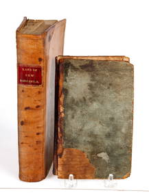
Sold1818 Book on Geography of United StatesPost-Rev. War to Civil War1818 Book, "A Geographical Description of the United States..." by John Melish, Choice Extremely Fine. 186 pages, published by the author. Marbled covers, rubbed and worn. InSee Sold Price
SoldJohn Melish Map"United States of America" map "Compiled from the latest and best Authorities" Philadelphia,1818. Bound into the Atlas Volume of Ree's "Cyclopedia" circa 1820.See Sold Price
SoldJohn Melish 1815 United States of America Map"Map of the United States of America", by John Melish, 1815. From "The Traveller’s Directory through the United States" by John Melish. Copper plate engraving with hand colored outlines of the UniteSee Sold Price
SoldJohn Melish (1771-1822) American. "Northern Section ofJohn Melish (1771-1822) American. "Northern Section of the United States, Including Canada', Map, Unframed, 14.5" x 20", together with another nine maps, by various hands, ten (10).See Sold Price
SoldAfter John Melish (1771-1822) American. "NorthernAfter John Melish (1771-1822) American. "Northern Section of the United States, Including Canada', Map, Unframed, 14.5" x 20", together with another nine maps, by various hands, ten (10).See Sold Price
EARLY CONSTITUTION & DECLARATION of INDEPENDENCEJohn McInnis Auctioneers,LLC4.6(502)See Sold PriceFeb 24, 2024
Arrowsmith & Lewis - Map of the United StatesTrillium Antique Prints & Rare Books4.5(30)See Sold PriceFeb 24, 2024
Carey, pub. 1796 - A Chart of the West IndiesTrillium Antique Prints & Rare Books4.5(30)See Sold PriceFeb 24, 2024
Carey, pub. 1796 - Map of the State of MarylandTrillium Antique Prints & Rare Books4.5(30)See Sold PriceFeb 24, 2024
Carey, pub. 1796 - Map of GeorgiaTrillium Antique Prints & Rare Books4.5(30)See Sold PriceFeb 24, 2024
Carey, pub. 1796 - Map of The State of South CarolinaTrillium Antique Prints & Rare Books4.5(30)See Sold PriceFeb 24, 2024
Carey, pub. 1796 - Map of KentuckyTrillium Antique Prints & Rare Books4.5(30)See Sold PriceFeb 24, 2024
Carey, pub. 1796 - Map of the Tennassee State formerly part of North Carolina (Tennessee)Trillium Antique Prints & Rare Books4.5(30)See Sold PriceFeb 24, 2024
Amazing John Sennhauser 1945 Oil CanvasAmazing Collectible Galleries4.6(170)See Sold PriceMar 02, 2024
AUTOMOBILE MANUFACTURERS:International Autograph Auctions Europe S.L.4.5(52)See Sold PriceMar 13, 2024
John Blakely Brass Police Mechanical NippersBruneau & Co. Auctioneers4.5(491)See Sold PriceMar 18, 2024


![[MAP]. MELISH. United States of America.... 1821 (1 of 1)](https://p1.liveauctioneers.com/514/20078/6859783_1_x.jpg?height=282&quality=70)


![[MAP]. MELISH. Map of the United States.... 1816 (1 of 6)](https://p1.liveauctioneers.com/514/38482/16500354_1_x.jpg?height=282&quality=70&version=1363615005)