ATLAS of ANTIENT GEOGRAPHY by SAMUEL BUTLER 1843John McInnis Auctioneers,LLC4.6(502)See Sold PriceFeb 24, 2024
18TH C. ANTIQUE MAP: FRENCH & INDIAN WAR, FRAMEDThomaston Place Auction Galleries4.4(386)See Sold PriceFeb 24, 2024
Rand McNally Railroad Map Cabinet w/ 21 Railroad MapsRail & Road Auctions4.6(165)See Sold PriceMar 08, 2024
Keith Haring - Ink on New York Map, Best Buddies, Inscribed, Signed, and DatedSapphire Auction Gallery4(67)See Sold PriceMar 02, 2024
LATE 17TH C. FRENCH MAP OF THE NEW WORLD BY ALEXIS-HUBERT JAILLOT (1632-1712)Thomaston Place Auction Galleries4.4(386)See Sold PriceFeb 24, 2024
Central Railroad of New Jersey Map of Sandy Hook Route-ca. 1903JM Hobby Supply and Railroad Artifact Auctions4.4(126)See Sold PriceFeb 24, 2024
Lot of Six Mixed Atlas Box Cars-HO Scale-New in BoxJM Hobby Supply and Railroad Artifact Auctions4.4(126)See Sold PriceFeb 25, 2024
Rand McNally/Santa Fe Railroad Map of Iowa-1912JM Hobby Supply and Railroad Artifact Auctions4.4(126)See Sold PriceFeb 24, 2024
NICOLAES VISSCHER (NETHERLANDS, 1618-1709) MAP OF THE NEW WORLDThomaston Place Auction Galleries4.4(386)See Sold PriceFeb 24, 2024
17TH C. WORLD MAP BY NICOLAES VISSCHER (NETHERLANDS, 1618-1709)Thomaston Place Auction Galleries4.4(386)See Sold PriceFeb 24, 2024
Lot of Six Mixed Atlas Cabooses-HO Scale-New in BoxJM Hobby Supply and Railroad Artifact Auctions4.4(126)See Sold PriceFeb 25, 2024
SoldJames Wyld, hand-colored mapsJames Wyld, "Map of the Countries lying between Turkey & Birmah...", London, 1839, hand-colored maps on four sheets, framed, 43 in. x 53 inSee Sold Price
SoldHand Colored Map, James Wyld (1812-1887)Antique c. 1855 map published by James Wyld entitled: "Parliamentary Representation" and "A Map Shewing the Places in England & Wales Sending Members to Parliament with the Numbers Returned. DivisionsSee Sold Price
SoldAN ANTIQUE HAND COLORED MAP, "Republic of Mexico andAN ANTIQUE HAND COLORED MAP, "Republic of Mexico and Texas," hand colored engraving on paper, "London, James Wyld, Charing Gros.," plate number 46, originally printed for Popular Atlas of the World (See Sold Price
SoldWyld map of U.S. with Texas idependentTitle: United States of America Author: Wyld, James Description: Engraved map, hand-colored. 38x55 cm. (15x21½").Map of the United States, with Texas an independent country, Oregon extending well norSee Sold Price
Sold1830 James Wyld Map of Persia and Caubul1830 James Wyld Map of Persia and Caubul. Hand-colored, detailed steel-engraved map of Persia and Caubul (Afghanistan) with original hand coloring. Engraved by Stockley. Attractive piano key border. 9See Sold Price
Sold1829 MAP, WESTERN HEMISPHEREAtlas map of Western Hemisphere marked PAGE 6 in top right corner. An original hand colored antique map, Page 6 from ATLAS OF THE WORLD by James Wyld the Elder (1790-1836), Geographer Royal, who introSee Sold Price
Sold1829 MAP, WESTERN HEMISPHEREAtlas map of Western Hemisphere marked PAGE 6 in top right corner. An original hand colored antique map, Page 6 from ATLAS OF THE WORLD by James Wyld the Elder (1790-1836), Geographer Royal, who introSee Sold Price
1829 MAP, WESTERN HEMISPHEREAtlas map of Western Hemisphere marked PAGE 6 in top right corner. An original hand colored antique map, Page 6 from ATLAS OF THE WORLD by James Wyld the Elder (1790-1836), Geographer Royal, who introSee Sold Price
Sold(CENTRAL AMERICA.) Wyld, James. Map of Central America(CENTRAL AMERICA.) Wyld, James. Map of Central America Shewing the Different Lines of Atlantic & Pacific Communication. Large hand-colored engraved map of Central America with an inset of the IsthmusSee Sold Price
Sold(LONDON.) Wyld, James. London and its Environs.(LONDON.) Wyld, James. London and its Environs. Large hand-colored engraved case map with separately printed borders pasted on as issued. 42x51 inches overall, dissected and mounted to original linenSee Sold Price
Sold"Map of The Germanic Confederated States, including the"Map of The Germanic Confederated States, including the Kingdom of Prussia," 1840, published by James Wyld (1812-1887), London, hand colored, presented in a gilt frame, H.- 25 3/4 in., W.- 30 in.See Sold Price
SoldWYLD, JAMES. The Province of Canada.WYLD, JAMES. The Province of Canada. Engraved 24-section case map, 675x990 mm overall; hand-colored in outline; some minor spotting and browning, slightly toned; lacking the case. London, [1850] ShowsSee Sold Price
SoldJames Wyld (1812-1887, London), "Map of North AmericaJames Wyld (1812-1887, London), "Map of North America Exhibiting Recent Discoveries Geographical and Nautical," hand colored atlas page, H.- 23 in., W.- 17 in.See Sold Price
SoldPair of Early 19th Century Maps of CanadaPair of maps titled "A Map of the Province of Upper Canada" (1838) and "A Map of the Province of Lower Canada" (1840) by James Wyld, London. Maps measure 23.5" x 37" and exhibit hand-colored highlightSee Sold Price
Sold(CANADA.) Wyld, James. A Map of the Province o(CANADA.) Wyld, James. A Map of the Province of Upper Canada. Engraved folding map, 585x885 mm, ample margins; hand-colored in outline; slight offsetting from the cartouche. London, 1838 This map is rSee Sold Price
SoldWYLD, JAMES. A New Map of the Province of LoweWYLD, JAMES. A New Map of the Province of Lower Canada. Two-sheet engraved map, 580x885 mm, top and bottom margin close, others wide; hand-colored in outline; a few cellotape repairs on verso with resSee Sold Price
SoldBarclay, James C1835 Hand Colored Map of EuropeHand Colored Copper Engraved Maps Published C1835, London for "A Complete and Universal English Dictionary" by the Rev. James Barclay et al. Engraved by Bingley. Paper Size: 11 x 8.5 inch (28 x 22cm)See Sold Price
SoldMap of the United States 1836 J. WebsterTitle: Map of the United States Author: Webster, James Description: Folding hand-colored engraved map. 40x49.6 cm. (15¾x19½"). With inset "Population &c of the United Sates." Also with a portrait ofSee Sold Price
SoldCIVIL WAR ERA HARPER'S WEEKLY RICHMOND, VIRGINIA /CIVIL WAR ERA HARPER'S WEEKLY RICHMOND, VIRGINIA / JAMES RIVER MAP / PRINT, hand-colored, with map to top third, titled "MAP OF THE / JAMES RIVER ETC. / FROM RICHMOND TO THE OCEAN", above image titledSee Sold Price
SoldFRAMED PRINT, COLORED MAP OF CHINA, JAMES WYLDFramed print on paper, "Map of China, Compiled from Original Surveys and Sketches", James Wyld (English, 1812-1887), published by J. Wyld, London, sight: 24.5"h, 31.5"w, overall: 25.75"h, 33"w, 11lbsSee Sold Price
Sold221: [South Africa]. James Wylf. South Africa. Lon: Ja[South Africa]. James Wylf. South Africa. Lon: James Wyld, c.1895. 20 1/4 x 32, hand-colored outline, folds into 32 sections, backed by linen. Very good, housed in moderately faded/worn pocket case. PSee Sold Price
SoldMap of Hawaii 1784-[86]Title: Chart of the Sandwich Isles Author: Cook, James Description: Copper-engraved map, hand-colored (later). 21x34 cm. (8¼x13¼").Important early chart of the Hawaiian Islands, a slightly reduced vSee Sold Price
SoldWyld, James C1840 Group of 4 Hand Coloured MapsIncl Spain/Portugal, Syria, Asia and Turkey in Asia. Hand Coloured Steel Engraved Map Published C1840, London for "Atlas of Modern Geography" by James Wyld. Centre fold as published. Paper Size: 11 xSee Sold Price
James Wyld (1812-1887, London), "Western Hemisphere,"James Wyld (1812-1887, London), "Western Hemisphere," c. 1824, hand colored, H. - 23 3/8 in., W. - 30 1/2 in.See Sold Price
THOMAS MOULE 1837 Colored Map of Warwickshire Framed vgcLuis Porretta Fine Arts4.3(10)See Sold PriceMar 02, 2024
Audubon - Blue-grey Flycatcher. 70Trillium Antique Prints & Rare Books4.5(30)See Sold PriceFeb 24, 2024
Audubon - Fork-tailed Flycatcher. 52Trillium Antique Prints & Rare Books4.5(30)See Sold PriceFeb 24, 2024
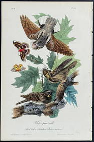
Audubon - Chuck-will's Widow. 41Trillium Antique Prints & Rare Books4.5(30)See Sold PriceFeb 24, 2024
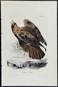
Audubon - Common Osprey Fish Hawk. 15Trillium Antique Prints & Rare Books4.5(30)See Sold PriceFeb 24, 2024
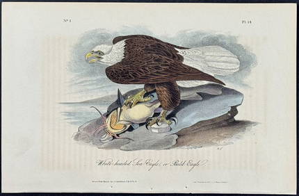
Audubon - White-headed Sea Eagle or Bald Eagle. 14Trillium Antique Prints & Rare Books4.5(30)See Sold PriceFeb 24, 2024
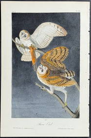
Audubon - Little Screech Owl. 40Trillium Antique Prints & Rare Books4.5(30)See Sold PriceFeb 24, 2024
American Goldfinch, Audubon, Royal Octavo hand-colored lithographPBA Galleries4.7(381)See Sold PriceMar 07, 2024
Blue Heron, Audubon Royal Octavo hand-colored lithographPBA Galleries4.7(381)See Sold PriceMar 07, 2024
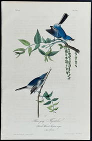
Blue Jay, Audubon, Royal Octavo hand-colored lithographPBA Galleries4.7(381)See Sold PriceMar 07, 2024
Louisiana Heron, Audubon, Royal Octavo hand-colored lithographPBA Galleries4.7(381)See Sold PriceMar 07, 2024
Mallard, Audubon, Royal Octavo hand-colored lithographPBA Galleries4.7(381)See Sold PriceMar 07, 2024
Pileated Woodpecker, Audubon, Royal Octavo hand-colored lithographPBA Galleries4.7(381)See Sold PriceMar 07, 2024
Roseate Spoonbill, Audubon, Royal Octavo hand-colored lithographPBA Galleries4.7(381)See Sold PriceMar 07, 2024
Blue Heron, Audubon Royal Octavo hand-colored lithographPBA Galleries4.7(381)See Sold PriceMar 07, 2024
The Snowy Owl, Audubon, Royal Octavo hand-colored lithographPBA Galleries4.7(381)See Sold PriceMar 07, 2024


![Map of Hawaii 1784-[86] (1 of 1)](https://p1.liveauctioneers.com/642/32613/13093237_1_x.jpg?height=282&quality=70&version=1347991406)