ATLAS of ANTIENT GEOGRAPHY by SAMUEL BUTLER 1843John McInnis Auctioneers,LLC4.5(505)See Sold PriceFeb 24, 2024
18TH C. ANTIQUE MAP: FRENCH & INDIAN WAR, FRAMEDThomaston Place Auction Galleries4.4(393)See Sold PriceFeb 24, 2024
Rand McNally Railroad Map Cabinet w/ 21 Railroad MapsRail & Road Auctions4.6(165)See Sold PriceMar 08, 2024
Keith Haring - Ink on New York Map, Best Buddies, Inscribed, Signed, and DatedSapphire Auction Gallery4(67)See Sold PriceMar 02, 2024
LATE 17TH C. FRENCH MAP OF THE NEW WORLD BY ALEXIS-HUBERT JAILLOT (1632-1712)Thomaston Place Auction Galleries4.4(393)See Sold PriceFeb 24, 2024
Central Railroad of New Jersey Map of Sandy Hook Route-ca. 1903JM Hobby Supply and Railroad Artifact Auctions4.4(127)See Sold PriceFeb 24, 2024
Lot of Six Mixed Atlas Box Cars-HO Scale-New in BoxJM Hobby Supply and Railroad Artifact Auctions4.4(127)See Sold PriceFeb 25, 2024
Rand McNally/Santa Fe Railroad Map of Iowa-1912JM Hobby Supply and Railroad Artifact Auctions4.4(127)See Sold PriceFeb 24, 2024
NICOLAES VISSCHER (NETHERLANDS, 1618-1709) MAP OF THE NEW WORLDThomaston Place Auction Galleries4.4(393)See Sold PriceFeb 24, 2024
17TH C. WORLD MAP BY NICOLAES VISSCHER (NETHERLANDS, 1618-1709)Thomaston Place Auction Galleries4.4(393)See Sold PriceFeb 24, 2024
Lot of Six Mixed Atlas Cabooses-HO Scale-New in BoxJM Hobby Supply and Railroad Artifact Auctions4.4(127)See Sold PriceFeb 25, 2024
Antique Map Print of Oceania - Map of Tonga - Friendly Islands - James CookTitle/Content: Antique Map Print of Oceania - Map of Tonga - Friendly Islands - James Cook Date: 1785 Material: Paper Dimensions: 10” x 17” inches / 26 cm x 42 cm Description: Chart of theSee Sold Price
Carte des Isles des Amis. Friendly or Tonga Islands.TITLE/CONTENT OF MAP: '[Cook 3e Voyage] Carte des Isles des Amis // Plan du Havre de Tongataboo // Tabouai Island // Mangeea Island // Wateeoo Island [Cook's 3rd Voyage - Map of Friendly Islands (TongSee Sold Price
Original Imray & Son Chart of South Pacific, 1876Nautical chart of the South Pacific from James Imray & Son, 1875, but stamped 1876. Details include New Zealand, Tonga Isles, Cook Islands, Tuobouai Archipelago, Tuamoti Archipelago, Fiji and more. UnSee Sold Price
Original Imray & Son Chart of South Pacific, 1876Nautical chart of the South Pacific from James Imray & Son, 1875, but stamped 1876. Details include New Zealand, Tonga Isles, Cook Islands, Tuobouai Archipelago, Tuamoti Archipelago, Fiji and more. UnSee Sold Price
SoldCook (Captain James).- Webber (John) and MarieCook (Captain James).- Webber (John) and Marie Catherina Prestel. Four views in the South Seas: 'A View in Annamooka, one of the Friendly Isle's'; 'View in Ulietea'; 'A View in Matavai, Otaheite'; 'ASee Sold Price
Carte Des Isles De La Societe Decouvertes...[Cook’s 1st Voyage] Carte Des Isles De La Societe Decouvertes Par Le Lieutt. J Cook. 1769. Folding map after Capt. James Cook showing the Society Islands, discovered on his first voyage. Plate 1 froSee Sold Price
Bellin: Map of Queen Charlotte Island, James CookBellin, Jacques Nicolas [1703-1772] Isles de la Reine Charlotte - map of Queen Charlotte Island on James Cook journey Date Published: [1785] Binding: No binding 40 X 23cm (16” X 9 1/2”), Folded (aSee Sold Price
SoldMap of Hawaii 1784-[86]Title: Chart of the Sandwich Isles Author: Cook, James Description: Copper-engraved map, hand-colored (later). 21x34 cm. (8¼x13¼").Important early chart of the Hawaiian Islands, a slightly reduced vSee Sold Price
Sold3pc 18th Century Maps of Macao & Islands- Cook etc3pc 18th Century Maps of Macao & Islands. Includes J.V. Schley 'Carte des Isles de le Riviere de Canton' c. 1750 (11.25x15''), James Cook 'Sketch Typa and Macao' 1785 (11.25x9''), and Nicolas Bellin 'See Sold Price
SoldCarte Des Isles De La Societé... J. Cook. 1769.[Oceania] Carte Des Isles De La Societé découvertes Par Le Lieutt. J. Cook. Paris, 1774. Detailed map of the Society Islands, based upon the contemporary surveys of Captain James Cook during his firSee Sold Price
MAP, New Zealand, CookNorth Island, New Zealand. Capt. James Cook, Riviere Tamise et Baye Mercure a la Nle. Zelande [on sheet with] Baye des Isles dans la Nle. Zelande [and] Baye de Tolaga dans la Nle. Zelande, from AusfuhSee Sold Price
Pacific Islands. Dusky Sound. Wallis Tonga Cook EasterTITLE/CONTENT OF MAP: Esquisse de la Baye Dusky, dans la Nouvelle Zéelande // Isles de Wallis // Isle Turtle // Isles des Cocos et des Traitres // Palmerston Isle // Isle Sauvage // Isle d'Hervey //See Sold Price
Pacific Islands. Dusky Sound. Wallis Tonga Cook EasterTITLE/CONTENT OF MAP: 'Esquisse de la Baye Dusky, dans la Nouvelle Zéelande // Isles de Wallis // Isle Turtle // Isles des Cocos et des Traitres // Palmerston Isle // Isle Sauvage // Isle d'Hervey //See Sold Price
Pacific Islands. Dusky Sound. Wallis Tonga Cook EasterTITLE/CONTENT OF MAP: Esquisse de la Baye Dusky, dans la Nouvelle Zéelande // Isles de Wallis // Isle Turtle // Isles des Cocos et des Traitres // Palmerston Isle // Isle Sauvage // Isle d'Hervey //See Sold Price
1790 Map of Friendly Islands Tonga“Map of the Friendly Islands (Tonga), by Alex Hogg at London, 1790. Very Good, measures 14 x 9”.See Sold Price
Map of the Friendly Islands (Tonga), 1786Map: Carte von den Freundschaftlichen Inseln Cartographer: Anonymous Place & Date: Germany / 1786 Size: 14 3/4" x 9 3/8" A simple but very detailed map of the Friendly Islands (Tonga), showing the rouSee Sold Price
1790 Map of Tonga Friendly Islands“Map of the Friendly Islands (Tonga), by Alex Hogg at London, 1790. Very Good, measures 14 x 9”. Free shipping for this item within the continental US.See Sold Price
1790 Map of the Friendly IslandsMap of the Friendly Islands (Tonga), by Alex Hogg at London, 1790. Very Good, measures 14 x 9”See Sold Price
South Pacific – Friendly Islands (Tonga) BritishTitle/Content of Map: South Pacific – Friendly Islands (Tonga) British Admiralty Chart 474, published 1897 Date: 1897 Cartographer: British Admiralty Material/Medium: thick paper Size: standard UnusSee Sold Price
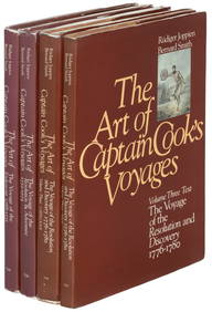
1778 1ed ed Captain James Cook Voyage1778 1ed ed Captain James Cook Voyage Pacific Islands Oceania MAPS 5v SET FOLIOS Complete with ALL Portraits, Maps, Folding Plates! An incredible 1st edition history of Captain James Cook voyages! CapSee Sold Price
SoldCaptain James Cook Map of New Caledonia 1778This is an attractive map of the voyage of Captain Cook in the Pacific Ocean near theislands of New Caledonia and Vanuatu. Captain Cook discovered the islands on hissecond voyage, and they included NeSee Sold Price
Soldc. 1781, Illustration Print Captain James CookPrints c. 1781 Captain James Cook Engraved Illustration Print c. 1781, Engraved Print “The Landing of Captn. Cook & c. at Middleburgh, one of the Friendly Isles", Fine. Overall size 9.5" x 15". PublSee Sold Price
Soldc. 1781, Illustration Print Captain James CookPrints c. 1781, Illustration Print About Captain James Cook c. 1781, Print “The Landing of Captn. Cook & c. at Middleburgh, one of the Friendly Isles", Fine. Overall size 9.5" x 15". Published in LoSee Sold Price
Soldc. 1781, Illustration Print Captain James CookPrints c. 1781 Captain James Cook Engraved Illustration Print c. 1781, Engraved Print "The Landing of Captn. Cook & c. at Middleburgh, one of the Friendly Isles", Fine. Overall size 9.5" x 15". PublisSee Sold Price
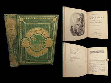
1789 Captain James Cook Life & Voyages Australia New Zealand Hawaii KippisSchilb Antiquarian Rare Books4.8(428)See Sold PriceMar 10, 2024
1871 Captain Cook Voyages Around the World Tahiti Hawaii Exploration AntarcticaSchilb Antiquarian Rare Books4.8(428)See Sold PriceMar 10, 2024
1764 Bellin Map of Lesser Antilles Northern Portion -- Petites Antilles ou Isles du Vent 3e. Partie.Jasper524.5(9.9k)See Sold PriceFeb 27, 2024
1683 Sanson Map of the Caribbean -- Les Isles Antilles, &c Entre Lesquelles sont les Lucayes, et lesJasper524.5(9.9k)See Sold PriceFeb 27, 2024
1845 Delisle/Bauche Map of Martinique -- Carte de l'Isle de la Martinique Colonie Francoise de l'uneJasper524.5(9.9k)See Sold PriceFeb 27, 2024
Coast & Islands between Cape Roxo. Guinea-Bissau & Bissagos. KITCHIN 1745 mapJasper524.5(9.9k)See Sold PriceFeb 28, 2024
Carte de la Guinée, contenant…'. Guinea & Cape Verde islands. BONNE 1771 mapJasper524.5(9.9k)See Sold PriceFeb 28, 2024
Le Canal de Mosambique, l'Isle de Madagascar… Mozambique. Africa. BONNE 1788 mapJasper524.5(9.9k)See Sold PriceFeb 28, 2024
Plan de la Baye & Isle d'Arguim'. Mauritania. Arguin island. BELLIN 1746 mapJasper524.5(9.9k)See Sold PriceFeb 28, 2024
Le Canal de Mosambique, l'Isle de Madagascar… Mozambique. Africa. BONNE 1790 mapJasper524.5(9.9k)See Sold PriceFeb 28, 2024
Partie Occidentale de l’Afrique. West Africa coast Canary islands BONNE 1788 mapJasper524.5(9.9k)See Sold PriceFeb 28, 2024
Partie Occidentale de l'Ancien Continent… W Africa Macaronesia. BONNE 1780 mapJasper524.5(9.9k)See Sold PriceFeb 28, 2024
1973 Cook Islands Silver 2 1/2 Dollars Ship BU (Capt James Cook)Golden Air Auctions4.4(265)See Sold PriceFeb 24, 2024
James Cook - Antique map Australia titled 'Gezigt van het Eil. Suffren'. Antique map of SuffrenProverde Auctions4.3(3)See Sold PriceFeb 28, 2024
Antique Map - Views on the coast of Asia. J. Webber del. Engraved after J. Webber and W. Bligh.Proverde Auctions4.3(3)See Sold PriceFeb 28, 2024
James Cook - Map of the Friendly Isles - Tonga IslandsProverde Auctions4.3(3)See Sold PriceFeb 28, 2024
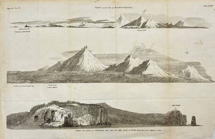
Antique Print with Coastal Views of Kamchatka in Russia by Cook, 1803Proverde Auctions4.3(3)See Sold PriceFeb 28, 2024


![Map of Hawaii 1784-[86] (1 of 1)](https://p1.liveauctioneers.com/642/32613/13093237_1_x.jpg?height=282&quality=70&version=1347991406)