ATLAS of ANTIENT GEOGRAPHY by SAMUEL BUTLER 1843John McInnis Auctioneers,LLC4.5(505)See Sold PriceFeb 25, 2024
18TH C. ANTIQUE MAP: FRENCH & INDIAN WAR, FRAMEDThomaston Place Auction Galleries4.4(393)See Sold PriceFeb 24, 2024
Rand McNally Railroad Map Cabinet w/ 21 Railroad MapsRail & Road Auctions4.6(165)See Sold PriceMar 08, 2024
Keith Haring - Ink on New York Map, Best Buddies, Inscribed, Signed, and DatedSapphire Auction Gallery4(67)See Sold PriceMar 02, 2024
LATE 17TH C. FRENCH MAP OF THE NEW WORLD BY ALEXIS-HUBERT JAILLOT (1632-1712)Thomaston Place Auction Galleries4.4(393)See Sold PriceFeb 24, 2024
Central Railroad of New Jersey Map of Sandy Hook Route-ca. 1903JM Hobby Supply and Railroad Artifact Auctions4.4(127)See Sold PriceFeb 24, 2024
Lot of Six Mixed Atlas Box Cars-HO Scale-New in BoxJM Hobby Supply and Railroad Artifact Auctions4.4(127)See Sold PriceFeb 25, 2024
Rand McNally/Santa Fe Railroad Map of Iowa-1912JM Hobby Supply and Railroad Artifact Auctions4.4(127)See Sold PriceFeb 24, 2024
NICOLAES VISSCHER (NETHERLANDS, 1618-1709) MAP OF THE NEW WORLDThomaston Place Auction Galleries4.4(393)See Sold PriceFeb 24, 2024
17TH C. WORLD MAP BY NICOLAES VISSCHER (NETHERLANDS, 1618-1709)Thomaston Place Auction Galleries4.4(393)See Sold PriceFeb 24, 2024
Lot of Six Mixed Atlas Cabooses-HO Scale-New in BoxJM Hobby Supply and Railroad Artifact Auctions4.4(127)See Sold PriceFeb 25, 2024
SoldHOMANN, Johann Chrisoph (1703-1730). Statuum MaroccaHOMANN, Johann Chrisoph (1703-1730). Statuum Marocca Norum, Regnorum Nempe Fessani, Maroccani, Tafiletani et Segelomessani... Nuremberg, 1728. Engraved map with hand-coloring in wash and outline ofSee Sold Price
SoldHOMANN, Johann Chrisoph (1703-1730). Statuum MaroccaHOMANN, Johann Chrisoph (1703-1730). Statuum Marocca Norum, Regnorum Nempe Fessani, Maroccani, Tafiletani et Segelomessani... Nuremberg, 1728. Engraved map with hand-coloring in wash and outline ofSee Sold Price
SoldHOMANN ENGRAVING MAP MOROCCO NORTH AFRICA, 18TH C.Unframed map, engraving on paper, "Statuum Marocca Norum," Johann Christoph Homann (German, 1703-1730), cartouche with title in upper left corner, showing Morocco, the Canary Islands, inset map of theSee Sold Price
SoldJOHANN CHRISTOPH HOMANN - Statuum Maroccanorum RegnorumJOHANN CHRISTOPH HOMANN 1703 - 1730 Statuum Maroccanorum Regnorum nempe Fessani. Insulae Canariae. Nuremberg, 1728 Colored copper etching (three) Signed, titled and dated Size 49.3 x 57.5 cm plateSee Sold Price
SoldAfrica.- Morocco.- Homann (Johann Christoph) StatuumAfrica.- Morocco.- Homann (Johann Christoph) Statuum Marocca Norum, Regnorum Nempe Fessani, Maroccani, Tafiletani et Segelomessani, decorative map of northwestern Morocco, including Canary Islands, wiSee Sold Price
SoldMAP, Morocco, HomannMorocco. Johann Christoph Homann, Statuum Marocca Norum, Regnorum Nempe Fessani, Maroccani, Tafiletani et Segelomessani..., 1728 (dated). Hand Color. This large and very graphic map shows the domainsSee Sold Price
SoldAN ANTIQUE MAP, "America Septentrionalis," NUREMBERG,AN ANTIQUE MAP, "America Septentrionalis," NUREMBERG, 1756, hand color engraving on paper, Homann Heirs under direction of Johann Christoph (1703-1730), publishers, a mossy grotto form title cartSee Sold Price
SoldItaly & Mediterranean.- Homann (Johann Baptist) StatuumItaly & Mediterranean.- Homann (Johann Baptist) Statuum totius Italiae novissima repraesentatio geographica simul exhibens Insulas Siciliae, Sardiniae, Corsicae Maltae, engraving with hand-colouring,See Sold Price
SoldHomann map of Italy c.1730Heading: Author: Homann, Johann Baptiste Title: Statuum totius Italiae novissima repraesentatio geograhica simul exhibens insulas Siciliae Sardiniae Corsicae et Maltae conante… Place Published: NurSee Sold Price
SoldCa. 1730 Johann Homann Comitatus Flandriae MapCa. 1730 Comitatus Flandriae Map, 'Johann Baptist Homann' , 24" x 21.5"See Sold Price
SoldDOPPELMAYR, Johann Gabriel (1677-1750). Globi CoelestisDOPPELMAYR, Johann Gabriel (1677-1750). Globi Coelestis in Tabulas Planas Redacti Pars I. -Pars II. -Pars III. -Pars IV. -Pars V. -Pars VI. Nuremberg: Johann Baptist Homann, 1730. Set of 6 double-pageSee Sold Price
SoldTabula Frisiae Orientalis. Teilkol. KupferstichkarteTabula Frisiae Orientalis. Teilkol. Kupferstichkarte nach E.G. Coldewey. Nürnberg, Johann Christoph Homann, 1730. 49 x 58,4 (51,4 x 60 cm). Karte mit dem Gebiet Ostfriesland. Mit zwei Insetkarten vonSee Sold Price
1730 antique MAP of GERMANY Netherlands Belgium Luxemburg 18th CENTURYNetherlands, Belgium, Luxemburg Tabula generalis totius Belgii qua Provinciae XVII Infer. Germania olim sub S.R.I. Vircula Burgundiae by Homann, Johann Baptist, 1663-1724 Nuremberg, 1730 Size 20.5 bySee Sold Price
1730 antique MAP of GERMANY Netherlands Belgium Luxemburg 18th CENTURYNetherlands, Belgium, Luxemburg Tabula generalis totius Belgii qua Provinciae XVII Infer. Germania olim sub S.R.I. Vircula Burgundiae by Homann, Johann Baptist, 1663-1724 Nuremberg, 1730 Size 20.5 bySee Sold Price
1730 antique MAP of GERMANY Netherlands Belgium Luxemburg 18th CENTURYNetherlands, Belgium, Luxemburg Tabula generalis totius Belgii qua Provinciae XVII Infer. Germania olim sub S.R.I. Vircula Burgundiae by Homann, Johann Baptist, 1663-1724 Nuremberg, 1730 Size 20.5 bySee Sold Price
1730 antique MAP of GERMANY Netherlands Belgium Luxemburg 18th CENTURYNetherlands, Belgium, Luxemburg Tabula generalis totius Belgii qua Provinciae XVII Infer. Germania olim sub S.R.I. Vircula Burgundiae by Homann, Johann Baptist, 1663-1724 Nuremberg, 1730 Size 20.5 bySee Sold Price
1730 antique MAP of GERMANY Netherlands Belgium Luxemburg 18th CENTURYNetherlands, Belgium, Luxemburg Tabula generalis totius Belgii qua Provinciae XVII Infer. Germania olim sub S.R.I. Vircula Burgundiae by Homann, Johann Baptist, 1663-1724 Nuremberg, 1730 Size 20.5 bySee Sold Price
Sold1730 MAP BY JOHANN BAPTISTE HOMANNMagnae Britanniae Pars Meridionalis, in qua Regnum Angliae tam in Septm Antiqua Angl-Saxonum Regna… Hand Colored engraving on paper. Dimensions: Framed H28.5" x W 24.5", sight H 22"x W 19" CondiSee Sold Price
SoldJOHANN BAPTISTE HOMANN HAND COLOURD MAP c. 1730Hand coloured map of London by Johann Baptiste Homann c. 1730.\'Accurater Grundriss u: Gerend der Koenigl: Gross Brittannischen Haupt und Residentz-Stadt London\'With five views of Royal Palaces UnfraSee Sold Price
SoldHOMANN: Virginia Marylandia et Carolina, 1730-60[Homann/Virginia/Maryland/Carolinas] VIRGINIA MARYLANDIA ET CAROLINA IN AMERICA SEPTENTRIONALI BRITANNORUM INDUSTRIA EXCULTAE. [Johann Baptiste Homann, ca. 1730-1760. First engraved c. 1714. This is aSee Sold Price
SoldMap of Madrid, by Johann Baptist Homann, c. 1730's,Map of Madrid, by Johann Baptist Homann, c. 1730's, Nurnberg, Bavaria, the city plat is framed by scenes of the Spanish King's palaces, gardens and diversions, including an early bullfight in which seSee Sold Price
SoldHOMANN, Johann Baptist (1663-1724) - Atlas NovusHOMANN, Johann Baptist (1663-1724) - Atlas Novus Terrarum Orbis Imperia. Nuremberg: Johann Baptist Homann, [c.1730-1740]. A copy in contemporary colouring of this atlas by Homann. Among the most imporSee Sold Price
Homann, Johann Baptist. Urbis Romae Veteris...Homann, Johann Baptist Urbis Romae Veteris... C. 1730 Copperplate engraving; coloured Printed area: 58 x 49 cm; 22.8 x 19.3 in A very detailed and attractive map of the city of Rome with a second mapSee Sold Price
Hand colored copper plate engraving, pubHand colored copper plate engraving, published by Johann Baptist Homann, Nuremberg, c. 1730, image size 22¼" x 19¼".See Sold Price
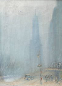
Johann Berthelsen (American, 1883-1972) - Brooklyn BridgeFreeman's | Hindman4.5(158)See Sold PriceFeb 28, 2024
Johann Homann Hand-Colored Map Engraving, c. 1730Auctions at Showplace4.6(740)See Sold PriceMar 17, 2024
Rare wobbly pagoda with clock and mechanismDr. Fischer Fine Art Auctions4.5(110)See Sold PriceMar 09, 2024
1750 GERMAN HISTORY ILLUSTRATED antique De origine Germanorum eorumque vetustisJasper524.5(9.9k)See Sold PriceFeb 28, 2024
1736 LARGE MAP OF SILESIA POLAND OPPAVIENSIS antique 25 by 34 3/4"Jasper524.5(9.9k)See Sold PriceFeb 28, 2024
1730 BIBLE in LATIN & GERMAN MASSIVE FOLIO PIGSKIN BINDING antique BIBLIA SACRAJasper524.5(9.9k)See Sold PriceFeb 28, 2024
1730 ANTIQUE ANACLETO REIFFENSTUEL VELLUM BOUND FOLIO 9.5 x 13.5" 18th CENTURYJasper524.5(9.9k)See Sold PriceFeb 28, 2024
1736 LARGE MAP OF SILESIA POLAND KARNOVIENSIS antique 25 x 4 3/4" Duchy of KrnovJasper524.5(9.9k)See Sold PriceFeb 28, 2024