ATLAS of ANTIENT GEOGRAPHY by SAMUEL BUTLER 1843John McInnis Auctioneers,LLC4.5(505)See Sold PriceFeb 24, 2024
18TH C. ANTIQUE MAP: FRENCH & INDIAN WAR, FRAMEDThomaston Place Auction Galleries4.4(393)See Sold PriceFeb 24, 2024
Rand McNally Railroad Map Cabinet w/ 21 Railroad MapsRail & Road Auctions4.6(165)See Sold PriceMar 08, 2024
Keith Haring - Ink on New York Map, Best Buddies, Inscribed, Signed, and DatedSapphire Auction Gallery4(67)See Sold PriceMar 02, 2024
LATE 17TH C. FRENCH MAP OF THE NEW WORLD BY ALEXIS-HUBERT JAILLOT (1632-1712)Thomaston Place Auction Galleries4.4(393)See Sold PriceFeb 24, 2024
Central Railroad of New Jersey Map of Sandy Hook Route-ca. 1903JM Hobby Supply and Railroad Artifact Auctions4.4(127)See Sold PriceFeb 24, 2024
Lot of Six Mixed Atlas Box Cars-HO Scale-New in BoxJM Hobby Supply and Railroad Artifact Auctions4.4(127)See Sold PriceFeb 25, 2024
Rand McNally/Santa Fe Railroad Map of Iowa-1912JM Hobby Supply and Railroad Artifact Auctions4.4(127)See Sold PriceFeb 24, 2024
NICOLAES VISSCHER (NETHERLANDS, 1618-1709) MAP OF THE NEW WORLDThomaston Place Auction Galleries4.4(393)See Sold PriceFeb 24, 2024
17TH C. WORLD MAP BY NICOLAES VISSCHER (NETHERLANDS, 1618-1709)Thomaston Place Auction Galleries4.4(393)See Sold PriceFeb 24, 2024
Lot of Six Mixed Atlas Cabooses-HO Scale-New in BoxJM Hobby Supply and Railroad Artifact Auctions4.4(127)See Sold PriceFeb 25, 2024
1730 antique MAP of GERMANY Netherlands Belgium Luxemburg 18th CENTURYNetherlands, Belgium, Luxemburg Tabula generalis totius Belgii qua Provinciae XVII Infer. Germania olim sub S.R.I. Vircula Burgundiae by Homann, Johann Baptist, 1663-1724 Nuremberg, 1730 Size 20.5 bySee Sold Price
1730 antique MAP of GERMANY Netherlands Belgium Luxemburg 18th CENTURYNetherlands, Belgium, Luxemburg Tabula generalis totius Belgii qua Provinciae XVII Infer. Germania olim sub S.R.I. Vircula Burgundiae by Homann, Johann Baptist, 1663-1724 Nuremberg, 1730 Size 20.5 bySee Sold Price
1720 antique MAP of GERMANY 18th CENTURY Lower Saxony & North Rhine-WestphaliaCirculi Westphaliae in omnes suos Status et Provincias… 18th century coloured map of Lower Saxony and North Rhine-Westphalia by by Johann Baptist Homann. Shows the area between Hamburg, Cologne,See Sold Price
1720 antique MAP of GERMANY 18th CENTURY Lower Saxony & North Rhine-WestphaliaCirculi Westphaliae in omnes suos Status et Provincias… 18th century coloured map of Lower Saxony and North Rhine-Westphalia by by Johann Baptist Homann. Shows the area between Hamburg, Cologne,See Sold Price
Sold(6) antique maps: Turcicum, Belgium, Stiria, etc.(6) antique maps: Turcicum, Belgium, Stiria, etc., 17th/18th century, largest: 21" x 24.5", unframedSee Sold Price
Sold(6) antique maps: Spain, Germany, Austria, etc.(6) antique maps: Spain, Germany, Austria, etc., 17th/18th century, largest: 21.5" x 26.5", unframedSee Sold Price
Fragment of an antique Flamish Gobelin - VerdureFragment of an antique Flamish Gobelin - Verdure, The Netherlands/Belgium, ca. 18th century AD. Handwoven in wool, depicting a pair of cranes in an ideal lush landscape. Dimensions: 67,3 x 62,5 in. DSee Sold Price
Sold(2) antique hand-colored maps: Austria and Germany(2) antique hand-colored maps: Austria and Germany, 17th/18th century, incl. Seutter, larger: 21.5" x 26.75", unframedSee Sold Price
Sold(2) antique hand-colored maps: Germany and Danube(2) antique hand-colored maps: Germany and Danube, 17th/18th century, Homann and Covens & Mortier, larger: 21" x 25.75", unframedSee Sold Price
SoldAntique Map Dunkirk & Ypres BelgiumDESCRIPTION: Map of Dunkirk and Ypres, Belgium. Hand colored copperplate engraving. 17th/18th century. Unmarked as to maker. MEASUREMENTS: 24-3/8" x 28-1/2". CONDITION: Fold marks as issued. 1" tear tSee Sold Price
Antique Map Dunkirk & Ypres BelgiumDESCRIPTION: Map of Dunkirk and Ypres, Belgium. Hand colored copperplate engraving. 17th/18th century. Unmarked as to maker. MEASUREMENTS: 24-3/8" x 28-1/2". CONDITION: Fold marks as issued. 1" tear tSee Sold Price
de Fer: Antique Map of Manheim, Germany, 1705TITLE/CONTENT OF MAP: 'Manheim [Mannheim]' DATE PRINTED: 1705 IMAGE SIZE: Approx 18.5 x 25.5cm, 7.25 x 10 inches (Medium) TYPE: Early 18th century copperplate map CONDITION: Good; suitable for framingSee Sold Price
18th C. Dutch & German Hallmarked Pewter Plates, 2Western Europe, Netherlands / Belgium or Germany, ca. 18th to early 19th century CE. A fine pair of pewter serving plates with continental patterns and touchmarks on the underside. The smaller is markSee Sold Price
SoldAntique Maps Northern Europe BelgiumFramed antique maps: ''Tabula Episcopatuum Leodiensis et Coloniensis,'' after Theodore Danckerts, and ''Leodium/Liege'', each plate inscribed, largest overall: 22''h x 25''w. 18th/19th centurySee Sold Price
SoldAntique 18th Century European Hutch Heavily CarvedMade in either Belgium or Germany. Looks 18th century possibly. 2 shelves for the cabinet on top and one for the base. Excellent carving. Hand pegged and pinned with planed panels. Excellent quality.See Sold Price
Vandermaelen: Antique Map of Northwest Europe, 1827TITLE/CONTENT OF MAP: 'Europe - Royaume des Pays-Bas - No 13 ' The north-western part of continental Europe, including modern-day Belgium and the Netherlands, western Germany, and north-eastern FranceSee Sold Price
SoldTWO 18TH CENTURY MAPS OF GERMANYTwo antique hand-colored lithograph maps. The first reads, "Palatinatus Inferior, sive Electroratus Palatinus ad Rhenum ... Cura et Studio Tobae Conradt Lotter, Geographi et Chalcographi Augustani" (sSee Sold Price
SoldTwo historical maps of the 18th century, Germany andTwo historical maps of the 18th century, Germany and Denmark, ''Imperium Romano-Germanicum ...'' (Central Germany). Copper engraving, Matthias Seutter c. 1730, ''Regni Daniae ...'', copperplate engravSee Sold Price
SoldASSORTED 18TH CENTURY MAPS, LOT OF FIVEASSORTED 18TH CENTURY MAPS, LOT OF FIVE, engravings on paper, including Jedidiah Morse "A General Map of North America from the best Authorities", England/Wales, Germany and Belgium. Not framed. 1745-See Sold Price
Sold9 European Maps, Fricx, 18th CenturyAfter Eugene Henri Fricx (France, 1644-1730), nine (9) engraved European maps, published c. 1745, from Covens and Mortier's "ATLAS DES PAYS BAS...." Some of the maps first appeared in Eugene Fricx's TSee Sold Price
SoldAntique French Copper Engraved Colored Map, Amsterdam18th century antique French copper engraved and hand colored maps of Amsterdam, Netherlands titled "Lemouicum, Auctore Jo. Faiano M.L. - Lymosin [on sheet with] Topographia Limaniae, Auctore GabrieleSee Sold Price
Gallia Vetus. Ancient Gaul. France Belgium Switzerland.TITLE/CONTENT OF MAP: Gallia Vetus [Ancient Gaul] DATE PRINTED: 1789 IMAGE SIZE: Approx 24.5 x 36.0cm, 9.5 x 14.25 inches (Large); Please note that this is a folding map. TYPE: Antique 18th century coSee Sold Price
SoldAntique Printed Europe Map Group18th-19th century AD. A mixed group comprising: a small map of the 'South East part of Germany', by Gibson (1774); a double-page coloured map of 'Prussia' by J. Rapkin; a hand-coloured map of 'FranceSee Sold Price
Early 18th Century German Map of Frisia, c. 1730Early 18th German Century Map of Frisia, c. 1730, the hand colored map entitled "Tabula Frisiae orientalis: olim Vbbonis Emmii deinde Sansonis et Allardi study notes cum variis autographis denuo sizedSee Sold Price
18th Century Hess Germany Hand colored Engraved MapGlobal Auctions Company4.3(36)See Sold PriceMar 03, 2024
1730 ANTIQUE ANACLETO REIFFENSTUEL VELLUM BOUND FOLIO 9.5 x 13.5" 18th CENTURYJasper524.5(9.9k)See Sold PriceFeb 27, 2024
La Basse-Guinée… Loango, Congo, AngoIa & Benguela Southern Africa BONNE 1790 mapJasper524.5(9.9k)See Sold PriceFeb 28, 2024
États du Roi de Maroc… d’Alger, Tunis & Tripoli. North Africa. BONNE 1790 mapJasper524.5(9.9k)See Sold PriceFeb 28, 2024
Le Canal de Mosambique, l'Isle de Madagascar… Mozambique. Africa. BONNE 1788 mapJasper524.5(9.9k)See Sold PriceFeb 28, 2024
Royaumes, Etats et Pays de la Haute Guinée. Gulf of Guinea. BONNE 1788 old mapJasper524.5(9.9k)See Sold PriceFeb 28, 2024
La Nubia ed Abissinia. Red Sea Ethiopia Sudan Eritrea Arabia. ZATTA 1785 mapJasper524.5(9.9k)See Sold PriceFeb 28, 2024
Le Royaume d’Adel… Ajan & Zanguebar. Adal Ajuran. Kenya Tanzania. BONNE 1788 mapJasper524.5(9.9k)See Sold PriceFeb 28, 2024
Le Canal de Mosambique, l'Isle de Madagascar… Mozambique. Africa. BONNE 1790 mapJasper524.5(9.9k)See Sold PriceFeb 28, 2024
Partie Occidentale de l’Afrique. West Africa coast Canary islands BONNE 1788 mapJasper524.5(9.9k)See Sold PriceFeb 28, 2024
Le Royaume d’Adel… Ajan & Zanguebar. Adal Ajuran. Kenya Tanzania. BONNE 1790 mapJasper524.5(9.9k)See Sold PriceFeb 28, 2024
États du Roi de Maroc… d’Alger, Tunis & Tripoli. North Africa. BONNE 1788 mapJasper524.5(9.9k)See Sold PriceFeb 28, 2024
La Basse-Guinée… Loango, Congo, AngoIa & Benguela Southern Africa BONNE 1788 mapJasper524.5(9.9k)See Sold PriceFeb 28, 2024
Egypte, Nubie et Abissinie. Egypt, Nubia & Abyssinia. Sudan. BONNE 1788 mapJasper524.5(9.9k)See Sold PriceFeb 28, 2024
ANTIQUE ROMAN ARMORIAL VELLUM BINDING, 1744, ILLUSTRATED WITH AN ANTIQUE MAP BY FLORUSNY Elizabeth 4.2(86)See Sold PriceMar 03, 2024
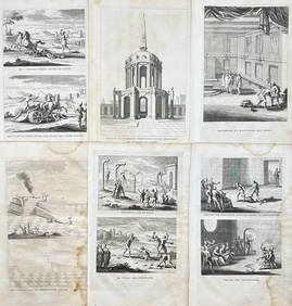
Antoine Augustin Calmet (1672-1757) - Set of 6 Religious Engravings - Tomb of Zechariah - Grotto ofProverde Auctions4.3(3)See Sold PriceFeb 28, 2024
Antoine Augustin Calmet (1672-1757) - Set of 6 Jewish Engravings - Tomb monument of the kings ofProverde Auctions4.3(3)See Sold PriceFeb 28, 2024
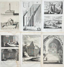
Antoine Augustin Calmet (1672-1757) - Set of 6 Architecture Engraving - Temple of Jerusalem -Proverde Auctions4.3(3)See Sold PriceFeb 28, 2024
The Last Coins of Europe 12 Coins Set - Spain, Portugal, France, Italy, Ireland, Belgium, Luxemburg,Andrew's Coin & Jewelry4.5(209)See Sold PriceMar 07, 2024