ATLAS of ANTIENT GEOGRAPHY by SAMUEL BUTLER 1843John McInnis Auctioneers,LLC4.6(502)See Sold PriceFeb 24, 2024
18TH C. ANTIQUE MAP: FRENCH & INDIAN WAR, FRAMEDThomaston Place Auction Galleries4.4(386)See Sold PriceFeb 24, 2024
Rand McNally Railroad Map Cabinet w/ 21 Railroad MapsRail & Road Auctions4.6(165)See Sold PriceMar 08, 2024
Keith Haring - Ink on New York Map, Best Buddies, Inscribed, Signed, and DatedSapphire Auction Gallery4(67)See Sold PriceMar 02, 2024
LATE 17TH C. FRENCH MAP OF THE NEW WORLD BY ALEXIS-HUBERT JAILLOT (1632-1712)Thomaston Place Auction Galleries4.4(386)See Sold PriceFeb 24, 2024
Central Railroad of New Jersey Map of Sandy Hook Route-ca. 1903JM Hobby Supply and Railroad Artifact Auctions4.4(126)See Sold PriceFeb 24, 2024
Lot of Six Mixed Atlas Box Cars-HO Scale-New in BoxJM Hobby Supply and Railroad Artifact Auctions4.4(126)See Sold PriceFeb 25, 2024
Rand McNally/Santa Fe Railroad Map of Iowa-1912JM Hobby Supply and Railroad Artifact Auctions4.4(126)See Sold PriceFeb 24, 2024
NICOLAES VISSCHER (NETHERLANDS, 1618-1709) MAP OF THE NEW WORLDThomaston Place Auction Galleries4.4(386)See Sold PriceFeb 24, 2024
17TH C. WORLD MAP BY NICOLAES VISSCHER (NETHERLANDS, 1618-1709)Thomaston Place Auction Galleries4.4(386)See Sold PriceFeb 24, 2024
Lot of Six Mixed Atlas Cabooses-HO Scale-New in BoxJM Hobby Supply and Railroad Artifact Auctions4.4(126)See Sold PriceFeb 25, 2024
SoldHendrik Hondius Map of Tierra del Fuego and StraiHendrik Hondius (1588-1651) "Freti Magellanici ac novi Freti vulgo Le Maire exactissima delineatio," Amsterdam, ca. 1630. This hand colored map depicts the southern tip of South America, featuring TieSee Sold Price
Sold[Hondius (Henricus)] Freti Magellanici[Hondius (Henricus)] Freti Magellanici ac novi Freti vulgo Le Maire exactissima delineatio, engraved map of southern South America showing the Magellan Straits, part of Tierra del Fuego, penguSee Sold Price
SoldLucini Magellan Map Tierra del FuegoAntonio Francesco Lucini (1610-ca. 1661), Sir Robert Dudley (1574-1649), and Francesco Onofri (fl. 1631-1679), "Carta particolare dello Stretto di Magellano e di Maire," Florence: Francesco Onofri, 16See Sold Price
MAP, Tierra del Fuego, RogerTierra del Fuego. E. Roger, Cote Meridional de la Terre del Fuego, from Recueil des Voiages qui ont Servi a l'Etablissement..., 1705 (published). Black & White. This rare small chart of Tierra del FueSee Sold Price
Antique Map - Tierra del Fuego - Le Maire Strait - Bay of Good Success - J. CookThis captivating engraving map by Captain James Cook originates from "An Account of the Voyages Undertaken by the Order of His Present Majesty for Making Discoveries in the Southern Hemisphere" by JohSee Sold Price
SoldAntique Italian Map of Tierra del Fuego, 1750Map: Tierra del Fuogo Cartographer: anonymous Place & Date: Venice / 1750 Size: 9 7/8" x 7 1/4" Condition: some wrinkling, otherwise in beautiful condition A superbly designed and colored MagellanicaSee Sold Price
SoldBlaeu Map of Tierra del Fuego or Magellanica 1650Willem Janszoon Blaeu (1571-1638), "Tabvla Magellanica qua Tierrae del fuego, cum beleberrimis fretis a F. Magellano et I. Le Maire detectis novissima et accuratissima descriptio exhibetur," AmsterdamSee Sold Price
SoldManuscript Map of Tierra del FuegoAmerican Sea Captain, Unknown Manuscript Chart of "Isla de los Estados" or "Staten Island" (Tierra del Fuego). Manuscript Map, Pen and Ink on Paper. c. 1810. 10" x 16" sheet, 12 1/2" x 18 1/2" framed.See Sold Price
A New and Accurate Map of Chili, Bowen, 1750Bowen's wonderfully detailed map of southern South America from his A Complete System of Geography. Includes an inset map of Tierra del Fuego and a plan of Santiago, capital of Chile. Cartographer: BoSee Sold Price
SoldGrp: 13 Maps of South AmericaGroup of thirteen maps of South America. Includes six overall maps of the continent; three maps of Chile and Argentina; two maps of the Straits of Magellan; one map of Tierra del Fuego; and one map ofSee Sold Price
SoldJANSSONIUS, JOHANNES. Tabula Magellanica Qua TierraeJANSSONIUS, JOHANNES. Tabula Magellanica Qua Tierrae del Fuego. Double-page engraved map of Tierra del Fuego with abundant local figure and fauna ornamentation. 20x23 inches sheet size, wide margins,See Sold Price
SoldSouth America.- Jansson (Jan) Freti Magellanici ac noviSouth America.- Jansson (Jan) Freti Magellanici ac novi Freti vulgo Le Maire exactissim delineatio, map of Tierra del Fuego and the Strait of Magellan, engraving on laid paper without visible watermarSee Sold Price
TWO LATE 18TH C. RIGOBERT BONNE DOUBLE SIDED MAPSTwo Rigobert Bonne (French 1727-1794), double sided maps, late 1780s, etching on paper comprising one map of the Tierra del Fuego and South Atlantic Islands and one map of the Strait of Magellan and TSee Sold Price
Jansson: Map Straits of Magellan, Tierra del Fuego 1640Map: Tabula Magellanica Qua Tierrae del Fuego Cartographer: Jansson Place & Date: Amsterdam / 1640 Size: 21 1/4" x 16 3/8" Jansson's superbly decorative chart of the strategic Straits of Magellan andSee Sold Price
SoldMallet: Map of South America, 1683Map Title: 'Païs qui sont aux environs de la riviere de la Plata et du païs des Patagons' SOUTH AMERICA, The Map runs from Brazil to Tierra del Fuego. Brazil Peru Chile Patagonia Tribes Date PrintedSee Sold Price
SOUTH AMERICA. La Plata. Brazil Peru Chile PatagoniaTITLE OF THE MAP: 'Païs qui sont aux environs de la riviere de la Plata et du païs des Patagons' The Map runs from Brazil to Tierra del Fuego. DATE PRINTED: 1683 IMAGE SIZE: Approx Overall page sizeSee Sold Price
Mallet: Antique Map of South America, 1683TITLE OF THE MAP: 'Païs qui sont aux environs de la riviere de la Plata et du païs des Patagons' The Map runs from Brazil to Tierra del Fuego. SOUTH AMERICA. La Plata. Brazil Peru Chile Patagonia TrSee Sold Price
South-Eastern part of Tierra del Fuego with StatenTitle/Content of Map: South-Eastern part of Tierra del Fuego with Staten Island, Cape Horn and Diego Ramirez Islands Date Printed: 1841-03-16 Cartographer: Robert Fitz Roy, J. & C. Walker Size: 24X37.See Sold Price
FALKLAND ISLANDS & PATAGONIA. Cape Horn.Tierra delTITLE/CONTENT OF MAP: 'Falkland Islands & Patagonia' Vignettes: Jason Islands; Penguins; Sea Eagles; Fugeans; Christmas Sound - Tierra del Fuego. 2 maps on 1 sheet. Patagonia is stated to be "InhabiteSee Sold Price
Tallis/Rapkin: Antique Map Falkland Islands & PatagoniaTITLE/CONTENT OF MAP: 'Falkland Islands & Patagonia' Vignettes: Jason Islands; Penguins; Sea Eagles; Fugeans; Christmas Sound - Tierra del Fuego. 2 maps on 1 sheet. Patagonia is stated to be "InhabiteSee Sold Price
SOUTH AMERICA. La Plata. Brazil Peru Chile PatagoniaTITLE OF THE MAP: 'Païs qui sont aux environs de la riviere de la Plata et du païs des Patagons' The Map runs from Brazil to Tierra del Fuego. The top image on the right hand side shows the entire mSee Sold Price
SOUTH AMERICA. La Plata. Brazil Peru Chile PatagoniaTITLE OF THE MAP: 'Païs qui sont aux environs de la riviere de la Plata et du païs des Patagons' The Map runs from Brazil to Tierra del Fuego. DATE PRINTED: 1683 IMAGE SIZE: Approx Overall page sizeSee Sold Price
SOUTH AMERICA. La Plata. Brazil Peru Chile PatagoniaTITLE OF THE MAP: 'Païs qui sont aux environs de la riviere de la Plata et du païs des Patagons' The Map runs from Brazil to Tierra del Fuego. DATE PRINTED: 1683 IMAGE SIZE: Approx Overall page sizeSee Sold Price
FALKLAND ISLANDS & PATAGONIA. Cape Horn.Tierra delTITLE/CONTENT OF MAP: 'Falkland Islands & Patagonia' Vignettes: Jason Islands; Penguins; Sea Eagles; Fugeans; Christmas Sound - Tierra del Fuego. 2 maps on 1 sheet. Patagonia is stated to be "InhabiteSee Sold Price
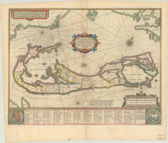
RARE 1638 HONDIUS MAP OF BERMUDA, FRAMEDThomaston Place Auction Galleries4.4(386)See Sold PriceFeb 24, 2024
[MAP]. [ALBRIZZI, Giambatista, 1698-1777]. Carta Geografica...Potter & Potter Auctions4.6(539)See Sold PriceMar 07, 2024
1760 MAP CARTE PARTICULIERE DE L'ISLE DE JUAN FERNANDES antique Robinson CrusoeJasper524.5(9.8k)See Sold PriceFeb 27, 2024
1636 MAP of SWITZERLAND DAS WIFISPURGERGOU antique 15 by 19"Jasper524.5(9.8k)See Sold PriceFeb 27, 2024
Blackie (Pub) 1882 Folio Print. Aborigines of South America. Brazil Patogonia Tierra del FuegoAlbion Auctions4.6(336)See Sold PriceMar 07, 2024
AFRICA. Posesione Espanola Costa Occidental Bioko Rio Oro Fernando Po 1913 mapJasper524.5(9.8k)See Sold PriceFeb 28, 2024
Coste Orientale d’Afrique…' South Africa. Mozambique channel. BELLIN 1746 mapJasper524.5(9.8k)See Sold PriceFeb 28, 2024
East coast of Africa from the Cape… South Africa Mozambique. CHILD 1745 mapJasper524.5(9.8k)See Sold PriceFeb 28, 2024
Coste Orientale d’Afrique'. South Africa Mozambique BELLIN/SCHLEY 1747 mapJasper524.5(9.8k)See Sold PriceFeb 28, 2024
Antique Map - Views on the coast of Asia. J. Webber del. Engraved after J. Webber and W. Bligh.Proverde Auctions4.3(3)See Sold PriceFeb 28, 2024
Antique Map of France, 1703 by Gillaume Del Isle PrintAntiques Online Auctions4.6(407)See Sold PriceMar 14, 2024


![[Hondius (Henricus)] Freti Magellanici (1 of 1)](https://p1.liveauctioneers.com/410/3027/1300321_1_x.jpg?height=282&quality=70)


![[MAP]. [ALBRIZZI, Giambatista, 1698-1777]. Carta Geografica... (1 of 1)](https://p1.liveauctioneers.com/928/318880/171361280_1_x.jpg?height=282&quality=70&version=1707501302)