ATLAS of ANTIENT GEOGRAPHY by SAMUEL BUTLER 1843John McInnis Auctioneers,LLC4.6(504)See Sold PriceFeb 24, 2024
18TH C. ANTIQUE MAP: FRENCH & INDIAN WAR, FRAMEDThomaston Place Auction Galleries4.4(389)See Sold PriceFeb 24, 2024
Rand McNally Railroad Map Cabinet w/ 21 Railroad MapsRail & Road Auctions4.6(165)See Sold PriceMar 08, 2024
Keith Haring - Ink on New York Map, Best Buddies, Inscribed, Signed, and DatedSapphire Auction Gallery4.1(67)See Sold PriceMar 02, 2024
LATE 17TH C. FRENCH MAP OF THE NEW WORLD BY ALEXIS-HUBERT JAILLOT (1632-1712)Thomaston Place Auction Galleries4.4(389)See Sold PriceFeb 24, 2024
Central Railroad of New Jersey Map of Sandy Hook Route-ca. 1903JM Hobby Supply and Railroad Artifact Auctions4.4(126)See Sold PriceFeb 24, 2024
Lot of Six Mixed Atlas Box Cars-HO Scale-New in BoxJM Hobby Supply and Railroad Artifact Auctions4.4(126)See Sold PriceFeb 25, 2024
Rand McNally/Santa Fe Railroad Map of Iowa-1912JM Hobby Supply and Railroad Artifact Auctions4.4(126)See Sold PriceFeb 24, 2024
NICOLAES VISSCHER (NETHERLANDS, 1618-1709) MAP OF THE NEW WORLDThomaston Place Auction Galleries4.4(389)See Sold PriceFeb 24, 2024
17TH C. WORLD MAP BY NICOLAES VISSCHER (NETHERLANDS, 1618-1709)Thomaston Place Auction Galleries4.4(389)See Sold PriceFeb 24, 2024
Lot of Six Mixed Atlas Cabooses-HO Scale-New in BoxJM Hobby Supply and Railroad Artifact Auctions4.4(126)See Sold PriceFeb 25, 2024
SoldGrp: 12 Regional Maps of AfricaGroup of twelve 18th and 19th c. regional maps of Africa. Includes two maps of the North African coast; one map of Madagascar; one page with seven inset maps of the major islands of Africa; one map ofSee Sold Price
SoldGrp: 11 Maps of ItalyGroup of eleven maps of Italy. Philipp Cluver map of Italy "Italiae Antiquae Delineatio" W. Poyntell & Co.; Barlow map of "Italy from the Best Authorities" C.Brightly & T.Kinnersley, Suffolk, 1806; JeSee Sold Price
SoldGrp: 11 Maps of FranceGroup of eleven maps of France. The group includes a canvas backed map with informational tables "La France divisee En Ses Principaux Gouvernements Avec toutes les Routes de ce Royaume. Dressee Sur leSee Sold Price
SoldGrp: 11 Maps of the British Isles w/ 1 Map ParmaGroup of ten maps of various regions of the British Isles, primarily dating from the 19th century. Includes one Thomas Kitchin (1718–1784) map of Leith, Ireland; one map of the rivers and canalSee Sold Price
SoldBaldwin & Cradock / SDUK: 12 Maps of India, 1835Map: India (11 regional maps + index map) Cartographer: Baldwin & Cradock; Society for the Diffusion of Useful Knowledge Place & Date: London / 1835 Size: 13 3/4" x 16 3/8" [each sheet Condition: b&w;See Sold Price
SoldGrp: 4 Regional Maps Blaeu OrteliusGroup of four hand colored regional maps. Includes three maps by Willem Janszoon Blaeu (1571-1638), "Prima pars Brabantiae cuius caput Lovanium," a map depicting Tienen and Leuven in Belgium, and "ComSee Sold Price
SoldGrp: 5 Maps of Africa Jaillot DelisleGroup of five maps of Africa. Includes Hubert Jaillot (1632-1712), "L'Afrique divisee suivant l'estendue de ses principales parties, ou sont distingues les uns des autres les Empires, Monarchies, RoyaSee Sold Price
SoldGrp: 10 Maps of Africa 17th-19th c.Ten maps of Africa by cartographers including Pierre Duval (1618–1683), F. Von. Stulpnagel, Emanuel Bowen (1693-1767), and Abraham Ortelius (1527-1598). Includes three maps of Morocco and thSee Sold Price
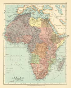
Sold1872 Map of AfricaAuthor: Bartholomew Title: 1872 Map of Africa Medium: Ink on paper Dimensions: 11"X13" Map of Africa dated 1872. Engraved for John Bartholomew and co. Published in Edinburgh and London. Map key locateSee Sold Price
1918 Map of AfricaAuthor: McNally Title: 1918 Map of Africa Medium: Ink on Paper Dimensions: 11"X14" Map of Africa dated 1918. Published by Rand McNally and Co. in Chicago. Part of the World Atlas and Gazeteer. DetaileSee Sold Price
SoldMiscellany.- - A mixed group of smaller maps of worldthe first group mostly 16th to 18th century, including regional and general maps Africa, India, Antarctica, the Mediterranean, Portugal, France and Italy, by or after Moll, Morden, van den Keere and oSee Sold Price
1836 Tanner Map Of EgyptMap by H S Tanner, 1836, Philadelphia, 14 x 11.5 in. Detailed regional map of Egypt, centered on the Nile. The map shows remarkable detail as to rivers, islands, mountains, gulfs, bays, deserts, townsSee Sold Price
SoldWest Indies from The Best Authorities.Title/Content of Map: West Indies from The Best Authorities. Date: c1790 Cartographer: LODGE, JOHN Publisher: POLITICAL MAGAZINE Size: 6.75Height - 11.75Width A general regional map with a few place nSee Sold Price
Sold1918 Map of AfricaTitle: 1918 Map of Africa Author: McNally Medium: Ink on Paper Dimensions: 11"X14" Description: Map of Africa dated 1918. Published by Rand McNally and Co. in Chicago. Part of the World Atlas and GazeSee Sold Price
1918 Map of AfricaAuthor: McNally Title: 1918 Map of Africa Medium: Ink on Paper Dimensions: 11"X14" Description: Map of Africa dated 1918. Published by Rand McNally and Co. in Chicago. Part of the World Atlas and GazeSee Sold Price
1836 Tanner Map of Egypt -- Egypt &c.Reserve Reduced! Title/Content of Map: 1836 Tanner Map of Egypt -- Egypt &c. Date: 1836, Philadelphia Cartographer: H S Tanner Size: 14 x 11.5 in. Detailed regional map of Egypt, centered on the Nile.See Sold Price
1836 Tanner Antique Map of EgyptTitle/Content of Map: 1836 Tanner Map of Egypt -- Egypt &c. Date Printed: 1836, Philadelphia Cartographer: H S Tanner Size: 14 x 11.5 in. Detailed regional map of Egypt, centered on the Nile. The mapSee Sold Price
1918 Map of AfricaAuthor: McNally Title: 1918 Map of Africa Medium: Ink on Paper Dimensions: 11"X14" Description: Map of Africa dated 1918. Published by Rand McNally and Co. in Chicago. Part of the World Atlas and GazeSee Sold Price
1836 Tanner Map of Egypt -- Egypt &c.Title/Content of Map: 1836 Tanner Map of Egypt -- Egypt &c. Date: 1836, Philadelphia Cartographer: H S Tanner Size: 14 x 11.5 in. Detailed regional map of Egypt, centered on the Nile. The map shows reSee Sold Price
1836 Tanner Map of Egypt -- Egypt &c.Title/Content of Map: 1836 Tanner Map of Egypt -- Egypt &c. Date Printed: 1836, Philadelphia Cartographer: H S Tanner Size: 14 x 11.5 in. Detailed regional map of Egypt, centered on the Nile. The mapSee Sold Price
West Indies from The Best Authorities.Title: West Indies from The Best Authorities. Publication Date: c1790 Cartographer: LODGE, JOHN Publisher: POLITICAL MAGAZINE Size: 6.75Height - 11.75Width A general regional map with a few place nameSee Sold Price
FRENCH COLONIAL CHAD & UBANGI-SHARI (C.A.R.). Oubangui-Chari Tchad 1931 mapJasper524.5(9.8k)See Sold PriceFeb 28, 2024
AFRICA. Antiqua; Rome Carthage, start Punic War 1908 old antique map chartJasper524.5(9.8k)See Sold PriceFeb 28, 2024
Northern & Southern Africa. Maghreb. Orange River Sovereignty. HALL 1854 mapJasper524.5(9.8k)See Sold PriceFeb 28, 2024
ANCIENT AFRICA cum Aegypto et Insulis. Nigritae Aethiopia. ARROWSMITH 1828 mapJasper524.5(9.8k)See Sold PriceFeb 28, 2024
Carte du Golfe de Guinée'. Gulf of Guinea. Nigeria & Cameroon. BELLIN 1747 mapJasper524.5(9.8k)See Sold PriceFeb 28, 2024
FRENCH COLONIAL CHAD & UBANGI-SHARI (C.A.R.). Oubangui-Chari Tchad 1938 mapJasper524.5(9.8k)See Sold PriceFeb 28, 2024
AFRICA. Posesione Espanola Costa Occidental Bioko Rio Oro Fernando Po 1913 mapJasper524.5(9.8k)See Sold PriceFeb 28, 2024
FRENCH COLONIAL CHAD & UBANGI-SHARI (C.A.R.). Oubangui-Chari Tchad 1929 mapJasper524.5(9.8k)See Sold PriceFeb 28, 2024
Algeria Morocco & Tunis. North Africa. Tunisia. Maghreb. BARTHOLOMEW 1898 mapJasper524.5(9.8k)See Sold PriceFeb 28, 2024
Young Alligator, drawn in London October 1739. Shark. Catfish 1746 old printJasper524.5(9.8k)See Sold PriceFeb 28, 2024
Early colonial Africa. Inset Madeira & Aden. SIDNEY HALL 1856 old antique mapJasper524.5(9.8k)See Sold PriceFeb 28, 2024
Pre-SECOND WORLD WAR AFRICA. European colonies & German mandates 1942 old mapJasper524.5(9.8k)See Sold PriceFeb 28, 2024
Northern & Southern Africa. Maghreb. Orange River Sovereignty. HALL 1856 mapJasper524.5(9.8k)See Sold PriceFeb 28, 2024
Africa. French West/Equatorial. Tanganyika Belgian Congo. STANFORD c1925 mapJasper524.5(9.8k)See Sold PriceFeb 28, 2024
Carte du Golfe de Guinée. Gulf of Guinea Nigeria Cameroon BELLIN/SCHLEY 1748 mapJasper524.5(9.8k)See Sold PriceFeb 28, 2024
Afrique…Nord-Ouest' & 'Inde' by Meissas. N Africa India Singapore 1861 old mapJasper524.5(9.8k)See Sold PriceFeb 28, 2024
Early colonial Africa. Inset Madeira & Aden. SIDNEY HALL 1854 old antique mapJasper524.5(9.8k)See Sold PriceFeb 28, 2024
Suite de la Coste de Guinée'. Ghana Togo Benin coast. Whidah. BELLIN 1747 mapJasper524.5(9.8k)See Sold PriceFeb 28, 2024