ATLAS of ANTIENT GEOGRAPHY by SAMUEL BUTLER 1843John McInnis Auctioneers,LLC4.5(505)See Sold PriceFeb 24, 2024
18TH C. ANTIQUE MAP: FRENCH & INDIAN WAR, FRAMEDThomaston Place Auction Galleries4.4(393)See Sold PriceFeb 24, 2024
Rand McNally Railroad Map Cabinet w/ 21 Railroad MapsRail & Road Auctions4.6(165)See Sold PriceMar 08, 2024
Keith Haring - Ink on New York Map, Best Buddies, Inscribed, Signed, and DatedSapphire Auction Gallery4(67)See Sold PriceMar 02, 2024
LATE 17TH C. FRENCH MAP OF THE NEW WORLD BY ALEXIS-HUBERT JAILLOT (1632-1712)Thomaston Place Auction Galleries4.4(393)See Sold PriceFeb 24, 2024
Central Railroad of New Jersey Map of Sandy Hook Route-ca. 1903JM Hobby Supply and Railroad Artifact Auctions4.4(127)See Sold PriceFeb 24, 2024
Lot of Six Mixed Atlas Box Cars-HO Scale-New in BoxJM Hobby Supply and Railroad Artifact Auctions4.4(127)See Sold PriceFeb 25, 2024
Rand McNally/Santa Fe Railroad Map of Iowa-1912JM Hobby Supply and Railroad Artifact Auctions4.4(127)See Sold PriceFeb 24, 2024
NICOLAES VISSCHER (NETHERLANDS, 1618-1709) MAP OF THE NEW WORLDThomaston Place Auction Galleries4.4(393)See Sold PriceFeb 24, 2024
17TH C. WORLD MAP BY NICOLAES VISSCHER (NETHERLANDS, 1618-1709)Thomaston Place Auction Galleries4.4(393)See Sold PriceFeb 24, 2024
Lot of Six Mixed Atlas Cabooses-HO Scale-New in BoxJM Hobby Supply and Railroad Artifact Auctions4.4(127)See Sold PriceFeb 25, 2024
SoldGrp: 11 Maps of the British Isles w/ 1 Map ParmaGroup of ten maps of various regions of the British Isles, primarily dating from the 19th century. Includes one Thomas Kitchin (1718–1784) map of Leith, Ireland; one map of the rivers and canalSee Sold Price
SoldGrp: 10 Maps of British Cities w/ 1 Map VeniceGroup of maps of British cities. Includes one map of Birmingham; two road maps for the London area: "A Map of the New Roads & c. from Westminster Bridge" and "A Plan of the intended New Road from PadiSee Sold Price
Sold19th c. Schoolgirl map of British IslesSchool girl map of the British Isles titled "Britain by C H." Title surrounded by a ring of roses. Hand colored ink and water color on paper. 11 5/8" H x 9" W. 19th Century. Provenance: Estate of SallSee Sold Price
All Original Ink And Watercolor British Isles Map In GcTitle: All original ink and watercolor British Isles map in GC Dimensions: Approximately 9" x 11 1/2" Provenance/Additional Information: (Some minor expected paper edges wear) Shipping: Domestic: FlatSee Sold Price
Sold(2) 19TH C. BRITISH ISLES MAPSLot of (2) Framed Engraved Maps, incl: North Wales, copper engraving by John Cary (1754-1835), London, publ July 1, 1812, with hand coloring, in a silvered molded wooden frame, with glass, OS: 11 1/4"See Sold Price
Bellin: Antique Map of Cape Verde Islands, 1746Map: Carte des Isles du Cap Verd Cartographer: Bellin Place & Date: Paris / 1746/1757 Size: 11" x 8 1/4" Condition: b&w; folds as issued; light overprinting Bellin's attractive and well detaileSee Sold Price
SoldBellin: Cape Verde IslandsReserve Reduced! Title of Map: Carte des Isles du Cap Verd Cartographer: Bellin Place / Date: Paris / 1746/1757 Size: 11" x 8 1/4" Condition: b&w; folds as issued; light overprinting Bellin's attractiSee Sold Price
Bellin: Cape Verde IslandsMap: Carte des Isles du Cap Verd Cartographer: Bellin Place/Date: Paris / 1746/1757 Size: 11" x 8 1/4" Condition: b&w; folds as issued. light overprinting Bellin's attractive and well detailed map ofSee Sold Price
Soldd’Anville: Hispaniola and Lower BahamasMap: Carte de l'Isle de Saint Domingue Cartographer: d'Anville Place & Date: Paris / 1731 Size: 16" x 11 1/4" Condition: b&w; light overall age toning, with folds as issued; a strong, dark impressionSee Sold Price
Bellin: Cayenne Island, French GuianaMap: Carte de l'Isle de Caienne Cartographer: Bellin Place & Date: Paris / 1753/1760 Size: 11" x 8 1/2" Condition: b&w; light overall age toning and few spots; a tiny, barely visible puncture hole inSee Sold Price
Bellin: Cayenne Island, French GuianaMap Title: Carte de l'Isle de CaienneCartographer: Bellin Place/Date: Paris / 1753/1760 Size: 11" x 8 1/2" Condition: b&w; light overall age toning and few spots; a tiny, barely visible puncture holeSee Sold Price
Bellin: Cayenne Island, French GuianaMap Title: Carte de l'Isle de Caienne Cartographer: Bellin Place/Date: Paris / 1753/1760 Size: 11" x 8 1/2" Condition: b&w; light overall age toning and few spots; a tiny, barely visible puncture holeSee Sold Price
Bellin: Cayenne Island, French GuianaMap Title: Carte de l'Isle de Caienne Cartographer: Bellin Place / Date: Paris / 1753/1760 Size: 11" x 8 1/2" Condition: b&w; light overall age toning and few spots; a tiny, barely visible puncture hoSee Sold Price
Bellin: Cayenne Island, French GuianaMap Title: Carte de l'Isle de Caienne Cartographer: Bellin Place / Date: Paris / 1753/1760 Size: 11" x 8 1/2" Condition: b&w; light overall age toning and few spots; a tiny, barely visible puncture hoSee Sold Price
SoldBellin: Classic Hispaniola MapMap Title: Carte de l'Isle de St. Domingue Cartographer: Bellin Place/Date: Paris / 1754/1760 Size: 11 1/2" x 7 5/8" Condition: b&w; light overall age toning; a tiny repaired puncture hole in the loweSee Sold Price
Montanus/Ogilby: View of Itamaraca Isle (Recife) BrazilTitle/Content of Map: I. Tamaraca Cartographer: Montanus / Ogilby Place & Date: London / 1671 Size: 13 7/8" x 11 1/4" Condition: b&w; overall age toning, some water staining along edges of wide marginSee Sold Price
SoldGrp: 4 Maps of Canada w/ 1 Map of the Indian OceaGroup of four maps of Canada, including "The River St. Lawrence accurately drawn from d'Anville's Map," London: John Harrison, ca. 1780; New York State Library, "Champlain's Map of New France 1632," NSee Sold Price
SoldGrp: Early Maps of North America w/ 1 Map EnglandGroup of early maps of North America with one map of England. Includes Louis Brion de la Tour (1743-1803), "Amerique Septentrionale, ou se remarquent les Etats Unis," Paris, 1779; John Melish (1771-18See Sold Price
SoldGrp: Maps of the British IslesGroup of maps of the British isles, featuring several lovely regional maps of Scotland, one map of Ireland, and several maps of England and Wales. With one map of France, featuring the English ChannelSee Sold Price
ANTIQUE MAGNA BRITANNIA MAP BRITISH ISLES & FRANCEANTIQUE MAGNA BRITANNIA MAP BRITISH ISLES AND FRANCE W 20" L 20":. For a high resolution photo CLICK HERESee Sold Price
SoldGrp: 11 Maps of ItalyGroup of eleven maps of Italy. Philipp Cluver map of Italy "Italiae Antiquae Delineatio" W. Poyntell & Co.; Barlow map of "Italy from the Best Authorities" C.Brightly & T.Kinnersley, Suffolk, 1806; JeSee Sold Price
SoldMoule, Thomas C1835 British Map. Isle of ManSteel Engraved Map Published C1835, London for "A Complete and Universal English Dictionary" by the Rev. James Barclay et al. Maps by Thomas Moule. Paper Size: 11 x 8.5 inch (28 x 22cm) Minor toning,See Sold Price
SoldArchibald Geikie - A large coloured geological map ofArchibald Geikie - A large coloured geological map of the British Isles, engraved by W and A.K. Johnson, Edinburgh 1864, with engravings of fossils (complete but needs backing and framing)See Sold Price
SoldZatta (Antonio) Li Regni D'Inghilterra e D'IrlandaZatta (Antonio) Li Regni D'Inghilterra e D'Irlanda,engraved map, with hand-colouring, 310 x 405mm, central vertical fold, Venice, 1776 or later; with 8 other maps, including 4 of the British ISee Sold Price
LATE 17TH C. FRENCH MAP OF THE NEW WORLD BY ALEXIS-HUBERT JAILLOT (1632-1712)Thomaston Place Auction Galleries4.4(393)See Sold PriceFeb 24, 2024
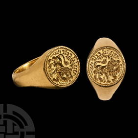
Medieval Gold Signet Ring with 'Indeed' Inscription and LionTimeLine Auctions Ltd.4.6(183)See Sold PriceMar 05, 2024
Tudor Period Large Bronze Glove Ring with Heraldic ArmsTimeLine Auctions Ltd.4.6(183)See Sold PriceMar 08, 2024
General Books - Four Maps of Great Britain Designed by Matthew Paris About A.D. 1250TimeLine Auctions Ltd.4.6(183)See Sold PriceMar 08, 2024
AN ANTIQUE FOLDING MAP OF THE BRITISH ISLES DATED 1873Hutchinson Scott Auctioneers4.4(42)See Sold PriceFeb 28, 2024
Chatelain - 3 Maps of the British Isles (England, Ireland, Scotland)Trillium Antique Prints & Rare Books4.5(32)See Sold PriceFeb 24, 2024
De Jode, Rare, pub. 1593 - Map of the British Isles [England, Scotland, Ireland] (Angliae Scotiae etTrillium Antique Prints & Rare Books4.5(32)See Sold PriceFeb 24, 2024
Map: A 17thC engraved map of the British Isles titled A Generall Mapp of the Isles of GreatClaydon Auctioneers Ltd4.3(125)See Sold PriceFeb 26, 2024
1800 MUNGO PARK TRAVELS to AFRICA 2 VOLS w/ MAP antique in ENGLISHJasper524.5(9.9k)See Sold PriceFeb 27, 2024
1744 ROMAN HISTORY ARMORIAL VELLUM BINDING ILLUSTRATED w/ MAP antique by FLORUSJasper524.5(9.9k)See Sold PriceFeb 27, 2024
1709 GREEK BIBLE ILLUSTRATED w/ MAPS antique VELLUM BOUND Septuagint editionJasper524.5(9.9k)See Sold PriceFeb 27, 2024
Framed Space Age Rand McNally Map of Planets Poster, 1958PUBLIC SALE4.7(226)See Sold PriceMar 02, 2024
Stanford, Edward 1901 Large Map. Geological Map of the British IslesAlbion Auctions4.6(341)See Sold PriceMar 01, 2024
Stanford, Edward 1901 Large Map. Hydrographical Map of the British IslesAlbion Auctions4.6(341)See Sold PriceMar 01, 2024
Stanford, Edward 1901 Large Map. Stereographical Map of The British IslesAlbion Auctions4.6(341)See Sold PriceMar 01, 2024
Paterson & Mogg 1822 Pair of British Road Maps. Isle of Thanet & WightAlbion Auctions4.6(341)See Sold PriceMar 01, 2024
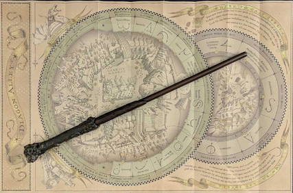
Universal Studios Harry Potter Wand BRapid Estate Liquidators and Auction Gallery4.5(1.1k)See Sold PriceFeb 28, 2024
Disney Magic Mediterranean Cruise 2007 Map W CoinsRapid Estate Liquidators and Auction Gallery4.5(1.1k)See Sold PriceMar 01, 2024


![De Jode, Rare, pub. 1593 - Map of the British Isles [England, Scotland, Ireland] (Angliae Scotiae et (1 of 2)](https://p1.liveauctioneers.com/6581/319571/171593327_1_x.jpg?height=282&quality=70&version=1707853304)