ATLAS of ANTIENT GEOGRAPHY by SAMUEL BUTLER 1843John McInnis Auctioneers,LLC4.5(505)See Sold PriceFeb 24, 2024
18TH C. ANTIQUE MAP: FRENCH & INDIAN WAR, FRAMEDThomaston Place Auction Galleries4.4(394)See Sold PriceFeb 24, 2024
Rand McNally Railroad Map Cabinet w/ 21 Railroad MapsRail & Road Auctions4.6(165)See Sold PriceMar 08, 2024
Keith Haring - Ink on New York Map, Best Buddies, Inscribed, Signed, and DatedSapphire Auction Gallery4.1(67)See Sold PriceMar 02, 2024
LATE 17TH C. FRENCH MAP OF THE NEW WORLD BY ALEXIS-HUBERT JAILLOT (1632-1712)Thomaston Place Auction Galleries4.4(394)See Sold PriceFeb 24, 2024
Central Railroad of New Jersey Map of Sandy Hook Route-ca. 1903JM Hobby Supply and Railroad Artifact Auctions4.4(127)See Sold PriceFeb 24, 2024
Lot of Six Mixed Atlas Box Cars-HO Scale-New in BoxJM Hobby Supply and Railroad Artifact Auctions4.4(127)See Sold PriceFeb 25, 2024
Rand McNally/Santa Fe Railroad Map of Iowa-1912JM Hobby Supply and Railroad Artifact Auctions4.4(127)See Sold PriceFeb 24, 2024
NICOLAES VISSCHER (NETHERLANDS, 1618-1709) MAP OF THE NEW WORLDThomaston Place Auction Galleries4.4(394)See Sold PriceFeb 24, 2024
17TH C. WORLD MAP BY NICOLAES VISSCHER (NETHERLANDS, 1618-1709)Thomaston Place Auction Galleries4.4(394)See Sold PriceFeb 24, 2024
Lot of Six Mixed Atlas Cabooses-HO Scale-New in BoxJM Hobby Supply and Railroad Artifact Auctions4.4(127)See Sold PriceFeb 25, 2024
SoldGrp: 10 Maps of British Cities w/ 1 Map VeniceGroup of maps of British cities. Includes one map of Birmingham; two road maps for the London area: "A Map of the New Roads & c. from Westminster Bridge" and "A Plan of the intended New Road from PadiSee Sold Price
SoldGrp: 11 Maps of the British Isles w/ 1 Map ParmaGroup of ten maps of various regions of the British Isles, primarily dating from the 19th century. Includes one Thomas Kitchin (1718–1784) map of Leith, Ireland; one map of the rivers and canalSee Sold Price
SoldForlani City View of GenevaFORLANI, Paolo (fl. 1560 - 1571).Ginevra [Geneva, Switzerland].Engraved map.Venice, 1567 (1569).10 3/4" x 16 1/4" sheet, 20" x 25 1/2" framed.A highly rare and finely engraved 16th century map of GeneSee Sold Price
SoldThomas Jeffries, "A Map of the British Empire in NorthThomas Jeffries, "A Map of the British Empire in North America," 20th c., print, after the 18th c. original, presented in an ebonized frame, H.- 19 1/4 in., W.- 12 7/8 in.See Sold Price
Ruscelli: HispaniolaCartographer: Ruscelli Place & Date: Venice / 1562 Size: 10 1/2" x 7 1/4" Condition: b&w The Hispaniola map from an early edition of Ruscelli's version of Ptolemy's Geography, published in 1561. RusceSee Sold Price
SoldUnknown, "A Map of the United States of America withUnknown, "A Map of the United States of America with Part of Adjoining Provinces," c. 1800, matted and mounted, hand colored, H. - 10 in., W. - 12 1/2 in.See Sold Price
Watson's Atlas Map of Louisiana, 1885, hand colored,Watson's Atlas Map of Louisiana, 1885, hand colored, presented in a walnut frame, H.- 10 1/2 in., W.- 13 1/2 inSee Sold Price
SoldUnknown, "A New Map of North America," mounted andUnknown, "A New Map of North America," mounted and matted, H. - 10 in., W. - 10 1/2 in.See Sold Price
George F. Cram, "Map of Louisiana," 1889, hand colored,George F. Cram, "Map of Louisiana," 1889, hand colored, presented in a gilt and burled frame, H.- 10 1/2 in., W.-13 1/2 in.See Sold Price
SoldWatson's Atlas Map of Louisiana, 1885, hand colored,Watson's Atlas Map of Louisiana, 1885, hand colored, presented in a walnut frame, H.- 10 1/2 in., W.- 13 1/2 inSee Sold Price
SoldGeorge F. Cram, "Map of Louisiana," 1889, hand colored,George F. Cram, "Map of Louisiana," 1889, hand colored, presented in a gilt and burled frame, H.- 10 1/2 in., W.-13 1/2 in.See Sold Price
Mast, Crowell & Kirkpatrick, "Map of Arkansas," 1890,Mast, Crowell & Kirkpatrick, "Map of Arkansas," 1890, hand colored, H.- 10 3/4 in., W.- 13 1/2 in.See Sold Price
Sold"Map of Louisiana," February 3, 1866, hand colored"Map of Louisiana," February 3, 1866, hand colored Harper's Weekly print, framed, H.- 15 3/8 in., W.- 10 1/8 in.See Sold Price
Sold"Map of Alabama," January 13, 1866, hand colored"Map of Alabama," January 13, 1866, hand colored Harper's Weekly print, presented in a gilt frame, H.- 15 in., W.- 10 1/8 in.See Sold Price
SoldHerman Moll, "A Map of Brasil," "A Map of ChiliHerman Moll, "A Map of Brasil," "A Map of Chili Patagonia," and "A Map of Peru," c. 1730, group of three hand colored engravings, presented in identical gilt frames, H.- 10 1/2 in., W.- 7 1/2 in.See Sold Price
SoldS. Walker, "Map of the United States," 19th c., sS. Walker, "Map of the United States," 19th c., showing the Indian Territory in Oklahoma, framed, H.- 10 1/8 in., W.- 16 1/8 in.See Sold Price
SoldRuscelli: Antique Map of Hispaniola, 1562Map: Isola Spagnola Nova Cartographer: Ruscelli Place & Date: Venice / 1562 Size: 10 1/2" x 7 1/4" Condition: b&w; overall age toning The Hispaniola map from an early edition of Ruscelli's version ofSee Sold Price
Ruscelli: Antique Map of Hispaniola, 1562Map: Isola Spagnola Nova Cartographer: Ruscelli Place & Date: Venice / 1562 Size: 10 1/2" x 7 1/4" Condition: b&w; light overall age toning The Hispaniola map from an early edition of Ruscelli's versiSee Sold Price
SoldUnknown, "Map of Upper California by the U.S. EX., EX."Unknown, "Map of Upper California by the U.S. EX., EX." 1849, H. -10 1/2 in., W. - 13 5/8 in.See Sold Price
SoldPlan of New Orleans, 1872, hand-colored engraved map byPlan of New Orleans, 1872, hand-colored engraved map by S. Augustus Mitchell, presented in a gilt frame, H.- 10 1/2 in., W.- 12 in.See Sold Price
SoldBook: "A New Set of Prints and Maps for the Old anBook: "A New Set of Prints and Maps for the Old and New Testament," by Thomas Stackhouse, 1726, H.- 15 1/4 in., W.- 10 in.See Sold Price
SoldPlan of New Orleans, 1872, hand-colored engraved map byPlan of New Orleans, 1872, hand-colored engraved map by S. Augustus Mitchell, presented in a gilt frame, H.- 10 1/2 in., W.- 12 in.See Sold Price
SoldGroup of Forty Five Maps from Black's General Atlas,Group of Forty Five Maps from Black's General Atlas, 1853, some double sheets, Single- H.- 17 1/4 in., W.- 10 3/4 in.See Sold Price
Sold"Map of the Main Portion of New Orleans," c. 1895, by"Map of the Main Portion of New Orleans," c. 1895, by Rand, McNally & Co., colored, framed, H.- 13 1/4 in., W.- 10 5/8 in.See Sold Price
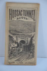
Fitchburg Railroad 1880 Hoosac Tunnel Route Public TimetableJM Hobby Supply and Railroad Artifact Auctions4.4(127)See Sold PriceFeb 24, 2024
Collection of 10 Maps of Cities in Israel for TouristsLevy Auction House4.3(11)See Sold PriceFeb 27, 2024
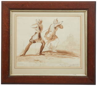
British School, "Valentines Day: The Combat Between Henry Wynd and Torquil of the Oak," late 19thCrescent City Auction Gallery4.3(233)See Sold PriceMar 01, 2024
Robert Herdman-Smith (British, 1879-1945), Group of Three Geishas Color Etchings, consisting of:Crescent City Auction Gallery4.3(233)See Sold PriceMar 01, 2024
ANDREW RAYMOND JANSON OIL ON BOARD ADIRONDACKSCharleston Estate Services Ltd.4.5(72)See Sold PriceMar 03, 2024
1800 MUNGO PARK TRAVELS to AFRICA 2 VOLS w/ MAP antique in ENGLISHJasper524.5(9.9k)See Sold PriceFeb 27, 2024
1749-59 21 volumes NETHERLANDS HISTORY ILLUSTRATED antique VELLUM BOUNDJasper524.5(9.9k)See Sold PriceFeb 27, 2024
1709 GREEK BIBLE ILLUSTRATED w/ MAPS antique VELLUM BOUND Septuagint editionJasper524.5(9.9k)See Sold PriceFeb 27, 2024
SECOND WORLD WAR AFRICA. European colonies & German mandates 1940 old mapJasper524.5(9.9k)See Sold PriceFeb 28, 2024
COLONIAL CENTRAL AFRICA. Kenya Tanzania Belgian Congo Angola. JOHNSTON 1912 mapJasper524.5(9.9k)See Sold PriceFeb 28, 2024
SOUTHERN AFRICA & MALAY ARCHIPELAGO. Cape Colony Indonesia &c. BUTLER 1888 mapJasper524.5(9.9k)See Sold PriceFeb 28, 2024
COLONIAL AFRICA. British French German Italian Portugal Spain.STANFORD 1906 mapJasper524.5(9.9k)See Sold PriceFeb 28, 2024
COLONIAL CENTRAL AFRICA. Kenya Tanzania Belgian Congo Angola. JOHNSTON 1913 mapJasper524.5(9.9k)See Sold PriceFeb 28, 2024
Two Hand-Colored 19th Century Maps of New Orleans and Louisiana, Larger- H.- 12 1/2 in., W.- 15 1/2Crescent City Auction Gallery4.3(233)See Sold PriceMar 08, 2024
Georg Bockler Map of Ancient Jerulsaem EtchingAuctions at Showplace4.6(744)See Sold PriceApr 07, 2024
Paterson & Mogg 1822 Pair of British Road Maps. Isle of Thanet & WightAlbion Auctions4.7(341)See Sold PriceMar 01, 2024
Paterson & Mogg 1822 Pair of British Road Maps. Rye, Eastbourne, SouthamptonAlbion Auctions4.7(341)See Sold PriceMar 01, 2024
Paterson & Mogg 1822 Pair of British Road Maps. Deal, Hythe, Shoreham, ChichesterAlbion Auctions4.7(341)See Sold PriceMar 01, 2024
Framed Vintage Map Of Le Port Au Prince In The Island Of Santo DomingoRapid Estate Liquidators and Auction Gallery4.5(1.1k)See Sold PriceMar 01, 2024
Herman Moll A New Map of Ye North Parts of AmericaWillow Auction House4.5(292)See Sold PriceMar 14, 2024