ATLAS of ANTIENT GEOGRAPHY by SAMUEL BUTLER 1843John McInnis Auctioneers,LLC4.6(502)See Sold PriceFeb 24, 2024
18TH C. ANTIQUE MAP: FRENCH & INDIAN WAR, FRAMEDThomaston Place Auction Galleries4.4(386)See Sold PriceFeb 24, 2024
Rand McNally Railroad Map Cabinet w/ 21 Railroad MapsRail & Road Auctions4.6(165)See Sold PriceMar 08, 2024
Keith Haring - Ink on New York Map, Best Buddies, Inscribed, Signed, and DatedSapphire Auction Gallery4(67)See Sold PriceMar 02, 2024
LATE 17TH C. FRENCH MAP OF THE NEW WORLD BY ALEXIS-HUBERT JAILLOT (1632-1712)Thomaston Place Auction Galleries4.4(386)See Sold PriceFeb 24, 2024
Central Railroad of New Jersey Map of Sandy Hook Route-ca. 1903JM Hobby Supply and Railroad Artifact Auctions4.4(126)See Sold PriceFeb 24, 2024
Lot of Six Mixed Atlas Box Cars-HO Scale-New in BoxJM Hobby Supply and Railroad Artifact Auctions4.4(126)See Sold PriceFeb 25, 2024
Rand McNally/Santa Fe Railroad Map of Iowa-1912JM Hobby Supply and Railroad Artifact Auctions4.4(126)See Sold PriceFeb 24, 2024
NICOLAES VISSCHER (NETHERLANDS, 1618-1709) MAP OF THE NEW WORLDThomaston Place Auction Galleries4.4(386)See Sold PriceFeb 24, 2024
17TH C. WORLD MAP BY NICOLAES VISSCHER (NETHERLANDS, 1618-1709)Thomaston Place Auction Galleries4.4(386)See Sold PriceFeb 24, 2024
Lot of Six Mixed Atlas Cabooses-HO Scale-New in BoxJM Hobby Supply and Railroad Artifact Auctions4.4(126)See Sold PriceFeb 25, 2024
SoldGillet “Map Of Northern Part Of New England”published 1823, uncolored as issued, depicting from the northern boundary of Massachusetts to show Maine, Vermont and New Hampshire, with detail of roads and settlements. Yale College is used as the PSee Sold Price
TWO-PART MAP OF NEW ENGLANDboth by George Gillet, 1821, compiled for President Dwight's travels, including 'Map of the Northern Part of New England', 8-1/2 x 14 in. (sight), and 'Map of the Southern Part of New England', 11-1/2See Sold Price
TWO-PART MAP OF NEW ENGLANDTWO-PART MAP OF NEW ENGLANDboth by George Gillet, 1821, compiled for President Dwight's travels, including 'Map of the Northern Part of New England', 8-1/2 x 14 in. (sight), and 'Map of the Southern PSee Sold Price
TWO-PART MAP OF NEW ENGLANDboth by George Gillet, 1821, compiled for President Dwight's travels, including 'Map of the Northern Part of New England', 8-1/2 x 14 in. (sight), and 'Map of the Southern Part of New England', 11-1/2See Sold Price
SoldHistorical Pair of Maps Of New England by GeorgePair of Maps Of New England by George Gillett, Esq., published in 1821 | The maps depict the northern and southern parts of New England | Each map was compiled by George Gillet, Esq. for Yale CollegeSee Sold Price
SoldPair Maps Of New England, George Willett 1821the northern and southern parts of New England, compiled for President Dwight's travels by George Gillet with Yale College as prime meridian, framed together. Light foxing, small creases, tear upper rSee Sold Price
SoldGillet "Map Of Southern Part Of New England"published 1823, uncolored as issued, depicting Massachusetts, Connecticut and Rhode Island, published in Timothy Dwight's “Travels in New England and New-York”. The eighth president of Yale CoSee Sold Price
Sold1823 Map of Southern New England, George Gillet1823 Dated map titled, "Map of the Southern Part of New England by George Gillet Esq. 1823". Strong plate impression and vibrant hand-coloring. Map framed under glass, measures: 17" H x 19" W, image:See Sold Price
MAP - Northern England. Van KeulenNorthern England. Gerard van Keulen, A New Encreasing Compass Map of Part of the East-Coast of England... / Nieuwe Wassende Gradige Pas-kaart van een Gedeelte der Oost Kust van Engeland..., 1730 (circSee Sold Price
SoldNorthern sheet of a 2-sheet map of New England.[New England] Northern sheet of a 2-sheet map of New England, 1760 or later. Includes a printed notice related to areas that are now part of Vermont: “Note/ Connecticut River is fixed by his MajestySee Sold Price
Soldca 1825 hand colored map of Northern New England &ca 1825 hand colored map of Northern New England & Upper State NY - 20"x23 1/3" sight sizeSee Sold Price
SoldMap. LIDALIA vel Lidisdalia Regio Lidisdail. CoppMap. LIDALIA vel Lidisdalia Regio Lidisdail. Copper plate engraving. Map: northern England & parts of Scotland. -- Dimensions: H: 15.5 inches: W: 20 inches ---See Sold Price
SoldRand McNally: Mobil - Northern New England Map, 1965Mobil - Northern New England 1965, Rand McNally Approx. 25x35.5 inches, 24-fold. Approx. 5x8.5 inches folded. No Reserve: This lot starts at $1 and has no reserve as a courtesy so that collectors canSee Sold Price
Rand McNally: Mobil - Northern New England Map, USAOriginal Rand McNally: Mobil - Northern New England Map, 1965 USA. Approx. 25 x 35.5 inches, 24 - fold. Approx. 5 x 8.5 inches folded. Estimate price: $40 - $50. NO RESERVE auction. Start price is VERSee Sold Price
RAND MCNALLY: MOBIL - NORTHERN NEW ENGLAND MAP, USARAND MCNALLY: MOBIL - NORTHERN NEW ENGLAND MAP, USA, 1965 Approx. 25 x 35.5 inches, 24 - fold. Approx. 5 x 8.5 inches folded. ESTIMATE PRICE: $40 - $50. OFFER: If an item is NOT SOLD, you can still giSee Sold Price
RAND MCNALLY: MOBIL - NORTHERN NEW ENGLAND MAP, USAORIGINAL RAND MCNALLY: MOBIL - NORTHERN NEW ENGLAND MAP, USA, 1965 Approx. 25 x 35.5 inches, 24 - fold. Approx. 5 x 8.5 inches folded. ESTIMATE PRICE: $40 - $50. NO RESERVE auction. Start price is VERSee Sold Price
RAND MCNALLY: MOBIL - NORTHERN NEW ENGLAND MAP, USAORIGINAL RAND MCNALLY: MOBIL - NORTHERN NEW ENGLAND MAP, USA, 1965 Approx. 25 x 35.5 inches, 24 - fold. Approx. 5 x 8.5 inches folded. ESTIMATE PRICE: $40 - $50. OFFER: If an item is NOT SOLD, you canSee Sold Price
RAND MCNALLY: MOBIL - NORTHERN NEW ENGLAND MAP, USAORIGINAL RAND MCNALLY: MOBIL - NORTHERN NEW ENGLAND MAP, USA, 1965 Approx. 25 x 35.5 inches, 24 - fold. Approx. 5 x 8.5 inches folded. ESTIMATE PRICE: $40 - $50. If an item is NOT SOLD, you can stillSee Sold Price
RAND MCNALLY: MOBIL - NORTHERN NEW ENGLAND MAP, USAORIGINAL Rand McNally: Mobil - Northern New England Map, 1965 USA Approx. 25 x 35.5 inches, 24 - fold. Approx. 5 x 8.5 inches folded. ESTIMATE PRICE: $40 - $50. NO RESERVE auction. Start price is VERYSee Sold Price
Rand McNally: Mobil - Northern New England Map, USAOriginal Rand McNally: Mobil - Northern New England Map, 1965 USA. Approx. 25 x 35.5 inches, 24 - fold. Approx. 5 x 8.5 inches folded. ESTIMATE PRICE: $40 - $50. NO RESERVE auction. Start price is VERSee Sold Price
Rand McNally: Mobil - Northern New England Map, USAOriginal Rand McNally: Mobil - Northern New England Map, 1965 USA. Approx. 25 x 35.5 inches, 24 - fold. Approx. 5 x 8.5 inches folded. For your convenience we will ship your item for a reasonable pricSee Sold Price
Rand McNally: Mobil - Northern New England Map, 1965For your consideration here is the Original Rand McNally: Mobil - Northern New England Map, 1965 USA. Approx. 25 x 35.5 inches, 24 - fold. Approx. 5 x 8.5 inches folded. For your convenience we will sSee Sold Price
Rand McNally: Mobil - Northern New England Map, 1965For your consideration here is the Original Rand McNally: Mobil - Northern New England Map, 1965 USA. Approx. 25 x 35.5 inches, 24 - fold. Approx. 5 x 8.5 inches folded. For your convenience we will sSee Sold Price
RAND MCNALLY: MOBIL - NORTHERN NEW ENGLAND MAP, USAORIGINAL RAND MCNALLY: MOBIL - NORTHERN NEW ENGLAND MAP, USA, 1965 Approx. 25 x 35.5 inches, 24 - fold. Approx. 5 x 8.5 inches folded. ESTIMATE PRICE: $40 - $50. NO RESERVE auction. Start price is VERSee Sold Price
Michigan Southern and Northern Indiana RR 14th Annual Report-February 28, 1869JM Hobby Supply and Railroad Artifact Auctions4.4(126)See Sold PriceFeb 24, 2024
1849 THE NEW-ENGLAND MERCANTILE UNIONNorth American Artifact Auctions4.6(182)See Sold PriceApr 20, 2024
[MAP]. [ALBRIZZI, Giambatista, 1698-1777]. Carta Geografica...Potter & Potter Auctions4.6(539)See Sold PriceMar 07, 2024
1816 MAP NORTHERN PART OF RUSSIA or MUSCOVY in EUROPE copper engraving ANTIQUEJasper524.5(9.8k)See Sold PriceFeb 27, 2024
1803 NARRATIVE OF INDIAN WARS IN NEW-ENGLAND antique Stockbridge AMERICANAJasper524.5(9.8k)See Sold PriceFeb 27, 2024
Afrique Pays… sud du Lac Tchad 30 Central African Republic VANDERMAELEN 1827 mapJasper524.5(9.8k)See Sold PriceFeb 28, 2024
"The Romance of Old New England Rooftrees" by Mary C. Crawford - Antique HardcoverRapid Estate Liquidators and Auction Gallery4.5(1.1k)See Sold PriceFeb 24, 2024
Black and white map of part of New York City (mostly Manhattan)Proverde Auctions4.3(3)See Sold PriceFeb 28, 2024
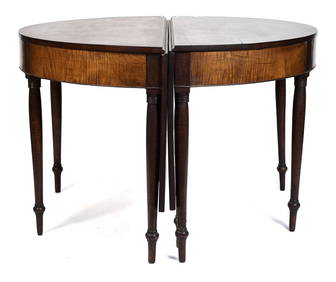
19TH C. NE TIGER MAPLE & CHERRY BANQUET TABLE.William Smith Auctions4.6(146)See Sold PriceMar 06, 2024
Herman Moll A New Map of Ye North Parts of AmericaWillow Auction House4.5(283)See Sold PriceMar 14, 2024
Vintage New England Clock Company Steeple ClockRapid Estate Liquidators and Auction Gallery4.5(1.1k)See Sold PriceMar 02, 2024
THE SMITHSONIAN GUIDE TO HISTORIC AMERICA : Northern New England (THE SMITHSO...Andrew's Coin & Jewelry4.5(209)See Sold PriceMar 07, 2024
Vintage SPNEA Society For Preservation of New England Gold Tone ANGEL Brooch PinAnnzstiques Auction House4.4(613)See Sold PriceJan 05, 2025


![[MAP]. [ALBRIZZI, Giambatista, 1698-1777]. Carta Geografica... (1 of 1)](https://p1.liveauctioneers.com/928/318880/171361280_1_x.jpg?height=282&quality=70&version=1707501302)