ATLAS of ANTIENT GEOGRAPHY by SAMUEL BUTLER 1843John McInnis Auctioneers,LLC4.6(502)See Sold PriceFeb 24, 2024
18TH C. ANTIQUE MAP: FRENCH & INDIAN WAR, FRAMEDThomaston Place Auction Galleries4.4(386)See Sold PriceFeb 24, 2024
Rand McNally Railroad Map Cabinet w/ 21 Railroad MapsRail & Road Auctions4.6(165)See Sold PriceMar 08, 2024
Keith Haring - Ink on New York Map, Best Buddies, Inscribed, Signed, and DatedSapphire Auction Gallery4(67)See Sold PriceMar 02, 2024
LATE 17TH C. FRENCH MAP OF THE NEW WORLD BY ALEXIS-HUBERT JAILLOT (1632-1712)Thomaston Place Auction Galleries4.4(386)See Sold PriceFeb 24, 2024
Central Railroad of New Jersey Map of Sandy Hook Route-ca. 1903JM Hobby Supply and Railroad Artifact Auctions4.4(126)See Sold PriceFeb 24, 2024
Lot of Six Mixed Atlas Box Cars-HO Scale-New in BoxJM Hobby Supply and Railroad Artifact Auctions4.4(126)See Sold PriceFeb 25, 2024
Rand McNally/Santa Fe Railroad Map of Iowa-1912JM Hobby Supply and Railroad Artifact Auctions4.4(126)See Sold PriceFeb 24, 2024
NICOLAES VISSCHER (NETHERLANDS, 1618-1709) MAP OF THE NEW WORLDThomaston Place Auction Galleries4.4(386)See Sold PriceFeb 24, 2024
17TH C. WORLD MAP BY NICOLAES VISSCHER (NETHERLANDS, 1618-1709)Thomaston Place Auction Galleries4.4(386)See Sold PriceFeb 24, 2024
Lot of Six Mixed Atlas Cabooses-HO Scale-New in BoxJM Hobby Supply and Railroad Artifact Auctions4.4(126)See Sold PriceFeb 25, 2024
French 1700s antique original engraving gravure mapTitle/Content of Map: French 1700s antique original engraving gravure map etchings decorative painting collection/English coast Date Printed: 1700s Material/Medium: Engraving Size: 36.5 X 20 ¨?chelleSee Sold Price
Bonne: Antique Map of Europe, Asia & Africa, 1781Map: Europe, Asia & Africa Cartographer: Bonne Date: 1781 Original engraving by Bonne, French Naval Hydrographer, circa 1781 Dimensions: 16" x 20" Rigobert Bonne (1727-1795) was one of the most importSee Sold Price
Original 18th c. H/C Engraved Lattré Map of EuropeAntique Original Hand-colored Engraved Map of Europe from PETIT ATLAS MODERNE ou collection de cartes élémentaires dédié à la jeunesse | Engraved and published in Paris by Jean Lattr�See Sold Price
Bonne: Antique Map of Europe, Asia & Africa, 1781Title/Content of Map: Europe, Asia & Africa Date Printed: 1781 Cartographer: Bonne Material/Medium: Engraving Size: 16" x 20" Original engraving by Bonne, French Naval Hydrographer, circa 1781. DimensSee Sold Price
SoldOriginal Antique Map of the Arctic Regions 1791Carte physique de la mer glaciale arctique by Jean Baptiste Nolin. Published in 1791 in Paris, France. From Atlas General, hand colored map. Text in French. Original copper plate engraving printed onSee Sold Price
Antique Map Haute Vienne Limoges B Rochechouart France1833 Perrot Map - Haute Vienne - Limoges Bellac Rochechouart St. Yrieix - France is an original antique copper engraved map over 175 years old. It is by Aristide Michel Perrot and engraved by Pierre ASee Sold Price
Antique Map Haute Vienne Limoges B Rochechouart France1833 Perrot Map - Haute Vienne - Limoges Bellac Rochechouart St. Yrieix - France is an original antique copper engraved map over 175 years old. It is by Aristide Michel Perrot and engraved by Pierre ASee Sold Price
Original Engraving - Antique FrenchBallin Sculpt17" x 22" - new frame and glassOwned by Tina, Owner of Silver Queen - Virginia City NVSee Sold Price
SoldRare Civil War Map of the Battle of Nashville TennesseeCivil War Map of the Battle of Nashville, Tennessee - Antique Original Nashville Battle Map Dated 1866 | Original antique engraving entitled "MAP OF THE BATTLE OF NASHVILLE" |Â Details include roadsSee Sold Price
VICTOR LEVASSEUR FRENCH DES HAUTES ALPES MAPVictor Gabriel Levasseur (1722 - 1811) antique French color engraving map of the "Dept Des Hautes Alpes". Mounted in a wooden frame behind glass screen. Paper measures approx. 12 3/4" height x 17 3/8"See Sold Price
Large Topographic Engraving Antique French map ofBasset ( Rue Jacque) edited and published this topographic map of Switzerland ( la Suisse ) Herisson eleve de Bonne is the cartographer , Rigobert Bonne (1727-1794) is a French geographer, hydrographeSee Sold Price
SoldLarge Topographic Engraving Antique French map of ParisEsnaud et Rapilly (Jacques Esnauts and Michel Rapilly ) edited and published this topographic map of Paris and its surrounding under the supervision of the Academie Royale des Sciences created under LSee Sold Price
Large Topographic Engraving Antique French map of SWITZERLAND 1796 HERISSONBasset ( Rue Jacque) edited and published this topographic map of Switzerland ( la Suisse ) Herisson eleve de Bonne is the cartographer , Rigobert Bonne (1727-1794) is a French geographer, hydrographeSee Sold Price
Antique French Engraving Felix Delamarche map South America 1838Charles-Francois Delamarche (1740-1817), the founder of the family firm was one of the most important French geographers and mapmakers of the second half of the eighteenth century. Successor to NicolaSee Sold Price
Antique French Engraving Felix Delamarche map of Africa 1838Charles-Francois Delamarche (1740-1817), the founder of the family firm was one of the most important French geographers and mapmakers of the second half of the eighteenth century. Successor to NicolaSee Sold Price
Large Topographic Engraving Antique French map of SPAIN PORTUGAL 1798Basset ( Rue Jacque) edited and published this topographic map of Spain and Portugal, Herisson eleve de Bonne is the cartographer , Rigobert Bonne (1727-1794) is a French geographer, hydrographer andSee Sold Price
SoldOriginal Copper Engraving ANTIQUE MAP AMERICAS 1817Details: Original Copper Engraving ANTIQUE MAP AMERICAS 1817 John & George Menzies Engravers John Thomson New General Atlas Political Borders British Territory Spain British Canada Atlas Original HanSee Sold Price
Antique French engraving Felix Delamarche Vaugondy Asia map 1838Charles-Francois Delamarche (1740-1817), the founder of the family firm was one of the most important French geographers and mapmakers of the second half of the eighteenth century. Successor to NicolaSee Sold Price
Antique engraving Felix Delamarche French map of Europe 1838Charles-Francois Delamarche (1740-1817), the founder of the family firm was one of the most important French geographers and mapmakers of the second half of the eighteenth century. Successor to NicolaSee Sold Price
Antique 18/ 19th C French Original Engraving PlateAntique 18th / 19th C French Original Engraving Plate. Le Contour by C N Cochin. French inscription. Hand colored over the original incised work in the metal plate. Plate measures 6.25 by 5 inches, frSee Sold Price
SoldAntique French engraving Napoleon Bonaparte circa 1830Authentic and antique French engraving in its original frame "Napoleon Bonaparte at Sainte Helene" by Roomild. This engraving was made in very early 1800's...probably 1830's! Good condition (little stSee Sold Price
SoldCowperthwait Map of North Carolina, 1854North Carolina, 1854. Original steel engraving map of North Carolina published by Thomas Cowperthwait & Co., Philadelphia, 1854. Features canals, roads and distances of stage coach and steam boat routSee Sold Price
Antique French engraving Napoleon Bonaparte circa 1830Authentic and antique French engraving in its original frame "Napoleon Bonaparte at Sainte Helene" by Roomild. This engraving was made in very early 1800's...probably 1830's! Good condition (little stSee Sold Price
Tanner's Map of Arkansas, 1836Map of Arkansas, 1836. Original steel engraving map of Arkansas from Tanner's Universal Atlas by H. S. Tanner, 1836. Features canals, roads and steam boat routes. Dimensions: 18.5" L x 16" WSee Sold Price
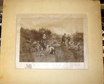
Daniel Ridgway Knight Engraving Signed by Courtauld Potato Helling 17" x 13"Luis Porretta Fine Arts4.3(10)See Sold PriceMar 02, 2024
ARTHUR L COX Original 1924 Fragonard Framed Mezzotint SIGNED The Pursuit 20" x 19"Luis Porretta Fine Arts4.3(10)See Sold PriceMar 02, 2024