

Popular Searches
Popular Searches

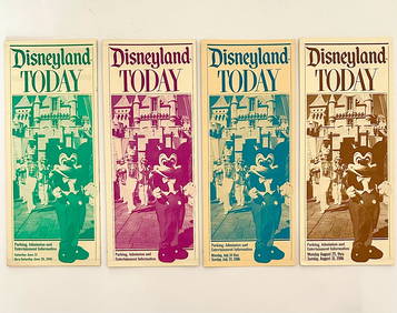
Four Early Disneyland Maps and Brochures, 1956-1960.
You May Also Like


Similar Sale History
Sold

Sold

Sold

Sold

Sold

Sold

Sold

Sold

Sold

Sold

Sold

Sold

Sold

Sold

Sold

Sold

Sold

Sold
![[WEST FLORIDA/MISSISSIPPI MAPS] good (1 of 0)](https://p1.liveauctioneers.com/dist/images/placeholder.jpg?height=282&quality=70)
Sold

Sold

Sold

Sold

Sold


Upcoming Sales
View All


TOP