SoldFour 19th C. Maps of the United StatesLot of four mid/late 19th C. maps of the United States. Various dates and publishers.See Sold Price
Sold1862 Bowen Civil War Map, Other 19th C. MapsFour 19th c. maps: 1. Framed Bowen's "Map of the Field Operations of the Army of Virginia during the Months of July and August 1862"; report of Maj. Gen. John Pope to the Committee on the Conduct of tSee Sold Price
SoldLg Framed early 19th c. Map of the WorldLg Framed early 19th c. Map of the World, "Mappe Monde", Indication des trois voyages du Capitaine Cook, French 1816 in floral gilt 32" x 46" frame Condition; was folded, some wear along fold lines frSee Sold Price
SoldWorld Map in Hemispheres 19th CMap: Mapemonde. (World map in hemispheres) Maker: Unknown Origin: French, 19th Century Medium: Original lithograph with hand coloring. Sheet Size: 6 1/4 x 9 inches No Reserve: This lot starts at $1 anSee Sold Price
SoldSTERLING SILVER SOUVENIR SPOONSGroup of approximately twenty-four late 19th - early 20th c.: shovel-form World's Columbian Exposition, St. Louis Exposition, Louisiana Purchase Exposition, Golden Gate International Exposition; All mSee Sold Price
Sold19TH C. SCHOOL GIRL MAP - "A Map of the World" by19TH C. SCHOOL GIRL MAP - "A Map of the World" by Hannah Comstock, Danbury (Connecticut), Sept 1815, ink and gouache on paper, the map based on Hondius's "Nova Totius Terraum Orbis" as first publishedSee Sold Price
SoldFour Antique Continental MapsFour Antique Continental Maps , 17th to 19th c., incl. map of Ireland, British Colonies, Virginia, and two bird's-eye-views, largest 18 3/4 in. x 26 in Provenance: Property deaccessioned from the LouiSee Sold Price
SoldART MEDALSFour, 19th/20th c., include rare 1904 St. Louis World Fair bronze German award, Manchester Agricultural Society Prussian Terrier award, etc.; Most marked; Largest: 4 1/2"See Sold Price
Sold19TH C. RE-STRIKE OF 17TH C. HONDIUS MAP OF THE WORLD"Nova Totius Terrarum Orbis Geographica ac Hydrographica Tabula, auct. Ind. Hondio.", a Paris, Chez Nicolas Bercy, 1649. Hand colored engraving, in stick frame, no glass. OS: 20 1/2" x 26 3/4", imageSee Sold Price
SoldLot of 4 Russian Books, 19th C. Bible, MapsLot of four likely Russian books with what look like Cyrillic lettering. Includes a Bible and a book of that appears to be about seafaring with a large fold-out river map.Dimensions range from 9.75 inSee Sold Price
Sold[Trains, Travel, 19th c.] Pair, Map & ProgramIncludes: *** DENVER AND RIO GRANDE RAILWAY, SCENIC LINE OF THE WORLD. NY, 1885. 28" x 15". Creased as folded, one 5" tear along one fold, some other smaller splits at folds/corners. Contains map andSee Sold Price
SoldTRANQUILLO MOLLO ATLASTRANQUILLO MOLLO ATLAS; Thirty-four maps out of an original fifty-two include America, United Kingdom, Australia, etc., Vienna, late 18th/early 19th c.; Most maps with color; 15'' x 20''See Sold Price
SoldGrp: 54 Maps of the World 18th and 19th c.Group of 54 maps of various regions of the world, dating from the 18th and 19th century. Foldable Map of Navarre on paper attached to linen, Tomás López de Vargas Machuca (1730-1802) "Map of theSee Sold Price
Sold(4) 19th c. hand colored maps of ConnecticutGrouping of four circa 1867 hand colored maps and one black and white advertisement from the "Atlas of New York and Vicinity" by Beers, Ellis & Soule, the drawings based on land surveys performed undeSee Sold Price
Sold(4) Mid 19th c. hand colored maps of New YorkGrouping of four circa 1867 hand colored maps and one black and white advertisement from the "Atlas of New York and Vicinity" by Beers, Ellis & Soule, the drawings based on land surveys performed undeSee Sold Price
Sold(4) Mid 19th c. hand colored maps of New YorkGrouping of four circa 1867 hand colored maps from the "Atlas of New York and Vicinity" by Beers, Ellis & Soule, the drawings based on land surveys performed under the direction of F.W. Beers, includeSee Sold Price
Sold19th C Hand Colored Map of State of Maine FRAMEDPublished by S.Augustus Mitchell, Jr. having a published date year of 1860. This hand colored map contains maps of the various countries of the world and plans of cities. Inset at lower right featuresSee Sold Price
Sold(4) 19th c. hand colored maps of ConnecticutGrouping of four circa 1867 hand colored maps from the "Atlas of New York and Vicinity" by Beers, Ellis & Soule, the drawings based on land surveys performed under the direction of F.W. Beers, includeSee Sold Price
Sold(4) Mid 19th c. hand colored maps of New YorkGrouping of four circa 1867 hand colored maps from the "Atlas of New York and Vicinity" by Beers, Ellis & Soule, the drawings from surveys by and under the direction of F.W. Beers, includes (1) PlansSee Sold Price
SoldFramed needlework on linen of the hemispheres titled ÒAFramed needlework on linen of the hemispheres titled ÒA Map of the World, probably late 19th c. 18.5h.x31.5"w."See Sold Price
SoldEnglish Ebonized Map Rack, 19th c., on turned suppEnglish Ebonized Map Rack, 19th c., on turned supports, the top sectioned to hold rolled maps, with four Louisiana coastal maps for demonstration purposes, H.- 35 1/2 in., W.- 22 1/2 in., D.- 15 1/2 iSee Sold Price
SoldLate 19th / Early 20th C Advertising CardsLot includes a selection from Singer sewing machine, Gold Medal Flour, World's Fair Map 1934, place cards, and related items.See Sold Price
17TH C. WORLD MAP BY NICOLAES VISSCHER (NETHERLANDS, 1618-1709)Thomaston Place Auction Galleries4.4(393)See Sold PriceFeb 24, 2024
19thc Colton Map, Comparitive Size of Lakes & IslandsConnoisseur Auctions3.9(336)See Sold PriceFeb 24, 2024
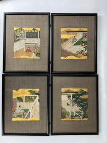
Four Japanese Panels of Genji Monogatari Painted in Early 19th CChina Luban Art & Antique, Inc.4.4(79)See Sold PriceFeb 24, 2024
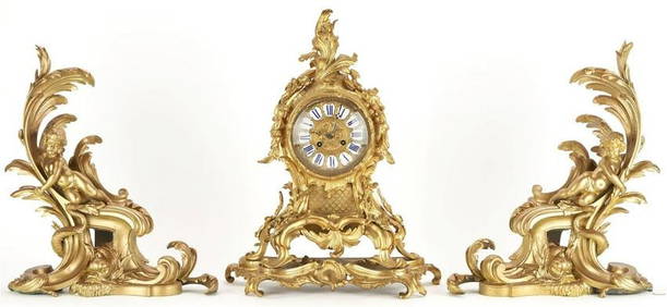
19th C. Pair Louis XV Style Bronze Chenets & French Rococo Style Bronze ClockWorld of Antiques, Inc.3.9(74)See Sold PriceFeb 29, 2024
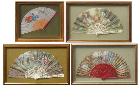
Group of Four Folding Hand Fans, 19th c., Largest- Seaside- H.- 9 in., W.- 18 in. (4 Pcs.)Crescent City Auction Gallery4.3(231)See Sold PriceMar 01, 2024
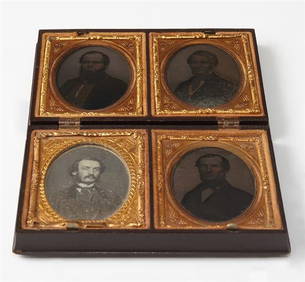
Group of Four Ninth Plate Photographs, 19th c., consisting of three tintypes of gentlemen withCrescent City Auction Gallery4.3(231)See Sold PriceMar 01, 2024
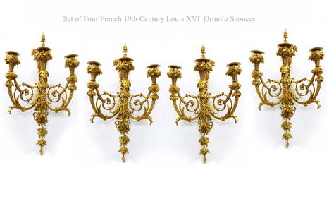
A Set Of Four 19th C. French Louis XVI Ormolu Sconces, Attrib. Henry DassonFive Star Auctions4.2(3)See Sold PriceFeb 29, 2024
Four 19thC Gothic side chairs, the top rails having large pierced trefoil decoration and the midClaydon Auctioneers Ltd4.3(125)See Sold PriceFeb 26, 2024
Map: A 19thC engraved and hand coloured map of South America. Published by the Society for theClaydon Auctioneers Ltd4.3(125)See Sold PriceFeb 26, 2024
Map: A 19thC engraved map titled Gloucestershire from the Best Authorities, after John Cary. Approx.Claydon Auctioneers Ltd4.3(125)See Sold PriceFeb 26, 2024
Map: A 19thC engraved and hand coloured map of Buckingham titled A New Map of BuckinghamshireClaydon Auctioneers Ltd4.3(125)See Sold PriceFeb 26, 2024
Map: A 19thC engraved map of West Riding, titled A Map of the North Part of the West Riding ofClaydon Auctioneers Ltd4.3(125)See Sold PriceFeb 26, 2024
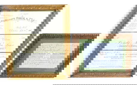
Four 19thC Welsh receipts / bill heads / compliment slips relating to Edward Finch & Co. Ltd.Claydon Auctioneers Ltd4.3(125)See Sold PriceFeb 26, 2024
1816 MAP SOUTHERN PART OF RUSSIA or MUSCOVY in EUROPE copper engraving ANTIQUEJasper524.5(9.9k)See Sold PriceFeb 27, 2024
1816 MAP NORTHERN PART OF RUSSIA or MUSCOVY in EUROPE copper engraving ANTIQUEJasper524.5(9.9k)See Sold PriceFeb 27, 2024
Rare 19thc Colton Map, Argentine Republic, Chile, Uruguay, PataguayConnoisseur Auctions3.9(336)See Sold PriceMar 16, 2024


![[Trains, Travel, 19th c.] Pair, Map & Program (1 of 5)](https://p1.liveauctioneers.com/3532/117365/60345272_1_x.jpg?height=282&quality=70&version=1519867546)