ATLAS of ANTIENT GEOGRAPHY by SAMUEL BUTLER 1843John McInnis Auctioneers,LLC4.5(505)See Sold PriceFeb 24, 2024
18TH C. ANTIQUE MAP: FRENCH & INDIAN WAR, FRAMEDThomaston Place Auction Galleries4.4(393)See Sold PriceFeb 24, 2024
Rand McNally Railroad Map Cabinet w/ 21 Railroad MapsRail & Road Auctions4.6(165)See Sold PriceMar 08, 2024
Keith Haring - Ink on New York Map, Best Buddies, Inscribed, Signed, and DatedSapphire Auction Gallery4.1(67)See Sold PriceMar 02, 2024
LATE 17TH C. FRENCH MAP OF THE NEW WORLD BY ALEXIS-HUBERT JAILLOT (1632-1712)Thomaston Place Auction Galleries4.4(393)See Sold PriceFeb 24, 2024
Central Railroad of New Jersey Map of Sandy Hook Route-ca. 1903JM Hobby Supply and Railroad Artifact Auctions4.4(127)See Sold PriceFeb 24, 2024
Lot of Six Mixed Atlas Box Cars-HO Scale-New in BoxJM Hobby Supply and Railroad Artifact Auctions4.4(127)See Sold PriceFeb 25, 2024
Rand McNally/Santa Fe Railroad Map of Iowa-1912JM Hobby Supply and Railroad Artifact Auctions4.4(127)See Sold PriceFeb 24, 2024
NICOLAES VISSCHER (NETHERLANDS, 1618-1709) MAP OF THE NEW WORLDThomaston Place Auction Galleries4.4(393)See Sold PriceFeb 24, 2024
17TH C. WORLD MAP BY NICOLAES VISSCHER (NETHERLANDS, 1618-1709)Thomaston Place Auction Galleries4.4(393)See Sold PriceFeb 24, 2024
Lot of Six Mixed Atlas Cabooses-HO Scale-New in BoxJM Hobby Supply and Railroad Artifact Auctions4.4(127)See Sold PriceFeb 25, 2024
SoldWILLIAM FADEN (English, 1750-1836)WILLIAM FADEN (English, 1750-1836); ''Topographical Map of the North Part of New York Island Exhibiting the Plan of Fort Washington, now Fort Knyphausen, with the Rebels Lines to the Southward...'', pSee Sold Price
SoldClaude Joseph Sauthier (1736-1802) William FadenClaude Joseph Sauthier (1736-1802) William Faden (1750-1836) hand colored engraved topographical map of the north part of New York Island exhibiting the plan of Fort Washington now Fort Knyphausen wiSee Sold Price
SoldA Topographical Map of the North Part of New YorkA Topographical Map of the North Part of New York Island, 1777 Faden, William. A Topographical Map of the Northn. Part of New York Island, Exhibiting the Plan of Fort Washington, now Fort KnyphausenSee Sold Price
SoldA Topographical Map of the Northn. Part of New YorA Topographical Map of the Northn. Part of New York Island, 1777 Faden, William. A Topographical Map of the Northn. Part of New York Island, Exhibiting the Plan of Fort Washington, now Fort KnyphausSee Sold Price
SoldA Topographical Map of the North Part of New YorkWilliam Faden (1750 - 1836). London: Faden, 1793. 19 3/4 x 13 inches. This map records activity in 1776 when the British, led by General Howe, attacked New York City, defended by General Washington. DSee Sold Price
SoldFaden. New York Island. 1777[American Revolutionary War]. Claude Joseph Sauthier. A Topographical Map Of The Northn. Part Of New York Island, Exhibiting the Plan of Fort Washington, now Fort Knyphausen, With the Rebels Lines toSee Sold Price
SoldFaden Map of New York, 1776FADEN, William (1749-1836). A Plan of New York Island, with part of Long Island, Staten Island & East New Jersey. Engraved map. London: William Faden, October 19th, 1776. 26 3/4" x 21 3/4" sheet, 39"See Sold Price
Faden Revoltionary War battle mapFaden, William (1749-1836). A plan of New York Island, with part of Long Island, Staten Island & East New Jersey. Engraved map with original hand color in part above letterpress text in 4 columns. LonSee Sold Price
Sold1776 William Faden Plan of New York Island MapDESCRIPTION: A Plan of New York Island with part of Long Island, Staten Island & East New Jersey, with a particular Description of the Engagement on the Woody Heights of Long Island, between FlatbushSee Sold Price
Faden Plan of New York Island during the Revolutionary War, First StateFADEN, William (1749 - 1836). A plan of New York Island with part of Long Island, Staten Island, and East New Jersey... Engraved map with original hand color. London: Faden, Oct. 19, 1776. 20 3/4" x 1See Sold Price
SoldUSGS Map Connecticut - Long IslandUS Coast & Geodetic Survey map of New York Long Island Sound - Eastern Part, Mercator Projection Scale 1:80,000 at Latitude 41.07, North American 1927 Datum, soundings in feet at Mean Low Water, colorSee Sold Price
Cary: Antique Map of New England, 1811An original hand colored engraved 1811 map titled ""A New Map of Part of the United States of North America Containing New York, Vermont, New Hampshire, Massachusets, Connecticut, Rhode Island, PennsySee Sold Price
SoldNew York State MapHand colored map of New York "A Topographical Map of the North Port / of / New York Island / now / Fort Knyphausen...", published in London...1777". Sight 17" x 9 1/2", overall 23 1/2" x 15 1/2".See Sold Price
1832 Baldwin & Cradock, London Map of North America19th century. An original map of North American, Upper Canada, and part of New York, Pennsylvania, and Michigan. Published September 1, 1832 by Baldwin & Cradock, London. Overall good condition;See Sold Price
SDUK: Antique Map of Quebec, 1846TITLE/CONTENT OF MAP: 'NORTH AMERICA, SHEET II., Lower Canada and New Brunswick with part of New York, Vermont and Maine' Québec Canada Montreal Three Rivers Maine New Brunswick. DATE PRINTED: 1846 ISee Sold Price
SoldGREAT LAKES. Upper Canada districts <1849 Lake HuronTITLE/CONTENT OF MAP: 'NORTH AMERICA, SHEET III., Upper Canada and New Brunswick with parts of New York, Pennsylvania and Michigan' The map shows the historic districts of Upper Canada (Ontario) as thSee Sold Price
SDUK: Antique Map of Upper Canada & Great Lakes, 1846Title/Content of Map: 'NORTH AMERICA, SHEET III., Upper Canada and New Brunswick with parts of New York, Pennsylvania and Michigan' The map shows the historic districts of Upper Canada (Ontario) as thSee Sold Price
GREAT LAKES. Upper Canada districts <1849 Lake HuronReserve Reduced! TITLE/CONTENT OF MAP: 'NORTH AMERICA, SHEET III., Upper Canada and New Brunswick with parts of New York, Pennsylvania and Michigan' The map shows the historic districts of Upper CanadSee Sold Price
Map of Upper CanadaMap of Upper Canada, North America Sheet III with parts of New York, Pennsylvania & MIchigan, published by the Soceity for Diffusion of Useful Knowledge, very good codnition. 12 1/4 x 16 1/2''See Sold Price
SoldGroup of Five Maps Drawn by Vaugondy.Robert de Vaugondy. Group of Five Maps Drawn by Vaugondy. London: ca. 1764. Includes: A New Map of Canada, Also the North Parts of New England and New York; An Accurate Map of North America (engravedSee Sold Price
SoldRobert de Vaugondy. A New Map of CanadaRobert de Vaugondy (Gilles & Didier) After. A New Map of Canada, Also the North Parts of New England and New York, with Nova Scotia and Newfound Land,with inset map of the Great Lakes, froSee Sold Price
SDUK: Antique Map of the Great Lakes, Canada, 1846Title/Content of Map: 'NORTH AMERICA, SHEET III., Upper Canada and New Brunswick with parts of New York, Pennsylvania and Michigan'. The map shows the historic districts of Upper Canada (Ontario) as tSee Sold Price
SoldTown of Southampton Map (North Haven & Art Village),Original engraving of Southhampton town, including Peconic Bay, Hobson Island and many landmarks & family names. Published by E. Belcher Hyde from "Atlas of Suffolk County, Long Island, New York," 190See Sold Price
SoldWilliam Damerum, Map of the Southern Part of the StateDAMERUM, William. Map of the Southern Part of the State of New York, including Long Island, the South, the State of Connecticut, part of the State of New Jersey and Islands adjacent. New York: Wm. DamSee Sold Price
1849 THE NEW-ENGLAND MERCANTILE UNIONNorth American Artifact Auctions4.7(198)See Sold PriceApr 20, 2024
Black and white map of part of New York City (mostly Manhattan)Proverde Auctions4.3(3)See Sold PriceFeb 28, 2024
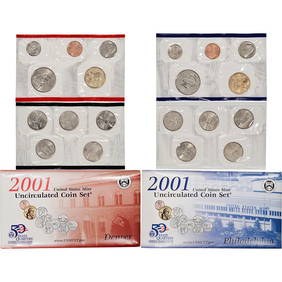
2001 20 piece United States Mint Set with Sacagawea Dollar in original Government packagingKey Date Coins4.4(1.4k)See Sold PriceFeb 25, 2024
2001 20 piece United States Mint Set with Sacagawea Dollar in original Government packagingKey Date Coins4.4(1.4k)See Sold PriceFeb 24, 2024
2001 20 piece United States Mint Set with Sacagawea Dollar in original Government packagingKey Date Coins4.4(1.4k)See Sold PriceFeb 26, 2024
2001 20 piece United States Mint Set with Sacagawea Dollar in original Government packagingKey Date Coins4.4(1.4k)See Sold PriceFeb 26, 2024
2001 20 piece United States Mint Set with Sacagawea Dollar in original Government packagingKey Date Coins4.4(1.4k)See Sold PriceFeb 25, 2024
2001 20 piece United States Mint Set with Sacagawea Dollar in original Government packagingKey Date Coins4.4(1.4k)See Sold PriceFeb 27, 2024
2001 20 piece United States Mint Set with Sacagawea Dollar in original Government packagingKey Date Coins4.4(1.4k)See Sold PriceFeb 28, 2024
2001 20 piece United States Mint Set with Sacagawea Dollar in original Government packagingKey Date Coins4.4(1.4k)See Sold PriceFeb 29, 2024
2001 20 piece United States Mint Set with Sacagawea Dollar in original Government packagingKey Date Coins4.4(1.4k)See Sold PriceFeb 28, 2024
2001 20 piece United States Mint Set with Sacagawea Dollar in original Government packagingKey Date Coins4.4(1.4k)See Sold PriceFeb 27, 2024
2001 20 piece United States Mint Set with Sacagawea Dollar in original Government packagingKey Date Coins4.4(1.4k)See Sold PriceFeb 29, 2024
2001 20 piece United States Mint Set with Sacagawea Dollar in original Government packagingKey Date Coins4.4(1.4k)See Sold PriceFeb 27, 2024
2001 20 piece United States Mint Set with Sacagawea Dollar in original Government packagingKey Date Coins4.4(1.4k)See Sold PriceFeb 27, 2024
2001 20 piece United States Mint Set with Sacagawea Dollar in original Government packagingKey Date Coins4.4(1.4k)See Sold PriceFeb 28, 2024
2001 20 piece United States Mint Set with Sacagawea Dollar in original Government packagingKey Date Coins4.4(1.4k)See Sold PriceFeb 29, 2024
2001 20 piece United States Mint Set with Sacagawea Dollar in original Government packagingKey Date Coins4.4(1.4k)See Sold PriceFeb 28, 2024
2001 20 piece United States Mint Set with Sacagawea Dollar in original Government packagingKey Date Coins4.4(1.4k)See Sold PriceFeb 29, 2024