Marc Chagall-Limited Edition -Paris Opera Ceiling after ChagallArt Legacy Auctions4.5(225)See Sold PriceFeb 24, 2024
Salvador Dali Pantagruel Limited Edition Lithograph Hand signed and numberedArt Legacy Auctions4.5(225)See Sold PriceFeb 24, 2024
Pablo Picasso Bouquet of Peace Collection Domaine Picasso Limited Edition on paper.Art Legacy Auctions4.5(225)See Sold PriceFeb 24, 2024
A RARE MAXFIELD PARRISH JACK AND THE BEANSTALK PRINTSoulis Auctions4.8(958)See Sold PriceFeb 24, 2024
LARGE MECHANICAL PRINT 'STARS' AFTER MAXFIELD PARRISHSoulis Auctions4.8(958)See Sold PriceFeb 24, 2024
Heinrich Aldegrever, etc. 15 old master prints. 16th-17th centuries. Aldegrever works include "ManTremont Auctions4.5(298)See Sold PriceFeb 25, 2024
SoldWilliam Damerum, Map of the Southern Part of the StateDAMERUM, William. Map of the Southern Part of the State of New York, including Long Island, the South, the State of Connecticut, part of the State of New Jersey and Islands adjacent. New York: Wm. DamSee Sold Price
WILLIAM DAMERUM - MAP OF THE SOUTHERN PART OF THE STATEWilliam Damerum - Map Of The Southern Part Of The State Of New York, 1815 - 22 X 18 1/4 In. - This Giclée Print Is Gallery Stretched And Ready To Hang Or Lean Against A Wall, Or Display On An Easel.See Sold Price
WILLIAM DAMERUM - MAP OF THE SOUTHERN PART OF THE STATEWilliam Damerum - Map Of The Southern Part Of The State Of New York, 1815 - 40 X 33 1/4 In. - Giclée On Canvas - Museum Wrapped - Large Piece Of Art - This Piece Is Ready To Hang On Your WallSee Sold Price
WILLIAM DAMERUM...MAP OF THE SOUTHERN PART OF THE STATEWilliam Damerum...Map Of The Southern Part Of The State Of New York, 1815...40 X 33 1/4 In.... Gallery Stretched Giclée PrintSee Sold Price
WILLIAM DAMERUM - MAP OF THE SOUTHERN PART OF THE STATEWilliam Damerum - Map Of The Southern Part Of The State Of New York, 1815 - 40 X 33 1/4 In. - Giclée On Canvas - Museum Wrapped - Large Piece Of Art - This Piece Is Ready To Hang On Your WallSee Sold Price
WILLIAM DAMERUM - MAP OF THE SOUTHERN PART OF THE STATEWilliam Damerum - Map Of The Southern Part Of The State Of New York, 1815 - 40 X 33 1/4 In. - This Giclée Print Is Gallery Stretched And Ready To Hang Or Lean Against A Wall, Or Display On An Easel.See Sold Price
WILLIAM DAMERUM -MAP OF THE SOUTHERN PART OF THE STATEWilliam Damerum -map Of The Southern Part Of The State Of New York, 1815 - Giclée On Canvas -44 X 36 5/8 In. - A Giclée Print Is The Highest Quality Print Available Today. Because There Is No VisiblSee Sold Price
WILLIAM DAMERUM - MAP OF THE SOUTHERN PART OF THE STATEWILLIAM DAMERUM - MAP OF THE SOUTHERN PART OF THE STATE OF NEW YORK, 1815 - Giclée on Canvas - Size-44 x 36 5/8 in.See Sold Price
William Damerum - Map Of The Southern Part Of The StateWilliam Damerum - Map Of The Southern Part Of The State Of New York, 1815 Size: 36 X 29 7/8 In. - This Is A Gallery Stretched Giclee Print On Canvas. The Piece Was Printed On High Quality Artist GradeSee Sold Price
WILLIAM DAMERUM - MAP OF THE SOUTHERN PART OF THE STATEWilliam Damerum - Map Of The Southern Part Of The State Of New York, 1815 - 40 X 33 1/4 In. - This Giclée Print Is Gallery Stretched And Ready To Hang Or Lean Against A Wall, Or Display On An Easel.See Sold Price
WILLIAM DAMERUM - MAP OF THE SOUTHERN PART OF THE STATEWilliam Damerum - Map Of The Southern Part Of The State Of New York, 1815 - 40 X 33 1/4 In. - This Giclée Print Is Gallery Stretched And Ready To Hang Or Lean Against A Wall, Or Display On An Easel.See Sold Price
WILLIAM DAMERUM - MAP OF THE SOUTHERN PART OF THE STATEWilliam Damerum - Map Of The Southern Part Of The State Of New York, 1815 - 36 X 29 7/8 In. - This Giclée Print Is Gallery Stretched And Ready To Hang Or Lean Against A Wall, Or Display On An Easel.See Sold Price
WILLIAM DAMERUM - MAP OF THE SOUTHERN PART OF THE STATEWilliam Damerum - Map Of The Southern Part Of The State Of New York, 1815 - 40 X 33 1/4 In. - This Giclée Print Is Gallery Stretched And Ready To Hang Or Lean Against A Wall, Or Display On An Easel.See Sold Price
WILLIAM DAMERUM - MAP OF THE SOUTHERN PART OF THE STATEWilliam Damerum - Map Of The Southern Part Of The State Of New York, 1815 - Giclée On Canvas - 36 X 29 7/8 In.~~A giclée print falls between serigraph and lithograph in quality. Although they can beSee Sold Price
WILLIAM DAMERUM - MAP OF THE SOUTHERN PART OF THEWilliam Damerum - Map Of The Southern Part Of The State Of New York, 1815 - Giclée On Canvas - 36 X 29 7/8 In.See Sold Price
WILLIAM DAMERUM - MAP OF THE SOUTHERN PART OF THEWilliam Damerum - Map Of The Southern Part Of The State Of New York, 1815 - Giclée On Canvas - 36 X 29 7/8 In.See Sold Price
WILLIAM DAMERUM - MAP OF THE SOUTHERN PART OF THEWilliam Damerum - Map Of The Southern Part Of The State Of New York, 1815 - Giclée On Canvas - 36 X 29 7/8 In.~~A giclée print falls between serigraph and lithograph in quality. Although they can beSee Sold Price
SoldMap of the Southern Part of the State of New YorkWilliam Damerum. New York, 1815. Engraved map with original hand color in part. 23 1/2 x 28 1/2 inches sheet, 33 x 38 Inches FramedSee Sold Price
Williams Map of Southern StatesWILLIAMS, W. (Mid-19th Century). Map of the Southern and South-Western States. Engraved map with original color in part. Pennsylvania, 1849. 12 1/4" x 18 1/4"sheet. Williams map was published as partSee Sold Price
SoldDARBY, WILLIAM. A Geographical Description ofDARBY, WILLIAM. A Geographical Description of the State of Louisiana, the Southern Part of the State of Mississippi, and Territory of Alabama . . . Second Edition. Three maps (including two folding wiSee Sold Price
1839 map of Southern and Western StatesNo. 12 Map of the Chief Parts of the Southern States and Part of the Western engraved by W. Williams. Shows swamps, topography, railroads, towns, cities, rivers, islands, bays, coastal features. 1839See Sold Price
Two Southern maps 19th centuryNO. 12 MAP OF THE CHIEF PARTS OF THE SOUTHERN STATES AND PART OF THE WESTERN, ca. 1839 colored engraving, framed by: Samuel Augustus Mitchell engraved by: W. Williams image size: H10 1/4" W16 1/4" ATLSee Sold Price
Scarce vintage map of the Deep South, 1875J. David Williams’ map of southern states from the very scarce Jones & Hamilton Atlas of the World Illustrated. Shows the six states that comprise the extreme southeastern United States. WonderfSee Sold Price
SoldFaden, William. Map of the Southern States, of NorthFaden, William. Map of the Southern States, of North America......Comprehending Maryland, Virginia, North and South Carolina from Delaware Bay to Savanna River (London: W. Faden, 1814), second editionSee Sold Price
MATTHEWS c1856 Map Of Upper Canada Ontario Indian Land Agency Divisions Scarce!Luis Porretta Fine Arts4.3(10)See Sold PriceMar 02, 2024
1887 Appletons' General Guide to the United State and Canada Part IIRail & Road Auctions4.6(165)See Sold PriceMar 08, 2024
[CHICAGO]. Rare Pre-Fire Illinois Map: “Blanchard’s Map of ...Potter & Potter Auctions4.6(550)See Sold PriceMar 07, 2024
Carey, pub. 1796 - Map of the Tennassee State formerly part of North Carolina (Tennessee)Trillium Antique Prints & Rare Books4.5(33)See Sold PriceFeb 24, 2024
1816 MAP SOUTHERN PART OF RUSSIA or MUSCOVY in EUROPE copper engraving ANTIQUEJasper524.5(9.9k)See Sold PriceFeb 27, 2024
1790 AFRICA TRAVELS Voyages dans le pays des Hottentots ILLUSTRATED antique RAREJasper524.5(9.9k)See Sold PriceFeb 27, 2024
Afrique. Pays des Hottentots #50. Namibia South Africa VANDERMAELEN 1827 mapJasper524.5(9.9k)See Sold PriceFeb 28, 2024
CENTRAL AFRICA. Tanzania, Kenya, Angola, Zambia, Congo, Mozambique 1903 mapJasper524.5(9.9k)See Sold PriceFeb 28, 2024
LIVERPOOL EARL OF: (1770-1828)International Autograph Auctions Europe S.L.4.5(55)See Sold PriceMar 14, 2024
Franz Johann Joseph von Reilly - The southern part of the Bishopric of Liège or the country ofProverde Auctions4.3(3)See Sold PriceFeb 28, 2024
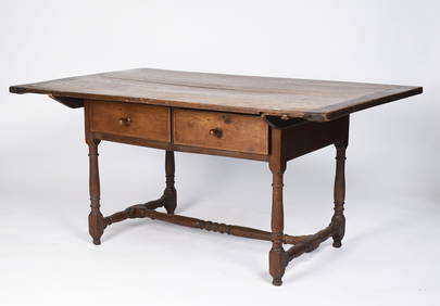
18TH C. SOUTHERN STATES WILLIAM & MARY TAVERN TABLE.William Smith Auctions4.6(147)See Sold PriceMar 06, 2024


![[CHICAGO]. Rare Pre-Fire Illinois Map: “Blanchard’s Map of ... (1 of 2)](https://p1.liveauctioneers.com/928/318880/171361260_1_x.jpg?height=282&quality=70&version=1707501302)